Diary Entries in English

Recent diary entries

It was another refreshing moment, educating me on the essence of been an active member on HOT foundation. Below is the agenda of the meeting held on Friday 8th February 2019 • Briefing from OSM Nigeria Coordinator. • OSM Communities - local and global • HOT Working Groups. • OSM Africa. • Mapping Tasks. • Brief from HOT Community Staff and Board. • Question & Answer session. • Review of past topics.

In all I left with just one key note from Gertrude Hope- Director of HOT(Senior Mentor). In her Words “Every Edit Saves Life”. #letgirlsmap and #mapthedifference

Posted by Polyglot on 9 February 2019 in English.

On Saturday the 2nd of February 2019 I went to this event thanks to a grant from Wikimedia Belgium to get me here with 3 fast trains and a somewhat slower one. That last one had to go uphill ALL the time tough, so it had a good excuse :-)

I demoed the PT_Assistant plugin, obviously and had the opportunity to network with several OpenStreetMap contributors who are interested in mapping public transport stops, itineraries and lines like I am.

In the beginning we got an interesting talk about “sustainable transport”, i.e. our generation fulfilling our transport needs without preventing the next generation(s) from doing so as well.

ToniE demoed his Perl script which performs validation on a selection of German PT networks and publishes them as web reports.

We also got a nice presentation of OpenTripPlanner. I hadn’t realised previously how useful it is for multimodal travel.

We may not have mapped a great amount on this day, but discussing how to go about it and exchanging experiences and views on the topic is obviously a very valuable exercise.

The hackerspace in Ulm has marvellous infrastructure, it has to be said. Great idea to have this kind of event there.

Location: 48.396, 9.990
Posted by alexkemp on 9 February 2019 in English. Last updated on 23 June 2022.
  1. Mapillary seems to be Losing It’s Marbles
  2. Git Along, Little Dogies
    (speeding up renaming files)
  3. I’m losing my Marbles because of Mapillary
  4. A new record for Mapillary - 62 blurs on a street sign

Mapillary is a location-photo-sharing site dedicated to inter-working with OSM & I like it a lot.

Mapillary is the street-level imagery platform that uses computer vision to fix the world’s maps.
450.7 million images; 6.5 million kilometers covered

I am registered on Mapillary since Apr 10, 2016 and it tells me that in that time I have uploaded 6,200 photographs shot whilst walking across 244.7 km of Nottingham’s suburbs. Most of those photos are registered as links with various PoI on the map, which means that someone browsing OSM can find a link attached to a Nottingham point-of-interest that will instantly let them see a blurred photo of what it looks like 32% of the time.

Blurred Photos

At the moment that I am writing these words the following photo has 33 auto-blurs attached to it, 32 of which affect the street-sign on the right (the 33rd is on the brickwork to the right):–

See full entry

Location: Gedling, Carlton, Gedling, Nottinghamshire, East Midlands, England, NG4 4BH, United Kingdom

Following our planned schedule to host a forthrightly webinar training session for all the teams I created and OSMNigeria Community,we successfully held our first webinar today. Agenda for the meeting include: 1 . Briefing from OSMNigeria Coordinator (Victor N.SUnday) 2 . OSM Communities-Local and global 3 . HOT Working Groups 4 . OSM Africa 5 , Mapping Tasks 6 . Brief from HOT Community Staff /Board Representative available 7 . Questions and Answer Session 8 . Review of past topics

It was great having participants and team coordinators/leaders of the various teams/local communities in attendance. Thank you so much Trudy Hope for showing up with a short notice via whatsApp message ,your presence and briefing were inspiring !!! Trudy Hope ,being a board Director of HOT was able to share good ideas to boost our growing community..And to my brother from another country Peter Johannes,you are always amazing ,showing up as a senior mentor so close to OSM activities and progress in Nigeria,thank you for coming on board to make our day. And to my OSMNigeria Community assistant ,Chukwuma Okolie, of Unilagmappersteam,you did a very nice and brief review of our previous webinar training.Thank you @Ikenna of AbsuMappersTeam and Saviour of UniqueMappersTeam Network.You all did a nice job!!! Look forward to working with you guys always to impact and grow #UniqueMappersTeam Network and #OSMNigeria.Cheers

Posted by Iyke on 8 February 2019 in English.

Just finished the first OSM Nigeria in-house webinar meeting Had in attendance: 1. Johannes peter from Tanzania 2. Gertrude Hope from Gambia Amongst others We reviewed all the trainings of 2018 (done by Chukwuma Okolie #UniLagMappersTeam. 1. HOT Tasking manager 2. ODK and OMK 3. Teach OSM etc. An overview of areas where mappers can find relevance 1. Youth mappers 2. OSMF 3. HOT OSM

Posted by MCDA on 8 February 2019 in English.

This past few months I have been noticing the erection of road name signs in the South of Fermanagh, which is great progress if you ignore the outrageous costs involved!

So I decided to ask my Council (Fermanagh and Omagh District Council or FODC for short) if they would consider allowing me access to the list of Roadnames so I could try and improve them on OSM. Needless to say I was shocked and stunned by their offer to release the data under an Open Licence for everyone to use!!

Although this is only the first phase of the project working along A and B class roads in Fermanagh, I am assured that once the next phase is complete they will publish these as well.

I would like to thanks SK53 for his work on converting the Irish grid co-ordinates and displaying the sign data on uMap. You can see his map here.

Posted by skquinn on 8 February 2019 in English. Last updated on 11 August 2021.

Please, review osm.wiki/Key:opening_hours before adding the opening_hours=* tag. If you don’t follow the syntax on the wiki, the software that actually uses the data just sees gibberish.

True examples of bad data I’ve just cleaned up today, with my comments after:

  • opening_hours=Varies (use “unknown” instead if truly unknown, or open-end syntax if variable beyond a fixed known range)
  • opening_hours=MWF 08:00-17:00; TT 10:00-19:00 (this can’t be automatically fixed by JOSM’s validator and has to be fixed by hand)
  • opening_hours=Closed since 2008 (nope, this isn’t valid per the syntax either. “closed” by itself, maybe, but in that case the amenity/shop/office should probably just be untagged with a note in description=*).
  • opening_hours: 08:00-24:00 pharmacy Mo-Fr 10:00-18:00; Sa 12:00-18:00 (either tag the pharmacy itself on a separate node, or use something like opening_hours:pharmacy=*)

Note that iD will not warn you of opening_hours syntax violations (in fact, as best I remember it will not check anything), it will happily let you put any kind of garbage you want in there. Maybe it should, though? How should we raise awareness that one can’t just slop any old junk in opening_hours in order for it to remain useful?

tl;dr the release notes 🙂

If you go to maproulette.org now, you will be greeted with the latest point release: 3.1.3. This is likely the final public release before 3.2, which will be a bigger one featuring a design refresh among other things! For now though, let me summarize the highlights of the 3.1.3 release.

Translations

MapRoulette is now available in Korean, thanks Dongha Hwang!

MapRoulette in Korean

The Japanese translation was updated to fix minor typos. MapRoulette is now available in 7 languages. If you want to contribute a translation file, have a look at the pull request for the Korean translation to get started. Don’t hesitate to ask if you get stuck!

Task Styling

Thanks to a pull request by Ilya Zverev, MapRoulette now lets you style the appearance of your tasks on the map using the simplestyle standard devised by Mapbox. They have a simple example in their documentation to give you an idea of how to apply styling using simplestyle.

Leaderboard Updates

See full entry

Posted by skunk on 7 February 2019 in English.

A few days ago, Ivan Seoane showed me weblate - an open source translation management system. Very nice and very suitable for OpenStreetBrowser. I installed it right away, you can find it here: https://weblate.openstreetbrowser.org. Also, Ivan is working on the translation for Galician, which is already available.

Be aware, that authentication is not connected to any other service (like OpenStreetMap, OpenStreetBrowser Dev, Github, Weblate), so you need a separate account there.

Not all parts of OpenStreetBrowser can be translated there, e.g. date formats have their own separate repository, as you have to actually produce code (it’s just too complex).

Posted by DP24PH on 7 February 2019 in English. Last updated on 19 March 2019.

This is also published on DEARPAUL24 Facebook Page and DEARPAUL24 Online Portal

Accessibility Status

Under BP 344, it is required for certain buildings and infrastructures to enhance the mobility of Persons with Disabilities by installing facilities and other devices (ramps, elevators/lifts). However, most sidewalks are not maintained and sometimes, wheelchair ramps and sidewalks got obstructed by debris, illegally parked vehicles, and illegal vendors. By mapping sidewalks (alongside highway/roadway) as foot=designated and foot=no for highway/roadway (due to certain Anti-Jaywalking laws where MMDA have even planned to include in the NBI records as derogatory behavior, and for public safety sake), the public will recognize the OSM efforts as humanitarian-friendly, especially in some parts of Metro Manila and Cavite where footbridges are to be mapped accordingly.

Similarly, elevators have to be mapped for easier mobility of Persons with Disabilities, even inside the building structure with the appropriate highway=corridor and indoor=yes footway attribute, and for footbridges, the standard layering will apply.

Bus Routes

Here are the following lists of updated Bus Routes as of 07 February 2019, and may subject to change anytime due to addendum from the Department of Transportation, Land Transportation Office, and Land Transportation Franchising and Regulatory Board:

Commuter Bus (C)

See full entry

Location: Sampaloc 2, Sampaloc, Dasmariñas, Cavite, Calabarzon, Philippines
Posted by Ataur Rahman Shaheen on 6 February 2019 in English.

“2019 YouthMappers Leadership Fellowship”, it’s just a simple sentence, but I could not measure its weight because for me, it is immeasurable.

Alt text

The 2nd bi-annual YouthMappers Leadership Fellowship Workshop was held from 6 -14 January 2019 in Pretoria, South Africa. It was a great feeling to be one of the selected fellows for this unique opportunity. The workshop focused on skill building, increasing youth leadership, enhancing open mapping techniques, data visualization, and professional development. The first half of the week included presentations on the history of YouthMappers, an introduction on OSM in the classroom, and presentations by our hosts at the University of Pretoria on their research that provide local context on South Africa as a collaboratory.

See full entry

Posted by alexkemp on 5 February 2019 in English. Last updated on 6 February 2019.

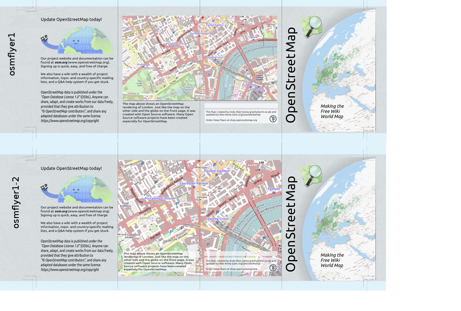
This is a another small update to a sequence of posts on updating some small leaflets originally produced by Andy Allan:–

  1. Fonts missing from OSM Promotional Leaflets
  2. Github HowTo: Clone Repository then make a Pull Request
  3. Printing OSM Promotional Leaflets
  4. Update to OSM Promotional Leaflets due to Padding errors
  5. Adding a Preview JPG + crop-marks for printing

OSM leaflet preview

This is how to add crop-marks and bleed-marks to a production-PDF for printing (the PDFs within GitHub do NOT currently contain any crop-marks and, whilst they contain 3mm bleed, they do NOT contain bleed marks either):–

See full entry

Location: Hockley, St Ann's, Nottingham, East Midlands, England, NG1 1LG, United Kingdom
Posted by Abubakari Rajabu Hiza on 5 February 2019 in English. Last updated on 30 April 2019.

Osm I’d: Abou kachongo Jr Joined Humanitarian open street Team as a digitezer since 2015, I have participated in various mapping project such as Dar es salaam Ramani huria with the propose to provide the basic map that shows all floods prones areas around Dar es salaam city, Tanzania minigrids, Zambia minigrids. Also I have participated in malaria project and Ebola project as well as Refugee’s mapping project

Posted by pangoSE on 4 February 2019 in English.

Hi :)

Inspired by the ongoing uprising and protesting I started yesterday working on Khartoum to improve a few things. Since I am not a native arabic speaker I learned a few tricks and thought I would share them here.

names

We have a policy of locale names and that means the arabic terms should be in the name= field. This was not the case and a lot of arabic names seems to be missing. I added fixme’s to all the places that lack an arabic name tag. See for yourself on OSMI

Help wanted!

If you know arabic please help add the arabic names to the places linked above.

If you are working in JOSM and want to help with the names I encourage you to do this:

  1. enable the expert mode in the settings
  2. file->download data
  3. switch to the new tab “download from overpass api”
  4. click “wizard”
  5. enter “place=*” and select khartoum on the area below
  6. click “download”

This gives you all the places in the editor of your selected area ignoring all the rest of the data. :D I recommend using search and/or filter to narrow down if you need to.

Viewing a map in a different language

I used these to get an overview of the names:

Does anyone know how often they are re-rendered?

landuse

I like to mark the different use of land se the render is able to color the map correctly. I added landuse=residential to existing areas where it made sense and created a few new ones. A lot more work is needed to tag parks, farmland etc.

multipolygons

This is not yet used in many places and the city could really benefit from an overhaul. There are a lot of neighbourhood-areas that overlap etc.

Happy mapping!

Posted by ERASTO ELIUD on 31 January 2019 in English. Last updated on 6 February 2019.

I’m really happy to be part of this team as a digitizer at Humanitarian OpenStreetMap Team in Tanzania (HOT) #0MDTZ . I had effectively participated in tracing roads and Buildings in several projects like Mini grid Tanzania, Mini grid Zambia and Uganda refugees mapping.. erastold@gmail.com

Location: Mikocheni, Kinondoni Municipal, Coastal Zone, Tanzania
Posted by alexkemp on 31 January 2019 in English. Last updated on 5 February 2019.

This is a small update to a sequence of posts on updating some small leaflets originally produced by Andy Allan:–

  1. Fonts missing from OSM Promotional Leaflets
  2. Github HowTo: Clone Repository then make a Pull Request
  3. Printing OSM Promotional Leaflets
  4. Update to OSM Promotional Leaflets due to Padding errors
  5. Adding a Preview JPG + crop-marks for printing

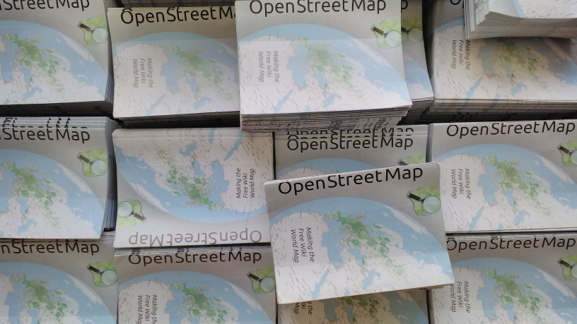
OSM flyers

Diary website 500 errors

Yesterday & earlier today this website was producing a HTTP 500 errors (server error, explicitly reported as an error in communicating with a 3rd-party server). It occurred as I attempted to update my post on Printing OSM Promotional Leaflets. I sent an email to the Server folks.

A few minutes ago I succeeded in updating that post but again noticed occasional problems, which appeared to be connected with the Markdown used on this site. Openstreetmap.org is also sometimes very slow in loading a page.

See full entry

Location: Hockley, St Ann's, Nottingham, East Midlands, England, NG1 1LG, United Kingdom