Diary Entries in English

Recent diary entries

Posted by TheDutchMan13 on 6 August 2018 in English.

A few weeks ago i started my next mega project on osm. This one includes adding surface tags to all the freeways in the Valley Of The Sun

It’s been a long few weeks, and a lot of work. But as of today i am 25% done with the project. Included in the project is adding streetlamps, walls and fixing any errors i find along the way. I’m also aligning the roads as i go to better fit the newer imagery. More updates will be added the next few weeks as i make more progress.

Thanks! Hans (aka) TheDutchMan13

Posted by Zverik on 4 August 2018 in English.

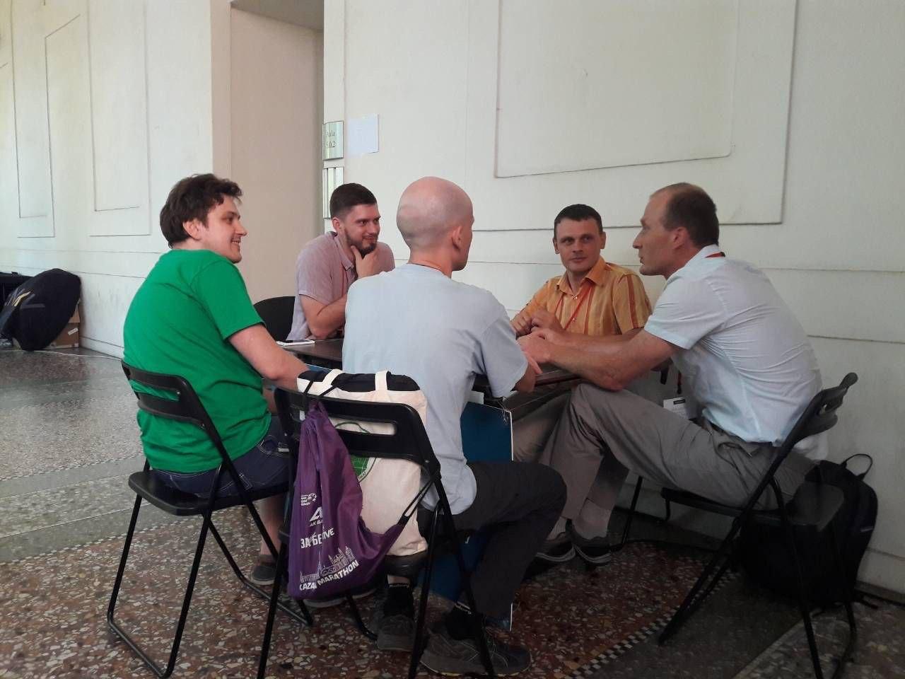
Victor, Ilya, Vladimir, Timofey, Daniil

“There are empty territories, but then a question arises: if they are completely empty, then why should they be mapped? For some reason, the local people decided that they don’t need to map that.”

“We, as white men, are very privileged, and we simply do not see obstacles.”

“Maybe in some form we will use the technologies made back in 2008-2009 for Osmarender”

“Why women can not program themselves an editor understandable to them, use tagging schemes that are necessary for women…“

“What this is about, is that Mapbox ruined the vector tiles for OSM.”

“To sum it up, we see that OSM is turning into Google Map Maker.”

Last week there was a big OpenStreetMap conference in Milan, where I obviously went. There were a lot of great talks, I met a hundred awesome people and shared many ideas. During the conference I wrote a live feed with thoughts and photos, though in Russian. That’s why I don’t plan to write a separate blog post: I’ve written enough.

See full entry

Posted by Kateregga1 on 4 August 2018 in English. Last updated on 5 August 2018.

State of the Map 2018 reinforced the diversity of the global OpenStreetMap Community and also lit a torch into the future of the OSM. This blogpost highlights my experiences in Milan and my key takeaways from the conference. State of the Map 2018

From the day I received the news that I was granted a scholarship to attend the conference, to the day I landed in Milan, it was all an awesome experience. The OSMF through Rob and Dorothea, provided wonderful support to make sure we all got our visas approved, and flights and accommodation booked. Visiting a new place can be intimidating, but thanks to the wonderful support everything went smoothly.

For me the fun began in Dubai where I met other scholars and participants Arnalie, Montshy, Iyan, and Eugene on the way to Milan, traveling as a group made it more fun and easier. The train ride from Malpensa Int. Airport to the Milan Central station took about 55 minutes, and then a 15 minutes walk to our hotel welcomed us to Milan.

See full entry

Location: Central, Kampala, Central Region, Uganda
Posted by Austin Zhu on 3 August 2018 in English. Last updated on 18 May 2020.

It’s always something hard to describe when philosophical things bump into your mind. And it even gets more sophisticated when you start to meditate.

A week ago, when I first stepped onto the soil of Milan along with curiosity and anxiety, I felt lonely. I walked aimlessly on the plaza under the glorious shine reflected by the Duomo and wandered around the Sforzesco Castle: everything just looks so different.

However, the loneliness didn’t last long. At the moment I entered the campus that morning, I met my wonderland. I felt so excited to see so many people from different backgrounds gathering together, talking about their experiences with OpenStreetMap. I was deeply impressed by the opening session which transmitted envisions towards the application and development of OpenStreetMap.

I listened to a variety of talks during the three days. I learnt creativity from that emoji map. I learnt the need and difficulty to transform the basic data structure. I learnt new methods to make AOIs. I learnt the efforts to maintain and grow a local community. And others too…

I’m not going to elaborate things and thoughts about talks, workshops or lightning talks much here because beyond the knowledge and technologies that I learnt from those wonderful talks, I would like to focus on more important discovery in this dairy. It helped shape my cognitive values, and will benefit me a lot in my future study and daily life.

People who travelled a lot always tell me how different the outside world is. But they merely views the scenery and feel the culture, they hardly exchange thoughts with other people. This world is about people, people who have great minds and unique stories to be told.

See full entry

Posted by pantierra on 2 August 2018 in English. Last updated on 28 July 2021.

How the OpenStreetMap data was made available to people’s smartphones

After the Nicaraguan OpenStreetMap community crowd-sourced with over 250 interested citizens the data of their capital’s public transportation system in OpenStreetMap, a schematic paper map was created from this data.

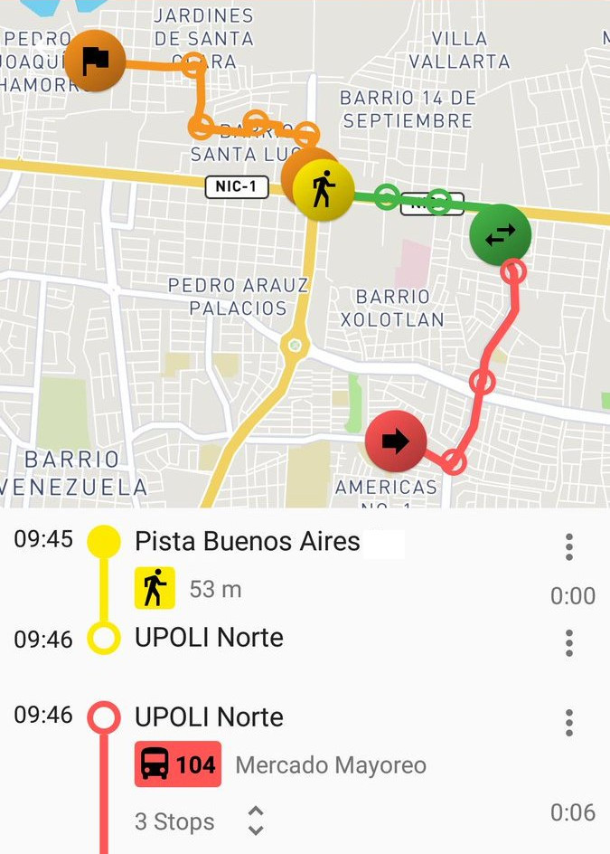
In a next step the community wanted to offer state-of-the-art routing applications to the visitors and inhabitants of Managua. For this, the data from OpenStreetMap was combined with also crowd-sourced schedule information by the Sofware tool osm2gtfs. The result is the common format for public transport data - GTFS -, which was then possible to include into existing applications, where the data can be used now:


Managua is available in the following mobile aplicaciones

Transportr: Public transport route planner for Android. Because its convenience and its characteristic of being Free Software, it is the best option for users of the collective transport.

See full entry

Location: Centro Histórico Sur, District I, Managua, 11103, Nicaragua
Posted by pantierra on 1 August 2018 in English. Last updated on 28 July 2021.

The Nicaraguan OpenStreetMap Community started some years ago a public transport project to create the first proper bus map of a Central American city. Once the data has been collected in a collective crowd-sourcing process directly on OpenStreetMap, a paper map has been created. In a next step this data should be made available in different applications. The most obvious and best path was to rely on the common format GTFS, which can be easily integrated in most public transport routing solutions.

At this point, checking different options to convert OpenStreetMap data into GTFS - unfortunately none was satisfying. Within this desk study I also stumbled over the python script osm2gtfs, by Torsten Grote, the creator of the great Free and Open Source public transport application Transportr. This script was targeted to only work for Florianopolis in Brasil. It grabbed data from OpenStreetMap, parsed online information about schedule from the bus operators’ website and created a GTFS out of it.

See full entry

Location: Centro Histórico Sur, District I, Managua, 11103, Nicaragua

Wetlands and swamps once dominated the western part of Ba Ria Vung Tau province have been converted into industrial parks and seaports. The remaining parts were gradually transformed into shrimp farms to meet the export-driven demands of the economy.

The mangrove forests which used to occupy all the swamplands are now limited to riversides only. If this trend continues, the landscape will be transformed into factories and apartment buildings in the next 10 years.

URL: https://www.openstreetmap.org/#map=14/10.6303/107.0178

see it here

Over the last couple months I’ve been busy fixing mapping in North Andover, MA, where I currently live. Issues with the mapping here in Massachusetts have largely been because of a lack of addresses, street data, business data, and stagnant notes left on the map for upwards of 4 years or so.

I’ve been very active with a couple projects as of late:

North Andover Addresses and Street Overhaul; Massachusetts Address Import notes

This project is progressively going through all parcels within the town and manually adding each address to the building, plus adding driveways, and assigning building=garage or shed as necessary. Plus, drawing in sidewalks as separate ways and correcting intersections and turn restrictions as necessary. It’s a slow process, because there’s so much to verify and add, and I’m doing this process largely on a block-by-block process, alone. This has gotten massively easier lately, however, as I’ve learned how to use JOSM to some extent, and discussion started about a Massachusetts wide address import, of which I provided details on how to do such an import using JOSM and the Conflation plugin. (Details of the current import effort are documented here: osm.wiki/Import/Catalogue/MassGIS_Addresses) Let’s delve deeper into this…

The Massachusetts Basic Address Points is a database divided by town with POI / point data encoded at the center of building polygons for addresses, however the data for streetnames and housenumbers have tags that need renaming, and all the streetnames are in upper case. We had lots of talk on the talk-us-massachusetts list and discovered several issues: 1. Is the title() function appropriate considering the possibilities for false positives, and how many such positives would there be (McCoy Street, YMCA Way). 2. How would you handle data conflicts with multiple addresses to the same building. 3. How would you split up the data import so that it doesn’t cause havoc on the server?

See full entry

Posted by pantierra on 31 July 2018 in English. Last updated on 28 July 2021.

Cover of the printed publication Over the last years several individuals of the Nicaraguan OpenStreetMap community MapaNica.net collaborated fruitfully in various occasions with UNICEF Nicaragua to experiment with participatory geotechnologies and children and adolescents on the Caribbean coast of the country.
This is the publication note by UNICEF Nicaragua (freely translated into English):

See full entry

Location: Sector Este Avenida Bolivar, District I, Managua, 11123, Nicaragua
Posted by pantierra on 31 July 2018 in English. Last updated on 28 July 2021.

Article about OpenStreetMap in the print magazine of the Austrian Scientific Exchange Service (OeAD News)

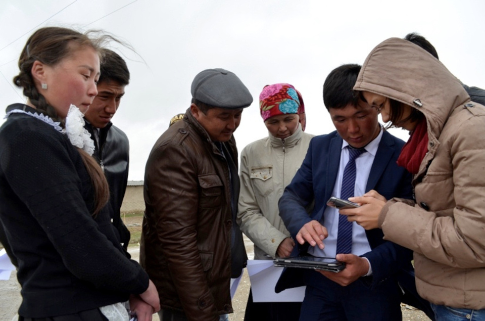
Villagers from Kyrgyzstan mapping with tablet and fieldpapers For the two students Taalaikul (15), Ulsana (16) and their teacher Kaiyrgul from the remote village of Jani-Talap, which lies on the edge of the roof of the world - on the Himalayas in the Tien Shan Mountains in Kyrgyzstan - water is the central theme. In the spring, the area is regularly flooded during the snowmelt, but after a few weeks, the wide river bed, which runs past the edge of the village, dries out for the rest of the year. The environment of the village appears dry and barren in summer, snowy in winter. The modesty of the people, but also their poverty can be felt and seen in the village. People make the most of it, having impressive patience and work together to improve the living conditions in this almost forgotten village that is hardly to find on any map.

See full entry

Posted by Chetan_Gowda on 31 July 2018 in English. Last updated on 1 August 2018.

Recently, Microsoft released 125 million US building footprints as open data across 50 states. The data is freely available for download and use. You can read about previous release of 9.8 million buildings here.

With the help of tippecanoe and Mapbox Studio, I have visualized Hawaii dataset to know how data looks like.

See full entry

Hello everyone,

As a coach for the Open Summer of Code in Belgium, I thought the community would be interested in reading a little about it and get inspired - along with reading how many of the teams used a map and specifically OSM.

What is the Open Summer of Code

If you have never heard about the Open Summer of Code yet, it is an awesome project. Students create an open source or open data application which a real client needs. The client -often, but not always a governmental organization- sponsors the students. During the four week program, the students get relevant workshops, gain lots of experience, have lots of networking opportunities and are exposed to other Open Source projects and ideas. This all is organized by Open Knowledge Belgium, a small but amazing organisation which furthers the use of open data in Belgium.

This year 73 (!) students participated, along with 17 coaches, making this eight edition bigger then ever. Furthermore, oSoc has been more international then ever, with lots of international students and projects and having a spinoff in Spain. This first Spanish edition had 10 students whom enjoyed it a lot. In other words, don’t hesitate to contact us. Wherever you are, you are welcome as student, coach, client of partner organization or perhaps even as organizer of your own edition.

For me personally, it was the first I participated to oSoc. I had the honor of coaching two teams, quite a challenge for someone just stepping in; but whatever challenge arose, there was always some coach with the right expertise to help out. Furthermore, with Ben Abelshausen (Xivk) and Jonathan Belien (jbelien) being coaches as well, OpenStreetMap was well represented, especially when Joost Schouppe passed by as well.

See full entry

Location: Brussels, Brussels-Capital, Belgium

As also posted on https://lists.openstreetmap.org/pipermail/local-chapters/2018-July/000307.html (Reply there on the mailing list, to keep the discussion at one place.)

On 30.07.2018 11:31, Raphael Das Gupta (das-g) wrote:

Hi all

As already posted in the SotM 2018 Telegram channel:

Local chapters and other local organizations (or unorganizations) shall join local-chapters@openstreetmap.org (this list) at https://lists.openstreetmap.org/listinfo/local-chapters to coordinate and help each other.

Also, local chapters should inform the OSMF (or relevant working group) if they feel the board, a working group or the foundation can help with something. On the other hand, local chapters feel that by working together, they (the chapters) may be able to provide more services and infrastructure to the community without overloading the the OSMF with things that aren’t exactly OSM “core business”.

There has been discussion about whether to found a working group in which local chapters will coordinate. That shall be futher discussed on the local-chapters@openstreetmap.org mailing list.

(Note that the previous “local chapters” working group was about defining what a local chapter is and has more or less ceased action once that was done and the first chapter had been accepted. Accepting new local chapters is not done by that working group, but by the OSMF board.)

Cheers,

Raphael

Location: Cascina Rosa, Città Studi, Municipio 3, Milan, Rodano, Milan, Lombardy, 20133, Italy
Posted by nyampire on 30 July 2018 in English.

I’m preparing my new project regarding Japan region. Here is some memo.

Intro

In Japan region, we OpenStreetMapper may trace governmental map.

Especially, GSI map has pretty precise and having good accuracy.

GSI map is based on KibanChizuJoho (Fundamental Geo Data) data which is protected by Japanese Survey law. KibanChizuJoho is an aggregated geo data gathered from municipalities.

Accuracy of KibanChizuJoho is 1:2500 (for urban area) or 1:25000 (for country area). My idea is to cover this 1:25000 area with OpenStreetMap.

List of 1:25000 area

GSI has been publishing those area as following tiled format.

I’ve made a geojson using a script provided by my friend.

Here is a list of municipality which has 1:25000 area. Not perfect through.

This list indicates 800, out of around 1800, are target.

Challenge

Current available imagery resource is not so clear on country side. (Bing, Mapbox, DG or GSI ortho)

See full entry

Every now and then Vancouver’s fire hydrants are a topic at the Greater Vancouver meetup. I assume this is because most fire hydrants have a reference id printed on them which makes them identifiable and StreetComplete started asking for their type.

We had noticed before that there is an area which includes parts of Downtown where hydrant refs start with a 0 (digit zero) or an O (letter O as in Oscar). The character is hard to identify on the physical tags but does looks different than the 0 (digit zero) in the number part.

To lift the ‘secret’, I looked up the refs in the open data catalogue of Vancouver link. All refs start on a letter. This means, the character is question is the letter O as in Oscar.

Vancouver uses the letters E until W from West to East throughout the city. A until D do not seem to be used but would fit onto the University Endowment Lands where UBC is located.

Posts with pictures:

P.S. While we tag the refs as found on the fire hydrants (e.g. H13006), the city has a different id schema for them: WH-H13-006.

Location: Riley Park, Vancouver, Metro Vancouver Regional District, British Columbia, Canada
Posted by Zverik on 29 July 2018 in English.

This is a very rough translation of parts of the discussion that happened on the Shtosm Telegram channel. I’ve translated it so the upcoming vector tiles BoF section does not miss my point of view, while I’m presenting OSM Streak in another room.

Kate in her keynote mentioned the recent article by Richard about what OpenStreetMap needs:

http://blog.systemed.net/post/15

The answer is vector tiles, he writes, but before that he makes a long intro about OSM not being a map; it’s a community and possibilities. He is right. But if we talk about tiles, you should understand one thing. Developers of OSM Carto style have been discussing switching to vector since April. They approach it as a technical task: to repeat the same thing, but with a different stack. And Richard’s point is that it would be wrong.

Style developers are fixated on quality, on cartography, on target audience. The make a product: tiles, which are featured on thousands of web sites. And this product, being showcased on our website, is overshadowing the real product that we make: the geospatial database. That is bad, since people believe OSM is tiles and mapping style, not data. They expect from the website to show traffic, to feature a ruler and satellite imagery. People feel that our product is the website, the routing feature, the mapping style.

What we need is to push the style to the sidelines, and to employ vector tiles. Though not to repeat what we already have in them, because then we’d get exactly the same: a product that overshadows the data. We should do intentionally raw tiles, which adapt to user’s needs. Roads, buildings, some POIs by default. But with a few clicks you could see bicycle routes: make a photo and go cycling. A map like a clay: very plain, but take it — and the possibilities are endless.

See full entry

Saturday we went for a drive, to scope out the border crossing to Iran at Artyk, about an hour and a quarter’s drive east of Ashgabat, mostly out of curiosity. I’m glad we did–there is a new bypass road from the M37 straight to the border crossing that had not been mapped and does not appear on any satellite imagery in the OSM editors. We collected GPS traces and Mapillary imagery (now being uploaded) and will work on updating this approach. While there, we mapped most of the village of Artyk, collecting street names (lots of signage!)

Then on the return we stopped in Balykçylyk to find out if we can buy fresh fish from the fish farm there (yes, we can!) and mapped most of that village as well as the fish farm itself. Our final major mapping foray was Ýaşlyk, site of the Berk brewery as well as, it turns out, a rather large jail.

I had never driven the old highway that used to be the only road connecting Ashgabat and Mary, so we decided to take it back to Ashgabat instead of the M37. We discovered that the road stops abruptly at what used to be a railroad crossing, but now is a dead end at the railroad tracks. We used OSM to navigate on back roads till we came out on the M37 again, but had we not taken the alternate route, we would not have noticed in satellite imagery that the railroad crossing had been decommissioned.

Location: Kaka District, Ahal Region, Turkmenistan
Posted by kucai on 29 July 2018 in English.

With the introduction of dual freq chip from Broadcom, and the maturing firmware on Mi 8, the possibility of 30cm accuracy becomes much closer to mappers (hopefully standalone receivers are in development too). How are you guys planning to deal with this? Do you think there will there be a map alignment wars? Will iD incorporate that imagery offset db plugin like in JOSM? Do we go nuts with different imagery having different lens zoom ratio on the same zoom layer and having align both to a unified offset?

The OCD in me wants to align everything precisely, but I sure appreciate the Soviet’s approach of “good enough”.