Diary Entries in English

Recent diary entries

It is rush decision for me to decide to go to Manila for attending State of the Map Asia. I saw there is a scholarship I could apply, so I want to talk about the situation of Taiwan community, and meet some OpenStreetMap-related company. I’m very glad I travel to the Philippine, meet some old friend like Wular, and meet the Mapbox data team in India.

Also I meet the famous Manning from the Philippine community. Mapbox team recently are relining Taiwan road network, using the new arrived Mapbox satellite image, and Strava GPS trace. I met these guys only online, finally I have a change to talk with them face-to-face, and thank them of their hard work. We discussed what is the situation in Taiwan, what we local community can do to help them.

Manning Opening

Here is my talk slide. Due to the limit time, I decrease the size of my slide and skip some event. In the following post here, I’ll describe what I told during my presentation, and keep a written record.

See full entry

Location: UP Campus, Diliman, 4th District, Quezon City, Eastern Manila District, Metro Manila, 1101, Philippines

Costs and environmental impacts are key elements in forest logistics and they must be integrated in forest decision-making. The evaluation of transportation fuel costs and carbon emissions depend on spatial and non-spatial data but in many cases the former type of data are difficult to obtain. On the other hand, the availability of software tools to evaluate transportation fuel consumption as well as costs and emissions of carbon dioxide is limited. We developed a software tool that combines two empirically validated models of truck transportation using Digital Elevation Model (DEM) data and an open spatial data tool, specifically OpenStreetMap©. The tool generates tabular data and spatial outputs (maps) with information regarding fuel consumption, cost and CO2 emissions for four types of trucks. It also generates maps of the distribution of transport performance indicators (relation between beeline and real road distances). These outputs can be easily included in forest decision-making support systems. Finally, in this work we applied the tool in a particular case of forest logistics in north-eastern Portugal.

Cite: Pérez-Rodríguez, F., Nunes, L., Azevedo, J.C. (2016) A SOFTWARE TOOL FOR ACCURATE ASSESSMENT OF COSTS AND CO2 EMISSIONS IN WOOD TRANSPORT USING OpenStreetMap©. Math. Comput. For. Nat. Resour. Sci., 8 (1): pp. 35–53.

Link to complete article

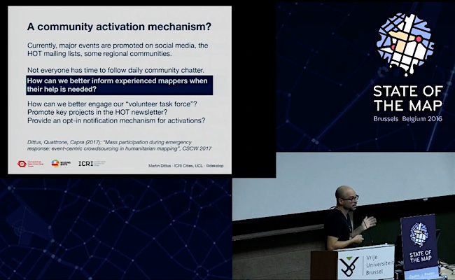
I just saw that the video for my SotM16 talk has already been online for a month… many thanks to the organisers and video team in Brussels for making this happen so quickly, and in such a high quality! You can find some summary notes further below, along with recommendations to HOT organisers.

The recording: Youtube: Building large-scale crowdsourcing communities with the Humanitarian OpenStreetMap Team

See full entry

Posted by Skippern on 21 November 2016 in English.

Johan

My son have just completed a globe based on Sérgio’s map. Still some minor flows in our work process, but watching how he enjoyed it, and how satisfied he was with the result, I guess there will be more of these. Probably need to look into thicker paper, and a more suitable glue. First round kept my kids busy for one weekend. I had to interact at several stages, i.e., he needed help with the outline of Russia and Canada, he was not sure he was able to cut the lines himself, and with the glue we used, I had to do the gluing while he watched.

Location: Centro, Guarapari, Região Geográfica Imediata de Vitória, Greater Vitória, Região Geográfica Intermediária de Vitória, Brazil
Posted by SimonPoole on 21 November 2016 in English. Last updated on 14 December 2016.

Two weeks back I was invited to Wherecamp Berlin, on the one hand to participate in the opening panel and on the other to have a short talk on the state of indoor mapping, more about that later.

Naturally the foreseeable impact of self-driving vehicles and machine learning in general was the, obvious, main topic of the opening panel. But outside of “things are going to change” I’m not sure that there was any other conclusion from a couple of oldish men without crystal balls.

From an OpenStreetMap point of view it was encouraging to see so many OSM based projects and operations presenting at the event mingling with essentially all the big names in geo-business.

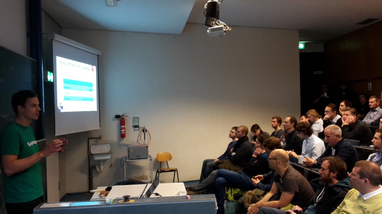
Stefan from GraphHopper presenting Stefan from GraphHopper presenting at Wherecamp Berlin.

From a bit of a nerdy view, the first day presentations from Qualcomm, Broadcom and Google on what we will likely be getting in the way of GNSS support in upcoming mobile phones was quite interesting.

See full entry

Right now I am sitting very close to a place in Adelaide - San Churro. I know its mapped, at least with name.

However if I search for “openstreetmap san churro”, I see:

  • Very rich data on opening hours (google), how long people spend at a location
  • A business listing and map (google)
  • A prompt to claim this business (google)

Contextually, my android phone already knows where I am so is potentially limiting the search to nearby businesses.

Previously I’ve been keen on a foursquare ‘checkin’ app to write to OSM and ask smart questions, as well as RDFa/schema.org markup to render useful results.

I’d like to go further and throw out a few feature requests with a bounty attached ($100 AUD each):

  • On android or ios, add a plugin to Owntracks to allow check-in to an Openstreetmap location, publishing Lat/Lon, OSM id or new place name(suitable for a note)
  • A way to connect to an Owntracks/Mqtt server and match user location/time to a 30 minute time slot (ie: indicating a likely valid opening hour)
  • A public owntracks server for interested OSM users (worldwide? Or just country based)?
  • An owntracks plugin for OSMand.
Posted by alexkemp on 20 November 2016 in English. Last updated on 8 February 2019.

To distract me from the difficulties of mapping the houses within Manderley (a recent development of £400,000 GBP houses ($494,000 USD, €467,000 Euro), half of which do not yet appear on Bing) here is a useless challenge for you:–

Find the Tree Rat

Non-golfers are warned of the danger of death from hi-speed golf-balls, and therefore not to trespass on to Mapperley Golf course. However, I walked all around the perimeter of the course, and took pictures every few seconds the whole way. At one point I came across some of the local wildlife; it tried to hide from me but I did manage to get a single frame with it in view.

Your mission, should you choose to accept it, is to (virtually) walk the perimeter of the Golf Course. As a virtual walk protective head-, elbow- & knee-gear are optional.

So, starting at the first frame of the walk, find the tree rat (sorry, squirrel). Be warned that the only way I could get it in shot was to photograph from a distance, so it is small & well blended in with the tree trunk as it rushes to get away from me. If you reach the houses then you have missed it (although the walk continues after the houses are mapped until we reach the clubhouse).

Golf:– a good walk, spoiled

words — wrongly — attributed to Samuel Langhorne Clemens (Mark Twain)

After surveying the desert of Manderley — it was midday Wednesday, 16 November & the place was almost entirely devoid of human life — I walked clockwise around Mapperley Golf course starting at the traffic lights at the top of Arnold Lane (having bought Pink Floyd’s single + LP as a young man I love that road just for it’s name), passing through Digby Park along the way (check out the Alphabetical Arboretum if you think that you can identify every tree & bush from it’s leaves) & finishing at Mapperley Golf Club-house. The Golf Course is full of dire signs warning walkers of imminent death, so the walk does not dare trespass upon the course but instead circumnavigates the perimeter.

See full entry

Location: Woodthorpe, Arnold, Gedling, Nottinghamshire, East Midlands, England, NG5 4JY, United Kingdom
Posted by pnorman on 20 November 2016 in English.

This is a repost from my blog because there’s been a fair amount of interest from OSM people on what I wrote.


If you want to serve vector tiles, there are a few server options that have developed, each with different strengths and weaknesses.

node-mapnik based

Language: nodejs
Layer definitions: Mapnik layer definitions in XML, typically preprocessed from YAML
Vector tile formats: Mapbox Vector Tiles
Data source support: PostGIS

Kartotherian, tessera, and other servers based on tilelive all rely on Node bindings to Mapnik to produce vector tiles. They all work with Mapnik layer definitions. This is a reasonably well understood language and consists primarily of a SQL statement for each layer. This is reasonably flexable and it’s possible to do proper code review, git conflict resolution, and other processes you need with an open style.

Some servers can turn the Mapbox Vector Tiles into GeoJSON, but not all do. There are other minor differences, but they all have the same major advantages and disadvantages.

The biggest problem with these options is that you have to either use the exact same versions of everything as the Mapbox developers while hoping their changes work with your code, or lock down your versions to a set of known good versions and periodically update when you need new features, retesting all your code. Neither of these is practical for an open-source style which wants to involve others.

If you don’t do this, you’ll find parts of your server failing with different combinations of Mapnik and node-mapnik.

Tilezen tileserver

Language: Python
Layer definitions: SQL in jinja2 templates, YAML
Vector tile formats: Mapbox Vector Tiles, TopoJSON, and GeoJSON
Data source support: PostGIS

Tilezen tileserver was written by Mapzen to replace their TileStache-based vector tile generation. Having been written by developers who wrote previous vector tile servers, it combines ideas and functionality other options don’t have.

See full entry

Location: Uptown, Moody Park, New Westminster, Metro Vancouver Regional District, British Columbia, V3M 3S3, Canada
Posted by scruss on 19 November 2016 in English.

My name is a problem. Not merely is my first name often misspelled (and, where I now live, almost universally mispronounced) it’s often assumed to be my family name. While it’s pretty common for Scottish guys to go by their middle name, since they’ll often have the same first name as their father¹, my first name really is my given name. It’s just my luck that my family name is more common as a first name. Also, my name is really long; with my middle name, it’s too long for Canada’s ID system, so I have an “official” name² that’s my real name minus a letter or two. I should just add LLC on the end and be my own legal partnership. Hence, it’s a lot easier to go by my nickname.

A friend’s rather odd quest to see how many of his Facebook friends had their names mentioned in Milwaukee streets led to me creating a list derived from OSM data³ for him. That got me wondering further: is there a city in the world where Stewart Street/Road/Avenue/… intersects with Russell Road/Street/Avenue/…?

Before I get preemptively banned from Overpass Turbo for life for thinking up the most futile way to heat up a server, I’ll probably never do this. If I did, I should probably just look in New Zealand⁴, because it often seems — in place names, at least — to be more Scottish than Scotland.


¹: This can make lowland Scottish genealogy an interesting challenge. I think I’ve got something like five consecutive generations of Roberts marrying Agneses in my ancestry; imaginative we ain’t. I do have to keep reminding myself that my lot were the ones who didn’t have the get-up-and-go to become hillbillies.

²: no, I’m not getting all Freemen-on-the-Land nonsense on you here. Just in case you were getting worried.

³: it’s here, along with instructions on how I did it: Milwaukee Street Names from OSM for Jeff

See full entry

Location: Bay View, Milwaukee, Milwaukee County, Wisconsin, 53207, United States
Posted by alexkemp on 18 November 2016 in English.

Test out your detection faculties: what is wrong with this picture of the 4 Seasons?

3 Seasons

It was shot last Wednesday with the kind permission of the householder on Plains Road, Mapperley. Try to ignore the fact that the camera is within a cheap smartphone & that the operator still does not know how to manually control the contrast whilst mapping.

The answer, of course, is that one of the Seasons is missing (stolen!).

Although they look like marble, they are in fact made of fibreglass, and are thus nice & light. That is exactly what some youths discovered many years ago when first put in place, just before those youths absconded with the statues. The police discovered the abductors, but only three of the Seasons. The statues returned are now concreted into position (whilst they yearn & mourn for their sister, of course).

Location: Woodthorpe, Arnold, Gedling, Nottinghamshire, East Midlands, England, NG5 4JX, United Kingdom
Posted by MikeN on 18 November 2016 in English. Last updated on 19 November 2016.

As previously mentioned in diary entry osm.org/user/MikeN/diary/39782 , the MapRoulette Rail challenge uses topological analysis of the rail network to generate the task list. Many tasks land on a multi-track crossing or include a rail yard, so many tasks correct fix more than 1 crossing per edit session. Also, anyone routinely reviewing an area might correct rail crossings outside of MapRoulette By re-analyzing current OSM data, finished tasks were marked off. Some findings for the last interval:

  • 1221 tasks marked complete in Map Roulette
  • 5468 tasks auto-marked complete after detection as fixed
  • 4.5:1 node correction per task ratio
  • Overall topological rail challenge 16% complete 10925 / 68758 tasks

Because the first MapRoulette tasks are more likely to land on in a ‘busy’ area, future fix rates and node correction to task ratio will probably fall as each task is more likely to point to an isolated crossing.

Many tasks end up making geometric corrections to the rails and surrounding roads.

The links to these challenges are:

[Crossing Ways: Highway-Railway, US] http://maproulette.org/map/980

[Crossing Ways: Pedestrian-Railway, US] http://maproulette.org/map/989

[Crossing Type: Highway-Railway, US] http://maproulette.org/map/990

[Crossing Type: Pedestrian-Railway, US] http://maproulette.org/map/991


There was a moment of panic as the analysis also discovered thousands of new tasks! This had 2 causes:

  • An abandoned rail line / cycle trail was changed to be a railway. I have commented on that changeset asking for more information.
  • A node from changeset osm.org/changeset/43738090 was moved across the country near the following changeset osm.org/changeset/43738103 in JOSM. From a history examination, I’m not sure if the rail node was attached to Benton Street. Maybe there is a JOSM hotkey that does this. To try to avoid this in the future, I have changed MapRoulette to open JOSM in a new layer.

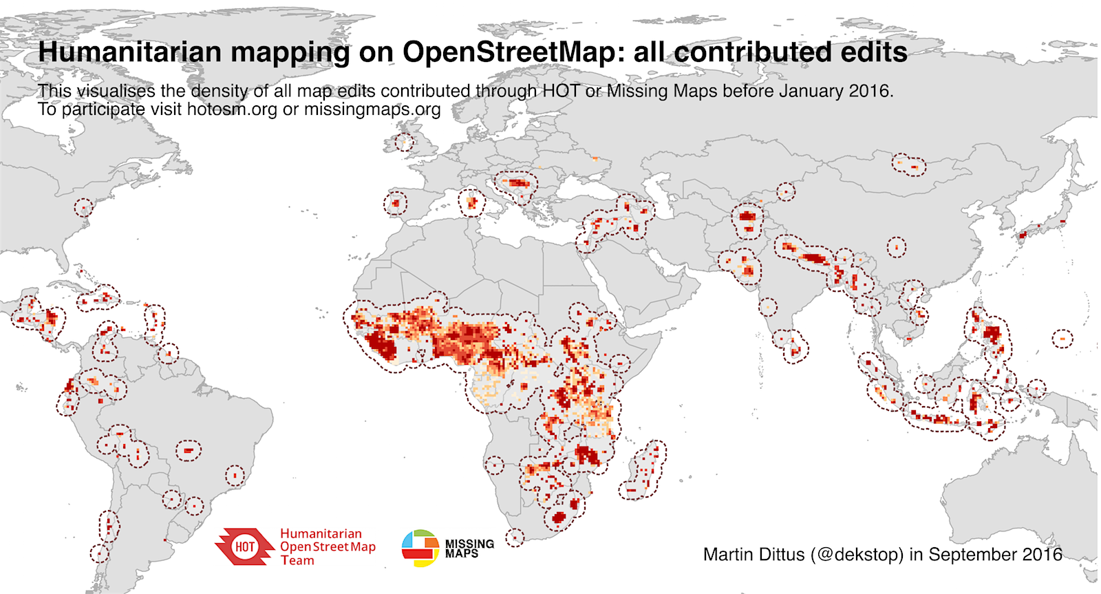
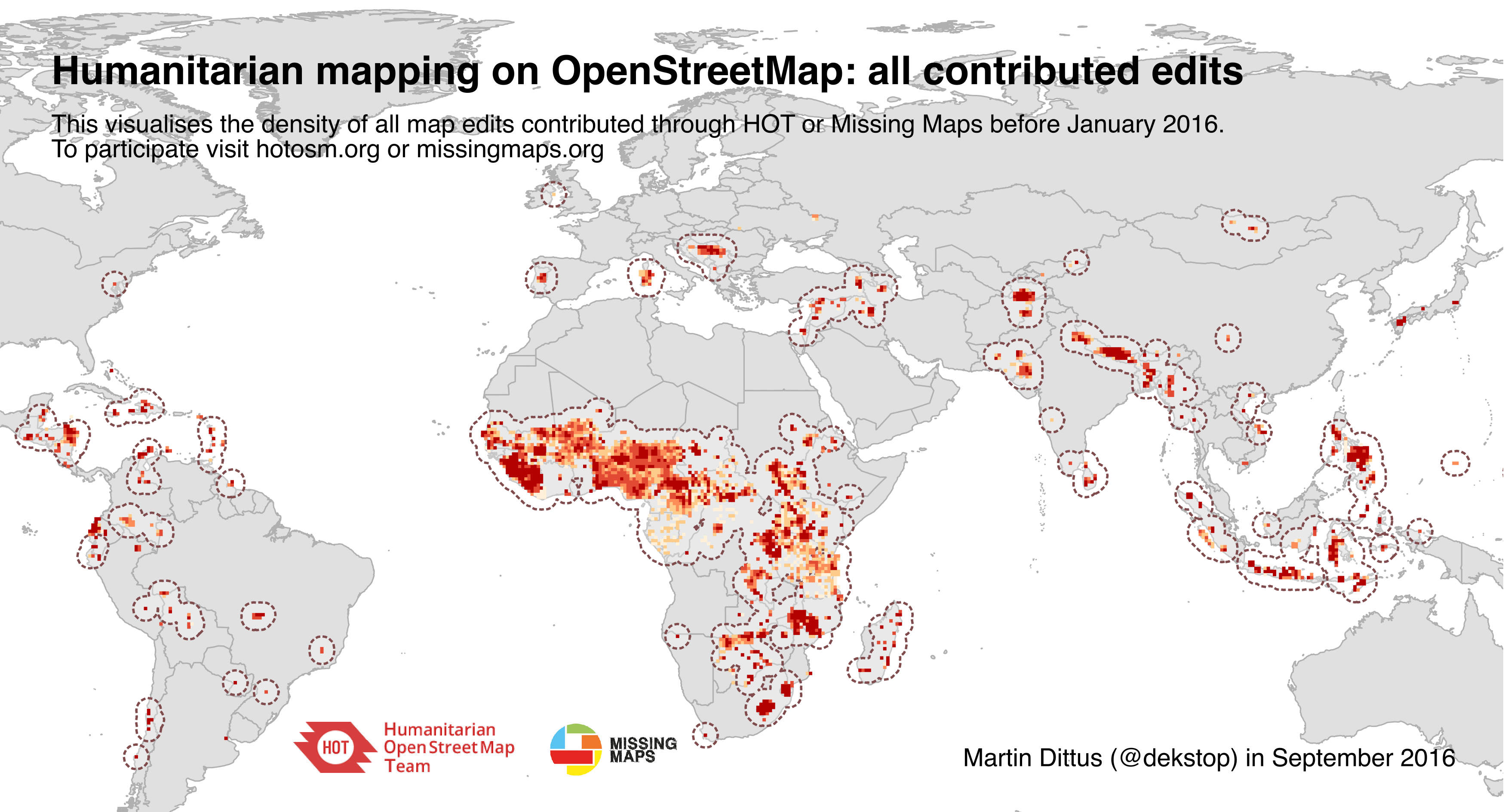
The visualisation below shows the regions of the world where the HOT community has contributed edits to OSM, which is one way in which we can show the impact of our community. The chart visualises contributions before 23rd Sept 2016. By this date, 32,000 people had contributed at least one edit, accounting for a total of 182,000,000 edits. This took an estimated 240,000 labour hours.

As mentioned before, I’ve been showing the visualisation in talks for a while now, and I regularly receive messages by people who would like to use it for their own slides, for mapathons and training sessions, and other uses.

A global map of HOT contributions

There is also a PDF version (11MB), a high-resolution PNG (1.3MB), and a folder with older versions if you want to do a visual comparison of map growth. Send me an email if you would prefer a version without annotations – I simply ask that you provide credit when you’re using it.

See full entry

Posted by alexkemp on 18 November 2016 in English. Last updated on 20 November 2016.

86 + 92 Plains Road, Mapperley NG3, UK

  • Q: What’s almost as good as a Green Field to a Housing Developer?
  • A: A single house on a large green site at the edge of town close to shops & schools

Here is the view between two houses positioned 100 yards up the road from these two properties to try to underline why developers want to build there (the view is of Mapperley Golf Course, shot on Wednesday 16 Nov on a classic sunshine-&-showers English day):

enjoy it whilst you can

Finally, my mapping gets me (almost) to the Ultima Thule (the lands beyond the suburbs of Mapperley & Gedling) (‘Ultima Thule’ was a bookshop in my University town of Newcastle Upon Tyne, and the name was explained to me as meaning “the unknown, unmapped, dangerous realms beyond the civilised world”) (or, Gateshead). Finally, my photos can begin to show not just bricks & tarmac but trees & mud. Excellent.

See full entry

Location: Woodthorpe, Arnold, Gedling, Nottinghamshire, East Midlands, England, NG5 4JY, United Kingdom

Here are the few observations from the OpenStreetMap edits between 24 October - 11 November.

Commented:

  • Bad imports: changeset 1, 2, 3, 4
  • Deleted roads: changeset
  • Deleted natural=wood: changeset
  • Deleted existing buildings: changeset 1, 2, 3, 4
  • Adding fictional data: changeset 1, 2
  • Adding buildings overlapping with highways: changeset
  • Changeset comment mentioning google: changeset
  • Deleted river: changeset
  • Added improper data: changeset
  • Deleted relevant information in neighborhood: changeset 1, 2

Community members commented on the following changesets:

These were some of the inconstant data for this week. Do keep an eye of the bad edits and comment on those changesets, which will make us maintain the quality of data in OpenStreetMap.

Look forward for another roundup next week.

Posted by Skippern on 17 November 2016 in English.

Data sources are becoming so detailed, and the community are still growing, this results in even more spectacular data on the map.

Just take a look, Mapillary coverage allows for a lot of details to be added, such as several shops, bars, banks, restaurants, fast-food places, are easily identified and added. Combining Bing, MapBox and other sources of vertical images allows us to draw buildings, and combining these buildings with Mapillary, we can add information allowing for spectacular 3D rendering (see here and here for 3D examples).

Also, the renewal of the public transport license resulted in data about bus routes being released, unfortunately, the data set was not complete, so some surveying will still be needed to complete the datas, but for now, something is available here.

The surrounding land have been covered with woods, meadows, farmlands, marches, mangrove, and more.

All in all, the map is developing quickly, just 8 years ago, this was a clean sheet.

Location: Centro, Guarapari, Espírito Santo, Southeast Region, Brazil
Posted by BushmanK on 16 November 2016 in English. Last updated on 17 November 2016.

Reading a pretty long discussion of tagging the Holocaust memorial in Berlin, it surprises me, how unclear our Wiki documentation still is. The main controversy there is about (not) using building=* tags for individual parts of the memorial installation. For those, who are not familiar with this memorial, it mainly consists of rectangular monoliths (stelae) of different height, arranged in rows.

It has been mentioned in that discussion, that current convention about a qualifying feature for using building=* is a presence of room inside the structure (I’d add, that it also applies to “parent structure”, since we still have building=entrance in use), so people can come in and stay inside it, and it’s the purpose of this structure.

Sometimes, it could be an extreme case, like building=roof, where we usually have an open space under the roof instead of an isolated space, forming a room. But unfortunately, both Buildings article and Key:building have almost zero information on this particular topic.

I mean, come on, guys, building=* is among the top tags by usage and it is often misused, but there is no more or less clear definition of it in English documentation. In Russian documentation, due to widespread legal nihilism, we have the first paragraph of the RU:Здания (Russian version of Buildings article) that gives a definition of the term “building” for awhile. German article has a bit shorter explanation as well. English version says something about a couple of special cases (houseboats, for example), but gives no general picture, like if it were obvious. No, it is not, especially in OSM, where terms quite often have own special meaning and definition.

Personally, I don’t see any issue with adding something like that to the English article by myself, except I’m obviously not a native English speaker and my English is American (I had an experience of complaints from a couple of Britons regarding of that).

See full entry