kuhni74's Comments
| Changeset | When | Comment |
|---|---|---|
| 11501173 | die Wetterstation ist eh schon weiter westlich eingezeichnet |
|
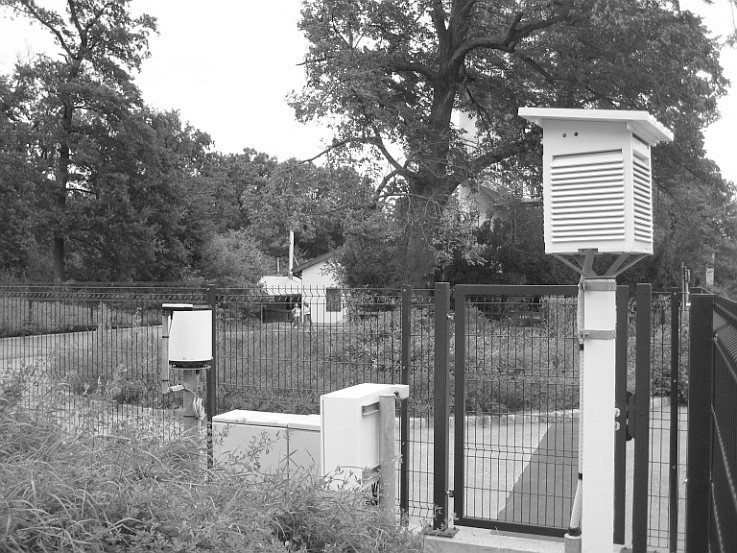
| 11501173 | könnte ein Geschwindigkeitsradar für Kfz sein? |
|
| 11501173 | hm, eher nicht, die sollte so aussehen (?) https://www.kordon.wien/files/seiten/unsere_umwelt/wetter/wetterstation_jubilaeumswarte.jpg |
|
| 11501173 | ist way/162129876 die Wetterstation der GeoSphere Austria (vormals ZAMG)? |
|
| 17136433 | habe nun die meisten repariert, aber vielleicht gab es noch weitere Änderungssätze? |
|
| 17136433 | Danke fürs Eintragen der Adressen, aber einige der punktförmigen Identadressen sind als "entrance=yes" getaggt, obwohl sie gar keine Eingänge sind! |
|
| 165023612 | this is not an alpine hut for tourism any more, only a museum |
|
| 184305156 | danke! |
|
| 184305368 | danke! |
|
| 172397614 | siehe auch https://de.wikipedia.org/wiki/Diskussion:Seel%C3%BCcke |
|
| 184141995 | Viele der kürzlich gelöschten Wege sind übrigens auch in der amtlichen Karte 1:50.000 des Bundesamts (BEV) sowie in basemap.at (ebenso amtlich) eingetragen. Im übrigen stimme ich den Vorrednern völlig zu. |
|
| 172397614 | Ist die ehemalige Zollhütte (way/139342424) in der Seelücke wirklich noch / wieder ein nützbarer "basis_shelter"? Vorher stand dort "Ruins". Am Luftbild sieht man tatsächlich etwas kleines mit Dach, aber wurde das vor Ort oder sonstwie überprüft? |
|
| 109336094 | bitte um Beteiligung an der Diskussion auf note/5344915 betreffend das Brunnsteiner Kar / Skilehrer Steig |
|
| 180951226 | Ich beziehe mich v.a. auf Mastaun(spitz) vs. Malanderspitz. Es ist natürlich nicht undenkbar, dass die offiziellen Karten die beiden Gipfel verwechselt haben. Meines Erachtens braucht es aber mindestens einen note in beiden Gipfelknoten, dass die amtlichen Karten (die "source" hast Du ja leider gelöscht) es anders sehen. Schon allein deswegen, weil vielleicht 2027 jemand kommt und die vermeintlich falschen Namen wieder zurückändert. Und meines Erachtens braucht es für die Deiner Meinung nach richtigen Namen etwas wie "source:name=". |
|
| 156868087 | wurde aufgrund note/5331035 korrigiert mittels changeset/183761650 |
|
| 156868087 | Ist der Weg entlang des Lej da Vadret tatsächlich wieder für Fußgeher offen? Nach dem Bergsturz vom 14.04.2024 war er ja offenbar gesperrt. Ein generelles "access=no" mit "foot=yes" ist aber widersprüchlich (auch wenn "foot=yes" das access sticht). |
|
| 182967246 | Warum hast Du die Flussaufweitung oberhalb von Ramingstein, die ich mit changeset/179652359 aktualisiert habe, wieder "zurückgebaut"? In den jüngsten BEV-Inspire-Luftbildern sieht man doch klar das neue breitere Flussbett?! |
|
| 173225519 | "Wegknoten" ist beim ÖTK der Überbegriff, hier ist laut ÖTK ein Kreuzungspunkt (K), aber ich bin da relativ leidenschaftslos. Ein bisschen intuitiver finde ich Kreuzungspunkt (das versteht jeder), "Wegknoten" klingt sehr GIS-technisch. |
|
| 170834708 | Okay, hab's korrigiert |
|
| 170834708 | Das sind die Höhen über Wiener Null, nicht über Adria! Hier fehlen jeweils 156,68m. https://de.wikipedia.org/wiki/Wiener_Null |