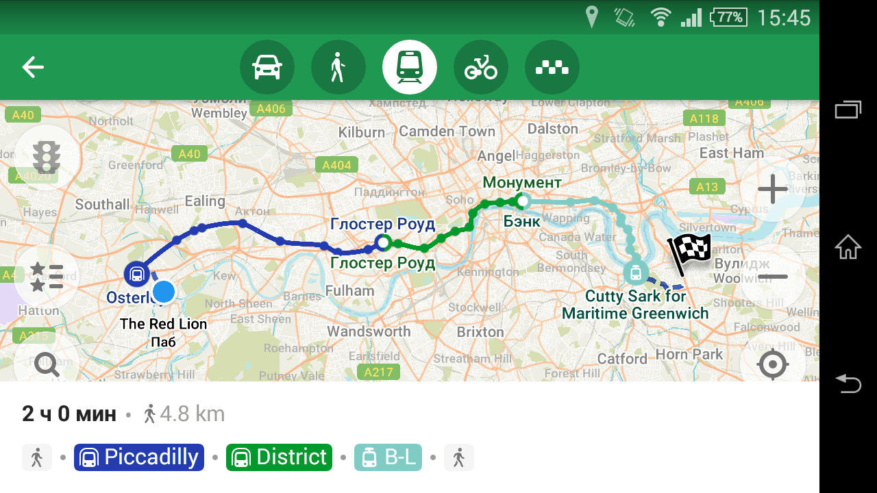
This is a very rough translation of parts of the discussion that happened on the Shtosm Telegram channel. I’ve translated it so the upcoming vector tiles BoF section does not miss my point of view, while I’m presenting OSM Streak in another room.
Kate in her keynote mentioned the recent article by Richard about what OpenStreetMap needs:
http://blog.systemed.net/post/15
The answer is vector tiles, he writes, but before that he makes a long intro about OSM not being a map; it’s a community and possibilities. He is right. But if we talk about tiles, you should understand one thing. Developers of OSM Carto style have been discussing switching to vector since April. They approach it as a technical task: to repeat the same thing, but with a different stack. And Richard’s point is that it would be wrong.
Style developers are fixated on quality, on cartography, on target audience. The make a product: tiles, which are featured on thousands of web sites. And this product, being showcased on our website, is overshadowing the real product that we make: the geospatial database. That is bad, since people believe OSM is tiles and mapping style, not data. They expect from the website to show traffic, to feature a ruler and satellite imagery. People feel that our product is the website, the routing feature, the mapping style.
What we need is to push the style to the sidelines, and to employ vector tiles. Though not to repeat what we already have in them, because then we’d get exactly the same: a product that overshadows the data. We should do intentionally raw tiles, which adapt to user’s needs. Roads, buildings, some POIs by default. But with a few clicks you could see bicycle routes: make a photo and go cycling. A map like a clay: very plain, but take it — and the possibilities are endless.