OpenStreetMap

The problems with "highway=path" in England and Wales
Posted by SomeoneElse on 20 November 2024 in English.Recently, there’s been quite a lot of discussion about the problems with using the tag “highway=path” in the forum. See for example threads here, here, here, here, here, here, here, here, here, here, here, here, here, here, here, here, here, here, here, here and here - and that’s only the last month or so!
It’s not descriptive
On it’s own, “highway=path” doesn’t really say anything other than it’s somehow possible to get from one end to the other. Have a look at the pictures in the wiki - all of those are regularly tagged as “highway=path” in some regions.
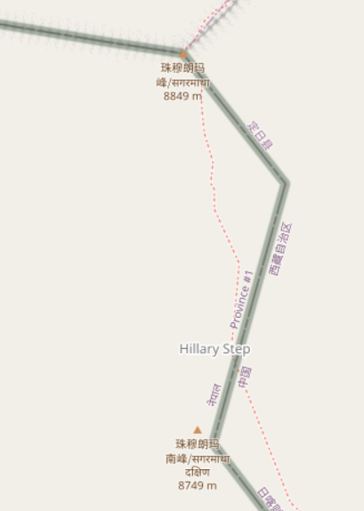
There are some really bizarre examples out there. Up the Hillary Step to get to the top of Everest? highway=path. A scuba diving route? highway=path.
While it is possible to add extra tags to say a bit more about the feature being mapped, often this simply isn’t done.
A data consumer (map maker, routing app creator or even just a human deciding whether to go for a walk somewhere) can’t tell what they’re going to find.
It’s impossible to tag the legal situation properly
The idea is that you can tag a path for pedestrians as “highway=path; foot=designated” and one for cyclists as “highway=path; bicycle=designated”.
The problem here is that “foot” and “bicycle” are “access” tags, and these aren’t always “yes” or “no”. Valid values might be “customers”, “destination”, “permissive” amongst others. If the “foot=designated” on a “highway=path” implies “foot=yes”, what should the tagging be if only customers are allowed?
In countries with some form of allemansrätten (much of Scandinavia, some other places in Europe, including Scotland) this is less of an issue. If you know you can go pretty much anywhere you don’t need to explicitly tag “foot=yes” on everything, and tagging “highway=path; foot=designated” isn’t a problem.