OpenStreetMap logo OpenStreetMap

Changeset When Comment
116981681

Hello Andy Parton and welcome to OpenStreetMap,
Please don't just use the changeset comment "Solar Mountain Gaming - Golf Edits" every time - in more detail what you are actually doing. See osm.wiki/Good_changeset_comments for details.
Best Regards,
Andy

116891119

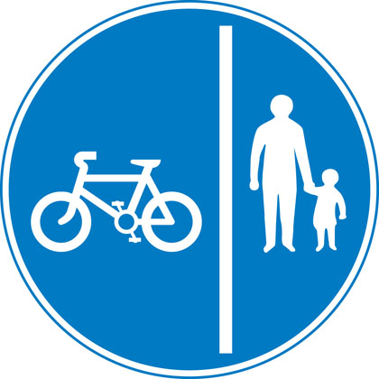
I don't know what the norm for cycling signage is in Warrington (haven't been there since the 80s) but if it's a cycleway I'd expect something like a blue "cycling" sign - maybe https://assets.publishing.service.gov.uk/media/55ba1284e5274a1521000023/sign-giving-order-route-pedal-cycles-only.jpg or https://assets.publishing.service.gov.uk/media/55ba12b1ed915d155c00001d/sign-giving-order-segregated-cycle-pedestrian-route.jpg , or some tactile paving that says ""cycleway" such as https://www.marshalls.co.uk/commercial/product/tactile-cycleway-unit, or something from the council that says (even if they haven't put up any signage) that they consider it a cycleway. Without any of those it's just a footpath.
Best Regards,
Andy

116891119

Hello,
Clearly there's an edit war going on over https://map.atownsend.org.uk/maps/osm-deep-history/#/way/30765899 etc.
Perhaps you could _both_ post evidence of why you think it is a cycleway or not a cycleway - maybe photographs would help?
Best Regards,
Andy (from OSM's Data Working Group)

116000762

(on cycling across pedestrian crossings) the Highway Code's very clear that you shouldn't: https://www.gov.uk/guidance/the-highway-code/rules-for-cyclists-59-to-82 . That also means that it's not normally necessary to explicitly tag bicycle=no on every pedestrian or equestrian crossing (not that you likely have many of the latter in Warrington)
Regards,
Andy

116333609

Witaj maraf24,
Jaki właściwie jest plan dróg? Zdjęcia lotnicze pokazują, jak wygląda duży obszar budowy.
Z poważaniem,
Andy Townsend, w imieniu Grupy Roboczej ds. Danych OSM.

116333609

Hello maraf24,
What actually is the plan for the roads? Aerial imagery shows what looks to be a large construction area.
Best Regards,
Andy Townsend, on behalf of OSM's Data Working Group.

116962327

@Hotel Gaj Kesri - when you say "it is showing" - in what map or app is it showing in the wrong place?

116760851

Thanks - fixed.

114063595

For info see osm.org/user_blocks/5638

116448024

For info see osm.org/user_blocks/5638

116560398

For info see osm.org/user_blocks/5638

116884701

Specifically this deals with these revert fails from the complex_revert:
cannot restore relation/5640784 to version 159 (put): 409 Conflict
cannot delete way/1023961261: 412 Precondition Failed
cannot delete way/1023961260: 412 Precondition Failed
cannot delete way/1023961262: 412 Precondition Failed
cannot delete node/9442424147: 412 Precondition Failed
cannot delete node/9442424139: 412 Precondition Failed
cannot delete node/9442424148: 412 Precondition Failed

116679532

Hello - a quick question about way/466428839 , which is highway=no presumably because there's nothing on the ground here. Should it really be part of the Norfolk Coast Path and the England Coast Path, and (a bit of a philosophical question) should it join way/466428842 which it crosses?
Best Regards,
Andy

73312487

Drop an email to data@openstreetmap.org (with a bit of info about what needs changing back to what) if you'd need us to help figure something out.
Cheers - Andy

81453505

Hello,
The Esri imagery is offset here. I've moved node/7242362789 etc. to match GPS and OS StreetView-aligned Bing.

116635310

Thanks

116296386

Hello MicronationMarker,
OpenStreetMap is not a place for fictional or imaginary countries. As you can see at https://osm.mapki.com/history/relation/11931692 , this has already been tidied up, just like it was last time: https://osm.mapki.com/history/way/676522134 .
Best Regards,
Andy Townsend, from OSM's Data Working Group.

102177655

Hello Ed,
I hope you don't mind me commenting on something that was only your 5th edit almost a year ago!
In this changeset you changed a few "highway=bridleway" in the New Forest to "bicycle=permissive". While it's true that there are permissive cycle routes in the New Forest (see for example https://www.newforestnpa.gov.uk/app/uploads/2018/01/New-Forest-Cycle-Routes-Map.pdf from the park authority), bridleways in the New Forest aren't like "public bridleways" elsewhere in that there isn't an automatic right to cycle on them. OSM has the tag "designation=public_bridleway" for "public bridleways", but there are almost none of those in the New Forest. Following advice from Forestry England I've changed the remaining ones in thhis changeset from bicycle=permissive to bicycle=no.
If you've got any questions by all means please ask, but don't worry - I'm not asking you to do anything, just letting your know for information.
Best Regards,
Andy (from OSM's Data Working Group)

116722663

OSM's Data Working Group had a report that a number of bridleways in the New Forest had "bicycle=permissive" set on them in error. What seems to have happened is that someone assumed that they are actually public bridleways ("designation=public_bridleway" in OSM, where a cyclist would have legal rights) rather than merely "highway=bridleway" - something designed for use by horses.
There are almost no "designation=public_bridleway" in the New Forest, but here are some routes where foot and horse traffic has legal rights, and some permissive cycling routes..

116635310

Hello,
I wonder if you had any idea - if this bit of NCN13 relation/9765637#map=17/52.07895/0.72564 runs down way/120452353 does that mean it doesn't run down the parallel road to the north?
Best Regards,
Andy