OpenStreetMap
GOwin's Comments
| Post | When | Comment |
|---|---|---|
| First Edit | Thank you for your contributions to the map @drivingforce, and welcome to OpenStreetMap. Apart from SatNav tracks (from GPS, Glonass, etc.), you might be interested in collecting street-level imagery using Mapillary or OpenStreetCam. The added advantage to this approach is that you’re not only collecting tracks, you’re also collecting photos that could be added to the commons which could be useful for extracting other information. There are also various tools available that makes data contributions or editing on mobile more convenient. Check out the gamified StreetComplete, or the general purpose mapping apps with editing function like OsmAnd or Maps.Me. If you’re keen to interact or have questions in mind, there are several channels for reaching out to local communities, check out the channels listed on osm.org/wiki/ph . We’d love to hear more from mappers outside the capital region. Cheers, GOwin |
|
| Lupang Arenda drone mapping - part 1 | @kucai |
|
| You Don’t Have to be Mad to Live Here, But it Helps | Thank you for sharing diary entries like this, Alex. They’re always a joy to read. |
|
| Community Mapping with the Elderly | Hindi ko napagtanto na mas personal pala ang koneksyon ng kuwentong ito. Salamat sa pagba-bahagi, Rally. |
|
| A Local Mappers API | Nice one, Martijn! It would be lovely to connect this with the Notes, where local knowledge is quite helpful. |
|
| Too bad I don't have a camera rig | Wow! That’s coverage is awesome, especially if it was done on bike. Kudos! |
|
| First Day | That’s awesome, Jessa. Welcome to the OpenStreetMap community. |
|
| First steps | Awesome! Welcome to OpenStreetMap. |
|
| filipinas | Let me guess, places you’ve visited in the Philippines? 😉 |
|
| My First Edits | Congratulations on your first edit, and thank you for your contributions. |
|
| First edit | Congratulations on your first edit. And, thank you for updating the map of your neighborhood. |
|
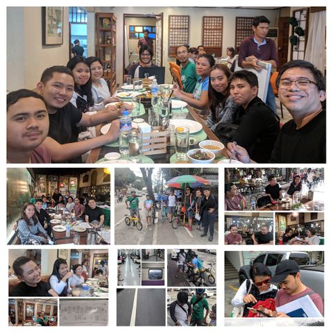
| Marikina Mapping Party @ Lilac Street | Thanks, Harry. What do you think of this collage?
I uploaded this and a few more of the photos I took with a PD-self license in the OSM wiki: MapaTime! |
|
| Marikina Mapping Party @ Lilac Street | We’ll all be looking forward to that. I remember you actually joined us for late lunch after the 2016 mapping party. :grin: |
|
| January 10 | David, just a clarification. The Asia-Pacific SotM idea was something we informally talked about around 2017, but since then things have changed with a passionate group of people in Oceania pursuing that idea in that side of the world. I hope a joint conference can happen in the future, however, communities from each region are always welcome to join neighboring regional SotMs. |
|
| January 4 | Tracing settlements + roads is the most doable task (requiring less training, covers larger areas) and most impactful during emergency and crisis mapping. That’s what we did during Yolanda (Haiyan), and should be considered as baseline for any mapping effort, the exception to this would be mapping facilities essential to response and civic action. |
|
| 400,000 Mapillary Images | Awesome! 🙇 |
|
| THE 10,000 Edits Challenge | Sorry for not being clear. I meant to ask who is the organization that is directing this effort, and not the participants’ ranking. Any website or community forum? |
|
| THE 10,000 Edits Challenge | Could you please say more about this 10,000 edits challenge? Who’s leading the effort, and who is doing validation work? |
|
| Missing Roads from ImproveOSM now also on MapRoulette | @mvexel. I still am. Looking forward to it. Thanks in advanced, Martijn. |
|
| Mapping: Make the World Connected | You definitely know more than me. It’s good to know that you made an attempt to find other tools to make field mapping more convenient, like the house number tagging tool Kudos! |