 OpenStreetMap

Today was the first day of my GIS & Cartography training organized by H.O.T, i was nominated by the unique mapper’s network team. It was educative and insightful can’t wait for the next two days of the training for more practical sessions.
Users' Diaries
Recent diary entries
Posted by dcapillae on 19 December 2022 in Spanish (Español).
Last updated on 6 June 2026.

 Árbol de Navidad en la plaza del Patrocinio (ubicación). Fuente: trabajo propio (CC BY-SA 4.0) disponible en Wikimedia Commons.
Acabo de añadir al mapa mi primer árbol de Navidad. El árbol, junto con otros objetos relacionados con la Navidad, se puede visualizar en este mapa interactivo creado por Miche.
Si queréis conocer cómo añadir al mapa árboles, mercadillos, belenes y otros objetos de temática navideña, en esta página del wiki encontraréis todos los detalles.
¡Feliz Navidad!
P. D. (2022-12-24): He añadido al mapa las ubicaciones de los dos principales mercadillos navideños y los belenes más significativos que se pueden visitar en la ciudad de Málaga, aquellos que se repiten año tras año, con fechas y horarios de apertura actualizados a las navidades de 2022-2023.
.png)
A ‘polling station’ or ‘voting center’ is a place where people vote, i.e. where ballots are cast. It can be a room in a building where voter registrations are checked, ballot papers are provided, and ballot box are available to put the ballot papers.
In Nepal, generally some rooms or blocks of schools and community buildings are used as the voting centers or polling stations for the purpose of voting in the election. While mapping a polling station in OpenStreetMap, we will add a node for a voting center and tag it.
Tagging Instructions:
Required Tags:
- amenity=polling_station
- polling_station=ballot_box
Naming Tags:
- name=* (commonly used name of the voting center in native (Nepali) language)
- name:ne=* (name of the voting center in Nepali language)
- name:en=* (name of the voting center in English language)
Posted by harrymahar on 19 December 2022 in English.

Introduction
In the third week of October 2022, unfortunately, there was a big flooding event in Jembrana District Bali that caused several damages and casualties.
The Support
Right after the flood happened, Bali Disasater Management Agency (BPBD) contacted Open Mapping Hub Asia-Pacific (OMH AP) team to give some mapping support in some of the affected areas. Before OMH AP launched the tasking manager mapping to respond to the request, we conducted rapid data gap assessment through disaster ninja to see whether we still need remote mapping support or we can directly support them in the data utilization to create a flood impact map on that area. After we found that there were OSM data gaps on the affected areas, OMH AP created the Tasking Manager Project to support that event.
Posted by TreeTracks on 17 December 2022 in English.

I’ve written a long blog post on sealed and unsealed roads in NSW. OpenStreetMap now has comprehensive coverage of road surface tags in NSW and the post provides lots of maps and tables to illustrate the patterns. Hope you enjoy it.
While I’ve been working on BLM Ground Transportation Linear Features (i.e. highways) in Imperial County, I took a small diversion to put in the BLM Off-Highway Vehicle Areas in California. Four of the major BLM OHV areas are in Imperial County, so it was relevant. These boundaries are important because many of the OHV areas are “open,” allowing cross-country travel off of designated roads and trails.
I’ve been working with the BLM CA Off Highway Vehicle Designations data set, which has 31 OHV areas in California and one OHV area from Nevada that slipped in because it’s managed by a BLM field office in California.
As I started adding the OHV areas, I noticed that almost all of these areas have never been mapped. Some of these areas are notable institutions in the off-road community, like Imperial Dunes (aka Glamis) and Johnson Valley (home of King of the Hammers). So adding these areas is a significant contribution to the map.
Tagging these areas is a little bit of a challenge. After some discussion with Minh Nguyen, I settled on landuse=recreation_ground and leisure=offroad_driving to tag all the OHV areas. The recreation_ground tag is a slightly odd fit but it seems close enough to be appropriate. And some renderers have an idea what to do with it.
Some of the OHV areas only permit vehicles on designated routes. That’s no problem because the access tags go on highway features and the OHV area doesn’t need any additional tagging. But many OHV areas permit open cross-country riding, so tagging vehicle access is an issue for these areas. I settled on adding motor_vehicle and ohv access tags directly to the areas, with values like yes for unrestricted access, permit where vehicles must have a pass, and permissive for the shared-use area of Johnson Valley which is periodically closed for military use (but not on a predetermined schedule).

A few days ago I wrote about extracting GPX location data from the raw videos coming out of my A129 dashcam, and uploading to Mapillary. I was doing this one video at a time. A typical drive yields a lot of short videos, each 1, 5 or 10 minutes long depending on the settings. Some automation would be nice!
Mapper n76 suggested in the comments to my previous post to concatenate the short videos first and then process the resulting single video. I tried this following the instructions on the ffmpeg website, but I could not get exiftool to extract location data from the resulting longer video. So what I did instead was write a simple bash script that just loops over all MP4 files in the directory and does the GPX extraction and Mapillary processing / uploading for each file. Here’s the full script I used, which has the gpx.fmt file you need for exiftool baked in for convenience, but the loop itself is simply:
for f in *.MP4; do
    exiftool -m -p gpx.fmt -ee -ext mp4 -w %f.gpx $f
    mapillary_tools video_process_and_upload $f --geotag_source gpx --geotag_source_path ${f%%.*}.gpx --skip_process_errors
done
I found that I need --skip_process_errors because there’s usually one image extracted from the start or end of each video file that cannot be matched with a timestamp from the GPX file. I don’t care enough about one single image out of an entire sequence to try and figure out why, but I’m sure someone more determined than I could fix it :)
Posted by Twardziel58 on 15 December 2022 in Polish (Polski).

I have created my first preset to speed up marking river milestones on Vistula (Wisła) river. I’m tagging both physical boards on the shore and virtual ones according to: / Stworzyłem swój pierwszy preset by przyspieszyć oznaczanie kilometrażu rzeki Wisły. Oznaczam zarówno tablice na brzegu jak i wirtualny pikietaż na rzece, zgodnie z:
I’m using following tags / używam następujących tagów:
- key=ref value=Wisła
- key=waterway value=milestone
- key=distance value=*
and following Open Sea Map tags / i następujących z Open Sea Map:
- key=seamark:type value=distance_mark
- key=seamark:distance_mark:category value=board (for the board on the shore / dla tablicy na brzegu)
- key=seamark:distance_mark:distance value=*
and special two for the virtual kilometer point in the river / i specjalnych dwóch dla pikietażu na rzece:
- key=river:waterway_distance value=*
- key=seamark:distance_mark:category value=not_installed
Opa
Vila Rica

Should consider going back and associating sidewalks with roadways, and adding curb type to ends of crosswalks
Posted by mapeadora on 14 December 2022 in Spanish (Español).
Last updated on 27 December 2022.

Durante la última semana de noviembre, participé a la Conferencia de Gestión popular de riesgos de desastres y OpenStreetMap LATAM 2022 organizada por OSM Perú y el nuevo capítulo de Youthmappers Llamitas Mapeadoras, en la Universidad Nacional Mayor de San Marcos en Lima.
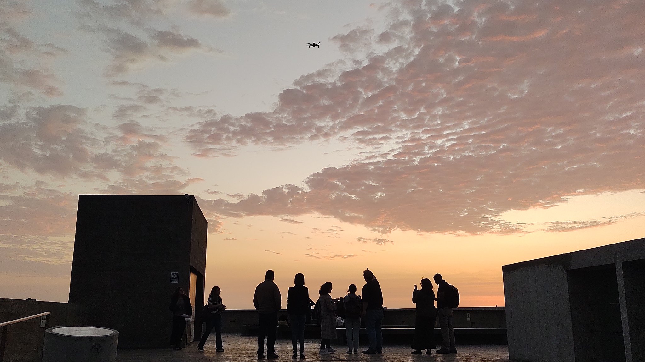
Aquí redacto unas reflexiones personales como contribuidora de OSM LATAM.
1.Fue un evento muy concurrido, sin ser un State of the Map y siendo esencialmente un evento nacional, pero con participantes internacionales. Pero rescato sobre todo que tuvo una participación de personas realmente interesadas en el tema y con real intención de colaborar, conocer, escuchar de experiencias de otr@s, reflexionar junt@s para aportar a sus situaciones comunitarias en materia de gestión de riesgo, y esto desde un enfoque no especialista y profesional, sin tampoco cerrarse al mismo. En este sentido, para mi, fue un evento muy integrador y me emocionó mucho. Logró la “I” de la sigla “GIRD”.

A few days ago i provided an example Overpass query to show buildings with a mapped start_date colour coded by age. This was in response to a query by long-time Latvian contributor richlv. Another user based in Latvia asked on Mastodon if it was also possible to look at data by how long ago since it was edited.
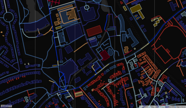
This proved to be quite a lot harder than my previous example. The issue is that the “@timestamp” field in Overpass-Turbo is always treated as a string and is never cast to a number or date. This meant that the MapCSS queries have to deal with regular expressions, so I’ve just done the bands in years (“way[@timestamp=~/YYYY.*/]”), as I haven’t experimented with how rich the regexp implementation is for MapCSS. An example of the amended query for roads and buildings in a given bounding box is here.
My Workshop Experience
Pista ng Mapa and State of the Map is not new to me because I attended some of their events before. In my previous conference experiences, I mostly share what we are doing in our institute (UPRI) and how open-source works. Now, what’s new to me is to do a technical workshop in this conference. I able to share what tools I mostly used for the development and discuss some information about geospatial development through python.
Our goal in this workshop is to encourage the participants to make themselves be involved in a open-source community and to tell them the importance of open data. In the workshop, I also did some hands-on activities using python. Most of the participants, don’t have experiences in programming but still able to do the activities. I hope that even after the workshop they will still continue to explore python and the tools I shared for geospatial analysis.
Thanks to a contribution by user danieldegroot2, dates and date ranges are now displayed in Dutch. Other languages which are currently supported are: English, French and German. If you are interested in adding another locale, please check out the module openstreetmap-date-format (HOWTO).
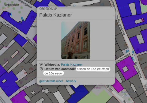
The reason for this module is the flexibility of the date system in OpenStreetMap, which allows for inexact dates like “C16” (16th century), “early 2000s” (sometime between 2000 and 2003), and “1848..1855” (between 1848 and 1855).

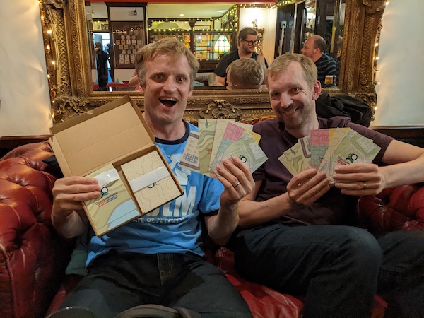
Back in October in we had a London pub meet-up in the Monkey Puzzle pub. It was pretty well attended. There were three or four people I hadn’t met before. For example I was pleased to meet user okwithmydecay. This username was familiar, I think because I’ve just seen him doing lots of editing in London. Good reason to recognise somebody’s username! We like that!
I took along some OSMUK leaflets which I have received a pack of (Order OSM UK leaflets here). I say leaflets, but they’re more like postcards. Single sheet of card. I think there’s five different designs with five different messages/target audiences. Me & Andy (gravitystorm) were critiquing them in the pub, although on the whole we decided they’re rather good, and certainly good that people have organised this.

Today, I mapped over 500 buildings in other to map my area to the OSM world, I have come to believe that mapping my locality will make tasks easier for gov’t and NGOs for carrying out their task, census, flood mapping, household, etc. I will send a goodwill message to #UNIQUEMAPPERSTEAM for introducing OSM s to me
Posted by Mamman1999 on 13 December 2022 in English.

Inaugural State Of The Map Conference Nigeria 2022 was super amazing experience and moments I ever share with folks in my entire life. I’ll like to seize this opportunity to share my way to unique mappers network and to Hot#openstreetmappers network. my name is Mamman Ali from Biu local government area of Borno state. I was was introduced to unique mappers network of Nigeria in early 2018, when I was opportune to attend the institute of certified geographers of Nigeria (ICGN) training here in federal university of port Harcourt. with the kind of gesture and hospitality I received from good people of port Harcourt and our humble national coordinator for unique mappers network Nigeria, with the little knowledge and amazing experience I share with people around the unique mappers teams of Nigeria I begin to develop passion and interest mapping and other humanitarian activities that comes intoto my line.

.webp)

Seriously. Me being sleep deprived made me create a huge issues. Lucky for me I knew how to before hand fix the issue…. At least I hope so. Double checking tomorrow to ensure no stray nodes are about again.
Sleep deprivation leads to mistakes. Mistakes lead to even less sleep because they need to be fixed.
TL;DR go the heck to sleep so you don’t make mistakes that’ll cost you more time.