-
I spent some time today improving the map data in my local area using the iD editor. As a local, I noticed that several roads were untracted
-
added roads but i got confused while selecting presets- then i realised the more i do mapping, the better i will get with using presets. Each preset serves a unique purpose.
-
Few weeks ago i spent time mapping my school in my city, i was soo fun- just wish they could use more updated satelite image.
Diary Entries in English
Recent diary entries

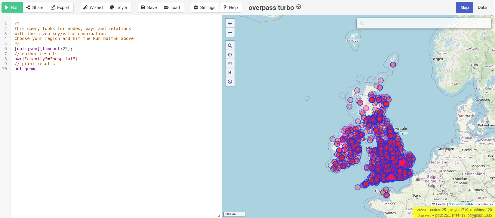
There has been a very interesting question on the OSM US Slack lately.
“Does anyone have a method to search through the OSM database for a building of a particular shape? I need assistance finding OSM buildings with this specific shape. They should be located in NJ, DE, northeastern MD, eastern PA, or southern NY.”
The question quickly exploded into a huge discussion. At the time of writing, there are already 71 replies.
Someone suggested :
“You could load OSM buildings into PostGIS and then use ST_HausdorffDistance to compare the geometries.”
From there, the discussion veered into how to solve that specific puzzle and find the exact OSM building in question.
One person added, “So the strategy is: create the shape of the building you want to search for, scale it to, say, fill a 100x100 m bounding box or something. Ask Postgres to, within a search-area bounding box, take each building and scale it to a 100x100 m bounding box, compute the Hausdorff distance with the scaled input shape, and return all OSM element IDs and their Hausdorff distances, sorted in ascending order.”
Another said, “What I’m currently doing is combining several shape exports into a single file with around 20,000 objects that have concavity. Concavity plus more than 10 nodes eliminates most buildings.”
At that point, instead of hunting that elusive specific OSM building, I became more interested in the generalized version of the problem.
So I added my two cents to the discussion:
“The generalized version of this problem would be : Can we represent a shape in some kind of data type that allows us to computationally check whether two objects have the same shape, regardless of rotation and scaling?
I haven’t studied the Hausdorff distance yet, but I’m wondering whether it can solve this problem, or if there’s a better alternative—Hu moments, Procrustes analysis, Fourier descriptors for contours…”
Someone replied :
Changeset: 178729012
Today I contributed to OpenStreetMap by improving map completeness in my local area in Bengaluru, Karnataka.
🔹 What I Worked On
Added a missing café using local knowledge Verified placement to ensure it was mapped at the correct entrance location Added appropriate tags including: amenity=cafe name= ##Bean Stop Café
Checked for duplicate entries before uploading
🔹 Mapping Approach
I focused only on verified, ground-truth information and avoided copying from copyrighted sources. All additions were based on direct familiarity with the area.
🔹 Quality Checks
Ensured the point was not placed on the roadway Confirmed correct spelling and capitalization Reviewed surrounding features for consistency
🔹 Objective
The goal was to improve local POI completeness and contribute accurate, structured data to OpenStreetMap. This is part of my effort to make consistent, quality-focused contributions rather than large, unverified edits.

Automatic Pedestrian Detection at Signalised Crossings
Hi everyone,
I recently noticed that many modern pedestrian crossings are equipped with automatic detection sensors that trigger the traffic signal without requiring a push button.
Currently, in OpenStreetMap, we can tag:
-
highway=crossingandcrossing=traffic_signalsfor signalised crossings -
button_operated=yes/noto indicate if a manual button is present -
traffic_signals:sound=yes/nofor auditory signals
However, there is no standard way to indicate automatic activation by a detector for pedestrians or vehicles.
To address this, I have proposed a new tag on the OSM forum: detector_operated=yes/no, which would clearly indicate that a traffic signal is automatically triggered by a detector.
You can view and comment on the proposal here: https://community.openstreetmap.org/t/proposal-tag-traffic-signals-detector-operated-pedestrian-presence-sensor/141624
Changeset: 176210161
In this changeset (176210161), I focused on improving building-level mapping by adding missing building outlines and refining structural details using Bing Maps aerial imagery.
The objective of this session was to enhance spatial accuracy and improve map completeness in the area. I ensured that:
- Building footprints were aligned correctly with satellite imagery
- Proper geometry was maintained
- No duplicate structures were created
- Tagging remained consistent with OSM standards
This edit was completed using the iD editor (v2.37.3), and I requested a review to ensure quality validation and community feedback.
Working on building details helped strengthen my understanding of:
- Accurate polygon tracing
- Satellite imagery interpretation
- Clean data structuring
- Version control within OSM changesets
I will continue improving structured building data and map quality in Karnataka.
Changeset number is 178690672
Today, I worked on improving map data around Yelahanka Taluku, Karnataka. I updated the official name of Sai Vidya Institute of Technology to reflect accurate real-world information and ensured proper tagging consistency.
In addition to correcting the name, I reviewed campus boundary structure, building tagging, and surrounding infrastructure to avoid duplication and maintain data integrity. I verified that the edits align with real-world sources and OSM tagging standards.
My focus during this session was on:
- Accurate name correction
- Structured campus boundary validation
- Road connectivity refinement
- POI accuracy improvement
- Avoiding duplicate objects
This session helped reinforce the importance of precise tagging, version tracking, and reviewing live map data versus cached tiles. I will continue contributing to improving structured geospatial data across Karnataka.
Posted by SomeoneElse on 17 February 2026 in English.
Last updated on 27 February 2026.
Many people have noticed that publicly available Overpass servers have been suffering from overuse (a typical “tragedy of the commons”). OSM usage policies generally contain the line “OpenStreetMap (OSM) data is free for everyone to use. Our tile servers are not”. Unfortunately, there have been problems with overuse of the public Overpass servers, despite the usage policy. “Just blocking cloud providers” isn’t an option, because (see here - use the translate button below) lots of different sorts of IP addresses, including residential proxy addresses, are the problem.
People who want to use e.g. Overpass Turbo do have the option to point it at a different Overpass API instance. If you’re using Overpass Turbo and you get an error due to unavailability, likely that is because the Overpass API that it is using is overwhelmed. There are other public Overpass API instances, but they may be complete (in terms of geography, or history) or up to date.
Lincolnshire ER OUT Routes
Hello! This is my first Diary Entry and I wanted to dedicate it to the Forum Post that I made about the UKs Only (I Believe) ER OUT routes in the case of any emergencies: mainly flooding in this case.
Overview
After major flooding in 2013 the council created the Lincolnshire ER Routes to enable people to quickly evacuate from the flood areas. Many of you make have driven past these and never even noticed! They are Red rectangular signs with the white text of ER out on them with a direction to follow. They are placed at every turn, so the evacuees follow the road ahead until a signs says otherwise.
Example Sign

Route End
The end of the route signifies that the evacuees are clear of the major flood risk and (presumably) there would be further guidance at the end of the route. The route end sign is the same as the direction signs however it features 5 black diagonal lines.
Purpose
Safe Routes to School is a program designed to help parents encourage their children to walk and bike to school safely, while promoting healthy engagement. In some locations, walking or biking to school is a child’s only means of getting to school. My goal is to help parents find the best routes to school and to assist them in working with local governments to improve safety. But we need more volunteers to help improve the data.
What We’re Building
- Pedestrian and bike maps
- Child-safe routing opetions
- Walking and biking isochrone (walkshed) tools
- Clear tutorials on how to map for pedestrians and cyclists
- Tools SRTS groups can use in their local communities
Pedestrian and bike maps
Bike maps already exist. Not only does OSM offer two different map layers for cyclists, but there are several apps available. Pedestrian maps are a different story. While there are some pedestrian maps, such as the University of Washington’s Taskar Center for Accessible Technology’s AccessMap.app, they are limited. What is needed is a tool that parents can use to find a good walking route to school, as well as a tool that can help improve pedestrian mapping, much like OpenStreetMap US’s OpenTrailMap.us. The rendering should show pedestrian ways, crossings, accessibility features like tactile pads and kerb ramps.
Routing Engines
OSM has some great routing engines. The user interface will likely need to be improved so that features can be added to avoid. For example, railways may be dangerous for children to cross. By allowing the addition of features to be avoid, it’s possible to provide a safe route.
Walking and biking Isochrones (Walksheds)
About 99% of supplements have garbage in them like seed oils, starch, citric acid or other fillers because most people are too ignorant to read the ingredients labels, let alone realize that ultra-processed pseudo-food is harmful for them in the first place.
I wonder if there is some tag for a nutrition supplements store to state that they offer clean supplements with just one ingredient, just like vegetarian tags, except focused on health rather than ethics.
Maybe diet:raw=* could somewhat apply?
For a while, I was interested in understanding what makes one pedestrian OSM way better than another. I wanted to know if there is some generic way to identify good walking routes from OSM data. I looked at Garmin and Strava heatmaps at first. Then I checked Strava segments and their proximity to points of interest such as rivers, ponds, and parks. Then I thought to look at my running pace along OSM ways to separate good and not-so-good walking routes. My idea was simple — a good walking route means a smooth running pace. There are fewer stops, less waiting at intersections, etc. Of course, my pace depends on many factors, such as how far I have to run to get to a certain place. So it cannot be a simple cutoff, but rather the distribution of paces along a given segment. This turned out to be a reasonably good approximation of how good or bad I perceive each route to be. I created this Kaggle dataset as an illustration. This relies on my personal GPX data, so it does not scale, but it captures the kind of local knowledge that I find hard to share in any other way.
Posted by Evgeny Arbatov on 10 February 2026 in English.
I mainly edit OSM based on GPX files from my runs. I use JOSM. I created a simple script to extract a buffered area around my GPX files to make sure I don’t accidentally edit parts of OSM I don’t intend to. See this Github Gist for the source.
Posted by quincylvania on 9 February 2026 in English.

Hello! I’m Quincy Morgan. Thank you for considering my candidacy for the board of directors of OpenStreetMap US.
If we haven’t met before, or if you just want to chat about OSM, I encourage you to reach out via OSM, Slack, email, or social media. You can check out my website for detailed information about me, my work, and more ways to contact me.
About
I have been an avid member of the OpenStreetMap community since 2018 in both volunteer and professional capacities. I am the only person to have been employed by both OpenStreetMap US and the OpenStreetMap Foundation. Recently I have organized my activities under Wayside Mapping.
Mapping
As a volunteer mapper, I’ve contributed more than 13,000 changesets over the span of 1,400 mapping days, including more than 3,000 changesets in the past year. My mapping interests are varied but include trails, waterways, peninsulas, scenic routes, monitoring stations, and undermapped places.
Development
As a paid and volunteer open source developer, I have made major contributions to OpenStreetMap tools such as iD, Field Papers, OpenTrailMap, and the openstreetmap.us website. Most recently, I have built and launched themap.is and OSM 411 on my own time.
Life
I’m currently based in New York City but have previously lived in Pennsylvania, California, and Idaho. I’ve spent time in all 48 contiguous United States and all 10 provinces of Canada. When I’m not at my desk, you can find me hiking, biking, paddling, train hopping, or road tripping to the next spot on the map.
Positions
I believe the core roles of a nonprofit board member are threefold:
1. Represent membership
A board member is a democratic representative of the members of the organization. If elected, it would be my job to actively listen to the community and be responsive to their interests.
About me
I started mapping in 2021 as I tried to ride every street in Brooklyn, NY on wandrer.earth. I kept finding private streets and other issues on OSM and began fixing them.
At the moment I split my time between the Seattle area and Tucson, Arizona. My professional work is in non-profit accounting. I have worked with a number of organizations covering a full range of financial responsibilities. Handling everything from hands on bookkeeping to grant management to financial strategy.
My mapping
My most cohesive, complete project is detailed mapping of Train Mountain Railroad, the worlds longest miniature railroad. If you’re curious I gave a talk at State of the Map US in 2024 about it.
Most of my mapping is more miscellaneous in nature. I’m a big StreetComplete user, and I’ll always pull over on a bike ride to map a public bookcase! I also enjoy contributing detail to pedestrian and bicycle networks.
Board service and goals
Through the last two years serving as the Board Treasurer I have help usher OpenStreetMap US through a number of shifts in financial situation. Guiding the staff through financial challenges and changes in financial structure.
Through the next two years I want to continue this work, and assist the staff in streamlining bookkeeping and reporting. In addition, as a best practice I would like to see the organization through a financial audit or review. Ultimately leaving the organization on an even stronger financial foundation than it is today.
The seriousness with which the OpenStreetMap community approaches discussions is a true strength of the project. Over years of debate, the community has formed a highly cohesive tagging system for names. These guidelines are simple for beginners, yet they allow for the precise classification and mapping of real-world names. A name is perhaps the most vital piece of data for most users—it is what they want to see on screens and paper, hear via voice navigation, and even touch.
However, this post isn’t about which tag to choose, but rather the format in which the name should be entered. I want to discuss the phenomenon of ellipsis—or, to put it simply, the shortening of names—and what we as mappers should watch out for when collecting and adding toponyms to the map.
What are elliptical toponyms?
Elliptical toponyms are geographical proper names that have been historically truncated or shortened in oral or written use. These are often names that originally included a generic term (a word indicating the type of object), which over time partially or completely disappeared. The table below shows several examples of such “shortened” Scandinavian and Baltic toponyms:
| Historical Full Form | Truncated Form | Explanation |
|---|---|---|
| Sed-ezeris | Sedzeris | The hydronym “Lake Seda” lost the generic term ezeris (lake). |
| Spanggroben | Spanget | A neighborhood near a stream; the second element -groben (ditch/trench) was dropped. |
| Stampedam | Stampen | A farmstead near a pond; the second element -dam (pond) was dropped, leaving only the specific element. |
| Sankt Peters Kirche | Sankt Peter | St. Peter’s Church; the second element Kirche (church) was dropped. |
Posted by luke_unknown on 6 February 2026 in English.
Last updated on 13 February 2026.
https://en.wikipedia.org/wiki/Akkadian_Empire https://en.wikipedia.org/wiki/Ebla#/media/File:Ancient_Near_East_2400BC.svg https://en.wikipedia.org/wiki/Bell_Beaker_culture https://en.wikipedia.org/wiki/Ebla https://www.historicnewburgh.org/_files/ugd/e582e3_718ec184562a4a38b356d24b99a57131.pdf https://www.usi.edu/media/cprjxhjf/campus-maps-floor-plans_01-21-2022.pdf https://amusingartifacts.org/2025/01/20/usi-campus-aerial-views-part-of-the-then-and-now-continuing-series-about-the-march-of-time/
Posted by Kazi_Md_Jabed_Hossain on 6 February 2026 in English.
.jpg)
Today, I continued my journey as an OpenStreetMap contributor by actively participating in humanitarian mapping through the HOT Tasking Manager. During this session, I focused on mapping basic features such as buildings and road segments using satellite imagery.
This experience helped me better understand the importance of accurate data in supporting humanitarian efforts, including disaster response and community planning. I paid close attention to data quality, proper tagging, and alignment with OpenStreetMap mapping guidelines.
Through this contribution, I strengthened my familiarity with the OSM editing tools and improved my confidence as a mapper. I also gained valuable insight into how collaborative mapping enables volunteers from around the world to support vulnerable communities with reliable geospatial data.
I look forward to continuing my contributions, improving my skills, and participating in more humanitarian mapping projects in the future.

Jovita Fuentes Javellana, age 82, of Acworth, GA, passed away on Thursday, February 7, 2019. She was born on June 24, 1936 in Iloilo, Barotac Nuevo in the Philippines to Angelina Agudo and Nicolas Fuentes. We call her by her name, Betty. Our lola (Grandma) Betty.

Jovita was a dedicated and loving wife, mother and grandmother. She had a talent for sewing, crocheting and gardening. In addition to being a wonderful mother, Jovita was also a great cook.
im sooo new plssss what can i benefit from this, i needddd this to help me for the future and stuff idk

Why this matters
In disasters and other connectivity outages, people on the ground often see road blockages, landslides, bridge damage, or other map-relevant changes before reliable Internet access is restored. Traditional reporting channels fail when cellular networks are down or overloaded.
This post shares a community-oriented experiment: using a LoRa mesh (Meshtastic) to send simple field reports from phones (via Bluetooth to a LoRa device) to a gateway that later publishes them as OpenStreetMap Notes once Internet is available.
Scope & safety: this is not an emergency response system. Please do not include personal data (PII) or life-critical requests. The goal is to support mapping workflows.
What we built (high level)
OSM Mesh Notes Gateway turns offline messages into OSM Notes:
- A field volunteer carries a GNSS-enabled LoRa device (e.g., T‑Echo) and connects their phone via Bluetooth using the Meshtastic app.
- They send a short message starting with
#osmnote. - The message travels across the LoRa mesh to a node connected by USB to a Raspberry Pi gateway.
- The gateway validates that the device’s last GNSS fix is recent (for mobility), queues the report if offline, and creates an OSM Note when Internet is available.
- The gateway replies by direct message (DM) with an acknowledgement and privacy reminder.
Key ideas that make it work in the field
### 1) GNSS recency checks (mobility-aware) Because position updates and text messages may arrive separately in a mesh, the gateway uses the latest known GNSS position per device and enforces strict time thresholds (e.g., 15s ideal, 60s max) to avoid placing notes far from the real location (especially in vehicles).
2) Store-and-forward queue
If the gateway has no Internet, reports are stored locally (SQLite) and retried periodically. Users get a local queue ID like Q-0007.