 OpenStreetMap

Kirtlington is not very well mapped Nor is weston on green business park - depends how much detail, e.g. compare to iSlip
Diary Entries in English
Recent diary entries
Posted by raphaelmirc on 7 April 2025 in English.

Você já parou pra pensar no que essa imagem representa na vida de quem tenta encontrar um endereço e não consegue?

Você já parou pra pensar no que essa imagem representa na vida de quem tenta encontrar um endereço e não consegue?
Pra quem mora em um bairro onde a rua sequer tem nome no mapa? Pra quem chama um Uber ou 99 e o motorista não encontra o local? Ou pra um estudante que precisa fazer um trabalho de faculdade, mas as ruas da sua comunidade nem aparecem direito no mapa? Isso tem um nome: dignidade.
Dignidade é poder dizer onde você mora. É receber suas compras online.
É chamar um carro de aplicativo sem preocupação. É poder passar seu endereço pra um amigo, pra um parente, pra um vizinho. As prefeituras, o governo estadual e federal deveriam olhar com mais seriedade para o registro de ruas, bairros, vilas e distritos. Se isso fosse feito de forma justa e abrangente, o Brasil não seria esse imenso vazio cartográfico, onde tantas ruas seguem sem nome.
Am the community leader. I participate different meetings organized by unique mapper network. E.g organized orientation for new babies. And I also joined with the meeting today.

On the 28 of March, I just discovered that our Village is not well represented in the wikipedia map, as well as the article about our community on wikipedia is not comprehensive, as i was researching further about my local community online.
That was the beginning of my journey on openstreetmap, as I’ve decided to become a contributor to help improve the visibility of our community on the world map.
Though I’m starting as a novice as at today been the 4th of April, 2025, I’m determined to walk myself through the process of learning how to edit on open street map. As I’ve started on a self learning steps, I look forward to maybe joining a community of mappers, finding someone as a guide and becoming a full member of openstreetmap community.
This blog post is part of a series of blog posts about the new OSM file format “OMA”. This is the fifth post. At the end of the article you’ll find links to the other blog entries.
When relations where introduced (in 2008, if I remember correctly) I was a big fan of them. They sounded great and promising. Meanwhile I think, it was a mistake to add relations, and if I where to decide I would probably remove them from OSM and replace them with something better.
Let’s have a closer look: Nodes and ways (and areas) are simple: A geometry with some properties. Relations do not share this simplicity. They share the properties, but they do not have their own geometry. Instead, they contain references to some elements. This makes things complicated.
I could write several articles about relations and why I think they are a bad idea, but this article is about relations in Oma files, so I’ll leave it at that for now.
Multipolygons
Instead, I’m going to take a closer look at what is currently done with relations. According to taginfo, more than half of all relations are multipolygons, that is, a collection of areas. Since we’ve already got areas in Oma files, this is easy to handle: All multipolygons are converted to one or more areas.

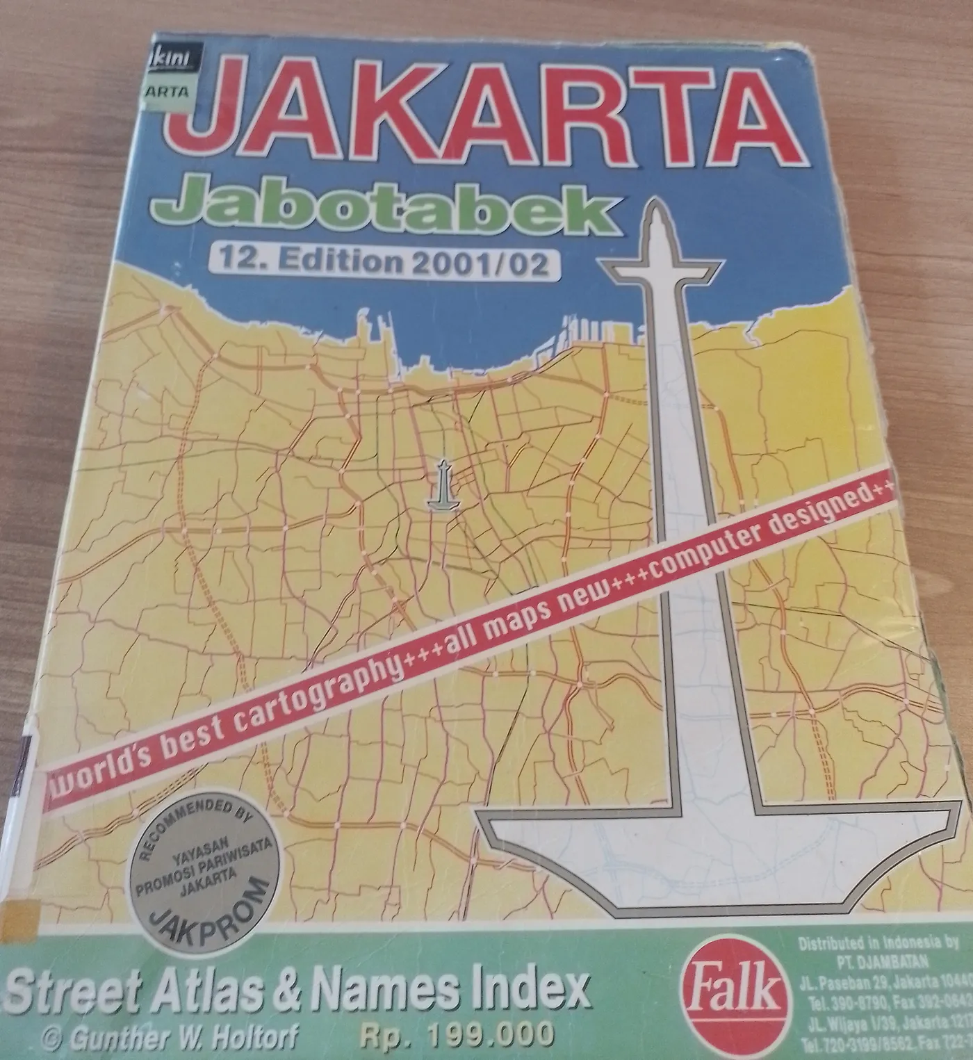
In 1973, Gunther W. Holtorf was assigned as the manager of Lufthansa in Indonesia.
From his first year working in Jakarta, many friends and visitors from abroad frequently asked him to act as their guide in the city. To assist his guests, despite having no formal background in cartography, he began sketching maps of Jakarta. His work proved useful and well-received, encouraging him to create a more detailed and comprehensive map of the city.
To achieve this, he initially approached the Jakarta City Planning Office. Instead of obtaining the topographic maps he sought as a base, he only found outdated maps of the city. This situation led the local civil servants to encourage him to produce a new map.
Gunther accepted the challenge. Every weekend, he explored Jakarta, navigating its narrow alleys and streets by foot, bicycle, and car. In addition to his weekend excursions, he also dedicated time each morning from 6:00 to 9:00 before heading to his office.
Posted by Grayforsyth on 2 April 2025 in English.
Last updated on 24 April 2025.
Location:
Teton County, Wyoming, United States

Posted by raphaelmirc on 31 March 2025 in English.
how to move the street name to the side of the street.

with this file coloured+name_offset.mapcss https://projeto.softwarelivre.tec.br/s/4z2jzQSjkL5oPTW you can move the street name to the side of the street, making the street name visible for better mapping of street names.
In this video I teach you how to use this file that you have to download to your computer.
File Link coloured+name_offset.mapcss
https://projeto.softwarelivre.tec.br/s/4z2jzQSjkL5oPTW
link no Youtube: https://www.youtube.com/watch?v=4jOnFjtuI10&t=57s
Posted by raphaelmirc on 31 March 2025 in English.
latest contributions

I have been mapping street names in Brazilian cities that need street name mapping.
The mapping is diverse between the North and Northeast regions, but I can map in any of the five regions of Brazil.
List of the latest mapped cities.
Imperatriz, MA osm.org/relation/332989
mapping roads in rural areas in openstreetmap.
learn how to map roads in rural areas with this video tutorial.

link to the video lesson on youtube https://www.youtube.com/watch?v=0kuxIGH8DuE&t=35s
UMBRAOSM Union of Brazilian Openstreetmap Mappers
Posted by raphaelmirc on 30 March 2025 in English.
How to map objects in Openstreetmap with Rapid Editor.
UmbraOSM (Brazilian OpenStreetMap Mappers Union) brings you another video tutorial, teaching you how to use the Rapid editor to map buildings and roads in OpenStreetMap. Check it out and improve your mapping skills!
 Rapid Editor https://rapideditor.org/
https://www.youtube.com/watch?v=SOIQnPCuAug&t=902s video link on youtube
UmbraOSM (Brazilian OpenStreetMap Mappers Union)
This blog post is part of a series of blog posts about the new OSM file format “OMA”. This is the fourth post. At the end of the article you’ll find links to the other blog entries.
The real subject of this blog series is the newly developed file format. So far I have mainly talked about the tools for creating and using the format, because the format itself is a dry subject. But now it’s time to dive more deeply into the format itself. I will not go into all the details, because I think that apart from some freaks like me, people are not interested in all the details. If you are, take a look at the specs.
Fast Access
OpenStreetMap data consists of a set of elements. Some of these elements are nodes, some are ways, and some are relations. You can think of OSM as a big storehouse where all the elements are scattered around:

Obviously it’s hard to find what you’re looking for, if there is no order.
The Order of OSM Files
Posted by Jaiden1254 on 28 March 2025 in English.
Coordinates should be formatted 1.236345 4.23643 Written by ChatGPT Due to kramdown I have to use https://docs.google.com/document/d/1P4YrHsAhZKu9BRt1HRnsBbQJl8MdDMoJ76Ht9w1aqG0/edit?tab=t.0

What is anti-SEO aktion?
Maybe you’ve seen one of my changeset comments reading “anti-SEO aktion”. Maybe I even reverted your changes in a changeset with that comment. You might be wondering, what does it mean?
Well, I hope “anti-SEO” is clear enough. OpenStreetMap is not a platform for boosting your online presence. Your OpenStreetMap listing, in all likelihood, does very little to improve your rankings. If the marketing agency you hired is improving their listing here, you ought to find one that used more evidence-based SEO practices.
And what of “aktion”? It’s a play on Antifaschistische Aktion, which was an anti-Nazi resistance effort in Weimar Germany. It’s not a political statement, per se. It’s just a bit of fun with changeset comments.
How do I get involved?
Any experienced mapper probably knows what belongs in OpenStreetMap and what doesn’t. For those who don’t, here are the general steps involved in fixing spam within the U.S. While following all of them isn’t necessary, it’s the best way to turn SEO efforts into a real business listing that improves the map.
Posted by Jan Prazak on 27 March 2025 in English.
Last updated on 7 April 2025.

Objects in private gardens which are of no public interest such as movable objects (like small swimming pools), should NOT be entered into any public maps! They add nothing to the quality and usefulness of a map, I consider it a map data spam.
I may sometimes remove such objects from the Frýdlant region, especially if not mapped correctly (make sure private swimming pools are marked as private to not interfere with searching for nearby swimming pools).
Posted by Raquel Dezidério Souto on 27 March 2025 in English.
Last updated on 1 April 2025.

Ler em Português
MapComplete, Panoramax, overpass turbo and uMap: what can you do with these programs when mapping trees?
But first, a suitable question: how important is it to map trees?
In addition to the urban issue, in which it is often assessed whether natural elements and urban equipment are preserved, whether they are adequate or well distributed in a given area, the greatest motivation for mapping trees is to monitor vegetation cover, since these individuals are ecologically relevant. Combined with an educational activity, it also helps to raise awareness of their importance among students.
Trees provide various ecosystem services (or environmental services), such as providing shelter and food for different species, cooling the ambient air, removing atmospheric CO2, producing biomass, preventing soil erosion, reducing noise pollution et al.
Mapping with MapComplete

Posted by mappinsauce on 26 March 2025 in English.
Last updated on 24 April 2026.
Project Outline
This entry is a statement of my intention to map out Bell Island, Newfoundland. I will start south and move my way north as the south is less densely detailed and work will likely be quicker. My intended workflow is stated below, where I will not move on to the next item on the list until the first item has been mapped as thoroughly as possible on the entire island. While I am experienced at working with geospatial data, this is my first project on OSM so any suggestions/comments on my work are appreciated.
I will provide updates through future diary entries as my work progresses. This is a casual project so I am not setting any timelines.
Workflow
- Buildings & associated roads
- Terrain
- (Might drop due to lack of local knowledge) Secondary urban & rural characteristics (cemeteries, parking lots, etc.)
Update 1: Initial Thoughts and Slight Workflow Alteration
(2025/03/26) After spending a bit of time mapping and getting a feel for the scope, type of work this project will require, it’s clear that this project will unsurprisingly take quite a bit of time.
To make this process as engaging as possible, I think it would be wise to alter my workflow slightly. Initially, I planned to start with only mapping buildings for the entire island. However this would mean hours and hours of monotony, so I think a good workaround here is to keep my current workflow structure, but just apply it to a smaller scale. For example, I’ll pick smaller sections of the island to do both the building and the terrain mapping. This will give the work more variety and also make it more clear which areas I’ve already worked on.
Update 2: Midway
(2025/04/15) At this point I’ve officially mapped out half of Bell Island, Newfoundland. Although I’m geographically halfway, the southern portion which I’ve mapped out is much less geospatially dense than the northern portion, so I’d estimate I’m about a third of the way through this project.

You may have noticed that I have marked a lot of buildings in Nanaimo with notes indicating that each of those buildings has multiple businesses in it. This is because on the next sunny weekend, I will be going down to Nanaimo to survey all of those businesses, and I need to be able to see at a glance which specific buildings I need to survey. I will need to know the exact position of each business within each building, so what I end up putting into OSM as a result of this survey is an as-accurate-as-possible depiction of each building’s “floor plan”, if you will.
One of the reasons as to why I loved this image set was because it was almost centered completely from the top-down, which made tracing buildings far easier. This new set that was introduced makes it extremely hard now, and all of the already-traced assets like buildings and roads are now quite skewed when based off the new set. It’s frustrating.