Diary Entries in English

Recent diary entries

Posted by Probelnijs on 16 August 2024 in English.

About a year ago I wrote about my experiences of mapping in Bonaire. It’s time for an update.

Satellite imagery

One of the challenges I had was adding data without high quality and recent imagery. Luckily, earlier this year the ‘Satellietdataportaal’ (Satellite Data Portal) made high resolution data available for Caribbean Netherlands.1

License

First things first though: are we allowed to use the aerial photos they publish for improving OpenStreetMap? There is a long thread on the Community forums. Whether it’s allowed or not depends on the agreement the Dutch government has with the satellite data provider.2 Luckily, in the topic itself it is discussed that it is allowed to use Pléiades, SuperView and TripleSat.

Geoblock

The downside? You can only use this in The Netherlands. The data is geoblocked. I’ve added a lot of new streets and buildings in Bonaire over the past few weeks, but only other people currently in The Netherlands would be able to validate that I’m mapping actual buildings. The rest of the world would need to wait for a worldwide aerial imagery provider to update their data.

Selecting the satellite data

In the Satellite Data Portal Viewer, after selecting Bonaire from the top left menu, you then need to select a part of the area for which you want to see the satellite data, then it gives you a list of options. Currently for Bonaire there are only three options (as we’re only interested in recent and high resolution satellite data). * Pleiades-NEO January 9, 2023 * Pleiades-NEO April 18, 2023 * Pleiades-NEO June 17, 2023

The January one is generally too cloudy, but the April and June ones are useful. Use the April one if you’re looking at the Western part of Bonaire (Rincon and Washingtong Slagbaai National Park) and use the June one for Kralendijk and all of the east and south.

You can simply click on ‘Select for WMTS’ which fetches you a link.3

Setting the background

See full entry

Update for the past 10 days of the mapping challenge.

Today I mapped the last village on the list, so in 71 days i have mapped around 100 villages. Since my initial personal challenge was to map for 100 days, I will continue mapping and add villages to the list. I will finish mapping what is left from the Online Mapping Party for OSM 20th birthday. List of villages is we mapped and what is still to be mapped is here.

Villages mapped during the past 10 days:

  1. Vorrozen

  2. Levan

  3. Pilur

  4. Kodër

  5. Toç

  6. Skrevan

  7. Arn i Epërm

  8. Lofkend

  9. Ogren-Kostrec

  10. Lenmushë

  11. Rrashtan

  12. Raban

  13. Skënderbej

  14. Kuç

  15. Jezull

  16. Shpatanj

  17. Arrëz

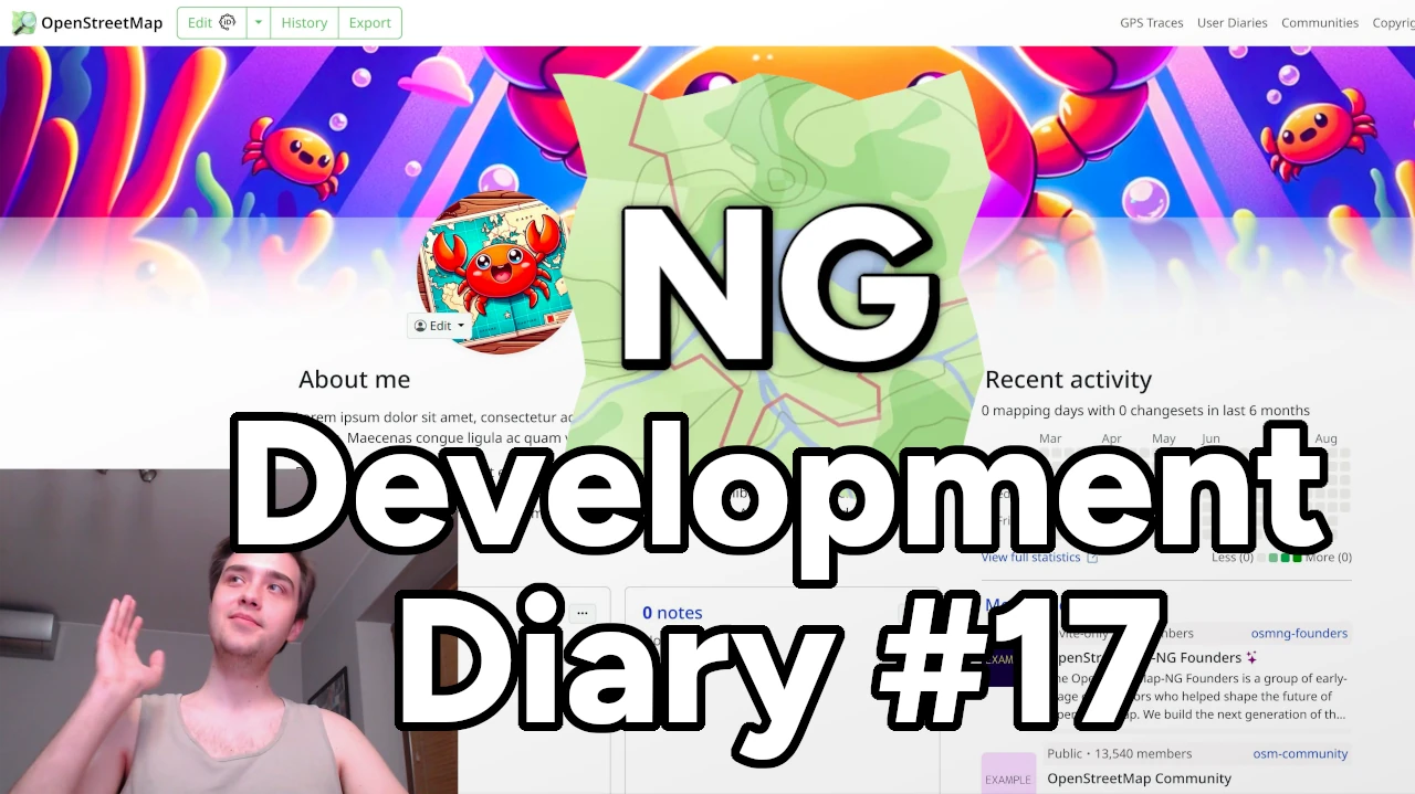
Heyy! I am very excited to share our latest OSM-NG development progress with you. Apologies for the slight delay — I wanted to wrap up some work for this week’s diary.

🔖 You can read other development diaries here:
osm.org/user/NorthCrab/diary/

⭐ This project is open-source — join us today:
https://github.com/openstreetmap-ng/openstreetmap-ng

🛈 This initiative is not affiliated with the OpenStreetMap Foundation.

📹 Video Summary

It’s been a while since our last video showcase, so let’s recap the recent progress in video format. It’ll also give you a better feel of the new exclusive profile backgrounds feature.

⬇ Click below to play ⬇

Video thumbnail

or click here: https://peertube.monicz.dev/w/5fKNRsq2K8jRyF22zEG5px

Profile Backgrounds

With OpenStreetMap-NG, users can now customize their profile backgrounds, making their personal pages even more personal. It’s time to show off your personality!

See full entry

Posted by NADARAJ SARANYA on 14 August 2024 in English. Last updated on 23 August 2024.

I did It. Successfully Completed 20 th osm Birthday Celebration Srilanka.

Celebration Date : 11th August 2024

Thank you all Speakers, Presenters and participants for making this 20th osm birthday celebration success. and once again thank you accept my Invitation. #Taichi Furuhashi #Pawan #Janjan Villar Orano #Priscovia #Sangeetha BC #Dibikshiya #Ark Arjun

Thank You So much everyone……

#openstreetmap

#20th birthday celebration Srilanka

#eastern university srilanka

It’s been over two weeks since the last progress report, and it’s time to update on the current status.

Project Progress

The core modules of the project have now been largely finalized, allowing us to enter the latter stage of development. The upcoming work will mainly involve adding new features within the existing framework.

Render

Firstly, the rendering part has been set up, though there are still some details that need polishment, such as styles and elements controlling the rendering. These will be adjusted in sync with the subsequent feature development to ensure that the styling aligns with the editing logic.

API call and XML obj

I’ve developed an OSM API module that wraps some of OSM’s interfaces using Promises and parses the returned XML into a JavaScript object for easier manipulation within the program.

Editor’s status management

Following that is the editing module, which primarily includes the operation logic and global data management.

For the operation logic in map editing, I’ve introduced a state machine, which manages the current state of the editor by listening to mouse and keyboard events. The state machine, referred to as “stateMachine.js” in the code, handles state transitions and data maintenance based on the functions and state relationships provided in the state diagram. Depending on the current state, it determines which actions to trigger and the new state to transition into. The state machine provides hooks that allow other components, such as mouse events in Pixi.js, to track events. Editing operations are carried out during state transitions.

See full entry

Posted by ElliottPlack on 11 August 2024 in English.

I was having a conversation with another mapper about the resolution of notes where the resolution of the note requires some local knowledge. These notes that require local knowledge may remain stale for a long period of time. You can read the full conversation here.

However, it is not uncommon that notes are resolved by people that are mainly interested in resolving notes. Anecdotally, based on the fact that I put in a lot of notes, there seems to be just a select few people that are going around resolving notes as their primary OpenStreetMap contribution, or at least a major part of it. I have all the respect in the world for these people. And to Danmer’s point, they don’t have enough help to get all their notes resolved, so leaving them unresolved, because notes only have two resolution options—they’re either open or they’re closed—can be challenging.

If the primary note resolution engine is people that most likely have no local knowledge, it is counterproductive to rely on that corps of people to address these notes that require local knowledge.

I think that we could probably classify notes into three categories:

  1. Those that anyone can resolve with just aerial photography and potentially some street-level photography.
  2. Notes that require some information that is not available with strictly what is presented to a remote editor, such as local knowledge, or something in the person who wrote the note’s mind.
  3. Spam.

See full entry

After years of development, I am excited to introduce a proposed feature for OpenStreetMap called Communities. Formerly called Microcosms, this feature is designed to bring mappers together and facilitate collaboration. On the main OSM website, it will be located on the Communities page.

What is Communities?

Communities are groups of mappers who share a common goal or interest. They can be formed around a specific geographic region, such as a city or neighborhood, or centered on a particular theme, like humanitarian mapping. The purpose of Communities is to provide a platform for mapping teams to connect with one another, work together as a team, and organize events.

Community Mapping Event

Key Features

See full entry

My Journey as an OM Guru Fellow: Empowering Communities Through Open Mapping

Introduction

In January 2024, I embarked on an exciting journey as part of the OM Guru Fellowship program under the Open Mapping Hub - Asia Pacific. As one of the 50 selected Guru Fellows, I had the opportunity to join the Training Track, focusing on conducting training sessions, webinars, and mapathons for community members. This fellowship aims to foster a sustainable OpenStreetMap (OSM) ecosystem in the Asia-Pacific region by building the capacity of new and experienced mappers alike.

Getting Started

The fellowship began with an orientation, where we learned about the scope of work, our expected roles, and the various activities we would undertake over the next five months. As a Training Track Fellow, I was excited to engage with diverse communities and contribute to the open mapping movement by sharing my knowledge and skills.

Training Sessions and Webinars

During the fellowship, I conducted two online webinars and one in-person training session. These sessions were designed to cater to both beginners and experienced mappers, covering a wide range of topics.

Online Webinars

See full entry

Location: East Taraka, Lae, Lae District, Morobe, Momase Region, Papua New Guinea

Development has quickly progressed through two weeks, and it’s time to write a bi-weekly report.

Project Progress

The project is still in its early development stage, so we are unable to provide a usable prototype at this time.However, our implementation of the rendering part has been basically determined.

After testing, points and paths can be rendered successfully.

Due to the ongoing development of the interfaces for other modules, some functions have not yet been implemented. For instance, highlighting segments of a path instead of selecting the entire path as in the default logic of the iD editor. Also, the rendering of polygons has not been implemented yet because it requires the interface of the editing module.

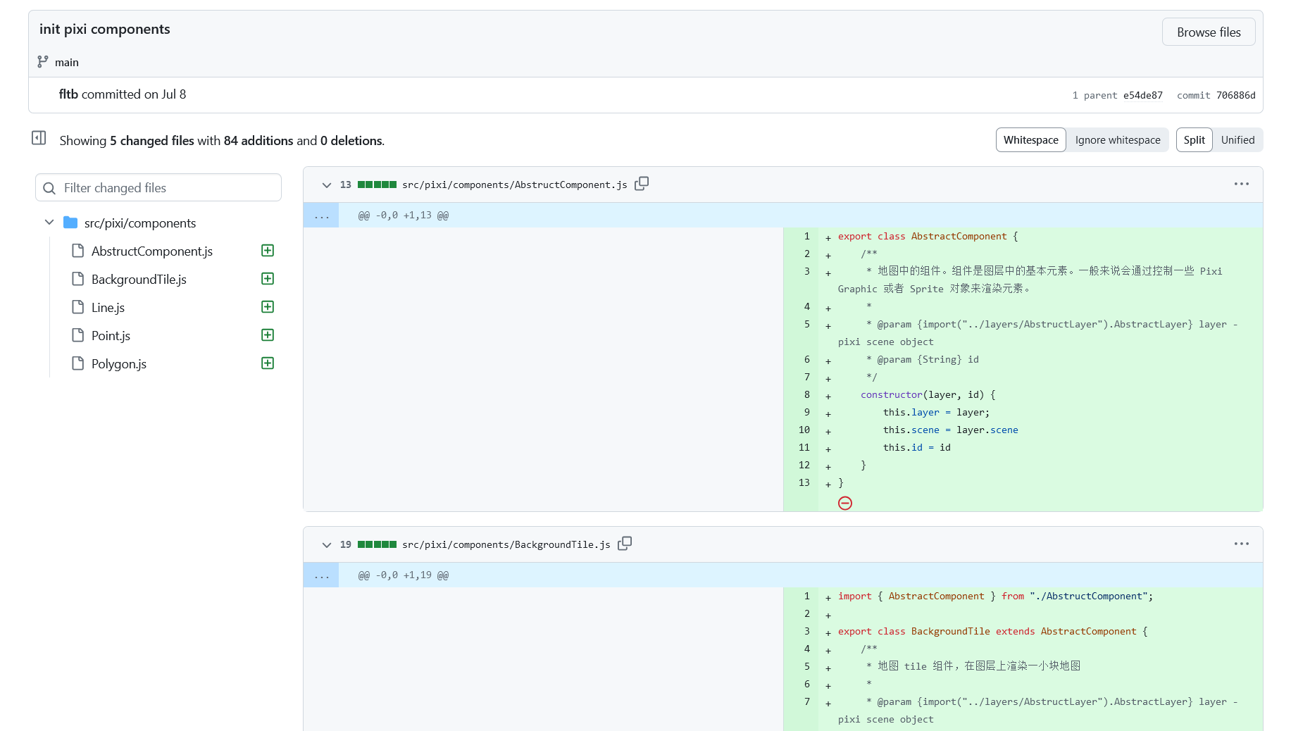
We plan to divide the project into different components to facilitate future development and maintenance.

Component and code structure in commits

Demonstration Effect

See full entry

Posted by IrdiIs on 6 August 2024 in English. Last updated on 8 August 2024.

Together with LibreLabs Albania and OpenStreetMap Albania, we decided to celebrate the 20th birthday with an Online Mapping Party. We decided to “Map the Balkans”, so we extracted 55 villages from 11 countries, and we will come together on the 10th at 19:00 to celebrate and map.

Blog post from LibreLabs - https://librelabs.cc/blog/openstreetmap-online-mapping-party/

OSMcal - https://osmcal.org/event/3041/

Wiki - osm.wiki/OpenStreetMap_20th_Anniversary_Birthday_party

Anybody who wishes to join is more than welcome!

Happy 20th birthday, OpenStreetMap!

Posted by manojkmohan on 5 August 2024 in English.

Our OpenMapping iniative for #Wayaland Last few days Our #opendatakerala team with #OSMKerala OpenStreetMap working with officials and National Disaster Response Force for the mapping needs in their field needs. Just Noticed a news came few days back. Thanks The New Indian Express

https://www.newindianexpress.com/states/kerala/2024/Aug/03/kerala-open-street-mapping-to-ensure-speedy-relief-for-landslide-victims

Location: Punchiri Mattam Colony, Mundakai, Vythiri, Wayanad, Kerala, India
Posted by JJSmapy18 on 4 August 2024 in English.

How is it going and what am I up to now?

Introduction

I know I put in a entry in the diary not to long ago but I want to let you know what I am up to now. I am putting the finishing touches on my eruv map with I hope looks good. I am getting help with it and thank you to the gentleman that is helping.

What’s next?

  • I am currently spending a lot of time on StreetComplete and MapComplete. They are really good for me. I am helping my local community by validating roads, building, hours of operation, what sidewalks are made of, if the road is asphalt or what ever. I am really having a lot of fun doing it and its a good feeling that hey I have no clue if this helps anyone but it helps knowing I am helping.

  • I am also interested in adding things to OSM. I am fascinated by what I have seen from others. It would be good to start with one thing like roads, building, etc. Still learning the types of things OSM maps. Then build from that point once I get relatively comfortable with whatever this is.

  • Eventually I would love to get down to one or two things and really get good mapping those. I do not know the full capabilities of OSM, its a lot I am sure. Just hope I can be more specific and get very comfortable doing that one or things.

  • I am super interested in sustainability and resiliency. I would love to start to map and get involved in this area at some point. I also want to find out if OSM has something like Esri Story Maps. I want to see if I can tell stories of people for resilience. Cultures and peoples have has a long history of successful resiliency initiatives. That is the Story Map type thing came from.

Conclusion

I am super happy I found OSM and you all are very kind and generous and always happy to answer question. Just want to say thank you!

OSM is a tremendously powerful tool that I would love to see how it is used day-to-day by different organizations.

Till next time!

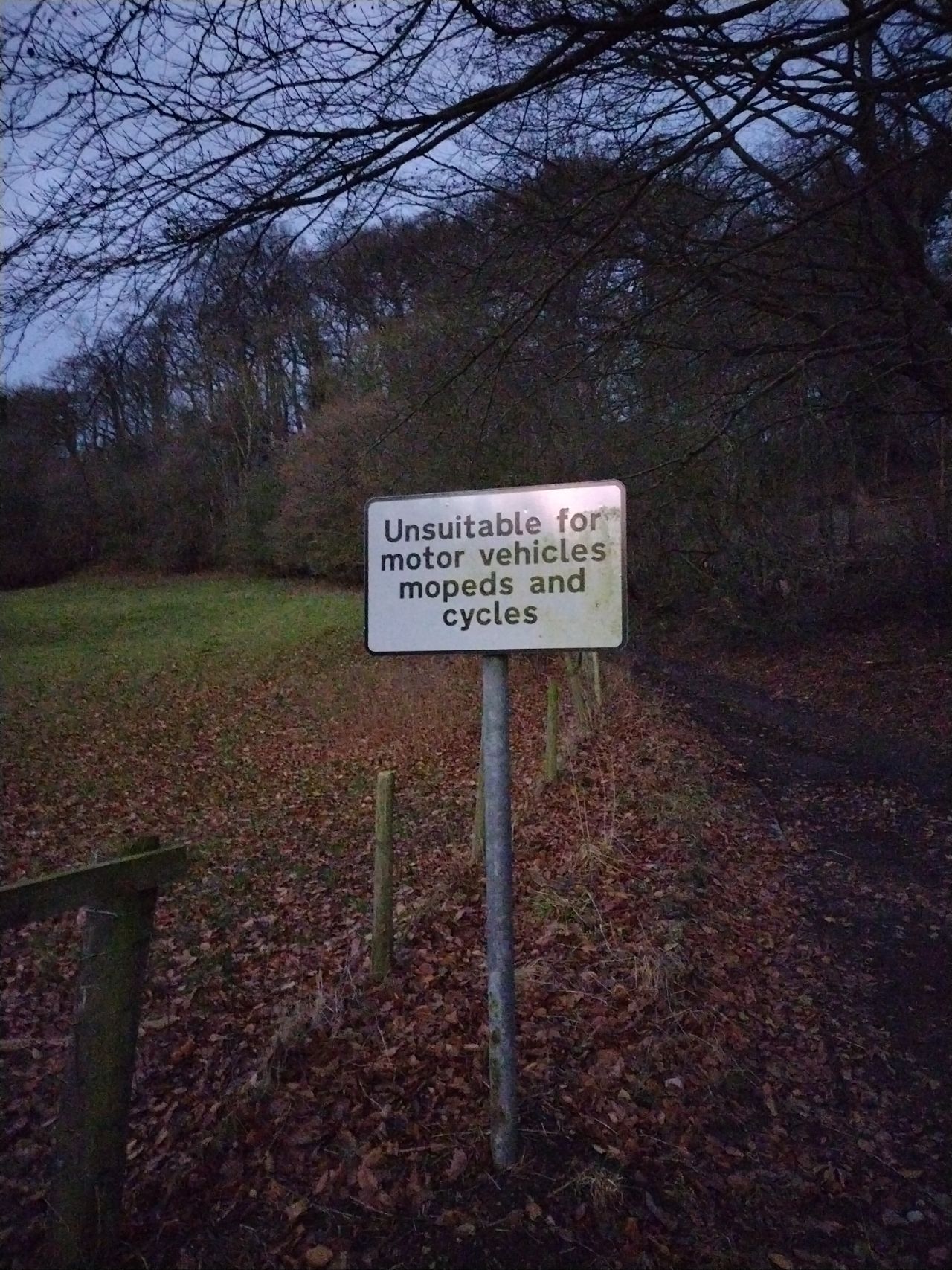
Unsuitable for motor vehicles mopeds and cyclists

My previous diary entry looked at the UK section of this OSM wiki page. A commenter there noticed that neither the wiki table nor my analysis covered highway=track (covered here) or highway=service (left for later).

We’ll use the same approach as before. Essentially, that’s this urban area (and this when looking at designation), and this rural area.

It’s useful to look at designation because that tells us what some of the access values should be, and also local authority data about public rights of way such such as visible in this overlay. We’ll therefore ignore ways in OSM with designation set but look to see if any of our examples “should” be designated as a public right of way.

See full entry

Location: Oldstead Mill, Oldstead, North Yorkshire, York and North Yorkshire, England, YO61 4BL, United Kingdom
Posted by NorthCrab on 2 August 2024 in English. Last updated on 16 August 2024.

Welcome to the sixteenth OpenStreetMap NextGen development diary.

This week, we continue focusing on feature parity and migration efforts.

🔖 You can read other development diaries here:
osm.org/user/NorthCrab/diary/

⭐ This project is open-source — join us today:
https://github.com/openstreetmap-ng/openstreetmap-ng

🛈 This initiative is not affiliated with the OpenStreetMap Foundation.

Project Keeps Growing

Before we get started with this week’s highlights, I want to highlight the continuous growth of the project in terms of popularity on GitHub. It’s amazing to see the community in action - thank you all! It keeps us all motivated! 🌠

Star History Chart

Geolocation Icon Pt.2

Last week, we talked about the new geolocation icon design. This week, we have iterated on it and created a custom design that looks and feels just right. Check it out:

See full entry

This is a diary about a recent drone mapping initiative that I participated in. I would like to give credits to the Open Mapping Hub - West and North Africa, OpenStreetMap Sierra Leone, Pete Masters and Ivan Gayton for all the support and knowledge given during the course of this initiative. I hope to learn more as we continue collaborating.

Purpose

The use of satellite imagery from multiple sources has been a pivotal aspect of open mapping campaigns across the world. However, satellite imageries have some limitations, such as low resolutions and delayed visitation time. This affects the quality of the digitization of physical features that are to be mapped. In order to address these limitations in open mapping campaigns, the use of Unmanned Aircraft Systems such as drones have been employed to capture images with high resolutions within desired timeframe.

Scope

With support from the West and North Africa Hub through the Mwalai microgrant, OpenStreetMap Sierra Leone embarked on the collection and processing of drone imageries in three slums across Freetown as part of the Know Your City initiative. The imageries would be used to map buildings and critical infrastructure, test the fAIr model and Field Mapping Tasking Manager.

Technical Specifications/Parameters

In order to have high resolution imagery, the team used a DJI Mavic 2 Zoom drone for the flights and Open Drone Map for the image processing. A smartphone-based flight planning and control application was used to conduct flights with specific elevation, overlap, and angle settings, allowing the operators to ensure consistent resolution, quality, and coverage across the areas of interest.

Flights were conducted above slums with dense buildings, therefore, flight settings with paths and gimbal angles that captured the top and sides of buildings and other infrastructure. The team used the following flight settings. 70% Frontal Overlap 80% Side Overlap -75 degrees Gimbal Angle

Processing

See full entry

Location: Mirimboe, Freetown, Western Area Urban, Western Area, Sierra Leone