Diary Entries in English

Recent diary entries

Posted by jothishbabu on 28 June 2024 in English.

Today, I want to look back on my time with OpenStreetMap (OSM) and how the OSM Guru Fellowship has helped me grow.

I started contributing to OSM in 2019. Since then, I’ve made over 2000 changesets. Each one has helped make the map a bit better and more accurate.

Working with Jungle Bus and GeoMinds has been great. These projects showed me how important good maps are, especially in places that need them most. I’m proud to have been a part of their work.

One of my biggest projects was mapping public transportation in Kochi. We added 24,000 kilometers of routes to OSM. It was a huge task, but knowing it helps people get around the city makes it all worth it.

The OSM Guru Fellowship has been amazing. It taught me a lot about OSM and its concepts, giving me the skills I needed to be a better mapper. I learned that knowledge is power, but community is even more powerful.

The OSM community is something I love being part of. It’s inspiring to see people from all over the world work together to map the world. The fellowship connected me with others who are just as passionate about mapping as I am.

Looking back, I’m thankful for everything I’ve learned and the people I’ve met. The OSM Guru Fellowship has been a big part of my journey, and I’m excited for what comes next. Here’s to more mapping and a stronger community!

Posted by jothishbabu on 27 June 2024 in English.

Kinnakorai is a beautiful village about 50 km from Ooty town. The beauty lies in the journey to the village itself. Kinnakorai is similar to any other remote mountain village in India, but the villagers looked at us like we came from Krypton on a UFO. I can’t blame them at all because we were in full gear with 25 people on different motorcycles.

By the way, the day I realized that the road to the village was incorrect, I had the complete GPX trace along the route. So, I planned to fix the roads, and here we are. I edited the roads with my GPX traces and pushed the updates to OSM. Now anyone can rely on those maps. :)

Posted by TrickyFoxy on 25 June 2024 in English. Last updated on 9 July 2024.

In new version of userscript, I focused on analyzing edits. QuickLook for changesets, hotkeys, filtering changesets, mass actions and more.

I wonder how well this phenomenon is known in the world 🤔

Help wanted: I would be grateful if someone knows how to get into the site code and manage the map (add new objects, change layers, colors …) This would make it much easier for new features to appear. Otherwise, they will only be available in OSM-NG (: upd: solution found!

👮‍♂️ QuickLook of changes in tags

Now you don’t need to open OSMCha for simple changesets. Tag changes will be visible directly on the changeset page.

See full entry

I started my journey as an OSM contributor in August 2018. My knowledge was initially limited to the iD editor and HOT tasking manager platform, with minimal community mapathon contributions within Nigeria. Consequently, my contributions to OSM were very low and inconsistent.

In November 2023, while seeking more opportunities to volunteer and contribute to the growing OpenStreetMap community, I discovered the OM Guru fellowship organized by the Open Mapping Hub Asia-Pacific. I applied as a Mapper, which complemented my background as a Remote Sensing and GIS student.

During my six-month tenure in the fellowship, I was exposed to various aspects of mapping, from building data capturing using JOSM, to Amenities/POI mapping with Every Door, and street-level imagery capturing using Mapillary, focusing on Disaster, Humanitarian, and Climate action. Additionally, I learned and developed my skills in JOSM validation and field mapping. The weekly training sessions and webinars exposed me to more applications of GIS and Remote Sensing in open spatial data science, thus enhancing my geospatial expertise.

One significant highlight of the fellowship was the Climate Change Challenge, where OM Guru-led groups competed in 8 climate challenges. I led a team of OSM contributors, which provided me with valuable leadership and teamwork experience. I was exposed to more applications and tools within the OSM ecosystem, such as Mapswipe, Maproullete, and mapping with RapidID. I contributed to mapping high priority, disaster prone and impacted areas in Asia-pacific countries.

See full entry

Location: Katabon, Shahbag, Dhaka, Dhaka Metropolitan, Dhaka District, Dhaka Division, 1205, Bangladesh
Posted by IrdiIs on 25 June 2024 in English.

Travelling to Thessaloniki today and got a 10-hour bumpy bus drive ahead.

Mapping while travelling by bus is definitely a huge challenge, but I think I managed to map Hajdaraj.

I think the village includes another area close to it, but somehow it is separated in a different residential area. Ill double check to make sure I got it all.

“#100villagesin100days #day21”

Welcome to the twelfth OpenStreetMap NextGen development diary.

This week brought some exciting updates and major news!

🔖 You can read my other development diaries here:
osm.org/user/NorthCrab/diary/

⭐ This project is open-source and publicly available:
https://github.com/Zaczero/openstreetmap-ng

🛈 This initiative is not affiliated with the OpenStreetMap Foundation.

In case you missed it…

We are now welcoming new contributors! To show our appreciation, we offer contributor incentives. If you’re familiar with Python, join us – it’s easy to get started!

Continue reading

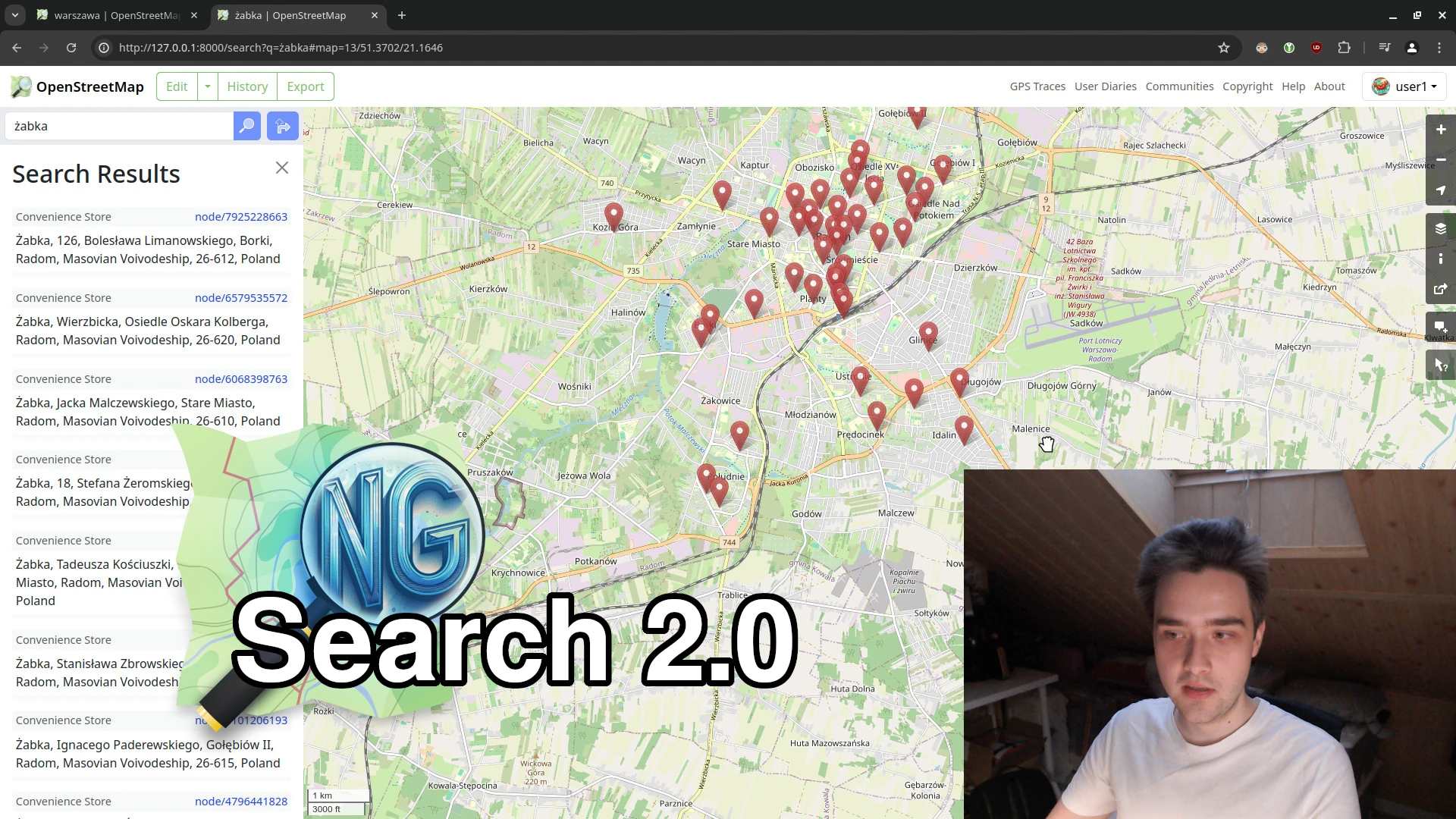
Search 2.0 (with video showcase) 🎉

This week, we made significant strides towards our NextGen vision. The new search functionality is nearly complete, and I’ve recorded a short video comparing OSM Ruby and OSM-NG side-by-side.

⬇ Click below to play ⬇

Video thumbnail

or click here: https://peertube.monicz.dev/w/c7Qwif6S4MpvuBBDu7x8LM

See full entry

Posted by jpennycook on 24 June 2024 in English. Last updated on 25 June 2024.

At the moment I’m only doing small edits, or edits using StreetComplete. I got frustrated by some people making bad edits which persuaded me there were other things that I could do rather than editing OSM.

Particularly annoying behaviours for me:-

  • Dunning-Kruger edits by people who have been here for a while but don’t edit that often - people who are absolutely sure they are right even when queried (and think the wiki is wrong), especially people whose changeset edits read like they are selling houses
  • people deliberately setting data they know is wrong but to make some route planner or map do what they want, even though they have been challenged on this repeatedly in the past
  • people adding data like access, surface, or tracktype in bulk to tracks that lack them just to fill in missing data without any evidence (so all tracks in a particular area get set to tracktype=grade2 whether they are actually asphalt or mud)
  • people copying from developers plans, rights of way descriptions, or other maps at the expense of reality (I map what’s there on the ground, they “correct” it because they’ve seen it on a plan, my journey planner tries to send me on unbuilt paths, through fences where I don’t have access, or my road bike on a dirt track suitable for a 4x4 off-road vehicle, and repeat over several years).

My main goal with editing OSM is to improve route planning on foot, bicycle, or public transport, hence why I’m keen to get surface, tracktype, smoothness, access, and construction tags correct.

I can not believe it that it has already been 20 days into the challenge and I have mapped over 30 villages so far. For the next five days I will be in Thessaloniki with a group of Wikimedians from the Balkans and I hope I manage to map every day, but if I don’t, I promise I will catch up.

If somebody following this want to catch up and learn or contribute to enriching Wikipedia, Commons and Wikidata from 26 to 30 June, reach out and ill let you know where you can find us.

Today I mapped Perkola and the surroundings. Perkola was partially mapped, so I moved around the map and mapped some other areas too.

“#100villagesin100days #day20”

We have started to export and upload contribute all the GPS Routing Data we have collected from our motorcycle 360* data recorder for [Vietnam Street View project] (https://streetview.vn).

Check our our Trace History upload in here: (osm.org/user/openmap-vn/traces).

The data we contribute will partly support the construction of the navigation process for projects using the open map OSM.

Posted by Softgrow on 24 June 2024 in English. Last updated on 25 June 2024.

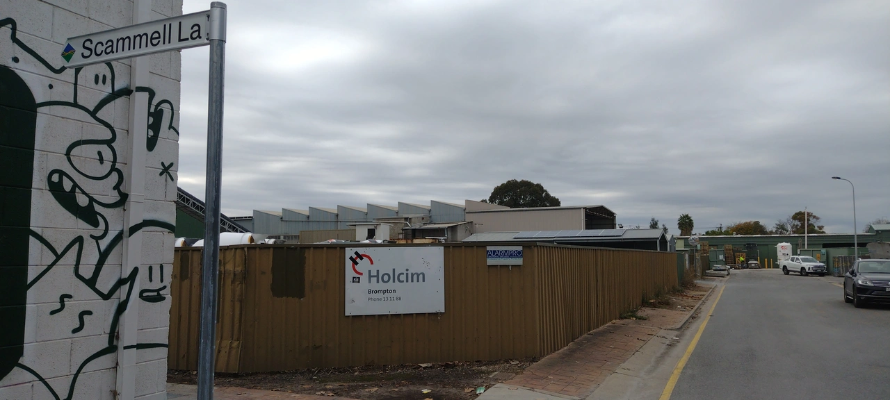
We all know that you should never map for the renderer and you should only map what is on the ground. But I think I’ve found the third sin, changing the ground to match the map. This nine year old way is a service lane with a name, but doesn’t give a source for the name. Doing a survey showed no signs and historic photos show it as without signs. So I contacted the local council, City of Charles Sturt and asked if they could erect signs, which they have.

Fingerboard sign saying Scammel Lane with council logo

I don’t feel the least bit guilty. 😊😊😊

Location: Hindmarsh, Adelaide, City of Charles Sturt, South Australia, 5007, Australia

The Creative Commons Zero (CC0) waiver is, in my opinion, the most free way to release open-source software. Unlike licenses that impose conditions on the use, modification, or distribution of software, CC0 allows me to waive all my rights to limit what users can do with the software. It effectively places the work in the public domain. This absolute waiver ensures that the software can be freely used by anyone, for any purpose, in any way. Here’s why I choose CC0 when releasing open source software and why I cannot – and will not – grant permission to use my CC0 software.

Software freedom

Other licenses impose various requirements on using software, such as:

  • Copyleft/viral licensing: Mandates that derivative works also be open-source and follow the same licensing conditions.
  • Attribution requirements: Requires giving credit to the original authors in all copies or substantial portions of the software.
  • Redistribution conditions: Imposes specific terms on how the software can be redistributed, including the requirement to state changes made to the code.
  • Source code disclosure: Requires making the source code available to anyone who receives a copy of the software.
  • License compatibility issues: Restrictions that affect the ability to combine the licensed software with other code under different licenses.

In contrast, CC0:

  • Imposes no obligations for attribution.
  • Requires no disclosure of source code.
  • Does not mandate any specific licensing for derivative works.
  • Places no restrictions on combining CC0-waivered software with other code.

This complete freedom fosters innovation, as developers can build upon CC0-waiver software without worrying about legal ramifications or compatibility issues with other licenses.

That means:

  • Hobbyists can use it.
  • Companies that make money can use it.
  • People I don’t like can use it.

See full entry

I started my journey in OSM Mapping contribution in September 2020. I have worked in multiple OSM HOT Tasking projects in ID editor and JOSM. The community has been a blessing for me as it was more engaging and conscious of OSM mapping and having a journey making the world a better place through OSM Mapping.

At the end of December 2023 Open Mapping Hub- Asia Pacific hosted a program call to all active contributors to embark on a journey with AP-Hub of fellowship of active mapping and community engagement with AP-Hub network and OSM community. I passed the exam with joyous remarks. I was selected for Mapping track out of 15 been selected for the Mapping Track of OM Guru Fellowship. There was 3 different track set by AP-Hub, one Mapping track (tasked for mapping), 2nd Validation Track (tasked for validation of OSM Mapping), and 3rd Training track (Tasked for training participants). On first month, we had 100 task mapping in HOT Tasking Manager. It was a rigorous mapping in Philippines, Vanuatu and Micronesia. On 2nd month, we have worked on Everydoor App POI collection. I have roamed around my neighborhood to taking detailed data of the POIs. On the 3rd month March 2024, we worked on Mapillary of 500 images. Then on 4th month April, we worked on QGIS mapping, before and after image of OSM Mapping and 100 mapping tasks in HOT Tasking Manager. On 5th month May 2024, we validated 200 tasks in HOT Tasking Manager.

The entire journey had made me a consistent mapper and having learnt many new applications to contribute to OSM Mapping, I am grateful to AP-hub for the amazing opportunity.

Greetings, fellow mappers! I am thrilled to share my journey as an Open Mapping Guru Validation Fellow. This fellowship, organized by the Open Mapping Hub Asia-Pacific, has been an enriching experience filled with learning, collaboration, and significant contributions to the OpenStreetMap (OSM) community.

My OSM Journey From Beginner to Advanced Mapper

My journey with OpenStreetMap began back in December 2021 during a training organized by the Geomatics Engineering Students’ Association of Nepal (GESAN). The collaborative spirit of OSM and its mission to create free, up-to-date maps for everyone instantly captivated me. Unlike other mapping services, OSM is a community-driven platform that offers unrestricted use, much like Wikipedia. Till then, I’ve started mapping my way around different parts of Nepal and have since expanded my efforts to encompass the global landscape. Over time, I became an active mapper, regularly contributing to the platform. The more I mapped, the more I realized the importance of accurate and up-to-date data, which led me to the Open Mapping Guru Fellowship. Last December, I learned about the Open Mapping Hub AP’s OMGuru Fellowship from a fellow colleague and luckly I got selected for the Validation track. It’s been an incredible journey so far, and I am thrilled to have made a significant and tangible impact on the broader OSM community.

Becoming a Validation Fellow

In early 2024, I enrolled in the Guru Program of the Humanitarian OpenStreetMap Team (HOT) and learned about the OM Guru Fellowship. Intrigued by the Validation track, I applied and was fortunate to be selected. The Validation track focuses on ensuring the accuracy and reliability of map data, which is crucial for disaster response, humanitarian efforts, and other vital uses. The sense of purpose that comes from knowing my work helps create dependable maps for these causes has been deeply fulfilling.

Fellowship Experience

See full entry