Diary Entries in English

Recent diary entries

Tampermonkey is web browser extension that allows adding JavaScript to any website in your browser and manipulate content of that website. It sounds scary and probably should, first you need to trust extension itself and then scripts that you install. Since extension itself has huge community and history, millions of installs across Chrome/Edge/Firefox extensions stores, 5 stars… Let’s assume we can trust it…

I wrote some time ago script that I want to share with everyone, it adds few buttons to OpenStreetMap.org website. Here is example how it looks like: Image showing new buttons added to OpenStreetMap.org website

On example of New York above buttons would take you to following websites:

  • PeWu nice and simple history view of changes on nodes, ways or relations
  • DeepHistory another history viewer, but in tabular view
  • Relation Analyzer helpful website for validating/analyzing relations
  • Overpass Opens Overpass at same viewport as currently seen on OSM website

See full entry

Posted by TrickyFoxy on 8 November 2023 in English.
A couple of million-dollar ideas
  1. Do you like to write descriptions for edits? And review other people’s edits if there is an unclear comment? Autogeneration of descriptions like in MAPS.ME and EveryDoor is interesting. But why not make ChatGPT do it?

  2. ChatGPT is already pretty good at recognising pictures. And we have thousands of open notes from StreetComplete with signs of establishments. It would be nice to add tags to the object in a couple of clicks that ChatGPT could recognize. Or build this function directly into some editor.

What kind of work would you put AI to?

Posted by Binnette on 8 November 2023 in English. Last updated on 11 November 2023.

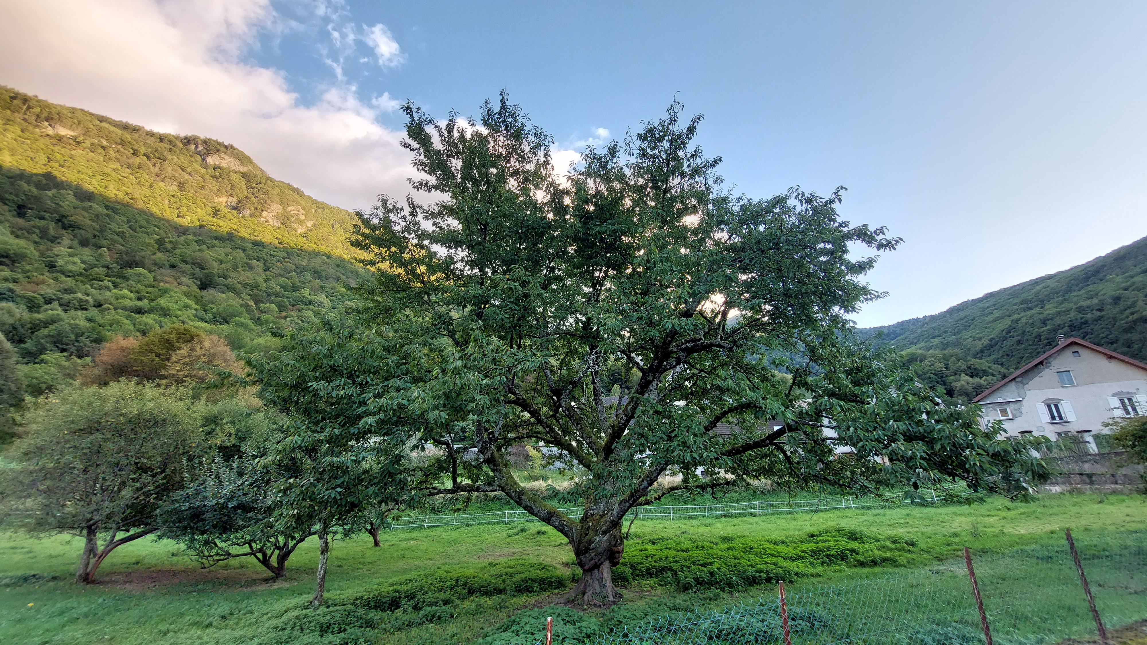
Greetings to all OSM contributors, I have finally found some time to share my mapping party report. I wrote it in English and French. This mapping party was held in France near Grenoble, in a village called Saint-Barthélemy-de-Séchilienne. There were 8 of us who participated in this mapping event.

Saint-Barthélemy-de-Séchilienne

For the report, I wrote some scripts: a bash script that uses the osmosis command to extract the following metrics like : number of roads, tracks, roads with names, alleys, shops, libraries, buildings, …, see the full list in the report.

The idea of this script was to download the data of the city/village before the mapping party and run the script on the resulting osm file. Then, do the same after the mapping party to see how many objects were added. Info about my script can be found here

See full entry

Posted by gvwaal on 6 November 2023 in English.

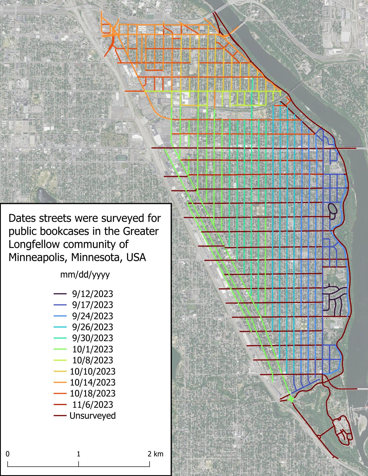
It is now cold out and also dark, which bodes poorly for finishing this project in a timely manner, because biking when it’s cold and dark isn’t fun. I was not able to achieve my goal of finishing this project by first snowfall (we got 1.8 in [4.6 cm] on Oct 31), but I’m not taking this to heart because a lot of my time the past several weeks has been spent with higher priority things.

Today I was able to finish two streets in about 30 minutes, which is great! These were some of the longer streets in Greater Longfellow, so the pace will be quicker from here on out, most likely due to there being less clutter obstructing my view.

Intro

Part 2

Part 3

Part 4

Figure displaying dates roads were surveyed in the scope area. Roads are colored based on date, with the earliest date, 2023-09-12, in very dark blue and grading to red for unsurveyed roads.

Posted by Xvtn on 6 November 2023 in English.

I’ve found it very enjoyable to record and upload GPS traces as I do various activities. These can help with assessing imagery offsets, route accessibility and popularity, adding brand new routes, and as a refresher after I get back from a walk, hike, bike ride, or drive. Here are some questions, issues, etc. I’ve been thinking about. Feel free to comment on any or all:

See full entry

I have been checking all Danish motorway,trunk,primary,secondary, and tertiary roads without a maxspeed tag using geotagged photos (Mapillary, Kartaview, Bing). The maxspeed status now is (distances in km):

Maxspeed stats

  • motorway :: missing maxspeed: 0 , total: 2586 , pct with maxspeed: 100.0
  • trunk :: missing maxspeed: 0 , total: 502 , pct with maxspeed: 100.0
  • primary :: missing maxspeed: 0 , total: 2771 , pct with maxspeed: 100.0
  • secondary :: missing maxspeed: 10 , total: 6531 , pct with maxspeed: 99.85
  • tertiary :: missing maxspeed: 5421 , total: 23739 , pct with maxspeed: 77.16
  • unclassified :: missing maxspeed: 24821 , total: 32060 , pct with maxspeed: 22.58
  • residential :: missing maxspeed: 20866 , total: 27987 , pct with maxspeed: 25.45

I believe this is really good. Most routing decision will have almost optimal data. Even if the first or last part of potential routes are short residential or unclassified ways with unknown maxspeeds, it will in most cases not affect the result because there are no alternatives.

Motor-vehicle users of OpenStreetMap apps will most of the time be on roads with known max-speeds. I know this because it is getting quite difficult for me to get to ways without maxspeed to produce geotagged photos. I download a GPX file with ways without maxspeed to OsmAnd so that I can try to photograph them if it not too much out of the way.

Quality

Of course having maxspeed tagged on many roads is only valuable if the tagging is correct. I did find some incorrectly tagged max-speeds. This was mainly due to:

See full entry

Location: Brageland, Daugstrup, Nordfyn Municipality, Region of Southern Denmark, Denmark
Posted by RaphmanG on 2 November 2023 in English.

Hey! Just testing out this diary feature.

I’m making a diary entry as I’ve just seen this feature, I assume this will be shown on my profile. I see we can also include a location to it! Should a diary entry be tied to a specific location? Writing this, I start to wonder…

  1. Do people use this feature at all? If so, for what?
  2. How do people find this? I’d assume it is not every mapper’s pastime to casually stalk other mappers’ profiles! Am I wrong?
  3. Are there mechanisms that allow you to discover local users?
  4. Do some people use the platform as a mean to meaningfully connect and perhaps extend connections to other projects or platforms?
  5. Are relations rather equal between users, as in Facebook, where friends are friends with each other and where exchanges are expected to be mutual or is there power distance between users, like on Instagram, with followers and the followed?

Perhaps I’ll make a new diary entry when I’ve found out! :p

Location: Dornach-Auhof, Linz, Upper Austria, Austria

mapping workshop for beginners on Openstreetmap

Oficina de mapeamento para iniciantes no Openstreetmap

Inscrições Abertas! Inscrição na Oficina de Mapeamento

Inscrições Abertas!

Inscrição na Oficina de Mapeamento

The Mapping of the Marco Neighborhood, Belém - Pará - Brazil will be done by Beginners and Advanced Mappers and aims to Include Buildings, Points of Interest (General Commerce, Schools, Health Centers and Squares) thus improving data from the City of Belém.

https://tasks.hotosm.org/projects/15707

Workshop created by umbraosm

UMBRAOSM - Union of Brazilian Openstreetmap mappers www.umbraosm.com.br

Location: Fazenda Lagoa Seca, Ibitiruna, Piracicaba, São Paulo, Southeast Region, 13404-755, Brazil

project activated by UMBRAOSM 2023/2024 edition

##01/11/2023 - project activated by UMBRAOSM Union of Brazilian Openstreetmap mappers

BRASIL - BAIRRO MARCO - BELÉM- (PA) - EDIFÍCIOS, PONTOS DE INTERESSE E ÁREA VERDE.

https://tasks.hotosm.org/projects/15707

O Mapeamento do Bairro Marco, Belém - Pará - Brasil será feito por Mapeadores Iniciantes e Avançados e tem como objetivo Incluir Edifícios, Pontos de Interesse (Comercio em Geral, Escolas, Postos de Saúde e Praças) melhorando assim os dados da Cidade de Belém.

The Mapping of the Marco Neighborhood, Belém - Pará - Brazil will be done by Beginners and Advanced Mappers and aims to Include Buildings, Points of Interest (General Commerce, Schools, Health Centers and Squares) thus improving data from the City of Belém.

BRASIL - BAIRRO MARCO - BELÉM- (PA) - EDIFÍCIOS, PONTOS DE INTERESSE E ÁREA VERDE.

https://tasks.hotosm.org/projects/15707

Link do Projeto: https://www.umbraosm.com.br/mapeia-belem.html

See full entry

Posted by Tomas Straupis on 1 November 2023 in English.

Attack

In the sinister depths of a fellowship of the underground cartographers, known for its dark secrets, two veteran system administrators, Hat-trick and Springbok, had laboured tirelessly to maintain a cursed digital infrastructure for years. Their expertise was revered, their work likened to the dark heart of the company’s success.

On a moonless night, a group of overconfident, so-called dunkrugers challenged Hat-trick and Springbok. These individuals were unaware of the malevolent forces that dwelled within the servers, but their arrogance led them to believe they could control the sinister systems.

Ignoring the administrators’ chilling warnings, they recklessly invaded the server room, meddling with cables and initiating occult-like configurations. Their actions unleashed a torrent of unholy chaos as servers crashed, forbidden data was consumed, maps started to lie, and the very essence of the system unravelled.

See full entry

In May 2023, I discovered the existence of two websites : “The Skyscraper Center” and “Skyscraper Page”, presenting skyscrapers from all over the world and especially… skyscrapers from Pyongyang!

I took this opportunity to enrich several free projects on which I’m active: Wikidata with the creation of the elements in the first instance, combined with images from Wikimedia Commons in the second instance, to place them and link them with the OpenStreetMap data in the final instance!

Creating the skyscrapers in Wikidata

Wikidata is a database that can be very useful for the OSM project. In my case, it was very useful for tracking each skyscraper.

And it’s very well suited to adding all the skyscrapers that existed in The Skyscraper Center and Skyscraper Page for Pyongyang city.

Wikidata has a number of “properties” (PXXX) which can be used to provide a whole range of information:

  • where each building is located (P625)
  • when they were built (P571)
  • their height (P2048)
  • the number of floors (P1101), etc…

See full entry

Location: 39.023, 125.761

TLDR: No.

Very long version: Maybe

I was inspired by Feye Andal recent post, so I’m telling my experience and providing a workflow to those who face the same problem.

Background

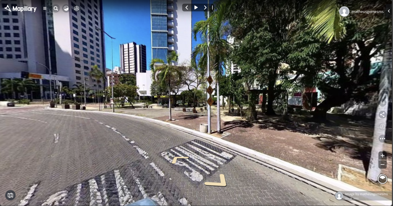
Recently I was looking to buy an affordable 360 camera to capture street-level imagery and obtain the processed elements that Mapillary provides (traffic signs and other points, via AI). I wanted it to use on my PhD research and of course, contribute to the OSM community and map data. The main recommendation is the now a bit old GoPro Max 360. The product is solid, and very easy to connect to Mapillary.

See full entry

Location: Sabiaguaba, Fortaleza, Ceará, Northeast Region, Brazil
Posted by Ride3400 on 31 October 2023 in English.

This is my first OSM contribution: THPRD in cooperation with Arbor Lakes HOA, LLC and Finley Woods/Noyes Development have created a new Waterhouse Trail segment with easement over Finley Woods and Arbor Lakes property. I added the new trail segment to the map after recording a GPX on my phone walking the trail. I hope I did it right!

Location: North Bethany, Bethany, Washington County, Oregon, 97229, United States