Diary Entries in English

Recent diary entries

This OSM diary is an English translation of Yekastreet’s OSM diary post called Sobre el “Mapping Workshop 2023”. Translating and re-posting because I enjoyed it so much :D

A reflection of YEKA and our journey…

Among the many kilometres of routes we have mapped in the seven years since Youthmappers started, our own journey as YEKAStreetMGA continues to surprise and please us the most. We have grown as a team, from our first mapathons in the barely equipped classrooms of the university, to the partnerships we are now forming with our local mapping networks. Design by design, we make the use of open data tools a little more accessible. Through methodological design (a term unthinkable for us in the early days), we have now transformed our first university meetings into structured processes to disseminate and share our knowledge with a new community of mappers.

What we have experienced as students, as women, in a socio-political context that routinely places us between non-functional institutionalism and the uncertainty of self-management in educational processes, reaffirms once again that teaching is a highly political act. Empowering. Essential in the construction of new models of society. And, in a country where making community is a crime, mapping and locating ourselves is in itself an act of humanitarian rebellion. Here we are, here we exist, more than planimetry and satellite rasters. We are vectors on the map, with direction and meaning. And our dedication and commitment to cultivating and growing the community in Central America overcomes the risks and dangers.

Central America yes, because when we speak of Latin America we make invisible the particular individuality of Central Americans, we exist between Mexico and South America, and although we share, we are indisputably different from the rest of Latin America in our struggles, way of life, needs and challenges.

See full entry

Hello everyone, better late than never, and yeah, that’s my first time here =D

This is meant to be a testimonial covering a somewhat more technical part, for a more “fun” version, I made a thread on Twitter* with LOTS of good photos!! (last year I’ve made a similar) !!

Well, in the beginning, I wasn’t expecting to even be at the event, like, another continent, too expensive travel… I’ve submitted my piece of work, that I was already working on It was (accepted)[https://talks.osgeo.org/foss4g-2023/talk/CRPWUS/]!

Then I’ve been approved for the travel grant program and also as a volunteer!!! I was so so glad, then I need to say thanks again for OSGEO, FLOSSK, UFPR, and HOT they were the ones that made the travel possible!!

Kosovo is a lovely country, there’s amazing and quite affordable food everywhere! Also, the locals and the “locals”, but from Albania (I found this shared sense of belonging very enchanting) received me very well, I got to know many badass people from FOSS community, like the giants from OpenLabs and Cloud 68, they are incredible people and contributors, now I’m really eager to get to know Tirana!

Now getting to the promised technical part: I saw so many solutions and applications, It’s so amusing to see ever-growing FOSS software, including in fields like 3D GIS and even digital twins fancy stuff.

As an OSM lover what I found most heartfelt was that everyone was so fond of OSM there, all applications with base maps had some OSM flavor/derived there, and all making analysis using OSM as the main or one of the data sources…

See full entry

Location: Kurilat, Kurilla, Municipality of Prizren, District of Prizren, 20080, Kosovo

Do we (OSM) have a league table for all countries/ entities (non-countries?), which is based on the quality of OSM mapping in that country?

I ask this question, because I was undertaking a MapRoulette challenge, to help with mapping in Algiers, and although some pockets of excellent mapping existed, it seemed clear that this was very much the exception.

  1. How do we gather metrics, to assess the quality of mapping in a given country, so that quality can be improved?

  2. How do we engage with the ‘local’ OSM community, to perhaps help them to improve mapping?

  3. Can we define a regular (and repeatable) set of MapRoulette challenges, that would enable remote mapping to be carried out, in support of ‘hands-on’ mapping/ surveying carried out by ‘locals on the ground’?

  4. How do we publicise tools such as StreetComplete, to help populate the data/ metadata of a country, in order to build upon the ‘big picture’ data that is gathered?

  5. What are we missing, above?

Please add to this, and edit, as appropriate.

Many thanks,

Chris

Posted by Tomas_J on 30 July 2023 in English. Last updated on 19 April 2025.

My personal list of the OSM projects for Slovakia (assorted by importance):

  • house numbers adding
  • cyclo routes adding
  • tracks adding (based on strava heatmap)
  • new bildings adding based on ortophoto
  • wikidata and wikipedia tags adding
  • waterways adding
  • railways tracks (re-)numbering
  • cry me a river - river precising
  • run forest run - forests’ precising
  • changes sets` review requests from new users
  • railway lines (long distance, commuters) - https://loom.cs.uni-freiburg.de/global
  • school/ agricultular (ex. JRD) areals
  • 3D buildings (churches, POI buildings…)
  • roundabouts precising
  • rail and informal path crossings’ access (type: node child railway child (highway=path -access=no)) -maxspeed -missing power lines

ToDos:

Welcome tool - https://welcome.osm.be/europe

Surfaces - https://data.humdata.org/m/dataset/slovakia-road-surface-data

JuRaVa cycloroute - to map by armchair mapping

Oprava názvov ulíc| Wikidata

Location: Očová, District of Zvolen, Region of Banská Bystrica, Stredné Slovensko, 962 23, Slovakia

Inspired by my endeavours to create a colour-coded map of sewer vents/ stink pipes by manufacturer, and by my county council’s endeavour to undertake a survey of holy wells, I started adding name:etymology:wikidata first to the holy wells in Co. Kilkenny, but then to the whole of Ireland.

I had produced a video about mapping holy wells in March 2021, but I think I need to make an updated one, because I was oblivious of the name:etymology group, and instead, had suggested people use subject:wikidata. Silly me. But at least, I only had to retag some of them rather than looking up every name.

Some saints or holy people like St. Patrick and “Our” Lady where easily identified, of course, but there were some very obscure saints there for which I had to create wikidata entries. For some, I just could not figure out which saint the holy wells were named after. I also had to skip St. Brigid and St. Kieran, because either name relates to more than one saint.

The first night I did this, I gave every saint a colour or colour combination, but I had to give up on that, because it is called the land of 1,000 saints after all. Here’s a list of saints IN Ireland on wikipedia: https://en.wikipedia.org/wiki/List_of_saints_of_Ireland. There are holy wells named after Biblical saints and early, non-Irish saints as well.

Some holy wells are also not named after a saint, but after the cure they supposedly give, Tobernasuil would be healing eyes, for example. That’s how far my Irish goes… But I’ve asked someone for help. But I added the wikidata identifier for “eye” in that case.

See full entry

Posted by Hungerburg on 29 July 2023 in English.

Rock glaciers – a mixture of ice and gravel that very slowly flows down a slope – are not mapped much. So it seems. Let us have a look. They are said to cover 167.2 out of 12.640 km² in the province where I live, so no small feat.

There is an inventory of 5769 polygons for them in mountainous Austria available for free online. Here to the description - https://doi.org/10.17738/ajes.2020.0001 - Here to the data - https://doi.org/10.1594/PANGAEA.921629

As usual, data is BIG. Let us trim it down a bit first: We only want rock glaciers in the narrow sense, of those only the so-called intact ones, and that not so overnoded.

ogr2ogr -simplify 0.01 -s_srs RGs_all_LambertProj.prj -t_srs EPSG:4326 Blockgletscher.geojson RGs_all_LambertProj.shp -where "LfState='INT' and LfType='rg'"

Resulting Blockgletscher.geojson loads quickly into JOSM. We can now pan and zoom the data smoothly over OSM-Carto background. This goes to show that rock glaciers are in fact mapped! Yet not as one might infer from the name, as natural=glacier, but natural=scree instead, at least, where there is something mapped at all and not just blank space.

See full entry

Location: Pfunds, Bezirk Landeck, Tyrol, Austria
Posted by SomeoneElse on 24 July 2023 in English. Last updated on 6 June 2026.

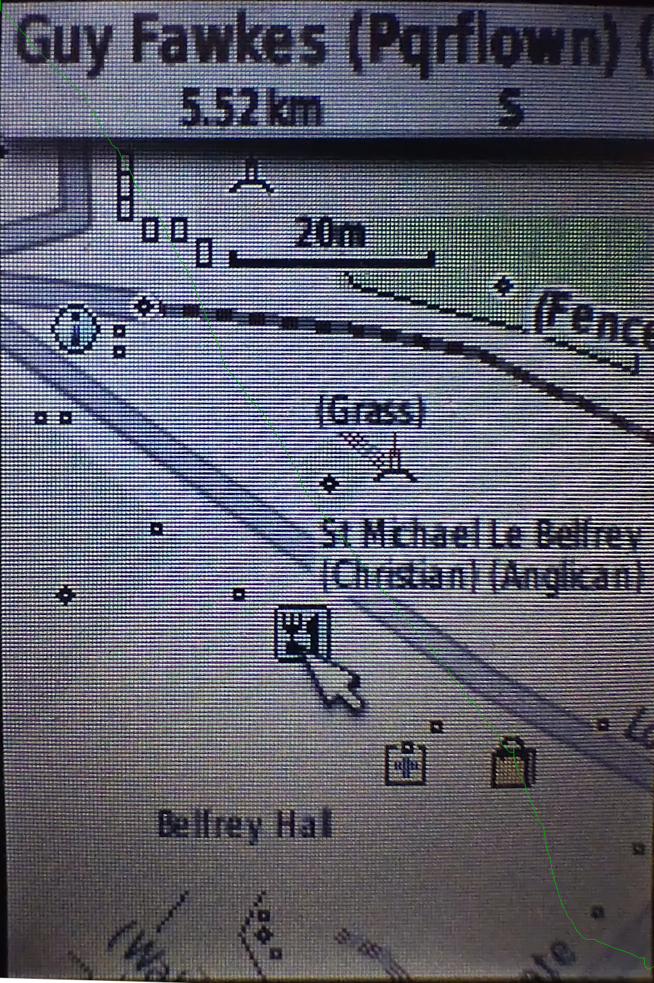
For many years I’ve used Garmin devices for both for navigation and for collecting data for OSM. As well as lots of premade maps in different styles it’s actually pretty easy to tinker with the map style yourself, although the OSM wiki makes it seem much more complicated than it actually is. It’s also pretty easy to see what OSM keys map to what values - there’s a file for points, one for lines and one for polygons that shows what OSM key and value corresponds to what Garmin feature.

I also maintain a web map style that tries to be much more inclusive than other web maps in terms of what it shows (have a look around the map legend for that), and thought that it’d be great to do the same for Garmin maps too. The web map style uses a lua script to preprocess OSM data before the CartoCSS code deals with it, which makes the latter much, much simpler. It turns out that exactly the same approach works when creating Garmin maps too, as described on this page.

See full entry

Location: 53.962, -1.083

This text is a continuation of my previous diary and do what the title says. The draft already existed 6 months ago, but just today I’m publishing this diary. Anyway, there’s comment I head about this on the @Wikimaps telegram

“You seem to be doing what we were doing 10+ years ago before Wikidata existed” – Maarten Dammers opinion on what this approach doing

Well, he’s right… but there’s a reason for that. This diary have 4 parts, the examples are on 3.

1. Preface

This extension could be perceived as one approach to make general proposed data extraction from OpenStreetMap Wiki, which , in a ABox vs TBox dicotomy, is the closest of a TBox for OpenStreetMap (*).

*: if we ignore id-tagging-schema and, obviously, other custom strategies to explain the meaning of OpenStreetMap data, which could include cartocss used to explain how to render as image. I do have a rudimentary draft of try to make sense of all of her encodings here, but not ready for today.

1.1 Wikibase is not consensus even between what would be ontologists on OpenStreetMap

Tip: for those wanting to view/review some past discussions, check https://wiki.openstreetmap.org/wiki/User:Minh_Nguyen/Wikidata_discussions#Wikidata_link_in_wiki_infoboxes. The same page from Minh Nguyen has other links, such as discussions to remove the entire Wikibase extension from OSM.wiki at https://github.com/openstreetmap/operations/issues/764.

See full entry

Posted by NorthCrab on 24 July 2023 in English. Last updated on 15 August 2023.

🗺️🦀 Hello to the OpenStreetMap community,

I am happy to announce my latest project, osm-budynki-orto-import — a fully autonomous building import tool currently in operation in Poland. This is my next step towards making OpenStreetMap (OSM) a more dynamic and efficient platform.

Dataset preview

This tool is designed with the objective of making building import process simpler and more accurate. The system utilizes official building data in conjunction with ortophoto imagery to validate the accuracy of the data before importing it.

At the heart of this tool lies an advanced computer vision model, with a precision as high as 99.7%. This accuracy is, in my opinion, superior to the capabilities of most average mappers, providing a faster and more reliable way of mapping structures.

See full entry

Posted by mapmeld on 23 July 2023 in English.

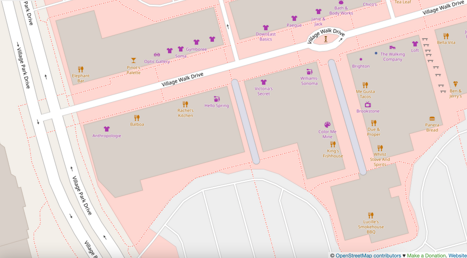
Last fall I posted about “Living Streets of OpenStreetMap US”. In Las Vegas, I encountered two pedestrian streets (tagged with highway=pedestrian), and they’re in an outdoor mall.

The next aisle over, by the Panera, is a walkable area tagged with benches but doesn’t have highway=pedestrian. I mapped a bike rack.
There’s also a splash pad on the map, which isn’t in any of the standard OSM renderers.

While visiting Moab, I corrected the new Utah Raptor state park to “Utahraptor”, and added two sculptures downtown (“Get Your Mind Rolling” was memorable).

I added some local businesses, parking access roads, residential access roads in a new development, etc. There are a good number of bike racks in national parks which ought to be mapped.

Shortly after I posted about bikes in northern Wisconsin / Lake Superior area, I found BicycleBenefits.org through the local co-op. Get discounts!

See full entry

Location: Moab, Grand County, Utah, 84532, United States
Posted by qeef on 18 July 2023 in English.

We have organized mapathons in Prague. We planned them, met on site, trained new mappers, mapped something and went to the pub. There we discussed and planned and exchanged our ideas. We called ourselves the core team. (I am only writing in the past tense because I am not there anymore; there is actually still a core team organizing mapathons in Prague.)

I was involved in Missing Maps CZ & SK from 2016 to 2020. I was involved in organizing mapathons. During that time I wrote and still maintain the mapathoner plugin. I like free software and I know that it is different from open source. I lobbed for openness. In 2020, I published Divide and map. Now. – the damn project and still maintain it. In 2022 I wrote simple hot intersecting areas and have not updated it since.

I am not sure if it’s time for this diary, but I want to write down my opinion about the core team and the community, because we have been talking about the community and the core team all along. And in my opinion, these two terms are often misunderstood.

DISCLAIMER: These are my own views. Please read this diary accordingly. I am in no way affiliated with OSMF, Missing Maps, HOT, MSF or the Red Cross.

Have you heard of WHAT, WHY, HOW and WHO questions? This is one of my favorite ways to discuss things.

Missing Maps’ WHAT and WHY are clear from their website. Let me put it another way: map the (vulnerable people of the) world because it’s a good thing. WHO is the community, the mappers. HOW is decided by the core team.

See full entry

Posted by b-unicycling on 18 July 2023 in English. Last updated on 3 August 2023.

I had added the odd sewer pipe using man_made=sewage_vent, because I had spotted some and was curious what they were. But someone in the Irish community had pointed out the under-documentation of man_made tags, so I did a bit of work, looked it up on wikidata and decided to go for man_made=sewer_vent instead. (I thought that man_made=sewer_ventilation_pipe was a bit long.) I retagged the existing ones which weren’t many anyway and added a few more from Wikimedia, especially in England, where many were covered by geograph.co.uk and one particular user (Rodhullandemu) especially. Sewer pipe on Regent Road By Phil Nash from Wikimedia Commons CC BY-SA 4.0, CC BY-SA 4.0 https://creativecommons.org/licenses/by-sa/4.0, via Wikimedia Commons

Some in Ireland and in England are listed monuments, believe it or not.

See full entry