 OpenStreetMap

I just realized that a water well is sometimes privat and sometimes not even visible to people. I feel so sorry that I commited removal requests of some water wells in Portugal because I could not find drinking water there…. from now on I only search for “drinking water” or “spring” on osm.
Diary Entries in English
Recent diary entries

Sharing from my post on https://blog.georeactor.com
Belgium’s Baarle-Hertog and the Dutch Baarle-Nassau overlap in one town riddled with border crossings and enclaves. Let’s take a look at OpenStreetMap:
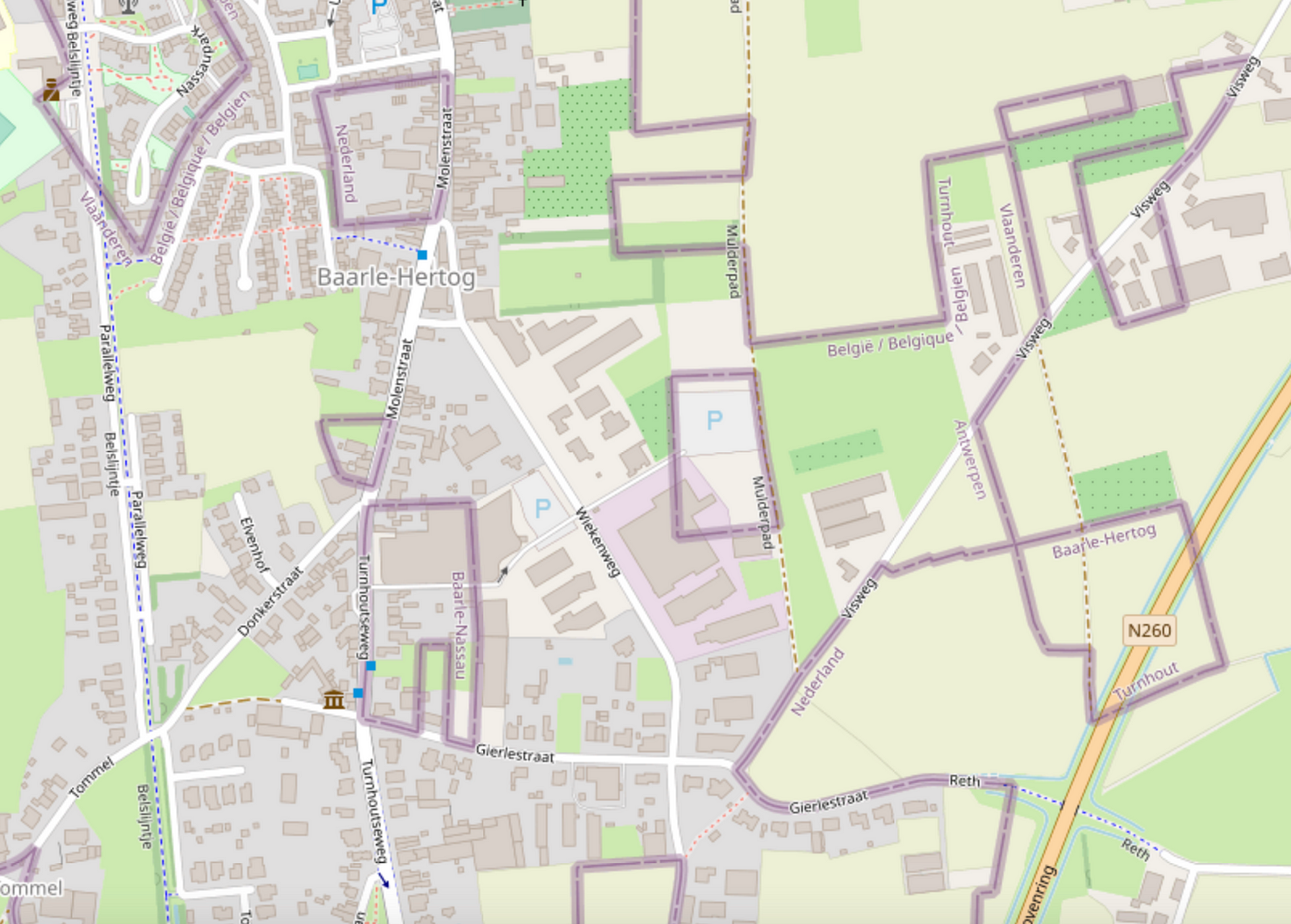
Wow, it looks complicated!
Legend depicts Baarle as a Kafkaesque theme park where buildings swap countries and laws are fluid. Sample anecdote:
There was a time when according to Dutch laws restaurants had to close earlier. For some restaurants on the border it meant that the clients simply had to change their tables to the Belgian side.
I likely learned about this town from the Google Sightseeing Blog a long time ago. As a maps nerd, I knew that I had to see it for myself one day.
Getting there
In April 2023, I took a train from Brussels to Antwerp, checked out the award-winning Port Authority Building, then another train onward to Turnhout, then a bus to Baarle-Hertog.

amenity=hitching_post
Short and easy, 214 uses.
tourism=trail_riding_rest
Well, it may contain one or more hitching posts. 1 use. That’ll be the person who wrote it up for the wiki and linked it about for good visibility. Ooh, and it’s rendered on the trail riding map. Perhaps it was made because other resting places are possible, so this becomes a unifying tag to look for if you are looking for a place to rest your horse? Much like a tourism=trail_riding_station seems to be a unifying tag to put on all the different things you can overnight your horse in? (1339 uses for that one, it’s doing a better job. Oh, except that I looked at how it was actually being used and some of it was for staging locations where overnighting would be illegal. So not all correct uses. And I can definitely see where the confusion comes from.) Although if these things are meant to be a unifying device, used in addition to the more specific tags, it probably ought to say that on the wiki page. Is that even how tags are meant to be used? I certainly see the utility.
amenity=animal_hitch
animal_hitch=ring/rail/post
horse=yes
er…
mule=yes
donkey=yes
llama=yes
Perhaps you should just be assuming your zebra/donkey cross or whatever other exotic bit of stock you’ve got =yes? Except if you’re in big horn sheep country, it very well might be that goat=no.
104 uses for all animals, but it isn’t popular enough to get combination details. For the type tag, there are 83 rings and 7 rails, but no posts at all. Nope, the people don’t want it for hitching posts. Well, except for the sorts who get particular about the post being horizontal between two other posts, AKA a rail. Or particular about there being a ring on the post, but the example dog_hitch (not kidding) is also a ring.
Oh, there’s also 2 uses of amenity=horse_hitch.

- Rivers and lakes may move 10 meters in 5 years.
- When you map a river, treat it like low-poly art.
- Think of the next mapper 3 years from now. No 200 point rivers. No holding space bar.
Simple rivers enable simple change.

Opening June 29th over 2 km between existing roads Vejledalen and Mælkevejen in the town Vejle, Denmark - Please Update! :-)

Hi, everyone,
Between the end of April and mid-May, my former TomTom colleagues * and I posted a communications survey with the goal of gathering some information about how OSM users experience OSM community communications. Now that the survey is complete, I want to give it context as part of our presentation at State of the Map US in Richmond, Virginia.
At SotM US, we will be presenting on How to Use Data for Effective Community Communication. (The project is supported by TomTom and informed by work that two of us have done for the CWG, but it’s not formally a TomTom or OSMF project.) Our primary source of data for this presentation is derived from a tool that scrapes publicly available, anonymized, channel data from OSM listservs and forums. To augment this data, we created a communications survey. We knew that we would not be able to get a broadly representative cross-section of the OSM user demographic with our limited time and resources, but we did believe we would get some additional details that could help inform our approach.
The survey had a mix of free answer and multiple choice questions about demographics, local community involvement, and experiences using the various forums, lists and other channels. We created 12 versions of the same survey to post in 12 different channel types so that we could get a sense of the user demographics per channel: community forum, mailing list, Telegram, Twitter, Discord, Slack, Mastodon, Reddit, IRC/Matrix, weekly OSM, Facebook, LinkedIn. We received 464 responses, with more responses from Europe and North America than from Latin America, Asia and Africa. We will present a few of the observable trends at our presentation, with the caveat that they are more impressionistic than representative.
Sanawad city boundry for Wikipedia by akmal khan
Posted by Peter Elderson on 30 April 2023 in English.
Last updated on 13 May 2023.
Turbo roundabouts are relatively new. They first appeared in Nederland, but are now starting to appear in many countries, including the US. I have tried my hand at mapping one, guided by a few front runners, then did a second one on my own. This diary entry details what I learned. As I go on, I will add things learned to this diary entry!
See [roundabout=turbo] (osm.wiki/Tag:roundabout%3Dturbo)
Variations: It’s hard to find two turbo roundabouts that are exactly the same. This is what I learned: Take care to start with an easy one, and never blindly apply the prescriptions. You have to know what it’s for. That’s why this diary entry contains a lot of explanation: those are the things I learned from the experts! Too bad the three-lane rotor roundabout in Rosmalen has already been mapped.
Mapping a turbo roundabout with JOSM
Tools used
JOSM with a detailed aerial photo background layer and style Lane and Road attributes active. This job would be near impossible with Id.
Skills required
Basic OSM editing: drawing and tagging nodes, ways, areas and relations. Cutting ways (P). Link ways to existing nodes and ways (Esc-drop, M, N). Unkink ways. Extend ways. Combining ways (C). Reverse ways (R). Copy and paste elements (Control-C and Control-V).
Skilled editing: Adjusting lines with O (round) and Q (straight). Create turn restriction relations: tag, add elements and assign roles to, via from. Use existing turn restriction to duplicate and adapt for a new restriction. Route relations: download members, identify ordering problems and membership problems, and correct sorting errors.
What?

Anton Khorev’s post inspired me to see what would happen if I open the iD Editor in landscape instead of portrait.
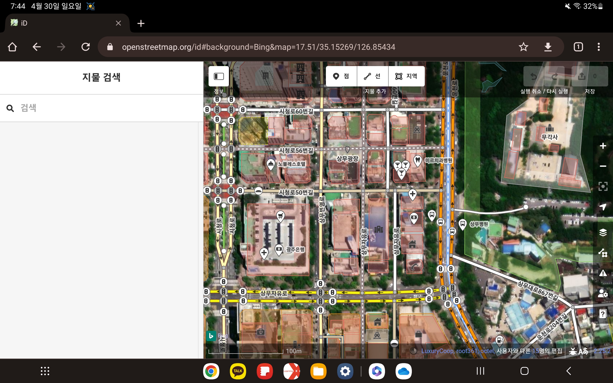
I’ve opened the iD editor in Google Chrome on my Galaxy Tab S7. it’s editable enough as it is, it would be nice to be able to turn it full screen.
Posted by JaneAmerica12 on 29 April 2023 in English.

It was awesome and amazing
Today was a great day. I learnt how to map out a location and I contributed by mapping out some buildings and some pathways. I know I’m a a beginner in this but I find it surprisingly fun and interesting. I mapped out Abi Local government area and I’m happy.
Posted by Starman6059 on 29 April 2023 in English.
Contributed in mapping buildings and roads.
Posted by Agho'sboy96 on 29 April 2023 in English.
i was able to contribute in the mapping of Abi LGA in Cross Rivers State and also attend the mapathon meeting in Nsukka Enugu via zoom
It was a wonderful experience mapping and I represented quite a good number of buildings on the map.
Posted by Frank Peng on 29 April 2023 in English.
Last updated on 4 January 2026.

This diary entry was formerly titled “Sock puppet accounts on OSM”.
What is a sock puppet account?
A sock puppet account is defined as a person whose actions are controlled by another. It is a reference to the manipulation of a simple hand puppet made from a sock and is often used to refer to alternative online identities or user accounts used for purposes of deception. Online, it came to be used to refer to a false identity assumed by a member of an internet community who spoke to, or about, themselves while pretending to be another person.
The use of the term has expanded to now include other misleading uses of online identities, such as those created to praise, defend, or support a person or organization, to manipulate public opinion, or to circumvent restrictions, such as viewing a social media account that they are blocked from, suspension, or an outright ban from a website. A significant difference between a pseudonym and a sock puppet is that the latter poses as a third party independent of the main account operator. Sock puppets are unwelcome in many online communities and forums. https://en.wikipedia.org/wiki/Sock_puppet_account
Why do people create sock puppet accounts?
One reason for sock puppeting is to circumvent a block, ban, or other forms of sanction imposed on the person’s original account. A sockpuppet is a false online name and profile created to hide the author’s identity, usually because of personal, political, or financial ties to whatever is being discussed or reviewed. (News Literacy Project, Para. 2)
Sock puppet account vandalizes OSM
I’ll mostly be fixing railroads on OSM, like improving alignment of train tracks so they’re better aligned with those shown in aerial imagery. Most railroads on OSM were imported from TIGER and may not align very well with train tracks shown in aerial imagery because most TIGER roads and rail lines were mainly used for taking census surveys and not for drawing actual alignments of roads and train tracks. I fixed a few rail lines by adjusting the train track nodes and adding new nodes to the train track ways so they’re better aligned with aerial imagery.

I am sharing some of my favourite OSM-related tools/websites/apps with a very brief description, including the most popular ones (you never know). I’ve certainly forgotten many of them and don’t know as many.
Websites
- overpass turbo: Fundamental website for database queries. Also useful for custom QA filters.
- taginfo: Check which tags are most used, their usage over time, the most used values for each tag etc. For the history of a tag there is also this site.
- RapiD: iD on steroids. Reports possible missing buildings and streets.
- osm-revert: Revert entire changesets (it replaced Revert UI which is no longer supported).
- Level0: Revert individual nodes. It is also a useful text editor for changing several tags at once. However, read this first.
- NotesReview: Filter OSM notes by user, date, text etc. There is also a site by Pascal Neis.
- Disaster Ninja: Not its main purpose, but there is an interesting layer called ‘Building Quantity’ in case you want to find areas with unmapped buildings.
- YoHours: To simplify the compilation of the opening_hours=* tag.
- How Did You Contribute: Stats about users. There’s also your changes’ heat map.
- Is OSM up-to-date?: Interesting site created by an Italian that tells you which nodes are less up-to-date. If there is nothing to update you can still leave a check_date tag.
- Field Papers: Edit OSM by taking notes on paper.
Renderer
- F4map Demo and OSM Buildings: In case you want to see the 3d tags rendered.
- Indoor=: In case you want to see the indoor=* tags rendered.
- Open Etymology Map: Another site created by an Italian. It renders the name:etymology tag. There is also a site that facilitates tagging it.
Wiki

In a comment on their recent diary entry publicerination suggested that use of leisure=pitch with sport=tennis was always intended for single tennis courts. I had my doubts given that someone in San Francisco was adding quantity, and I have added pitch:count and there is also a documented tag courts. Were we just the odd mappers out?

A relatively quick way to answer this was looking at tennis courts in the UK as I have a 1-2 year old import available for Great Britain. Overpass can also be used to collect the data, but it’s not possible to calculate areas directly. I ran a query which pulled tags, the geometry and the area of each pitch in square metres and saved this first as geojson and then as a csv file.
Wasted my time