Diary Entries in English

Recent diary entries

Posted by mvexel on 27 February 2023 in English.

This is a cross-post from my blog

I posted a couple of days ago about my first captures with the GoPro MAX camera I have on loan and uploading to Mapillary. This all went pretty smooth, so I wanted to capture while biking. I bike around town a fair amount and you can cover more ground in the same amount of time compared to walking, so I was eager to try it.

Years ago, I captured Mapillary imagery with my regular GoPro HERO 3+ camera mounted on my bike:
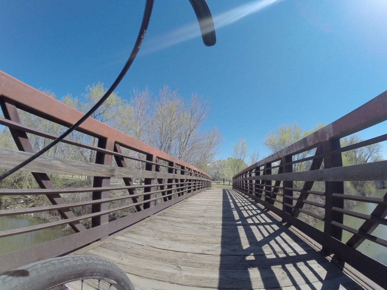
bike capture image example

I remember from back then (2014) that the uploading process was not super straightforward, but Mapillary was only 1 year old then, so that was to be expected.

I still have some of the accessories from my HERO 3+, like a helmet attachment and a quick-release adapter. The accessory interface on the cameras hasn’t changed, so those things work even with the most recent GoPro cameras. Here’s the helmet attachment with quick-release shoe:

See full entry

Location: Central City, Salt Lake City, Salt Lake County, Utah, United States

Introduction

Introducing me, Dimas, the head of the UGM SpaceTime community. We are one of the teams that passed the funding from the 2022 Booster Grant program held by the Open Mapping Hub Asia-Pacific and the Indonesian OpenStreetMap Association (POI).

Activity

In this funding, we updated OSM data related to the Trans Jogja and Teman Bus routes and the location of bus stops in Yogyakarta City and its surroundings. In addition, the output of our activities is WebGIS which displays existing routes and stops.

About the Existing Data

It was found that the data in OSM related to routes was found to be inconsistent with the routes we had validated through field surveys. In addition, many routes were cut off in several segments and errors in tagging data. So we intend to update the data based on current conditions in the field.

Updating Data

We will completely change the Trans Jogja and Teman Bus routes in “Relations” in OSM. So maybe there will be many changes regarding routes and stops in Yogyakarta after I upload this diary.

Location: Pogung Kidul, Sinduadi, Mlati, Sleman Regency, Special Region of Yogyakarta, Java, Indonesia
Posted by pedrito1414 on 23 February 2023 in English.

Ruben Martin and I discuss the recent activities and what’s coming up for the humanitarian open mapping community.

What’s covered this week in brief?

  • Response to the earthquake in Syria and Turkey
  • Milestone for URBE LATAM and the Preventório favela mappers in Brazil
  • Sharebacks of the Mapping for Resilience Initiative in Hoima, Uganda
  • OSM Community Spotlights at Community Working Group
  • Events coming up
  • Mappy quote of the week

What’s happened this week?

Over the past few weeks, the OpenStreetMap community has mobilised in response to the devastating earthquake that hit Turkey and Syria. More than 7,500 mappers have contributed to the response so far, and 221 validators have validated over 5,870 tasks in Turkey alone — the contribution of this relatively small number of validators has been phenomenal, trying to ensure high data quality for the relief efforts.

See full entry

This is a cross-post from my blog

I have always been excited about the opportunities open street level imagery (SLI) offers to OSM. I helped launch OpenStreetView (now Kartaview) back when I worked at Telenav and was an early contributor to Mapillary as well. Recently, I’ve had the opportunity to work more closely with the great folks at Mapillary. This re-kindled my excitement for SLI & OSM! Good things are rolling out and will continue to roll out in 2023, so stay tuned! The Mapillary blog is the best source for announcements.

Most recently, Mapillary added support for 360° video upload to their desktop uploader and the CLI tools! This is great news for anyone with a supported camera, like the GoPro MAX. I happen to have one of those so time to try it out!

The Mapillary help pages include great and authoritative guides on using 360° cameras including specific instructions for using the GoPro MAX. This post is just me summarizing my own experience.

Preparing

You only need to do these steps once.

  1. Get the latest version of the Mapillary Desktop Uploader available for Windows, Linux and MacOS.
  2. Install the Uploader onto your computer.
  3. Open the Uploader and log into your Mapillary account.

Capturing

  1. Make sure your GoPro MAX is fully charged and set to 360° video. I used 5.6k and 30fps1.

See full entry

Location: Liberty Wells, Salt Lake City, Salt Lake County, Utah, United States

2023, here I am and still going strong. December 2021 Kumbirai Matingo just posted in a WhatsApp Group, ‘Anyone interested in OSM, please inbox’. I didn’t know what OpenStreetMap was or what it was all about but I was keen. I honestly wanted an activity to take me away from the boredom of staying at home hoping that the COVID-19 infection rate would decrease and go back to school. There I was in OSM_Zimbabwe steering committee not sure what OpenStreetMap was.

Fortunately in January 2022, Zim was hosting the Africa Monthly Mapathon. 28 January 2022 the first day I added a feature on the OpenStreetMap, Mutasa District Zimbabwe. Thanks to @Last Mufoya. ##to be continued

Location: Mbare, Harare, Zimbabwe

BRAZIL - SÃO SEBASTIÃO - (SP) - AREAS AFFECTED BY FLOODS, FLOODS AND LANDSIDES ON FEBRUARY 19, 2023

SOS São Sebastião - São Paulo - Brazil. https://tasks.hotosm.org/projects/14297

BRAZIL - SÃO SEBASTIÃO - (SP) - AREAS AFFECTED BY FLOODS, FLOODS AND LANDSIDES ON FEBRUARY 19, 2023 Brazil On February 19, 2023, the cities of the North Coast of São Paulo were hit by more than 600 mm of rain in 24 hours, with São Sebastião being the most affected and with the highest number of deaths so far.

The neighborhoods that were most impacted are: Baleia, Barra do Sahy, Boiçucanga, Camburi and Juquehy.

Mapping in the City of São Sebastião/SP - Brazil will be carried out by beginner and advanced mappers and aims to

DESCRIPTION For this mapping, use the Bing image.

Many buildings are very close but not really touching. Try to map them as closely as possible without allowing them to connect with each other or the streets.

See full entry

Posted by ctuncan on 20 February 2023 in English.

JURD’S LAKE Woodland vestiges of the picturesque

Jurd’s Lake was part of the picturesque grounds of Weston Grove House, the former estate of Southampton MP William Chamberlayne in the 19th Century.

Today it is an area of established woodland, with pleasant flowery glades to explore. You may even find broad-leaved helleborine during the early summer.

The small lake and reed beds are a unique habitat. Willow warblers have previously nested here. Through careful landscape managernent a variety of butterflies can be found including purple hairstreak, small skipper and six spot burnet moth.

Himalayan balsam is widely found in the area, spread along the stream. The seed heads explode firing their seeds distances of over 20 feet. Although it looks attractive the fast-growing plant competes with native species and the shallow roots errode the stream bank.

SPECIES TO LOOK OUT FOR • Broad-leaved helleborine (ochid) • Purple hairstreak (butterfly) • Six spot burnet (moth)

Did You Know? Not all moths fly at night. There are several day flying moths including thesiz spot burnet moth.

Location: Waterside Park, Woolston, Southampton, England, SO19 9TY, United Kingdom
Posted by CityEnginer on 20 February 2023 in English.

Thought I’d give editing my home town a go again ( have been here before). Please forgive me for any mistakes, it will not have been intentional. I see some issues with POIs for example a police station that doesn’t exist anymore the adjacent firestation is still there with POI. Do I remove the POI or just remove the info attached? When it’s a shop or a former bank I think I probably should remove the info and leave the point….. if anyone has any pointers on where to get guidance on this that would be nice, otherwise I’ll keep looking for guidance!

Posted by Baovola on 20 February 2023 in English.

This year, I promised myself to contribute every day in order to catch my absence since my registration in 2015.

I really enjoy mapping and I take even just 5 min every day to edit in OSM.

Yesterday, I totally thought, I had already mapped. Since we are dealing with electricity on this rainy season (yes, in my city, when it rains, sometimes there is power failure which turns off our wifi :D ). So, I broke my daily activity.

https://github.com/bvl2016/30DayMapChallenge2021/blob/main/maps/OSM_Failure.jpg

I hope for the coming day to contribute more.

PS : don’t know how to import image here :D

Beside national parks, there are form of flora and fauna protections which falls into the category of Nature Reserve.

One example I know by personal experience is sectors of rivers where fishing is forbidden or regulated, usually to protect the ecosystem.

OSM holds the Nature Reserve tag already.

The class of protection is also a good way to describe, but fish reserves are not listed explicitly. Also it seems that is applies to boundaries only.

…research in progress… suggestions are welcome!

Posted by Minh Nguyen on 20 February 2023 in English. Last updated on 8 March 2026.

If you’re a member of OpenStreetMap U.S., check your inbox and vote in this year’s election for the open seats on the board of directors. There are some familiar names and some new ones, but each of them is well-qualified and eager to serve the community. For the first time in a while, you won’t see my name on there. After four straight years on the board, I’m wrapping things up and stepping aside to let those with fresh energy take the organization forward from here.

Four years ago, when I first ran, the organization had just hired Maggie as our new executive director. We were still transitioning from years of depending on an all-volunteer board to keep the lights on. Putting an on annual conference was enough to keep our hands full. Formal partnerships with other organizations were still a ways off. Did anyone notice we hadn’t officially become a local chapter yet?

© 2016 Tatiana Van Campenhout, CC BY 2.0

See full entry

Location: Livonia, Wayne County, Michigan, United States

I’m writing this entry mainly to say that I intend to put maxspeed tags on a lot more Champaign streets now that I have the information I need to be on pretty firm ground in doing so. That information is in the form of the default (read: non-posted) speed limits on roads in Illinois and Champaign.

First, the Illinois state laws on this. According to the Illinois Vehicle Code the speed limit in urban areas regardless of whether it’s residential, a business district, or an industrial area is 30 MPH unless otherwise posted. In alleys it’s 15 MPH. The one exception is near schools where the limit is 20 MPH, but signs must be posted in those areas.

The Champaign Code of Ordinances is the same with one exception: the university district. Here the unposted speed limit goes down to 25 MPH. If you’re wondering what the definition of that district is, it’s in the definition section but I’ll quote it here since it’s short enough:

University District means that area within the following boundary: Start at University and First, proceed east along University south row line to Wright, proceed south on Wright (extended) along City limit line (located at the back of east curb) to Windsor, proceed west on Windsor along north row line to Neil, proceed north on Neil along east row line to Springfield, proceed east on Springfield along south row line to First, proceed north on First along east row line to beginning.

Keep in mind it does not include the section of the University of Illinois that’s in Urbana. I’m focusing on Champaign so I’ll leave it to you to look up Urbana’s code on this.

The point of all this is that unless a speed limit is otherwise posted or a street or road goes through the University District it’s safe to set maxspeed=30 mph on streets and roads and maxspeed=15 mph on alleys, even without a sign.

See full entry

Since 06 February when the first earthquake struck Turkey and Syria, more than 6,500 mappers have mobilised to contribute to the response through the creation and improvement of OpenStreetMap data.

On 09 Feb, I wrote a diary post about whether the OSM data being contributed by mappers and validators in Turkey and Syria was helping anybody. This one builds on that theme…

Below is a selection of maps and map products being used by responders that incorporate OpenStreetMap data (gathered through searching data sources on maps and data products on ReliefWeb, the MSF Geo Centre and through what people are reporting on the HOT disaster-mapping slack channel). Click through the links to explore the maps yourself…

Map from REACH: Northwest Syria --- Earthquake Exposed Communities

☝️Map from REACH: Northwest Syria — Earthquake Exposed Communities

See full entry

Posted by gsommer on 18 February 2023 in English. Last updated on 20 February 2023.

I am Austrian and have been working with GIS (Geographic Information Systems) in Vienna until I retired to Ireland in 2020.

I always liked maps and I got interested in OpenStreetMap at some point, recognizing the great potential of it. I also got interested in Irish placenames after moving to a Gaeltacht area on the Dingle Peninsula in County Kerry. During the Covid lockdowns I started some mapping of Irish placenames, but at some point I gave up, as I did not really see an audience for it and found it rather time consuming.

Recently I learned that some people in our the community want to record the Irish names of farmers fields, which until now have been passed on by word only from one generation to the other. But this does not work anymore, and there is fear in the older generation that the names will be lost forever.

When I heard this I suggested to map the fields and their names and did some testing with OpenStreetMap, which worked very well and was much appreciated by members of the community and of CFLT ([Comharchumann Forbartha an Leith Triúigh] (https://www.cflt.ie/)).

I am not only mapping disconnected field areas, but instead I first add field boundaries as barriers with proper tagging (wall, hedge,…) and then build a relation documenting the land use and adding the field name to it. This way it is not only about displaying field names on the map but also adds useful details for navigation and avoiding unnatural and bad looking gaps between landuse areas.

To be able to extract all this data for producing specialized maps for the community using QGIS and also as backup, the features are tagged with a new tag key cflt:category

Authors: Heather Leson, Said Türksever

Mapping Progress

(Map data: OpenStreetMap contributors) Click here for the animated version.

OSM communities continue to respond to the Türkiye and Syrian earthquakes. We seek your help this weekend and have some guidance. OSM communities and individuals have been great in helping complete mapping tasks.

Your impact

You’ve had a great impact. See the OSM wiki for examples of how emergency responders are using your edits and how OpenStreetMap communities contributed

See full entry

Location: Çöçelli, Pazarcık, Kahramanmaraş, Mediterranean Region, 46700, Turkey
Posted by valhikes on 17 February 2023 in English. Last updated on 18 February 2023.

I tend to wonder a bit about this community we supposedly have. In about 6 years of edits, but only about 200 edits, I had one single interaction with community and it’s still bugging me 2 years later.

You see, this character wandered over to my changeset and commented that they had removed a trail because it “might be misleading” and they couldn’t find it on their USGS map.

Which is cute considering the USGS for the area doesn’t date back to 1995 like much of them. It dates back to 1960. You can’t find the Redwood National Park on most of it, much less any of the trails the park has made. You find the logging roads the park has actively and successfully decommissioned. The one thing you can be sure about USGS for this area is that it is wrong. Heck, I hiked on a combination of Forest Service and USGS maps all over the west for a couple years and I’ve gotten to a point that if I see these two sources agreeing, I am certain I’ll run into something very different on the ground. It’s better than a coin flip. So it’s not even uncommon that USGS is wrong. It’s just particularly wrong in this area. And it should be obvious.

But it wasn’t to this new then mapper. So they submitted this changeset to “exclude a non-existing trail”.

It’s an official trail! It literally has signs at both ends pointing it out! When you get a permit to backpack here, they send you a map that includes this trail! Yes, with all those fords that have been left swimming there in the creek. I painstakingly got it onto that map using my GPS track from actually hiking this actual trail and imagery. That track bounced around a lot there under the big trees making it quite an effort. I want this trail back.

So that bit of community didn’t leave a good taste.

See full entry

Location: Humboldt County, California, United States

I received the following reply from Bill Beaver, Senior GIS Analyst for Santa Cruz County, Arizona in regards to copyright and importing data. All county GIS data (hosted at https://sccaz-gis.maps.arcgis.com/home/index.html) except parcel data is in the public domain and not copyrighted.

I have created the user SantaCruzCountyAZImport for this import.

From: Bill J. Beaver <bbeaver@santacruzcountyaz.gov>
Date: Wed, Feb 15, 2023 at 9:02 AM
Subject: RE: OpenStreetMap and SCC GIS Copyright
To: Galen Asphaug <...>


Hi Galen,

Anything on that site is open data except parcels. To download the data in various formats try our public data share at: https://v953w.app.goo.gl/CtgX

Bill

Bill Beaver | Senior GIS Analyst
Santa Cruz County IT Department
275 Rio Rico Dr. #1
Rio Rico AZ 85648
(520) 375-7786

-----Original Message-----
From: Galen Asphaug <...>
Sent: Tuesday, January 31, 2023 11:51 PM
To: Bill J. Beaver <bbeaver@santacruzcountyaz.gov>
Subject: OpenStreetMap and SCC GIS Copyright

Hello, I hope this message finds you well.

Thank you for making Santa Cruz County GIS data available to the public. My name is Galen Asphaug. I am a contributor to the OpenStreetMap project, a collaborative open project to create a global geodata set freely usable by anyone.

We respect the intellectual property rights of others, and I write to ask if we may use your data. We are interested in reproducing some of the data hosted at https://sccaz-gis.maps.arcgis.com/home/index.html
(specifically: building footprints, addresses, road names and paths, and 'Patagonia Addresses with Businesses' data). This is a fantastic dataset and we appreciate the field work.

Can you please clarify what license (if any) this data is being shared with?

Thank you again for helping to ensure that this data is being used as widely as possible, and to support the general public and local commerce.

Galen Asphaug.
Location: Patagonia, Santa Cruz County, Arizona, 85624, United States

10 days ago, I wrote an essay about Bing Map Builder and how it could be used to fork the OSM community.

I made a prediction there:

Assume that Bing Map Builder becomes a really decent and good editor and that about a third of the edits happen through Map Builder. Microsoft could then -at some time in the future- decide to let updates from Map Builder flow to Bing Maps first, and only let them flow towards OpenStreetMap at a later time, “to review them for quality”.

It seems that this prediction has become true already (1). In the discussion under my previous entry, people noticed that “no bing accounts appeared anymore” in the new to OSM-listing. Time to re-investigate!

So, what is the behaviour now? I drew a new building, clicked saved and… the building disappeared from my screen. When opening the network console, this network call proved my suspicions. The created data is now sent towards https://bing.com/mapbuilder/changeset/submit and contains the changeset data (and bit of extra information)

See full entry

Posted by b-unicycling on 16 February 2023 in English.

As hinted at in my last diary post, I had taken up mapping National Monuments in Ireland using the key ref:IE:nm (as documented in the wiki). I can’t quite remember when I started and how and why, but I think I noticed the numbers in the National Monuments calendar which was kindly sent to me by Jean Farrelly from the National Monuments Service (I presume in recognition of my engagement with them in the shape of reporting possible unknown monuments).

According to ohsome.org, I started on January 20th which happens to be the same day I created the wiki page, makes perfect sense. I “finished” (see TODO below) with Co. Tipperary yesterday.

The first numbers, I added from above mentioned, beautiful calendar (and the 2022 one), but of course, that only gives you roughly 12 per year. (Some beautiful sites are repeatedly presented, apparently.)

See full entry