
https://sccaz-gis.maps.arcgis.com/home/index.html
Santa Cruz County, AZ government website, contains links to shapefiles for building footprints, addresses, roads, etc. Need to request permission to import? osm.wiki/Import/Guidelines
 OpenStreetMap
https://sccaz-gis.maps.arcgis.com/home/index.html
Santa Cruz County, AZ government website, contains links to shapefiles for building footprints, addresses, roads, etc. Need to request permission to import? osm.wiki/Import/Guidelines
Finally completed the mapping of the urban environment of Magog (Quebec, Canada). Addition of buildings (15K), major parking lots (700), adjustment of street geometry (3K). Added details on the boardwalk facing the lake.
Began the trace on 11 Oct 2022
After many years, I finally decided to dive back into running a full planet import using the Overpass API.
To keep things budget-friendly, I rented a modest Intel-based server for around 40€/month — nothing fancy, just dual data center SSDs and 64GB of ECC RAM.
What surprised me was the runtime: the initial import using release 0.7.58.5 took a whopping 33.5 hours — at least 10 hours longer than I had anticipated. I managed to shave that down to 26.5 hours by tweaking some settings, like enabling LZ4 compression across the board and increasing the chunk size parameter. It helped, but clearly, there’s still room for optimization.
I continued testing with my own experimental Overpass fork, that includes support for PBF, multithreading, and many other changes under the hood. Initial measurements looked quite promising with 10.5 hours total runtime. After some further analysis and improving some data structures, the import took 7 hours and 23 minutes. Peak memory consumption was still quite ok at 22G. I tried different settings to achieve lower memory consumption, at the cost of longer processing time (e.g. 8 hours and 13G peak memory).
Depending on compression settings, the final planet database was in a range of 230-265GB.
Detailed results are available on this wiki page: osm.wiki/User:Mmd/Planet_import_challenge_22
That’s all for today.
It seems a little
if you ask me.
It was really a good and great feeling being part of the HOT interns for 2022, I am really excited about it and can’t really express it well. The internship has given me the opportunity to learn from experts, network and meet different people across the globe to share ideas, learn and impact our community through OpenStreetMap by providing quality data, I am becoming better day by day, I am gradually Improving on my mapping skill in another dimension with just few hours of kick off, Imagine me in couple of coming weeks, I am super excited about my Improvement.
I was nervous about not getting things right, it is really great and awesome, I am better than the way I came but mapping Project 12062 was a bit hard for me in Identifying building features. In my conventional mapping, any task I start mapping, I MUST finish it no matter how hard the task is but project 12062 challenged me because I found it difficult marking a task complete because I keeping thinking if that is building or not because the Imagery is coarse but I am gradually defeating my fear of not getting it right because I am improving and Validators feedback is really building my confidence.
I never know it was hard somehow using iD editor because I used iD editor for 2 years before switching to JOSM and I have been using JOSM expect on training New OSMites in my local community which is just for demonstration. using it in mapping during my first week of internship was hard, stressful and funny as it is, I was even using JOSM Shortcuts on ID Editor
The Validators feedback is really relieving and encouraging, I think i Will adopt the method of giving feedback. Validators feedback boost my morale and inspired me to do more, I will be using such feedback in future to inspire OSMites
City of Edmonton has an excellent data set to assist with entry into JOSM. navigate to https://data.edmonton.ca/ to locate data sets.
example: Street lighting https://data.edmonton.ca/Transportation/LED-Streetlights-Map-View/9xmi-y7kn
This is a giant data set, but data can be exported for use directly to CSV, XML, etc.. or you can further make use of the API to select a subset by clicking on the view source data:
rxke-mcvd : verify the right data set endpoint location radius (in m?)
https://data.edmonton.ca/resource/rxke-mcvd.geojson?$where=within_circle(geometry_point, 53.595, -113.479, 1000)
adjusting the circle to a suitable radius and location in the city to start working with the data, consult the API for more details on points vs geometry.
Once downloaded as geojson, import to JOSM to help with your edits.

The OSM wiki contains links to various downloads for Garmin maps, as well as some information about creating your own from OSM data.
For many years now I’ve used maps on Garmin devices that I’ve created myself. I’ve done this so that I show things like England and Wales public footpaths and bridleways that I’m not aware that other maps can show. Until now, I’ve never quite got around to making the mechanism publicly available, or indeed the maps themselves. I’ve finally got around to fixing that.
The “readme” here explains how to run the script yourself, if you want to do that. If you don’t, you can download the latest files for Great Britain. New maps should appear there about weekly.
Differences between these maps and other maps for Garmin devices include:
I hate it here. I miss 306 Harleston Road
State of the Map 2022 is over, so I’ll join many others in writing how SotM was to me.
The most unique and appeal thing for me about events like this is being able to meet people in person and talk to people I don’t often see. Alas there were so many people I’d like to have spent more time with. There were many people I met in person for the first time having only had online interactions, and many people I’d seen before.
All the talks are online (both on media.ccc and YouTube.com). “What you map is not always what you get”, is a good primer on OSM tagging.
The main social event was fun and in an interesting venue. It was nice how it was spread out, so you could easily mingle and talk to many people. I was affected by the mess up with the cards, but I got a cocktail & ice cream, so was happy 🐘 🐦.
I took part in the OSMF Board Ask Us Anything Q&A session. (video (media.ccc), (yt). It was a good talk. Lots of interesting questions. I hope I & the rest managed to answer enough. I’d like to manually improve the subtitles & translations. Someone asked about board diversity, and I made That Joke™🥚︎ to the lads after 😆︎.
The OSMF didn’t do the paperwork for the OSM Austria Local Chapter application, so we did a signing ceremony then. 🐦
I travelled by train from Karlsruhe to Firenze, took about 8 hrs but is good for the environment and more relaxing than dealing with airports. While I was quietly open at the last SotM, this was my first using my real name. Everyone in OSM were totally cool about it all (bar the usual suspects).
A week after I got back, I tested positive for Corona. 😭 I’ve 3 vaccinations, so I had a headache for a few days. I quarantined, which was a little dull, and missed some events. The vaccinations really work. I didn’t wear a mask as much as others at SotM (or afterwards). I guess I succumed to the social norms of “no mask” 😔.
Hello everyone! This is my first OSM Diary. All the views and opinions are my own. I have summarized every week of my HOT DQI 2021 and added here. Hope you will like my experience and learnings. Happy reading! Any comments, suggestions and feedbacks are highly appreciated.
It was wonderful feeling to finally start this amazing internship journey from diverse community across the globe. The official kickoff of this internship was done by Sam and Becky. Later, on the same day the training on Introduction to OSM and Id editor were carried out by Mikko and Sam. This week we also learned basics of JOSM editor from Becky. Other comms orientations and contracts works were signed this week. We started mapping using ideditor this week. After years of working on JOSM, I felt a difficult start to get my hands on id editor again. This week was full of excitement rather than learning for me personally.
As the OSMF administrative assistant, I have been supporting the volunteers of the State of the Map (SotM) organizing committee with conference organisational tasks since 2017. This is a brief report on my work for State of the Map 2022.
Board decisions
I worked on the following:
Work included but was not limited to:
In addition to creating invitation letters for the travel grantees/scholars, work included:
I’m continuing on my quest to map all the bike racks in Chicago, but it’s going a bit slower than I thought. Last update, I had a little less than 200 racks mapped, which is pretty good progress. This update I’ve gotten to 306. Here’s a look:
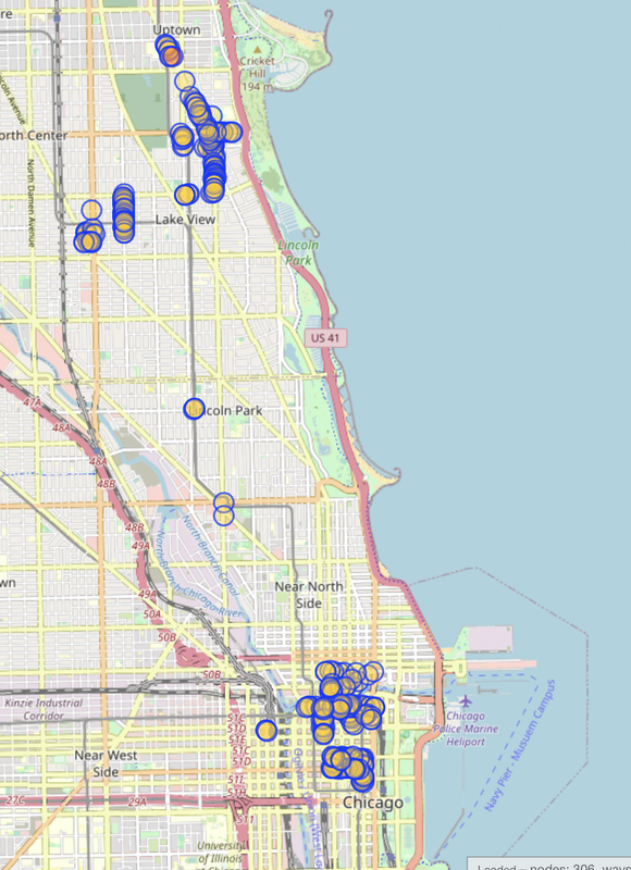
I got a suggestion last time to try using data from the city to help map the racks. Unfortunately, the data from the city isn’t super accurate. It can be off by as much as 2 blocks using the map on the official website. So I got data that was a little more updated, stripped the locations from it (the geocoder used was inaccurate) and punched it into Google MyMaps to see how accurate it was. It’s better, but still not something I’d want to use for actual mapping.
Another approach I’ve tried is using Mapillary. I bought a 360 camera and recorded a few tracks around town. Supposedly they’ll automatically tag stuff using computer vision (bike racks included), but none of my sequences posted more than a week ago have been tagged yet.
On September 9-11, 2022, I attended the Wikimedia Summit 2022 in Berlin, Germany as a representative of the Wikimedia Community User Group in Uganda. As someone who belongs to several communities, I was interested in learning from the Wikimedia community lessons that could be replicated by the OpenStreetMap community.
The Wikimedia Summit is the annual conference that brings together Affiliates of the Wikimedia Foundation. The program was designed around the implementation of Wikimedia Foundation’s 2030 Movement Strategy initiatives, and provided a space for connecting, celebrating, learning and planning for the future of the Wikimedia movement.

Photo by Jason Krüger CC BY-SA 4.0, from Wikimedia Commons
After I reconnected with Ilya at SOTM and talked to him about his new app Every Door, I thought it would be nice to organize a mapping party around it back home. I just got back from some Mall Mapping with a small OSM Utah group, and wanted to share my experiences with the app.
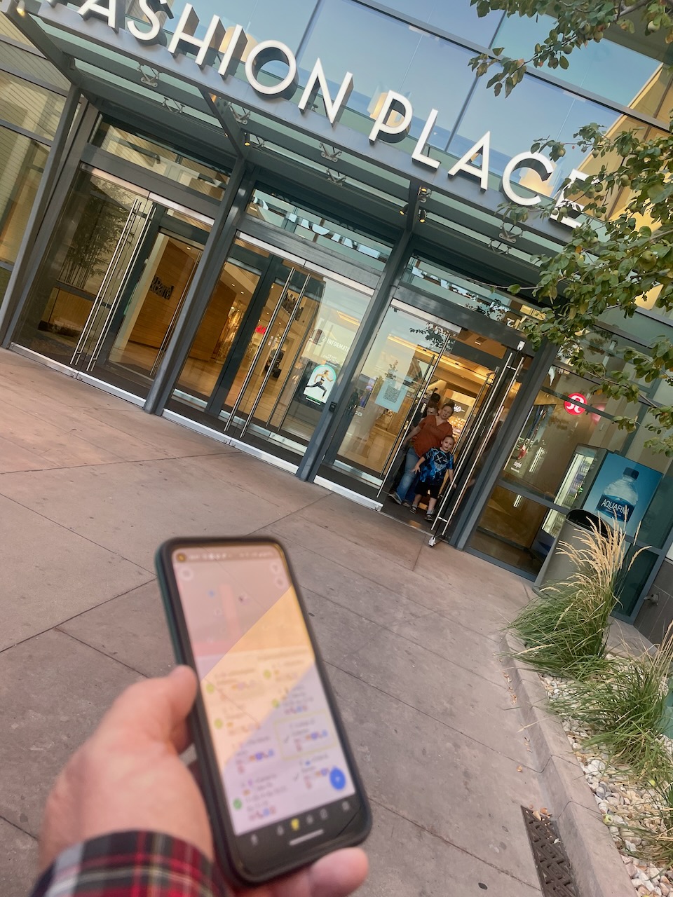
First things first, the app works great. The fact that it’s on Android and iOS and looks and works the same on both platforms is great. The interface is snappy, there’s no annoying crashes or delays, and everything is fairly easy to discover and learn how to use.(However, this is coming from a group of people who have experience with OSM mapping and are at least a little savvy about technology..)
There were two interface elements that took us a little time to figure out. One was the “modes” at the bottom. The default mode is POIs (the coffee cup icon). It is not immediately clear what the other modes do, but for people with some experience with OSM, you can figure it out in a few minutes.
In the recent days I’ve experimented with rendering floor plans using indoor data from OSM. The Simple Indoor Tagging schema suggests pretty lean additive tagging rules to specify the floor level of features and extends to drawing room/area shapes. Well done guys! It’s a very nice and flexible suggestion to add indoor data to OSM.
Turns out coverage of indoor data in OSM is quite limited:
This is expected given the difficulty to source indoor data paired with the limited editor support. And frankly, I don’t see much use in mapping indoor data (as part of OSM) except for POI floor levels.
The Simple Indoor Tagging is right in suggesting to map walls only if not already defined by room shapes. Having wall shapes in OSM would dramatically increase the number of nodes and make it more difficult than it already is to edit indoor data. Note that the spatially overlapping room shapes in the different floors are already troublesome to edit unless one uses things like JOSM’s filters extensively.
Being aware of these constraints I came up with the following process to generate walls on the fly:
From time to time, I come across mappers that really specialize on a specific mapping topic. I was doing some random mapping in my state when I came across this very well mapped school:
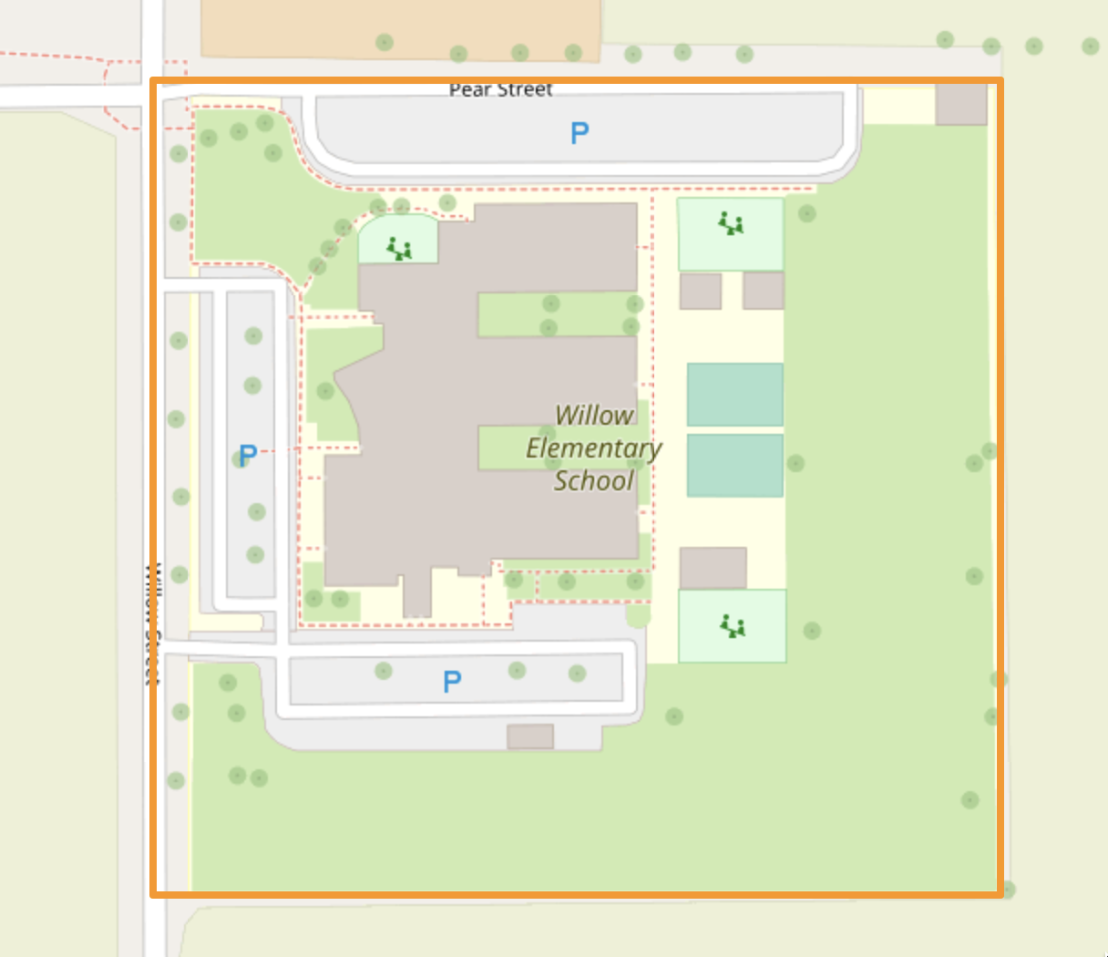
This mapper, Chef7, has mapped lots of schools across the United States in high detail:
Just creating this entry to link to the Wiki page for a proposed address import in Cache Valley, UT.
See also: Previous diary entry with a slightly more fuzzy proposal
Please add any comments here or on the Wiki page.

Actually, this is going to be my first international conference out of Africa it was an amazing conference, and I had the opportunity to meet with different people all over the world. Attending a workshop and two different conferences, I will say it is the best so far.
During the workshop sessions and conference, different organizations hosted additional events, such as HOT unSummit at SotM, HOT unSummit Social in the evening, and YouthMappers Documentary Premiere which was insightful and emotional.
It’s all good


