Diary Entries in English

Recent diary entries

First stop, Cercedilla

The Spanish government has decided to fully subsidise the regional train services around major Spanish cities for the rest of the year, to try and encourage people to use public transport more. Now I don’t use Madrid’s Cercanias services very often, because I work mostly from home, but I decided to get my free ticket and explore the region a bit more. Then it occurred to me that I could also take advantage of the offer to do a bit of OSM mapping in different places.

So yesterday I got on the train and headed to Cercedilla, sitting at the foot of Madrid’s mountains. It’s a station I have been to many times, but always to start a hike - you can walk straight out of the station and onto a trail that takes you up to those mountains. This time I headed for the nearby village, gathering addresses and points of interest as I went.

I was giving a test run to the Every Door application, presented by Ilya Zverev at this year’s State of the Map event in Florence. It worked very well for capturing the points of interest, the address and building interface was a little trickier to understand - but I liked it and will use it again. I need to check whether I can configure it a bit more so that I don’t need to add so much to the data later at home. But I can stop being the mapper with the old Garmin GPS for a while.

More OSM away days around Madrid will come, the free ticket lasts until the end of the year!

Location: 40.741, -4.056
Posted by poornibadrinath on 8 September 2022 in English.

It is always amazing to connect with like-minded people on topics you are interested in and talk about making it better. That’s what State of The Map has always been to me. And this time, thanks to HOT UnSummit, I got a chance to attend one as a student, and understand the use cases of maps from a very fresh perspective.

After more than 5 years of working in the mapping sector, I decided to pursue my Master’s in Cartography and being a student again, both of the conferences of SoTM and FOSS4G proved to be very beneficial to attend and understand the ways the mapping community are branching out in.

Alt text

I have been a part of the SoTM community for a few years now and have got a chance to even present some of the talks on OSM and validation. However, the whole experience at Florence this time was very different and engaging. The first in person conference after COVID, it was fantastic to meet everyone I knew in person and connect on maps and more.

See full entry

Location: Innere Altstadt, Altstadt, Dresden, Saxony, Germany
Posted by Zing929645 on 7 September 2022 in English. Last updated on 19 September 2022.

Introduction to JOSM Route Visualization

Hi, this diary is for showing what I have done in GSoC 2022. Two months went so fast that I suddenly realize the final date has come. But I still want to follow the guidance and try something I haven't done before, and I can't wait to show the power of this plugin and some new functions that help.

JOSM route visualization plugin is for displaying the full picture of the public transport routes, which is convenient for users to query and greatly improves the efficiency of route maps and members modification.

Checking the relevant function, you can open the relation editor of some route or public transport objects , and then grasp a big picture of the distribution of routes by specially enhanced image instead of a list of way members. In the meanwhile, the path-finding algorithm and logic handling is great for users to choose the next way to extend existed routes from given options rather than add ways needed manually.

Previous Posts

Greetings

Progress in First Half

First Half Summary

  • Fix the problem that target route figure is under the layer of other irrelevant models.[merge_request1][merge_request2]
  • Make the ways under the route relation of same type as the selected relation of route more evident and add waterway features.[merge_request2]
  • Mark the selected stop in main window[merge_request3]
  • Listing distance from next and previous stops and relation routes in the dropdown of clicked stop[merge_request4]

Second Half Summary

  • Add turn restriction to guarantee path-finding logic to avoid ways it shouldn't be turning to. [merge_request5]
  • Add access restriction to guarantee path-finding logic to avoid ways that have no permission for route extension according to transport mode match.[merge_request5]
  • Handling Roundabout[merge_request6]

Effect Contrast (Part of visual effects display)

Target route floating problem:

See full entry

Location: Allston, Boston, Suffolk County, Massachusetts, United States
Posted by david_daish on 6 September 2022 in English.

Removing duplicate bike paths, updating details of bike paths, and improving routing information is fun! The Sockburn roundabout and bridge is one of the most hostile places for bikes and pedestrians I have ever visited. In the process of surveying it with a fieldpaper map, I almost got hit a few times. To be fair, I was biking with one hand, the other was holding the map XD. I sent an email to the CCC asking if they were intending to improve it.

Adding businesses in the Upper Riccarton chinatown area was great fun! It adds so much texture when you really get down to the fine details. Such an interesting place that I never hear people talk about. I really recommend Ramen Miyako, it slaps.

Location: Upper Riccarton, Christchurch, Christchurch City, Canterbury, New Zealand
Posted by Hawa Adinani on 5 September 2022 in English. Last updated on 8 September 2022.

My motivation for attending the conferences was to share the local perspective of open mapping communities and learn from other communities on how they uphold diversity, sustainability, and impact in solving challenges in their communities. I’m grateful to unSummit scholarships for covering all of my travel expenses so that I could participate in this global gathering! - It was worth it.

I was impressed to see and meet the diverse groups represented at the conference, as well as to see that the majority of grantees (both from Unsummit and FOSS4G grants) come from underrepresented communities, which made the conference more interesting - I met and connected with people from different corners of the world… Peru, Fiji, Brazil, Cape Verde, Jamaica, Guinea, Vietnam, and others who have different ideas about open mapping and how they use geodata to solve local community challenges.

SotM was incredible…there are so many applications for OSM data, and they vary greatly from north to south. SotM was also full of community talks and how OSM communities are leveraging data to solve problems in their communities: all of the talks that I attended were excellent, but my favorite was Florian’s talk titled “How to Kill OSM.” (https://2022.stateofthemap.org/sessions/A8JLUY/) - in my opinion, he had great ideas about OSM’s sustainability thinking.

FOSS4G - a more diverse participation, i.e. academia, developers, users, community, business people, and so on: sometimes I would reconsider approaching someone, worried that they would open their computers and run scripts to explain what they do - haha (you should know by now that I am not a technical person, I enjoy working with them though) - but I still enjoyed every minute of the conference with amazing workshops and talks.

See full entry

On the search for some nice curvy roads. Found some decent ones. SR 424 seems lovely. Next time up I want to go to the Whitefish Ski Resort area before it gets too busy in winter. Not sure if I’ll go there or Ashley Lake next, but it’ll be one of the two. Might knock out both at the same time.

Location: Kalispell, Flathead County, Montana, United States
Posted by Zverik on 3 September 2022 in English.

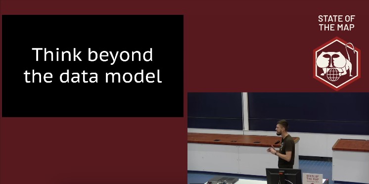
I thought for quite a few days on the Jochen’s study for the OSM data model, and I’ve no idea on whether it’s good or bad or how to improve it. The process feels pretty straightforward to me.

But that’s the issue. It’s not impossible. To fix OSM data issues, changing the data model is not important. Frankly, I don’t have anything to add to my 2019 talk at Heidelberg. It was a reply to Jochen’s and Andy’s musings on API 0.7 back then, and it is still now.

Inspired by Gustavo’s diary on his SotM experience, I am putting some of my thoughts down on paper…

This was only my second in-person State of the Map (first in Belgium) but it felt like I’d been many times - people were so welcoming and open, the organisation and volunteers were great and there were a lot of familiar faces (and usernames).

On Friday my main track highlights were Martijn on 10 years of MapRoulette and Kristen on Entry Level Mobile Mapping.

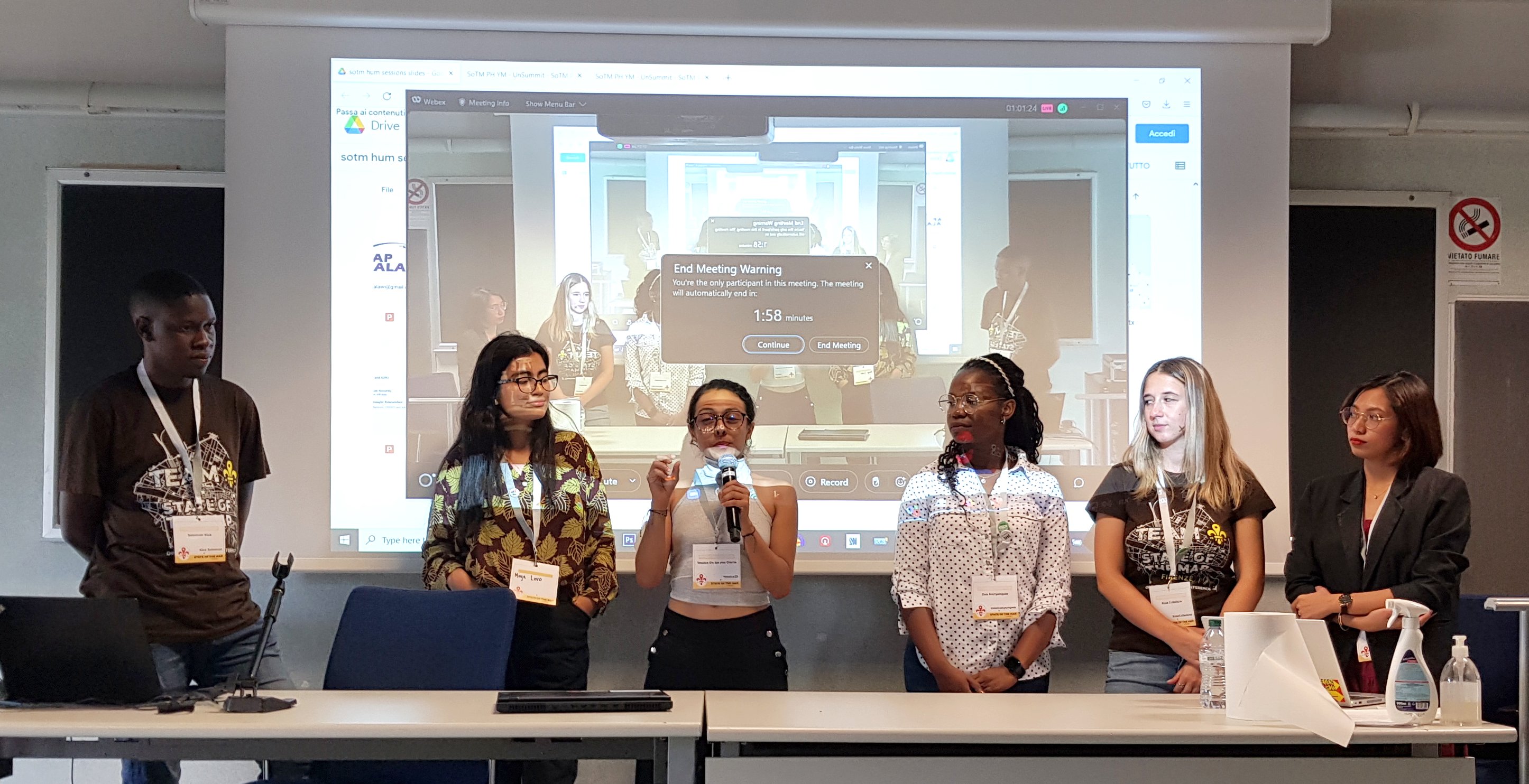
On the Friday afternoon (also World Humanitarian Day), I hosted the HOT unSummit Humanitarian sessions (which you can watch again here) and we heard fantastic stories and insights and saw some great maps, data and tools from 12 different speakers, all relevant to humanitarian open mapping and from all corners of the world. Kudos to the speakers for being so well prepared and to the audience for being so engaged and curious. It was a really great afternoon.

Presenters from the HOT unSummit Humanitarian Sessions at SotM 2022 receiving questions

See full entry

Location: Le Masse di Sotto, Quartiere 5, Serpiolle, Florence, Tuscany, 50141, Italy
Posted by jmsbert on 1 September 2022 in English.

utilsplugin

Buildings_tool

  • must have plugin
  • press "b" to activate the plugin
  • rectangular buildings can be created with just two mouse clicks if another object is selected as guide for orientation
  • if no other object is selected, three mouse clicks are required
  • tag "building=yes" is inserted automatically
  • pressing "CTRL" deactives auto-snapping. This is required to avoid that the new building has shared nodes with highways
  • choosing a node of an existing building as first node offers the possibility to align the new building to the one already existing.
  • more information: osm.wiki/JOSM/Plugins/BuildingsTools

HouseNumberTaggingTool

  • used to assign house numbers to ways or nodes
  • simply select an object and press "k" on the keyboard to open a window with common address keys
  • if (downloaded) objects in the vicinity have already assigned keys like "addr:street" or "addr:postcode" these values can be easily selection from a drop-down list. This avoids false edits.
  • tool allows to automatically apply increments to house numbers every time a new house number is assigned (increment slider at the bottom of the window)
  • more info: https://josm.openstreetmap.de/wiki/Help/Plugin/HouseNumberTaggingTool

Terracer

See full entry

Posted by Socredelir on 31 August 2022 in English. Last updated on 1 September 2022.

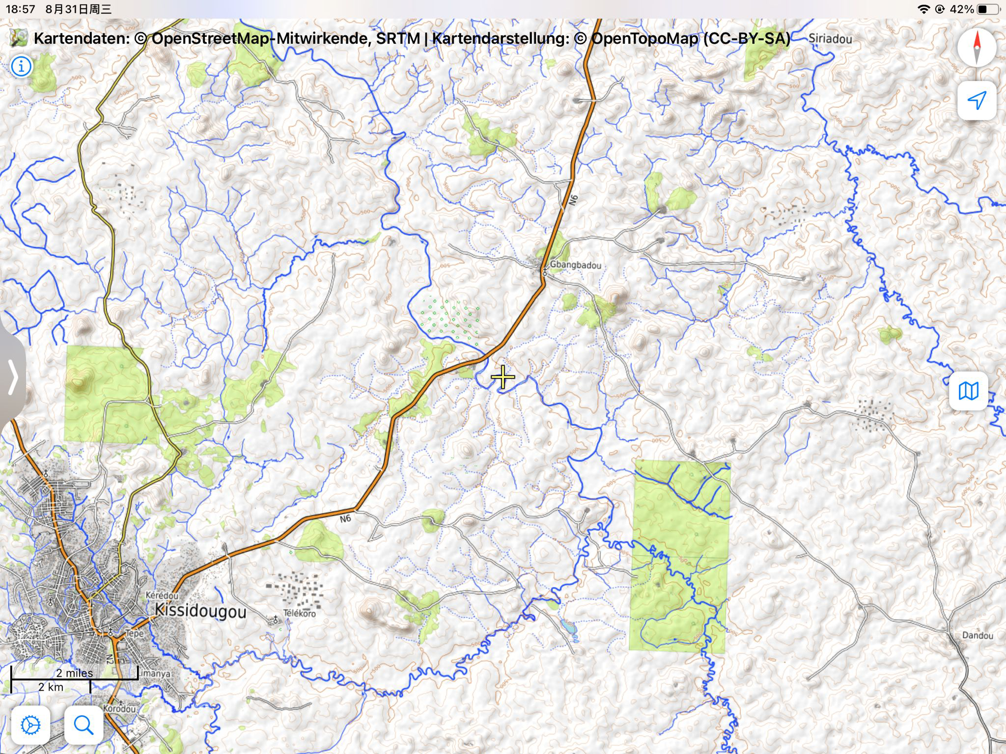
More than 5 mysterious building sites were found in Kissidougou district, Guinea, where the satellite maps show only forest.

These sites were crowded each with more than 30 buildings, each are squares with size about 100x30 m. It is very clear to be seen when we take a look at the OpenTopomap in the north and the east of Kissidougou city, where these buildings are rendered as a lot of big black spots.

Image

The position marked in the article is only one typical example among them: osm.org/#map=15/9.2019/-10.0495

See full entry

Location: Longoa, Kissidougou, Kissidougou Prefecture, Faranah Region, Guinea

Introduction

Taking open-source street-level imagery is a productive and fulfilling way to make a lasting contribution to OpenStreetMap. Typically, amateur street-level imagery uploaded to platforms such as Mapillary and Kartaview consists mainly of images scraped from dashcam footage, or from a handheld smartphone. To a lesser degree, some 360 imagery is also taken. Whilst these are valuable, many street-level imagery sequences suffer from various drawbacks including poor resolution and spatial accuracy, motion blur and narrow field of view. Generally the imagery compares poorly to proprietary alternatives that cannot be used for OSM. In this post I propose a fairly low-budget option for 360 street level imagery that has led to satisfying results. The results are comparible to roughly 1st-2nd generation Google Streetview (circa 2010) and is far better than TomTom/Bing Streetside imagery in Australia.

In this post, GPS refers to geopositioning in general through GNSS, rather than the US satellite constellation.

This post is written from Australian perspective using Android/Windows, so results may vary.

By “affordable” I mean <$1000 AUD. My total expenditure on this project was $700-800 AUD, so that may be inaccessible to some.

I am likely to update this post in the near future as the project continues. Please check back here regularly if you are interested, and feel free to reach out on OSM or the OSM World Discord server.

Camera selection

See full entry

Location: Hurstville, St George, Sydney, Georges River Council, New South Wales, 2220, Australia

On this day, I participated in Unique Mappers OSM Nigeria, a monthly Mapathon. It was so exciting to have everyone joining from different part of Nigeria and beyound. I look forward in few weeks ahead when Etsako east would be completely mapped to provide open map and data for humanitarian use.

Today I participated in Unique Mappers OSM Nigeria monthly Mapathon during which I facilitated the mapathon and providing training to newbies in the beginners room. It was so exciting to have everyone joining from diffrerent parts of Nigeria and beyond ,including Germany and Tanzania. We look look forward in the few weeks ahead Etsako east project would be completely mapped to provide open map data to drive humanitarian response and social good project

It was wonderful, if slightly overwhelming and sometimes surreal to finally meet so many fellow mappers again at SOTM Firenze last week, as well as so many new friends that I’d only interacted with online. This was my 4th in person event and it reinforced not only how much Crowd2Map has grown since Brussels 2016 but also how the mapping community has changed.

In 2016 arrived in Brussels late at night, a bit disconcerted to find that I was sharing a bed with a stranger - Miriam from GeoChicas. We quickly got over this surprise and she became a great friend and ally, even visiting the FGM Safe Houses we work with in Tanzania en route to FOSS4G 2018. In Brussels I was a newcomer who knew no one. I tried to navigate the seeming chasm between the brown shirted craft mapper gang and the humanitarian team. In Firenze I was very pleased to note much less of this divide. Arriving felt like coming home after a long journey, meeting so many people from previous events and others for the first time IRL.

Particular highlights for me were talking about the impact of our Digital Champion project, meeting colleagues from Missing Maps HOT and Youthmappers who I’d only interacted with online. Kristen Tonga’s talk on the challenges of mobile mapping in rural Tanzania really resonated with our experiences setting up our Digital Champions program, and we look forwards to working with her going forwards.

Ilya is always enthusiastically working on something interesting and this year was no exception, we’re looking forwards to working with him on Every Door soon. The We’re also looking forward

We were particular proud that Binyam Dele Youthmapper Ambassador from Ethiopia wants to replicate our work fighting FGM there.

Greatly looking forward to next meet up - particularly State of the Map Tanzania in January 2023 and hope to see many of the mapping community there either in person or online!

Posted by radiotrefoil on 28 August 2022 in English. Last updated on 26 June 2025.

The following is an incomplete list of 360 camera sequence examples by model on Mapillary, along with some comments, with respect to the image quality and price of the camera. This will be an ongoing work in progress.

Camera Example Comments
GoPro Fusion Radiotrefoil Image clarity much worse near stitch line between hemispheres but overall quite good
GoPro Max 360ms; ademturkmen Very similar performance to Fusion
NCTECH LTD iSTAR Pulsar zaf3kala Professional quality 11K spherical images, price unknown but assumed to be very high
LG Electronics LG-R105 yoelt Cheap option, offers OK results but a lot of text illegibile
HUAWEI VOG-L29 lehestener Invalid spherical image?
Insta360 One X2 jkingsleya Image quality doesn’t justify price of camera
Ricoh Theta SC adam2  
MADV/Xiaomi Madventure gness  
Garmin VIRB 360 max93600  

Please feel free to help me add to this list and share your insights using the Google sheets link below. https://docs.google.com/spreadsheets/d/1ajTm_0fRKLHiGJS2TW0CNscbW4NItuyjkJxzU_kbLXg/edit?usp=sharing

The Mapillary GraphQL API can access metadata for camera make/model, however it is an undocumented feature and lately I have been getting “access denied” error even when using my API token. If anyone knows a workaround please comment.