Diary Entries in English

Recent diary entries

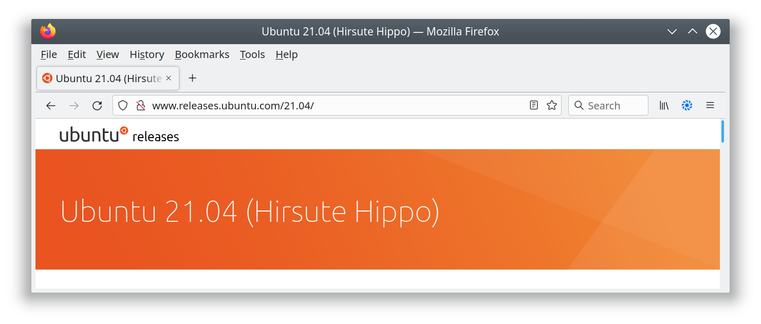
Screenshot of Ubuntu release page

I’ve added a new page to the switch2osm guide: “Manually building a tile server (Ubuntu 21.04)”. The work that the Debian developers have done to include the required software inside Debian 11 is now in Ubuntu 21.04, so there’s actually less setup work needed than in previous Ubuntu versions.

Ubuntu 21.04 isn’t an LTS release, so Debian 11 or Ubuntu 20.04 are still the recommended options for servers that are expected to stay around for a while. One of the regular faux pas with the Natural Earth download site has just been and gone, but the guide includes a workaround in case problems reoccur there.

See full entry

Location: Southwest, Tasmania, 7116, Australia

ROAD CLASSIFICATION DECISION MATRIX

Default Starting Ranks: [UK] [IRL] [DE] [FR] [IT]

INTERSTATE/MOTORWAY motorway [US:I] [UK:M] [IE:M] [DE:A] [FR:A] [IT:A]

NHS (DIV) trunk [UK:A(T)] [IE:N] [DE:B] [FR:N] [IT:SS]

US (ALL) / NHS (UNDIV) primary [UK:A] [IE:N] [DE:L] [FR:D] [IT:SS]

STATE PRIMARY secondary [UK:B] [IE:R] [DE:K] [IT:SP]

STATE SEC/COUNTY tertiary [UK:C]

TOWNSHIP residential

other things to think about for status changes: for Primary to Trunk: NHS mainline/some Strahnet (exc intermodal connnectors) +1 controlled access (limited intersections) +1 divided highway +1 interchanges at intervals +1 super-2 in places +1 or upgrade to motorway super-2 with widened centerline, rumble strips, mandatory headlight usage. Trunk means “watch out”; dangerous roads serving the role of a motorway one with design/safety compromises.

Secondary to Primary: high relative traffic +1 wide shoulders +1 Interstate Business Route +1 (not automatically in NHS!)

Tertiary to Secondary: 4 or 6-lane divided +1 through route +1 retail strip +1 interchanges with an Interstate (case-by-case)

Residential to Tertiary Divided, serving major retail centers and industrial parks +1 MD: Has yellow center line and is through/collector route VA: Numbered Secondary 600-999, selected routes above 1000 (VA numbers almost every road, but these lower numbers are usually important) PA: Numbered SR 1xxx-4xxx WV: County Routes (whole & fractionals)

for drops in status: numerous traffic signals in quick succession (drop from trunk) -1 retail strip (usually cause for above): drop from trunk to primary, but up from tertiary to secondary if divided. -1/+1 low speed limit -1 city environment -1 narrow shoulders -1 twists/turns/grades -1 (in relation to nearby straighter roads serving the same general direction)

See full entry

Posted by jidanni on 14 September 2021 in English.

Here we see that most of today’s cellphones’ GPS traces are “all over the parking lot,” thus will degrade the quality of OSM when making a map from them, https://medium.com/@importanttech/we-tested-mobile-gps-gnss-accuracy-and-found-some-surprising-results-b9ec35873e2e

But yes, you could say having a path on the map is better than no path.

See also https://www.sciencedirect.com/science/article/pii/S0263224121001858 .

The idea to map radars and mirrors of the Czech highways was raised in the mailing list of the Czech community. One of the comments is questioning about how to track the work done–and that’s exactly the problem to be solved by the damn project. (Note that the idea to map radars and mirrors of the Czech highways is still just an idea and there are no further steps done yet I’m aware of.)

I already wrote two Get inspired by … diaries. These were the potential HOT tasking manager improvements and the Tanga Building Footprints Import. This diary discuss the use of the damn project for tracking the work done on highways.

Create area

The damn project helps mappers by dividing some big area into smaller squares that a human can map. How this applies to highways?

It’s possible to upload two kinds of GeoJSON boundary files to the damn manager. If the FeatureCollection has member ‘name’ then divide to squares function is NOT used. Moreover, I’ve updated the damn project to understand what to do with a feature containing a LineString geometry: create a “square” with the border around the LineString. (“Square” here means a square of an area of the damn project.)

So… when you download some highway=motorways within some interesting bounding box (I mean from overpass API in JOSM,) save as GeoJSON, and add name member, you are able to upload that as GeoJSON boundary file to the damn manager.

Note that I experimented with joining ways to make larger squares of an area. The JOSM damn plugin then refused to automatically download the OSM data of a square because the square was too large, and the data had to be downloaded manually.

Mapping

The mappy client may help to visualize the area. An example is area 2352 and it looks way better with background image switched off. The JOSM damn plugin, light client, or panel using map random square/map nearest square are better options, though.

See full entry

Today as of this week, I started editing the missing map details around the Gordons( esp the National Stadium), Rita Flynn Netbal Centre, Sir John Guise Stadium as well as commercial Buildings around Waigani area. It took me almost 3 days before the 3-D model of these Stadium(Sporting facilities) appeared in F4map.com. I hope to see these models also reflected in 3DBuildings.com.

Although these are LOD 2 models( in my context), I may hope to try pulling those models into Blender-OSM to further enhance these Buildings, in the future( to take 3D modeling a further step up). I hope to still edit areas that aren’t not mapped out around Port Moresby areas, such as Gerehu Suburbs which are still missing details. Alot still needs to be done around our National Capital city which is still lacking map elements in OSM.

I have done all my BEST and its almost a year that I have actively been editing maps around Port Moresby area esp. the Metropolitan area where high-rise Buildings and densely-packed detached buidings are.

One fundamental function that anyone can use is the Building tags; as I am using only the ID Editor as I don’t have access to use JOSM to verify if my tags are valid. Thanks goes to the OSM moderators who are providing me helpful tips&insights on how I can edit the maps with any error. I am still pressing and pulling myself up-to-date with OSM HELP menu and correcting myself to re-edit feature entries which are erroneous.

Thankyou all and once again happy mapping to all the Mappers around Papua New Guniea and to the Moderators who are taking their time to correct us.

BOLA! and happy Mapping.

Location: Yairik, Lagaip-Pogera District, Enga, Highlands Region, Papua New Guinea
Posted by arnalielsewhere on 12 September 2021 in English. Last updated on 13 September 2021.

If you want to translate this post to be more comprehensible, I recommend to use deepL translator.

Disclaimer: All opinions are mine and do not necessarily represent opinions of HOT or other organizations/groups I am affiliated with.

The HOT Board and Chairperson Election period this year started this month of September. Both positions require that you are a voting member to be able to run, nominate and vote.

PS. Becoming a voting member is another cycle/election :)

I’d like to share five (5) challenges or “dare” to the HOT Voting members (which includes Board members and chairperson).

#1 Unengaged membership: How can we engage 1M contributors if we cannot engage our 217 (and growing) voting members?

HOT received funding from the Audacious Project last year - “Over the next five years, HOT will engage one million volunteers to map the places that are home to one billion people.”

When I applied for my staff position, this has been one of my strong drivers/motivations: to meaningfully engage contributors/communities (including the voting membership), and benefit from the work that HOT does. I believe the voting membership is one of the most important of these communities but hasn’t been prioritised in recent years.

I challenge the HOT membership, how can you help engage your fellow voting members, esp. those you nominated as a voting member and vice versa?

#2 Community Participation: How do we actively participate and support communities/groups locally (your local communities), regionally (eg Open Mapping Hubs), and globally (e.g. HOT / OSMF Working Groups)?

HOT shifted from global to regional structure to ensure that power, decision-making and resource allocation happen much closer to the communities we seek to support and in which we want our impact to be. How do you think the voting members can support the Regional Hubs and local communities?

See full entry

Location: Montezuma County, Colorado, United States

The division of the Republic of Djibouti (RDD): Total Area: 23,700 km²

the following text shows how the Territory of RDD is Divised and coded:

• afr_dji_l02_2011 the Republic of Djibouti (RDD); RDD constitutes the second level administrative unit. Represents The total area of ​​the country is 23,700 km².

• afr_dji_l03_2011 the Regions; The region constitutes the 3rd level administrative unit. Represents The administrative division of the Prefectures or districts of the Region.

• afr_dji_l04_2011 the Sub-Prefectures: The Sub-Prefectures constitute the 4th level administrative unit. Represents The administrative division of the Sub Prefectures of the Region.

• afr_dji_l05_2011 the Communes (only in the Regions of Djibouti 5 or the capital city); The 5th level administration subdivision constitutes the Commune. the Djibouti region is the divided in two part urban and rural: o The Communes of Djibouti city are urban, o And the rest of the Region are rural.

• afr_dji_l06_2011 Arrondissement; The 6th level administration subdivision constitues the Arrondissements. there are 6 (A1, A2,..,A6).

• afr dji l07 2011 les Quartiers; The 7th level administration subdivision constitutes the Quarters and it is divided in two part quarter and locality o The quartiers for Djibouti-ville. o The locality for the rest of the country

Location: Oue`a, Tadjoura, Tadjourah, Djibouti
Posted by TylerOSM on 10 September 2021 in English.

HOT members - welcome to the 2021 election cycle! If you’ve been considering running for a board seat, or simply my informal take on things, read on!

This year, we have several unique factors at play:

  • HOT has just entered (as of July) its second year of implementation of Audacious Project implementation, working toward a goal of engaging 1 million contributors to map an area home to 1 billion people across 94 countries.
  • The organization has gone through a period of rapid change in the past 12 months, opening two regional hubs, adding roughly 45 staff members, doubling our annual budget, and putting the organizational foundations in place to dramatically scale up community support. We’ll continue to scale from 2021-22.
  • The environment around us has also changed dramatically, opening up new possibilities with recent technical advances and forcing us to re-think ways of working under Covid-related movement restrictions.
  • Lots more has been happening: see our Annual Report (I’ll write more on where we stand and where we’re heading next month).
  • Amidst all of this, five of seven board seats are up for grabs.

I’ve been reflecting on this. As someone who works to serve and expand the open mapping / OpenStreetMap movement every day, what would position HOT in the best way to support the movement? Given the changes and uncertainty, what specific skills would add the most value? What specifically do we need coming out of this year’s Board of Directors election cycle?

I’ve come up with a rough grouping of skills and experiences that have the potential to add significant value as part of HOT’s Board of Directors. HOT has an incredible diversity of lived experiences in our membership, though, so if you don’t see your particular experience here, it doesn’t mean it wouldn’t benefit HOT.

In no particular order, here’s my top five archetypes:

The serial entrepreneur or tech trend-setter

See full entry

Posted by SK53 on 8 September 2021 in English.

I was intrigued by the photo on the wiki illustrating the hardest level of the Swiss Alpine Club scale for mountain hiking (known as SAC Scale on OSM and tagged with sac_scale). I couldn’t identify the location and wondered by looking for ways with the tag I could do better.

A quick overpass query revealed widespread misuse of the sac_scale tag for true alpine climbing routes which the Swiss Alpine Club grades using a completely different scale.

A few of the more egregious examples:

  • Geant-Rochfort Arete. A classic high-level snow ridge encompassing a couple of 4000ers. Tagged with highway=path and sac_scale:

Aiguille de Rochefort

Description of route on Hikr.

  • Biancograt of Piz Bernina: apparently trail visibility is horrible, which is a bit of a surprise, because the ridge is rather narrow.

See full entry

Location: Pontresina, Maloja, Grisons, 7504, Switzerland

tldr; hot_tech is running the second round of an ai-assisted mapping study
Call to action: please sign up to participate or share with your networks
time: read: 5m | sign-up: 5m
best before: Sept 17th, 2021

Hi all!

As some of you may remember, earlier this year HOT undertook an experiment to compare tradiational mapping with AI-Assisted mapping. After the first round of results have been gathered (soon to be released), hot_tech will be undertaking round two (Sept 17th, 2021) and we are looking for beginner mappers (<50 changesets) to join the study.

The experiment is designed to compare the results of traditional remote mapping workflows (editing in ID Editor) with emerging AI assisted workflows (editing with RapID). To do this, we will be conducting mapping experiments of two locations (Uganda and US), with beginner mappers (<50 changesets) using the two different remote mapping workflows (RapID and ID).

On Sept 17th, 2021, we will run one mapathon of 90 minutes, with participants being randomly assigned - prior to beginning mapping - to map building footprints with either ID or RapID. Data will be gathered on the existence of map features in two locations (US and Uganda) from which we will compare the completeness of mapped features and similarity of map features when compared with an OSM reference dataset.

For the mapathons we will be using convenience sampling from our networks by generating a public call for participants.

A couple of specific asks, please email if:
_ You would like to be involved in any capacity (organising, recruiting, sharing, supporting, please shoot me an email)
_ You would like to support the mapathons specifically, that would be great
_ You would like to participate in the mapathons please please sign up to participate HERE »

Thanks all, I hope everyone is safe and well and looking forward to exploring this with you all soon.

Kindness,

bo

Location: Naz, Esserts-Salève, Monnetier-Mornex, Saint-Julien-en-Genevois, Upper Savoy, Auvergne-Rhône-Alpes, Metropolitan France, 74560, France
Posted by SimonPoole on 5 September 2021 in English. Last updated on 17 December 2021.

As a rule of thumb, the primary name would be the most obvious name of the feature, the one that end users expect data consumers to expose in a label or other interface element.

From the OSM wiki Key:name

I’m currently tidying up a couple of loose ends in preparation for the release of version 16 of Vespucci. One of those dangling bits was supporting the new format of the name-suggestion-index (NSI).

The NSI was conceived back in 2013 by Aaron Lidman as a list of canonical name spellings for chains of stores, restaurants and other similar facilities, most notably for use in iD. Vespucci has supported use of the NSI nearly since day one, see a diary post from 2014 (this works quite differently in current Vespucci versions). Since then it has morphed to a, supposedly, authoritative source of tagging for a very wide range of objects. Some would say that the current version has expanded its reach far beyond what is actually useful (flagpoles ffs), but that is not the topic of this post.

Prior to the release of iD 2.20 the NSI had been in a long period of stasis with updates being made to the data, but these were not actually being deployed and given the larger format changes I had all but forgotten about it and the data in Vespucci was really old. However over the last couple of months some colleagues pointed out some weird behavior in Vespucci and iD when using NSI generated presets for tagging. In particular name tags are being added to things like excrement bag dispensers and automated postal package depots.

See full entry

Posted by Gustavo22Soares on 4 September 2021 in English.

As already mentioned in the previous text OpenStreetMap is not so friendly to the common user but serves very well for cartographers, I also received many comments that OSM is not a final product but a shared knowledge base and even some comparisons with linux… But using OSM should not be difficult or depend on the rebrand from big companies, I believe that it has a way to reach the common user and win market and being opensource and still bring more mappers to the community.

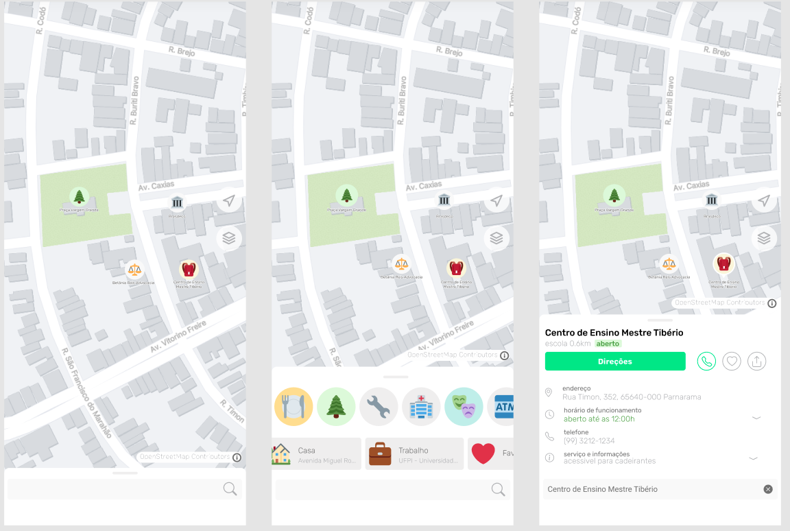
For some time now I have been working on what would be an ideal client that I would really use and recommend to my friends and colleagues. This has been growing since I read the article The Mobile Map App Part I: The Void so I decided to create a draft:

hermes.png

But to get this idea off the paper I need your help, if you have some experience with Flutter or React and want to take OpenStreetMap to a new level please contact me: gustavo22soares@pesso.al

Location: Centro, Teresina, Piauí, Northeast Region, Brazil