Diary Entries in English

Recent diary entries

At the Python Unconference in Hamburg, we released the new OSMAlchemy library, which allows for the simple creation of arbitrary, OSM-data based applications with a low resource footprint in Python. It wraps around the popular SQLAlchemy database library and allows access to the whole world of OSM data as if it were in a local SQL database, and uses such a local database for caching.

See the GitHub repo for the code and a README, and find the original presentation from the release talk.

You can write to osmalchemy@veripeditus.org if you have questions or comments, or use the GitHub issue tracker.

I’ll be at State of the Map in Brussels this week presenting all of our work on validating OpenStreetMap data. At Mapbox, we spent the last few months looking at changes that happen in OpenStreetMap closely - geometry, tags, users and the community. I’m really excited to share what we learned, and to open the conversation on how the community can focus on keeping the map from breaking while growing. I’ll be presenting the tools we have been building, insights about problematic changes, response, mechanics of communication and more during my talk.

Our team just published an approach to validating OpenStreetMap data - talking about identifying problematic changes, inspecting them, communicating and eventually fixing. Let me know what you think!

What makes OpenStreetMap special is the community. The community is what makes OpenStreetMap a truly self-healing map. The community is the map.

Map of recently reverted changesets

See full entry

I was meaning to say (and left it a bit late) it is a great honour to be nominated for the OpenStreetMap awards.

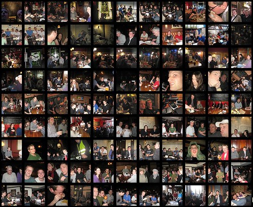
I have realised recently, with some embarrassment, that despite trying to contribute in many different areas, my greatest contribution to OpenStreetMap has almost certainly been my diary entries about people sitting around in pubs! :-)

montage of OpenStreetMap pub photos

See full entry

Posted by yvecai on 22 September 2016 in English.

When Mapquest layer disappeared, this was a problem for OpenSnowMap: its cold colors and less detailed style were great to overlay ski pistes onto. But the end of this freely available map forced me to build a simple style with plenty of room for ski pistes: the OpenSnowMap Base Snow Map.

A winter topo map

I used OSM-Bright to start building this style. Using colder colours more suited to a winter map, of course I also added relief. In particular, relief hillshading led me to desaturate highways to avoid they pops out the shadowed side of the hills .

Ski pistes are not rendered on this layer, the OpenSnowMap remains an overlay. In fact, they are rendered on the Base Snow Map with 12 pixels wide transparent labels that forbids other labels to take place where ski pistes from the OpenSnowMap overlay will land.

I want to see it!

This style is only showcased on http://beta.opensnowmap.org for now. The mobile part of the website is shown with ‘retina tiles’ by default, but you can choose this high-dpi option or not from the menu.

For these mobile-friendly tiles, I choose to render 384px tiles and display them with a 1.5x scale factor. That please my eyes on my own phone and the server seems to be OK with them, so please tell me they also looks good on your phone or tablet.

Of course, Openstreetmap-carto is still available, although without high-res tiles but a simple scaling for the mobile version. Here also let me know what the default should be: I find it more usable with the scaling on my device, although a bit pixelized.

That’s great, but …

See full entry

State of the Map attendees are coming to Brussels from (at least) 52 countries! The global State of the Map is a unequaled time to come together in person to share experiences from every corner of the world, find common ground, and plan what’s next for OpenStreetMap.

Many of us, among the over 400 attendees, are local community organizers. We hold mapping parties, organize local SotMs, even register organizations and sign up as official Local Chapters. I’m excited that we have dedicated time to talk as local communities on Sunday – during the panel discussion of State of the Local Map and the open discussion of Local Chapters Congress. There’s call to have a Local Birds of a Feather. The discussions we have in Brussels will continue with local communities gathering next week in Manila for State of the Map Asia.

Folks like Martijn, Joost, and myself have been talking with OpenStreetMap local community organizers over the past few months, to learn more about what they’re doing, motivations, their challenges, and what they need from the global OpenStreetMap community.

What I’ve found is that local communities are seeking to get more organized to engage more officially with government agencies, universities and other institutions. They find they need financial administration beyond borrowing someone’s bank account. While some have seen the value of becoming an official OSM Foundation Local Chapter, there is still lack a clarity to some about the necessity and benefits. Nevertheless, they see a lot of value to learn from others working on similar issues – everything from legal and administrative issues of starting an organization, to sharing community engagement strategies that work, to amplifying the voices of their community in the global OSM conversation especially for non-English speakers. Regional connections are especially valuable, for working with mappers in similar languages, timezones, and to some extent culture.

See full entry

OSM Stars from wiki

This Sunday, we will meet the nominees for the first OSM Award and learn who gained the most votes in each of the six categories, including Mapping and Blogging. 650 mappers have already voted, and if you have not, please head to the awards website and make your choices. All you need is an OpenStreetMap account.

The voting closes on the morning of September 22nd, when the Brussels Maptember begins with two great conferences: HOT Summit and FOSS4G.be. After that we will dive into OSM topics at the State of the Map, and on Sunday, before lightning talks and workshops, we will know the winners.

But for now, there are still ties in some categories, and your vote can decide who will get the award. Do vote now and meet us at the State of the Map!

Posted by Crumeniferus on 19 September 2016 in English.

There are only a few small areas where I often go and already I seem to have become obsessed with representing them as accurately and fully as possible. Norden Park and Ride is becoming a pet project and I don’t even have anything to do with the steam railway that terminates there!

Somewhere, when I first joined OSM, I remember reading a warning to the effect that contributing to OSM is addictive. I’m not an addict, I’m just a frequent user. I can stop at any time I choose. Any time at all. Any time. After this next edit…

A review of the existing data in 5 most populated cities of France was detailed in our previous diary. Through this diary, we will be introducing you all to a handy tool for mapping turn restrictions.

Adding turn restrictions using OSM Navigation Map

OSM navigation map is an open tool that was built to review and add missing data for turn restrictions. It relies on Mapillary as a source to identify the turn restrictions in the detected traffic signages from the street level images captured by the volunteers.

The data team in Mapbox has used this tool for reviewing the existing restrictions and as well adding the missing ones for US cities, 5 cities each in Canada and Germany. The tool assists in reviewing the restrictions easily and quickly.

detected_only_right_turn Detected signage of only_right_turn restriction in Mapillary

See full entry

Last week, as a part of making OpenStreetMap more navigable, we started updating possible missing turn restrictions in 5 cities of Germany i.e., (Berlin, Stuttgart, Wolfsburg, Munich and Frankfurt), with the help of OSM Navigation map which uses Mapillary detected traffic signs. Around 1900 turn restriction were reviewed in these 5 cities and we managed to add 112 OSM notes where probable missing data was found.

screen shot 2016-09-19 at 3 00 19 pm

We have received a great response from the community on this task, and as of now, 71 notes are resolved. It would be great if the community could resolve remaining 41 notes to enhance the accuracy of navigation data present on OpenStreetMap.

Here is the list of OSM notes for missing turn restrictions.

See full entry

Posted by alexkemp on 18 September 2016 in English.

As yet another in the “for heaven’s sake, what on earth has this got to do with mapping” series of incidental snapshots, drawn from life & art seen on the streets of Carlton & Gedling, as your intrepid mapper penetrates deeper & deeper into the hitherto unexplored heartlands of England, I bring to you one of the unacknowledged obsessions of the Brits: Fairies

purchased from the internet

This plaque was on a house on one of the eastern slopes of Marshall Hill and caught my attention immediately. The lady householder told me that she purchased it a few years back via the internet.

The Oirish (and, indeed, all the celts in the British Isles) (which is to say, everyone except those descendants of William the Bastard) freely admit to an active engagement with the Little Folk. As is so often the case, this is just the English being disingenuous, since they are as fascinated by the natural spirits of this place as everyone else.

Location: Gedling, Carlton, Gedling, Nottinghamshire, East Midlands, England, NG4 4BH, United Kingdom
Posted by alexkemp on 16 September 2016 in English. Last updated on 17 September 2016.

I’ve just added old_name=Stoney Pit Lane to Cavendish Road. This information comes from a historian within #66 (start-date=1930), a splendid lady who, due to old age, now has difficulty weeding her garden. Her body may be becoming infirm, but her mind is as sharp as a pin.

The houses on the north side of Cavendish Road increase quite normally until Belper Avenue. The last house (Short Cut To Beauty) is actually numbered on Belper Av; it’s neighbour is 78 Cavendish Road, and the next house on the other side of Belper Av is Dom’s Barbers, which is number 206. Originally, Stoney Pit Lane finished at Number 78. Then near the end of the last millennium the road was both extended & renamed to Cavendish Road. This information was not recorded previously.

My historian’s mother was born in 1900 & began to attend school in 1903. That was not normal for the times. Each morning, her mum’s cousin would call at the house in the morning, make a fuss of her mother, then carry on to school. Then her mother began to follow behind her cousin to school. Each morning a teacher would bring her mother back home until, eventually, after days & days of this happening, they let her stay. Naturally, she sat in on the lessons. By the age of 12 her mum had passed every exam that they could throw at her.

My historian also told me about Farmer Kerry & Farmer Tattersall. Dark-haired Kerry was the farmer that owned the fields on the College (south) side of Carlton Road, whilst blonde-haired Tattersall was the farmer that owned the fields on the Petrol Station (north) side of the same road. She went to school with Alma & Olga (Farmer Tattersall’s daughters), and explained to me that the farmer insisted on having roads named after his daughters when he sold his fields.

Another snippet was that the authorities had to grade the top off Carlton Hill, so that the trams could get over it.

See full entry

Location: Sneinton, Nottingham, East Midlands, England, NG2 4ND, United Kingdom
Posted by alexkemp on 16 September 2016 in English.

I’ve written before at my surprise in finding large numbers of houses in Carlton, Nottingham NG4, UK built between the 1880s & 1930s, that still had outdoor khazis. The ones that I used as my illustration were opposite the middle of the Carlton Cemetery (16 July, Worth Street).

In the past 2 months I have mapped clockwise down Cavendish Road, Coningswath Road and all the roads of Marshall Hill, Westdale Lane West then all the way back down Cavendish Lane on the other side of the road and yesterday (Thu 15 Sep) struck the western end of the same Cemetery. It should, therefore, not be a surprise to find some more Khazis outside each of these (at a guess) 1930s flats, but it was.

There was a service road supplying (what is now) some waste ground at the back of the flats (you can see the Cemetery on the other side of the fence:—

rest at last

Whilst exploring that I spotted a walk-through to the rear of the flats, and there were the khazis (these are for 4 flats, 2 in each of 2 adjacent houses):—

See full entry

Location: Gedling, Carlton, Gedling, Nottinghamshire, East Midlands, England, NG4 4BH, United Kingdom
Posted by Yoshinion on 16 September 2016 in English.

Because I cannot sign up for the osm wiki, I guess that I will have to suggest it here:

approximate=yes

## to be used when the geometry of the area/line is approximate ## depreciates comment=location_approximate

needs_survey=yes

## to be used when a local survey is necessary

Also, the railway=light_rail needs a “easy key-value” changer like the normal railway=rail…

Posted by alexkemp on 16 September 2016 in English. Last updated on 1 May 2017.

I’ve mentioned Stone Lions before, and have seen many, many more since then in the gardens of Carlton & Marshall Hill (and ignored most, as I do not wish to bore with unnecessary repetition), but these pink-eyed lions on Cavendish Road seemed to call for attention:—

Cavendish Lions

The same 4 lions (only 3 pictured here) can be seen in Google StreetView, but they are grimy & street-dark (Cavendish Road is a main thoroughfare for cars & buses from Nottingham & Carlton). Since then, the householder has not only had them blast-cleaned to bright-white but has had their eyes painted pink. Excellent!

In complete contrast, here is a garden in Cromford Avenue, sheltered & away from that main road:—

See full entry

Location: Gedling, Carlton, Gedling, Nottinghamshire, East Midlands, England, NG4 4BH, United Kingdom
Posted by DougPeterson on 16 September 2016 in English. Last updated on 18 September 2016.

In a previous diary entry I documented my use of survey points for creating imagery offsets for Bing and USGS Large Scale Imagery. At the time I did not think to create them for USGS Topographic as the points were not on the map. However, I came to realize I can still improve the offset there if features (primarily roads) in the area survey point are in good alignment and can be seen on that layer. These are not as good as the satellite but it would at least be an improvement for tracing old roads, trails and wetland contours.

I also decided I should create offsets for Mapbox Satelitte. I do not use that layer as much as the resolution or clarity seems a little less. In addition, I sometimes have issues with cloud cover on that layer. Creating the offset does not take that much more effort and it might be of use sometime for myself or someone else. The cloud cover issue means I was not able to create an offset each time.

Entry updated to move personal documentation to personal wiki.

Posted by Nakaner on 15 September 2016 in English.

This is the English of my previous posting in German.

How to cast your vote?

Open awards.osmz.ru. You will be redirected the OSM login page because the voting platform uses the authentication via OSM to ensure that every OSM account only gives one vote. The voting platform has been written by Ilya Zverv (Zverik), is hosted at his own hardware.

There are six categories I want to explain in the following paragraphs.

Core Systems Award

Following people are nominated:

  • Grant Slater and Tom Hughes who are members of OSMF Operations Working Group and operate the central servers of the OpenStreetMap project and additional services operated by OSMF, e.g. the wiki, the mailing lists, OSM Help. As you might have experienced, they do a great job. Do you remember the last downtime which was their fault?
  • Roland Olbricht has designed and developed the Overpass API and is its maintainer (relevant code contributions have been made in recent time by other contributors, too). He is responsible for the German instance of Overpass API which is sponsored by FOSSGIS e.V.
  • Bryan Housel is the main developer of iD. It is difficult for me as a JOSM fan to find nice words about him and his work. I do not like him very much because he has a mind of his own.
  • Mateusz Konieczny is a co-developer of OSM Carto map style which is used at www.openstreetmap.org and is the OpenStreetMap map for many people outside OSM community. He implemented the new road colouring scheme during Google Summer of Code 2015. Thanky you!
  • Sarah Hoffmann is the main developer of Nominatim, the only geocoder which is a community project. (There are other free geocoders but they are backed by a company). She operates the public Nominatim instance on nominatim.openstreetmap.org and therefore is member of Operations Working Group. I admire her tilting at windmills—people who abuse the public Nominatim instance to do batch geocoding (converting addresses into coordinates).

See full entry

During the month of August this is the approximate changeset percentage breakdown between editors that uploaded user edits into OSM:

screenshot 2016-09-15 15 33 50 Source: OSMCha

As a follow up to our review of sample edits from Maps.Me, we decided to randomly review changesets during August to understand the difference in quality and contributions from this editor from our previous review.

Summary

  • Changesets reviewed: 475

  • Problematic changesets: 12

  • Minor issues: 33 Raw notes

  • No obvious issues: 430

Problematic changesets


1.Changesets 1, 2 with a lot of amenity=fountain and tourism=camp_site tags on residential areas with alphanumeric names. We commented on the user’s changeset.

See full entry