Diary Entries in English

Recent diary entries

Posted by SomeoneElse on 6 December 2019 in English. Last updated on 14 August 2022.

Imagine I’ve just installed OsmAnd on an Android phone and want to change the rendering slightly.

For completeness, the OsmAnd version is 3.5.5, I downloaded it from Google Play, where it’s called “OsmAnd - Offline Travel Maps & Navigation”. The Android phone is a Blackberry DTEK50 (actually a badged Alcatel design) running Android 6.

I ran OsmAnd and skipped the initial download (because I’ve already got some .obf files to install), but you’ll probably want to download some local data.

I want to copy files to and from the device, so I’ll plug it into a PC. How you copy files depends on the OS on your PC. Next, plug the device in via USB and select “copy files via MTP” from the prompt that appears on the device (this actually varies by Android version, and what options are available to copy files to and from a device depend on that and the phone itself). A window showing an MTP connection to the device contents will probably appear - check you see something in there. If you don’t, unplug it and plug it in again.

I’m running Ubuntu Linux on the PC and want to copy files to and fro from the command line, so I’ll install something to allow me to do that, check that I can read something from the device, and unmount it again:

cd
mkdir mtp
sudo apt install jmtpfs
jmtpfs ./mtp
ls ./mtp
fusermount -u ./mtp

For me the “ls” above shows ‘Internal storage’. Before copying anything used by OsmAnd in the steps below I’ll make sure that it isn’t running on the phone. How to do this varies by phone - on mine it’s “menu” and then “close”.

Next, we’ll look at what maps are currently installed. How to do this varies by Android version, but this is how things appear on this Android 6 device:

See full entry

Location: Osmotherley, North Yorkshire, York and North Yorkshire, England, United Kingdom
Posted by mikelmaron on 6 December 2019 in English.

“Governance” are the key rules and processes by which an organization functions. Setting the structure is one of the primary responsibilities of the Board, and in the long run where Board work has the most impact. It’s top of mind for me for the future of OSMF. I think a lot of the churn in OSMF can be settled by having better processes. This is not about centralized control, actually quite the opposite. I talk about this in my Board candidate statement and Q/A, but it’s kind of buried. And it can be pretty dry. Don’t expect excitement here. But it’s important. Want to surface a few ideas and my perspectives.

The most immediate action I want us to take is splitting the Advisory Board into a group of Local Chapters, and a group for corporates. The Advisory Board as-is has failed – the Board asks for nothing from it, and the Advisory Board offers up very little. I don’t think Local Chapters and companies have the same concerns, or have a lot to say to each other in front of the Board. So let’s split and see if it becomes more interesting. As usual, discussions from the Advisory Board would be reported out publicly.

I’m more interested in what Local Chapters have to say. I think empowering Local Chapters in OSMF governance is how we make sure that OSMF is relevant and serving more communities and mappers. There was an excellent discussion on this during State of the Map. It’s not clear what governance models make sense – federated decision making, designated rotating Board seats, etc – but let’s start looking at this in what will be a long deliberation. I think the Local Chapters and Communities Working Group could also be a good place to dig in.

See full entry

Posted by kartonage on 6 December 2019 in English. Last updated on 23 September 2022.

Since the days are getting less than optimal for me to go out to record sequences, I took the time and reflected about what I had achieved this year so far. This diary might not be very informative or technically detailed but I just wanted to put down my thoughts on it in writing.

overview My coverage this year as per Mapillary. Since my activities spread all over the city of Berlin I tend to cross the inner city a little bit more.

Gear

This year I managed to intertwine my cycling habits and my contributions to OSM even more by purchasing an action cam that was finally satisfying my needs. While I already had a GoPro Hero5 Session in 2018 I was never really satisfied with the lack of internal GPS tracking and the additional steps to add my own gps tracks to the images. Especially with a lot of stop and go traffic inside the city I had to spend too much time processing the images and adding GPS data. It was actually somewhat of a mispurchase.

See full entry

Location: 52.521, 13.405
Posted by EditConscript on 6 December 2019 in English.

heed this word of advise, your account will be promptly deleted by the Site_admins without notice to you if you do so.

these are the form of action to be taken swiftly, keeping the community in vision with how it should be as according to the policy!?

You are welcome for the clarifications

Location: Sutton Coldfield, Birmingham, West Midlands, England, United Kingdom
Posted by ke9tv on 6 December 2019 in English.

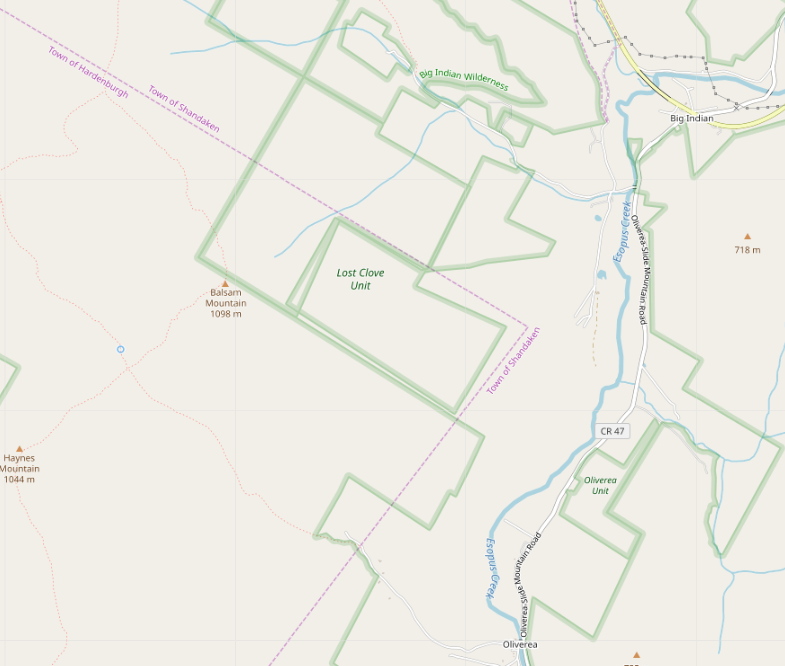
This post is intended to provide (rather too much) detail into my thinking as I attempt to synthesize several conflicting data sources into a ‘best guess’ drawing of an indefinite border between two townships in the Catskill Mountains of New York.

Our story begins when I noticed, while doing an import, that the Lost Clove Unit of New York City’s watershed recreation lands was badly misaligned with neighbouring parcels of state wilderness area, and that nothing seemed to join at right angles.

screenshot of the problem

See full entry

Location: Town of Shandaken, Ulster County, New York, United States
Posted by SomeoneElse on 5 December 2019 in English.

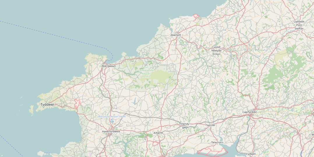
Welsh place names in Wales

Following recent discussions on OSM mailing lists about tag homogenisation it struck me that there probably wasn’t a good summary anywhere of the tools that people use to change the tags in OSM data into something that they can use. You might wonder why on earth we need to do this, given that OSM has natural language names for everything, but unfortunately many words used in OSM might have different meanings around the world, such as “city” and “highway”. However, this isn’t a diary entry about that - it’s a brief summary of what I’m aware of and have used for converting the “super detailed” tagging in OSM into something more appropriate for e.g. something rendering OSM data.

osmosis

The documentation for this is here. I wrote a diary entry about how I use this method to change the “name” language of Welsh-speaking places in Wales to Welsh, and Scots Gaelic-speaking places in Scotland to Scots Gaelic.

See full entry

Posted by imagico on 5 December 2019 in English. Last updated on 8 December 2019.

The Answers and Manifestos of this year’s OSMF board elections have been published a few days ago and a lot of people are probably studying those right now. This is very interesting reading but also a huge volume of text so i have written an analysis of the candidates and their statements some might find helpful.

And since this year’s elections are significant because they could result in both a significant shift to the better and to the worse for the OSMF and the OpenStreetMap project i am also providing an overall voting recommendation based on my analysis. Please keep in mind that this analysis and the recommendation are based on the candidates’ qualification for the position of a board member. Just because i consider someone non-qualified as an OSMF board member does not mean i have an overall bad opinion for them as a person.

I would recommend to vote for (in that order):

  • Guillaume
  • Allan
  • Rory
  • Clifford
  • Dietmar
  • Eugene
  • Nuno
  • Gregory

I would not include:

  • Jinal
  • Mikel
  • Steve
  • Michal

(Edit 2019-12-08: I recommended not to include the last four candidates above but as Alan pointed out there is no harm including them. The likeliness of this making a difference is extremely low of course. What you should do depends on if you have a preference among those candidates you generally find non-suitable or if you want to make a distinct statement by not including them).

Every member should of course decide based on their own personal preferences who to vote for. Even if your values and ideas of what are important qualifications in a board member for the benefit of OpenStreetMap are similar to mine, you might vary the order from my recommendation to reflect your individual preferences. Read my arguments and reasoning and if you have the time also read the full answers and manifestos and form your own qualified opinion to make a good election choice.

See full entry

Posted by migurski on 5 December 2019 in English.

I’ve made OpenStreetMap a major part of my life and work since 2005. I love the sparkling audacity of a complete, freely-licensed, street-scale map of the world built from the ground up by a community motivated to share work for collective benefit. Living in the United States I know firsthand the benefits of high-quality free public data like we get from the US Geological Survey and Census, and OSM promises to extend this benefit to the whole planet.

OSM for me has always been a story of global impact through work: at Stamen Design I led our participation in open mapping with a mix of early San Francisco mapping parties, paid clients, and experimental projects. Some, like Field Papers (presented as “Walking Papers” at SOTM 2009 in Amsterdam) helped OSM become a force in humanitarian mapping and have since matured into useful infrastructure. I’ve helped OSM US since its first conference in Atlanta in 2010 and served a term on the US Foundation board in 2012. In 2016, I coined the term “craft mapping” in a widely-read and commented-upon blog post to tell a story about the contrast between OSM’s hand-made history and its potential utility future. OSM’s greatest strengths are its worldwide reach, open contribution model, and free license. I have recently grown so excited by the large-scale use and expansion of OSM that I joined the Facebook mapping team last year to contribute to our OSM efforts.

Read my complete manifesto on the Wiki for more about why I think I’d make a good OSMF board member.

Posted by woodpeck on 5 December 2019 in English.

Dear Facebook,

you started out as a harmless geek’s wet dream, a site for male college students to rate how sexy they found the women studying with them. You’ve grown up since then, and are now motivated not by adolescent lust but corporate greed. You’ve managed to make headlines as the enabler of genocide[1], the manipulator of elections[2], and posing an unprecedented danger to human rights[3] – among the lesser counts of privacy violation, publishing hate speech, and outright lying to politicians, the press and the public.

Now I cannot know if all this is down to sheer recklessness or just incompetence. For all I know there might be thousands of honest, upright, well-meaning people working for you, all blameless, all just doing their job, and perhaps it is just “the circumstances”, or “a few bad apples”, or “unfortunate events” that lead to all the pain and suffering that Facebook is responsible for.

But I have to judge you as one giant organism. I cannot separate the good from the bad. Facebook is one big black box and it touches things and they turn to ashes.

I don’t want OSM to turn to ashes. So please, Facebook, stop touching OSM. You’ve already done a lot of damage in your bumbling and lying first encounters with us, where you imported tons of computer-generated data and then claimed to know nothing about it. We know you’ve set a couple of untrained college kids to do this[4], given them free rein to disrupt OSM on your payroll. You’ve now switched to using individuals as conduit for your contributions through your “Map with AI” efforts, never giving the wider OSM community a chance to vet this dangerous approach, but nonetheless publicly claiming you were doing this “with OpenStreetMap”. You are not: you are doing this to OpenStreetMap, and you don’t care what it does to our project.

See full entry

Note: I’m a not a native English writer and for this topic I’d be more comfortable writing in French, but I wanted to have a wider audience here. Please keep it in mind while reading.

OSM contributor for a while, I’m also working in a small company that use OSM data from times to times. To better promote OSM, I think we really need a better openstreetmap.org website. In this post, I’d like to suggest some points of improvement for the openstreetmap.org website.

My experience in promoting OSM

For some years, I’m doing a lot of promotion of OSM to various public, mostly as an OSM volunteer but also for my company. I have spoken about OSM to university students, municipalities representatives, the regional public sector (firemen, road network agency), associations (active in environment protection, local history, tourism) and some private companies (i.e., in electricity network management). At OSM-Belgium, we also set up a simple email address (community@osm.be) where any organisation which has a particular demand with respect to OSM can reach the community. Therefore I also get some requests from this address from companies or non-profit organisations for using OSM in their activities. Usually they only have a very vague idea of what OSM is, and it is not uncommon that they think of OSM as a software or another thing that OSM is definitely not (I’ve once read a student report where OpenStreetMap was compared to OpenLayers and LeafletJS!). So I’ve wrote plenty of emails presenting and explaining OSM, usually with links to some OSM Wiki pages, learnOSM, and/or overpass-turbo queries. Our incredible OSM ecosystem of software, maps, web services, projects is just amazing, but I sometimes feel frustrated that some core functionalities of OSM are actually not on openstreetmap.org.

Lack of integration of basic tools

See full entry

I mentioned my candidacy for the OSMF Board, and as part of the election process, the community suggested questions, and long time OSMer Mike Collinson collated & edited them down.

The answers to the official list of questions has been published! Read here → Answers and Manifestos to the OSMF 2019 AGM

My answers to the questions will have more detail. My manifesto (also on the wiki page) is here. If you have any questions ask away on the comments (or email me privately)

“Steady as she goes, let’s change everything” – My campaign motto

Hello all. I’m Rory McCann ( ᚛ᚏᚒᚐᚔᚏᚔᚋ᚜ 🏳️‍🌈 on osm )

I’m originally from Dublin, Ireland, but live in Karlsruhe, Germany and work in Geofabrik GmbH. I’m a craft mapper and social justice hacker, and I’d like you to vote #1 for me to be your board member.

I’m a craft mapper. OSM is great when it’s a project of people to map their world, when ordinary people feel empowered to collect information about areas or topics that matter to them, when they feel empowered to use that information to make things, to have fun, or to make the world a better place. (People have this power and ability, they might not know it yet) I am a skeptical when giant global corporations starts acting friendly and offers “help”. They’re not doing it out of their kindness of their hearts! But a passionate OSMer I can trust!

I’m a hacker. I like Free Software/Open Source, and in an ideal world everything should be FLOSS. But I’m practical and do use propritary software when there are benefits. OSM should strive to support free software. I’m wary of heirachies. OSM & OSMF is better when it’s passionate people, rather than dozens of paid employees who are just punching a clock and an elite execute/management/leadership “team” who can talk the talk.

See full entry

Posted by SJFriedl on 2 December 2019 in English.

TL;DR - I recommend voting for Guillaume and against Mikel.

Though I’d been in the Membership Working Group for some time, it was mainly as a hobby mapper wanting to help with housekeeping and back-office support and without any real sense for OSMF governance or politics.

The Global Logic incident changed everything for me.

Using my day-job skills as an internet security guy, I dove into the investigation with my fellow MWG members, and at the time I didn’t know if this incident was a bad thing or not.

Guilllaume was running for the Board at the time, and as I didn’t know him at all, was very much on the lookout for any attempt to spin this into some kind of election advantage, and I would have had no part of it. I had no dog in this fight and wanted this investigation to be scrupulously fair and neutral.

To his credit, so did he: I never once saw even a hint of electioneering, and I promise that I was looking for it. He proposed many avenues of investigation that could have been exculpatory, looked for alternate explanations, and never once attempted to cast any shade upon GL (or anybody else) that the evidence did not fully support.

His fastidious attention to detail and to integrity of process earned my profound respect, and is why I am voting for him again.

But once the report was released to the board, I got to learn how things really work around here.

I’d been warned that our report would not be well received, and Mikel led the charge on pushback with what could only be described as throwing his weight around, bordering on bullying. It was shocking. Our investigation was not within the “remit” of the Membership Working Group? Really?

I’m not willing to publish private communications between MWG and the board without the permission of all the participants.

Another MWG member commented: “MWG did not expect this level of abuse”.

See full entry