
I’ve hiked for about 5 years in the area and have found some very nice places to swim/hike/scramble.
More later
 OpenStreetMap
I’ve hiked for about 5 years in the area and have found some very nice places to swim/hike/scramble.
More later
Several hours ago three Ukrainian ships were attacked, shot and captured by Russians in Black Sea. Currently there are around 6 wounded on Ukrainian side. Ukrainian government considers declaring martial law. Make no mistake, we face war.
@SomeoneElse, Andy, stop changing the borders of Ukraine. I don’t care any more what you can possibly say. From now on, you are an accomplice. Stand down and leave DWG before you disgrace yourself, us and the project even more.
I call to DWG to publish a transcript of the vote on Crimean “resolution”. We need to know our heroes.
I was asked to do a workshop on mapillary yesterday by the OSM community.
I delivered some slides to kick off. These are here I was focussed on discussing how best to manage the mapillary app on an android device.
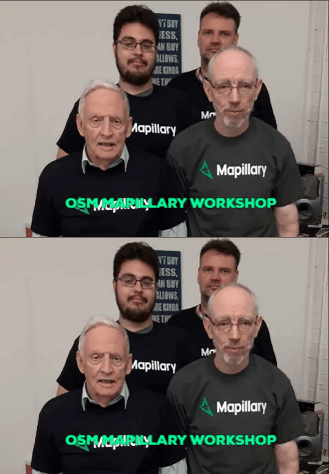
At the end of the talk we went walking after breaking into groups of 2 and heading out with our phones held high. We decided simply to walk around the blackpitts area of Dublin and capture some of the uncovered areas. In general main roads in Dublin have a high chance of some coverage, but when you look at side streets and a lot of residential roads there simply isn’t the same level of coverage.
On Virtual walk of the America Discovery Trail with minor deviations. XL Line 1344 at Independence Pass CO on 11/24/2018
When I developed the map style that you can see here from OSM-carto one thing that I didn’t carry forward was the representation of borders. Partly this was because it’s not easy to separate maritime ones from non-maritime ones, the the purple maritime country borders frankly don’t look very nice:
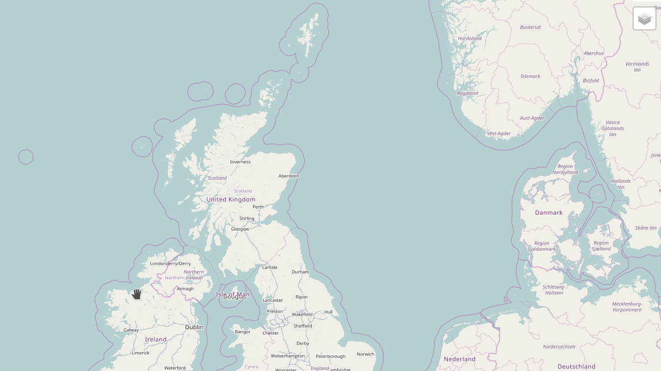
Partly it was also due to “clutter” - I didn’t want an arbitary boundary to get in the way of a river or stream or other feature.
Sometimes however, it would be useful to see what borders are where, so why not do it as an overlay? This turned out to be rather easier than anticipated.
I should stress that this is currently my personal opinion and my personal view and not the opinion of OSM-UA.
In the recent days we’ve seen a number of interesting notions. First of all, the one by Frederik Ramm. Yes, that Frederik Ramm.
I think I don’t quite understand some ideas of Herr Ramm.
Herr Ramm seems to be misunderstanding the nature of OSM. OSM is not a business like Geofabrik. It is not enough to make a resolution to see it working. You have no army, no corporate security, no riot police. No way to one-way enforce a decision. You need (surprise!) to convince people.
First of all, “there was really not any doubt” is not an argument. It is a way to avoid presenting documents. Simply put, it is sophistic.
Next, the argument of “not silently” is simply false. You (and I mean DWG here) never posted the transcript of your discussion, neither did you make a statistic check on community to realistically evaluate if your decision is implementable. You were not elected by the community. We have no reason to trust your decision except your reputation, and reputation is a fragile thing.
Next, I do agree that “political map” is not the intention of OSM. But OSMF needs to take some political decisions into account, or risk being subjected to national and international laws. Putting disclaimers in your resolution doesn’t make it any better. We are not “misinterpreting”. We are extrapolating the effects of this decision, and evaluate your actions, not your words, just as one old dusty book teaches us. Russian propaganda (namely, rg.ru, the official state press of Russian Federation) already uses your decision and both you and I have absolutely no way to stop them.
Dear all,
Today, v4.17.0 of the OpenStreetMap Carto stylesheet (the default stylesheet on the OSM website) has been released. Once changes are deployed on the openstreetmap.org it will take couple of days before all tiles show the new rendering.
Changes include
Thanks to all the contributors for this release including jeisenbe, a new contributor.
For a full list of commits, see https://github.com/gravitystorm/openstreetmap-carto/compare/v4.16.0…v4.17.0
As always, we welcome any bug reports at https://github.com/gravitystorm/openstreetmap-carto/issues
.
Some of you might be interested in a small prototype that I coded during the past days. It’s an audio interface to select JOSM presets and here it is in action:

Well the idea of speech2josm is, that armchair-mapping is pretty intuitive. You trace outlines from aerial imagery and apply tags. But finding the right preset, fill in details to get the right OSM tags is very annoying. And beside all the tricks in JOSM (F3 search, autocomplete textboxes, toolbar-shortcuts, clone existing objects …) it seems to be the most interrupting and (in the mind of UX) expensive action while mapping. Add way, switch edit mode, add tags, switch select mode, …
We all know the OSMF has a small membership compared to the mapping community. Worse, it is skewed towards certain countries. You might hear people say Germans and US Americans dominate the membership.
In a perfect world, all countries have a similar participation rate to OpenStreetMap, and mappers from all countries participate in OSMF by the same degree. The first is not something that is easily changed, but the second should clearly be our ambition. In France, a discussion about this led to a recruitment campaign with the explicit goal of rebalancing. This piqued my curiosity. Oh, and it increased membership with 90 people (from a mere 42).
But numbers without context are of little use. Guillaume (user Stereo) supported the French with membership statistics, and hooked me up with a list of membership by country for all countries. Now I’d say OSMF membership would ideally reflect the mapping community - skewed slightly for countries with a bigger data-user community. Unfortunately, no thorough statistics about mappers by country is available. Fortunately, there is something close to it: “the number of daily mappers” in a country. It is not a perfect measure:
hdyc has a de facto “estimated home location”. This would allow to take some of the random noise out of the equasion
“active mappers” (people with at least three months with a mapping day) might be a better measure
in some cases, it’s impossible to find the country of people who only map abroad
But it’s close enough, and it’s available. Pascal Neis, deserving his last name as usual, sent me a list of all countries with the avarage number of daily mappers over the last 12 months.
The easiest useful measure in this context is the membership rate, which allows to compare countries. For the world, you get 26 OSMF members for every 100 daily mappers. This rate varies from 0 in Tanzania to 94 in the US. On a map, it looks like this:
I see that many paths are disappeared between Haskovo and Harmanli and specially below road number 8. Can anybody tell me what is happening?
Starting to add roads and other features in Somalia, around Baidoa (Baydhabo بيدوا), I often come across with long ways that have “attribution: Mart Roumen; FAO-SWALIM; Madmappers-SOM-2008-01’”. Most of them are not more visible through many satellite imageries, sometimes cross water or residential areas regardless of any feature on the ground.
I know Somalia and other territories can change very quickly but it looked me strange that so many areas changed dramatically. So, when I have no evidence of them I delete them.
I believe we are entering dangerous grounds here, setting a very curious precedent, to put it mildly.
*1. The way I see it, the authority of DWG is focused on vandalism
Nowhere in the description of DWG on OSMF wiki we see that it is entitled to make decisions about territorial disputes. The way I see it, it was and is intended for preventing copywrited uploads, vandalism and edit wars.
As we can see from DWG’s resolutions, the only existing decision concerning disputed territories (or at least the only one published) is about Crimea. That raises questions such as “why making a decision about this at all?” and “why revising it 4 years later?”
*2. DWG is not transparent in what it does
MapRoulette 3.1.1 is now available on maproulette.org. Here’s what’s new!
Mapillary images are now available as an overlay on the map. If you’re zoomed in far enough you can select the Mapillary overlay from the Layer dialog.

This is a work in progress. Let us know if you have any suggestions to make it better! And yes, we plan to support OpenStreetCam images soon as well.
MapRoulette now supports rebuilding tasks from Overpass based challenges as well as local and remote GeoJSON challenges. You can use the ‘Rebuild’ link at the top of you Challenge maintenance screen to start the process. For Overpass based Challenges, it will simply re-run the Overpass query. For remote GeoJSON files hosted someplace else, it will reload the GeoJSON from there. For local GeoJSON challenges, you will be prompted to select a new GeoJSON file to upload from your computer.
Planning to map the Bürgerbus line. There are a few stops missing which need a visit to locate them. A rough idea of the line is here.

I wrote an article about OpenStreetMap and its related services and applications
Turkmenistan aspires to renewed status as the “hub” or “crossroads” of Central Asia, harkening back to the days of the Great Silk Road that connected Xian in China to Istanbul, Jerusalem, and Antioch, and from there to Rome and beyond. I thus took it upon myself to check out and ensure proper mapping of as much of Turkmenistan’s national highway system as I could, and then to check out its border crossings with neighboring countries. They are now all easily identifiable, both national highways and border crossings, I think properly tagged, and in the case of highways, every gas station I could see has been added to the map (still have a few FIXMEs out there, and there are undoubtedly some gas stations I haven’t found yet, but…) So far other mappers and I have mapped 156 gas stations in Turkmenistan, up from the very few on the map in 2015. Turkmenistan is ready for higher volumes of motor traffic and has a better road atlas on line to help navigate!

We started a new meet-up about OpenStreetMap and other geo-related topics. Check our blog post: http://maptime.io/salzburg/event/2018/11/13/Stammtisch/
Yesterday was the last OSMF board meeting before this year’s Annual General Meeting. And like it is already kind of tradition this last meeting had more visitors listening in than any on the previous meetings and IIRC even more than last years pre-election meeting making it probably the largest board meeting in OSMF history.
And this despite the guests having to wait for half an hour because the board started the meeting with a closed session.
And here is where the surreal part started. The closed part was - as you can read on the meeting agenda - meant to determine if two of the board members (Frederik and Heather) had a conflict of interest regarding the subject of the OSMF organized editing policy or guideline as it is now called. This is because apparently two other board members (Mikel and Martijn) were already considered to have a conflict of interest (and after me asking at the end of the meeting confirmed that they recused themselves). Now we don’t know the details yet - no word was uttered by the board in the public part of the meeting about the outcome of the closed part of the meeting (did i already mention it was surreal?). We know that apparently Frederik and Heather were not determined to have a conflict of interest because they participated in the vote later. But we don’t know who decided this and we don’t know who decided that those who had a conflict of interest were allowed to participate in the discussion none the less.
Added details to Phila. NE Airport KPNE from FAA airport chart 00528AD


