Diary Entries in English

Recent diary entries

Introduction

Hi!
My name is Francisco Albacete Chicano (but feel free to call me Paco!), and this year I have been selected for the GSoC 2026 with OSM, working on Valhalla Enhance Pedestrian routing project with my mentors Kevin Kreiser and Christian Beiwinkel.

Who am I?

Well, I am a second year student of the University of Murcia (studying computer science), who randomly discovered OpenStreetMap and began with a small programming project to learn more about it! While I was fascinated by it, I discovered OSM had projects for GSoC, I had for sure to take a try! So I started getting in touch with Valhalla as I really enjoy pathfinding algorithms and optimizations. And when I am not coding, I have been playing video games for most of my life and really like to have experiences with my family and friends (even better if there’s beer!).

What is the project about?

See full entry

Location: Vista Alegre, Murcia, La Arboleja, Murcia, Área Metropolitana de Murcia, Region of Murcia, Spain
Posted by Ralphia on 25 May 2026 in English.

I’ve been adding ALPRs throughout the region in my community and, first of all, wow there is so many of them. Second I am aware of what Flock cameras look like but I am unable to figure out who owns / creates the other more squat looking ones. If anyone has any information on how to identify the other cameras please let me know, I’d like for my information to be as accurate and precise as possible!

Location: Del Rosa, San Bernardino, San Bernardino County, California, 92404, United States

How dare you cast aspersions on and try to obstruct me and my work on OpenStreetMap in Victoria, BC. I thought OpenStreetMap was supposed to be collaborative, but instead you proceed to misrepresent my statements and get openly hostile and destructive toward my efforts. Now I must demand that you cease all further interference with and circumvention of what I am trying to do. I will not have it.

Posted by b-unicycling on 24 May 2026 in English. Last updated on 27 May 2026.

For quite a while now, I have been thinking about making a tutorial on mapping lifting stones. In case you are not familiar - this is a tradition throughout parts of Europe (VERY strong in the Basque country), but also in Asia and North America. Local men (and less often women, but that did happen) proved their strength by lifting a dedicated stone in the local area. You’ll find more information on Wikipedia and examples on Wikimedia. The tradition might go back thousands of years.

Since and because of the lockdown during Covid, Irish man David Keohan (“indiana stones” on Instagram) has been reviving the tradition in Ireland which very much entailed finding these stones, some of which had not been lifted in 200 years! There is a website with a map (Mapbox, so based on OpenStreetMap), but I followed up on some of the locations, and they’re not all correct.

Lifting Stones. Glen Roy Lifting Stones. Glen Roy by david glass, CC BY-SA 2.0, via Wikimedia Commons

See full entry

Posted by pussreboots on 24 May 2026 in English.

Earlier this month my husband and I drove by or through a number of small communities in Northern California as we were headed to and from Canada. One of them was Grenada. I was curious to see if it was mapped on OSM. It wasn’t, save for the streets (including some erroneously added ones).

So I’ve spent my mapping time this month on Grenada. And now the buildings and addresses are there.

Location: Grenada, Siskiyou County, California, 96038, United States

We all gave OpenStreetMap a try once, no? Same for me. No idea how old my (old) account is. I haven’t used it for years, and I wasn’t able to re-enable it again… but… in Autumn 2024, a friend told me about StreetComplete. I liked the idea of StreetComplete. Everyone likes it. But as mentioned, I had to create a new account for all of this 🤦 But it was worth it!

In this Autumn, my OpenStreetMap journey started. In Büsum, Northern Germany. In my vacation… After my vacation and multiple passing weeks, I mapped more and more. Dived into many details, tried to gather more and more knowledge in many areas, and there was and still is so unbelievably much. I took every opportunity combining required doings in the “real world” with mapping them in the virtual world. My friend and I discussed mapping, tools, great plans, even better ideas and so on and so forth. Well, we all had such dreams, no?

At some point we thought that OpenStreetMap should become a more prominent topic in our town. There was already a wiki page for our town. If I remember correctly, the last changes were from 2009. It contained great ideas and plans, but you can imagine that a lot has changed in the last ~15 years. In OSM and also in our town. Understandably, basically all content was out of date.

Since we collected already a lot of ideas what could be done, we started to re-write the wiki page step by step. The idea was to create a new entry point for people that are interested in OpenStreetMap in our town. Give them ideas on what can be done in our town. Also, since no one really likes to maintain MediaWiki pages regularly 🙈 the page should be pretty static. The content should give beginners, intermediates and nerds a helping hand on how to start on anything.

So everyone should find their obsession… mapping hydrants, trees, playgrounds ❤️ And be honest: You all have one!

See full entry

Location: Innenstadt, Fulda, Landkreis Fulda, Hesse, Germany

Hello, just a collection before putting it into a purposal

so there are many issues about walk=no at Gleisanlagen. Each enities pushing it to not my problem.

  1. Routers need it to avoid Tracking through have traffic with separate sidewalks
  2. Openstreetmap verifable on the spot
  3. Historie of foot=no is changing in wikipedia.
  4. StreetComplete is asking if its forbidden, not if its forbidden by sign.
  5. Just use access.
  6. Maybe foot:implicit=no / hazard:railway=yes source:foot:implicit=DE:StVO:25(5)
  7. osm.wiki/Key:access suggest “saftey reasons” sidewalk=no or hazard=*
  8. Vorschlag railway=light_rail impliziert ?foot=no?
  9. There is a exception for maxspeed. Maybe create another train-crossings.
  10. Grashopper working as expected. OSRM and navigating through busy crossroads. Valhalla has issue.

Reasons:

  1. “Just use a better Router”,
  2. Street-Speed-Limit is also not verifable on the Ground.
  3. osm.wiki/DE:Key:foot
  4. https://community.openstreetmap.org/t/poll-should-streetcomplete-disable-the-are-pedestrians-forbidden-to-walk-on-this-road-without-sidewalk-here-quest-in-the-uk/118387
  5. Openstreetmap verifable on the spot
  6. ?
  7. DE:Key:hazard No, Entsprechend der OSM-Konventionen sollten nur Gefahren bzw. Gefahrenstellen kartiert werden, die vor Ort überprüft werden können.

Perfect solution: https://github.com/streetcomplete/StreetComplete/issues/2472 Are pedestrians legally prohibited from walking here according to a road sign?”

https://community.openstreetmap.org/t/foot-no-oft-falsch-erfasst-durch-streetcomplete-quest/95470/6

https://community.openstreetmap.org/t/falsches-gefahrliches-fussgangerrouting-durch-sidewalk-tagging-anderbar/130145

https://community.openstreetmap.org/t/foot-no-prohibited-impossible/5135/25

https://www.gesetze-im-internet.de/stvo_2013/__25.html (3)+(5) Gleisanlagen

Location: Weiden, Lindenthal, Cologne, North Rhine-Westphalia, Germany

I live in Washington State and noticed that several main roads like state highways did not have a speed limit set. When I use OsmAnd or Organic Maps to navigate, those apps are guessing what the speed limits are for several roads, creating very bad guesses of how long a trip will take. Fuel-efficient routes also are not optimized unless max speeds for roads are known.

I discovered several awesome websites that make finding existing speed limits a breeze. I don’t like relying on Mapillary, even though they do an amazing job in making it easier to map speed limits. I just don’t want to support their owner Meta (Facebook).

Specifically for my state, I found this website: Washington https://geo.wa.gov/datasets/WSDOT::wsdot-roadway-data-speed-limits/explore?location=47.916813%2C-118.330518%2C15

Move your mouse over any state highway, click on it, and it shows you the speed limit for that road segment.

With this website, it makes finding the speed zones significantly easier. I don’t have to use Bing Streetside or Mapillary anymore because I rely on government data instead.

I also found other state websites and will list them now so they are all grouped together.

Virginia https://www.virginiaroads.org/maps/VDOT::vdot-speed-limits-map/explore?location=37.356725%2C-78.949534%2C12&path=

North Carolina https://www.arcgis.com/apps/mapviewer/index.html?layers=2229ffaa3ea5470992d021023618e1e6

Texas https://gis-txdot.opendata.arcgis.com/datasets/txdot-speed-limits/explore?location=33.705213%2C-100.174890%2C9

Florida https://gis-fdot.opendata.arcgis.com/datasets/fdot::maximum-speed-limit-tda/explore?location=27.792987%2C-83.778658%2C7

New York https://gis.dot.ny.gov/html5viewer/?viewer=risviewer

If we get more people to check major roads and update their speed limits, routing engines like OsmAnd, Organic Maps, GraphHopper, OSRM, and Valhalla will be able to create routes that are much faster, safer, and more fuel efficient.

See full entry

Location: Riverside, Spokane, Spokane County, Washington, 99201, United States
Posted by rphyrin on 22 May 2026 in English.

That day, I received this email.

19 May 2026 (1:19 PM): We would also like to invite you to a special mapathon as part of the OpenStreetMap Community Building activities in Syria. This activity aims to train participants on using the OpenStreetMap platform and contributing to mapping buildings and roads to support humanitarian work in Syria. Date: 22 May 2026. Time: 11:00 AM (Syria Time). Location: Online (meeting link will be sent after registration).

11:00 AM Syria time is about 3:00 PM in UTC+7.

So, this afternoon, I attended the online meeting.

After that, I joined the mapathon hosted on the HOT Tasking Manager.

Even though, in the presentation, the speaker conducted the mapathon using the iD editor in the browser, this time I preferred to use my set of “powertools”: JOSM, Draw Buildings (B), and LastUpdated.

See full entry

I grew up in Nepal. Hills everywhere. Roads that don’t exist on any map. Communities that satellites can barely see through the cloud cover. When I first heard about OpenStreetMap, I thought: this is exactly what those places need.

That was a few years ago. Since then I’ve spent over 300 hours mapping, not because someone paid me to, but because I kept thinking about the person who might one day need that road to exist on a map before they could get help.

How I Started: Before I knew what OSM was, I was already messing around with maps, visiting new places, uploading photos to Google Maps, adding names, leaving notes about locations. I liked documenting places. That habit slowly turned into something bigger.

A hackathon in college introduced me to humanitarian mapping. That’s when it clicked: mapping wasn’t just a tech thing. It was about making communities visible.

My background is electrical engineering. My job is in the cable car sector. Neither screams “mapper.” But when you work in mountain infrastructure, you see how much depends on accurate geographic data, withdrawal routes, access to remote villages, disaster response. The gap between what exists on the ground and what exists on a map is sometimes jarring.

I’ve actually validated more tasks on HOT than I’ve mapped myself, which felt strange at first. But validation matters as much as mapping, maybe more. A wrong building polygon in a flood response map doesn’t help anyone.

On Women and Mapping: Most mapping events I’ve attended, online or in-person, are heavily male. So is the leadership in local OSM chapters. But whenever a woman shows up and starts contributing, the quality is often excellent. Careful, methodical, detail-oriented. And then they disappear. Not because they lost interest, usually because no one made space for them to stay.

See full entry

Location: Gaidakot-03, Gaindakot, Nawalpur District, Gandaki Province, Nepal
Posted by rphyrin on 20 May 2026 in English.

While preparing this article, I wanted to export the coordinate data of the battlefield map that I created in Altilunium LocationPad to GitHub Gist.

Then, I realized that the exported file format was actually just plain JSON, not proper GeoJSON. That’s why GitHub Gist couldn’t render it as an interactive map.

So, in this version (26.5.20), Altilunium LocationPad now properly exports and imports coordinate data in the proper GeoJSON format.

Image 1 : The exported GeoJSON can now be properly rendered by GitHub Gist.

Hi, I am Venetis, a computer science student from Thessaloniki. This summer I’ll be working on closures.osm.ch as part of Google Summer of Code 2026, mentored by Simon Poole and David Haberthür.

closures.osm.ch is a platform where road authorities submit temporary road closures so that routers can avoid them. The data is there, but right now it doesn’t actually affect routing. That’s what I’m fixing.

My work this summer comes down to three things:

  • Adding a Valhalla-powered routing endpoint that genuinely avoids closed roads
  • Building a sidecar service that feeds active closures into Valhalla’s traffic tile system
  • Improving the DATEX II/CIFS importer that brings closure data in from external sources

I’ll be posting updates here at each milestone. The code is on GitHub if you want to follow along.

Coding starts May 25. Looking forward to it.

Location: 1st District of Thessaloniki, Thessaloniki Municipal Unit, Municipality of Thessaloniki, Thessaloniki Regional Unit, Central Macedonia, Macedonia and Thrace, Greece

For the first time, Humanitarian Data Exchange (HDX), a widely used platform for sharing humanitarian data, is releasing disaster-specific OSM datasets. This has allowed OSM data to be downloaded over 440 times in response to recent disasters in Madagascar and Mozambique including within the disaster affected countries themselves.

This initiative kicked off in early 2026 and has already resulted in two regularly updated and focused HDX-OSM datasets:

HDX Mozambique Floods 2026
An example above: HDX page containing OSM data for Mozambique Floods in 2026

Although the same data is directly accessible on OSM, being on HDX ensures:

See full entry

Summary

Issue #1 when first using offline OpenStreetMap navigation apps for Android, such as OsmAnd, Comaps, and Organic Maps: the size of the map to be downloaded. In many places, it’s the entire country or nothing. And that often amounts to over 100 MB, with some cases exceeding 500 or 600 MB. Why is that?

Personal experience: the rise of smartphones in the Global South

During the summer of 2013, I coordinated an OSM mapping HOT project in northern and northeastern Haiti with others. At that time, the go-to tool for field data collection was the small, rugged, and energy-efficient Garmin Etrex series devices, though they required a fairly lengthy editing process on a computer. I had had my first Android smartphone for a few months by then, and as I recall, OSMtracker already existed, perhaps Vespucci as well (though I didn’t discover it until later), and OsmAnd was in its early stages. However, the app ecosystem wasn’t yet mature enough to replace the eTrex. At the end of the mission, I saw some Haitian participants start to get their first smartphones.

A few months later that same year, during another mapping mission in Mongolia, I had a meeting with officials from the Asian Development Bank whom I was trying to convince of all the benefits of OpenStreetMap. At one point, I used the emergence of these OSM mobile apps as an argument, noting that they would soon allow anyone to easily access and contribute to OSM data, given that smartphones would soon be in everyone’s hands. I didn’t feel like I was making wild guesses: cell phones were already everywhere, and it seemed quite logical that Android smartphones—whose affordable models were just starting to hit the market—would also be successful and boost both contributions to and use of OSM.

See full entry

Posted by Skunkman56 on 18 May 2026 in English.

30x30 (https://en.wikipedia.org/wiki/30_by_30) is a global initiative proposed in the Kunming-Montreal Global Biodiversity Framework to conserve 30% of the area represented by Earth’s land, water and oceans. This goal has been adopted by many countries and non-governmental organizations, including The Nature Conservancy and the United States in the Biden administration’s Executive Order 14008 (Section 216) later a key element in the launch of the America the Beautiful initiative in 2022.

OpenStreetMap has adopted International Union for Conservation of Nature standards for describing protected areas, including parks, nature reserves, and other lands. As a free, open-source, community-driven and collaborative geographic feature database, OpenStreetMap is a useful tool for assessing progress towards this goal. Continual updates, world-wide coverage, native-language support and a robust open data working group governance structure; OSM is perhaps the best “live” tracker towards accomplishing this goal.

Posted by SomeoneElse on 16 May 2026 in English. Last updated on 18 May 2026.

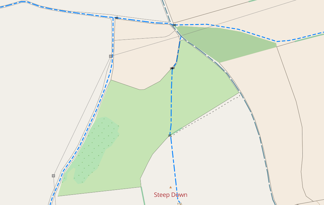
Some bridleways and restricted byways near Worthing

Over the last few weeks I’ve improved the way that paths and tracks are shown on map.atownsend.org.uk in both the raster and vector versions. The aims were:

  1. Improve clarity, so that their visibility in e.g. nondescript woodland was better
  2. Improve consistency, so that the display of them on vector and raster looked similar to each other, and the “visual weight” of each class broadly matched when looked at together on a map.
  3. Reduce confusion so that two different things were not shown in similar ways.
  4. Show “good quality” paths and tracks (e.g. paved and compacted gravel surfaces) differently to other ones to help answer the “will it be muddy” question.

See full entry

Location: Sompting, Adur, West Sussex, England, United Kingdom