 OpenStreetMap

This week, I am attending State of the Map Europe 2024, where I’ll be a speaker on at least two occasions. Because of that, I have been working on material for the conference, and I would like to include it in my development diaries. However, to avoid spoilers, this must obviously be done after the conference :P. Please expect development diary #15 to be published shortly after SOTM EU, which ends on Sunday. I will also try to get the video recording of my talks in case you miss them. Cheers 🦀!
Diary Entries in English
Recent diary entries

Are you familiar with the OpenStreetMap Statistics created by Piebro? It’s a handy tool that analyzes OSM changeset files and creates graphs from various perspectives.
- https://piebro.github.io/openstreetmap-statistics/
- https://github.com/piebro/openstreetmap-statistics

The project’s README also indicates that analysis can be performed for individual countries or regions. I analysed the Japanese region in my local environment, so I’ll summarize the procedure.

a
I started contributing some edits to OSM using StreetComplete, it’s nice to be able to help!

Yesterday i received a message from perenniallylate notifying me that he had mapped village 99 on the list, Tremul, and asking me if it was okay for him to map some villages in the upcoming weeks.
I thanked him in private, but also want to thank him publicly for contributing to mapping Albania and putting Albanian villages on the map.
Anyone can map any village from the list, because I can always add more villages to it. It would be amazing if you could send me a message or leave a comment that you mapped it, but even if you do not, it is totally okay.
Today I continued mapping and mapped Kryemadh and the surrounding areas, including villages Kalimash and Shtanë.
“#100villagesin100days #day40 #+1contributor”

↓ Version française ci-dessous ↓
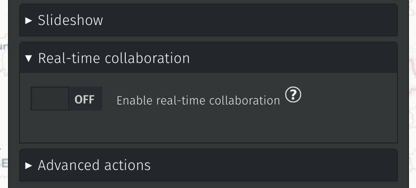
The latest 2.4.X release sets the path for two major requested features: real-time collaboration and one-click remote data importers.
Additionally, minor improvements and bugfixes have made the tool more stable and usable.
Real-time collaboration
Thanks to our NLnet sponsorship, we have been able to make the first push in that direction. This is not yet activated in any (known) instance but the underlying code is deployed and we will be able to manage allocated resources and fine-tune how websockets are deployed. Details of the next steps are available on Alexis’ blog post.
Given the required server changes for that new feature, it will be part of a future 3.X version when the dust has settled.
Remote data importers
We made 4 importers to begin with:
Today I mapped in Peshkopi. Tomin ain’t really a village of Peshkopi but a neighborhood, so after mapping it I proceeded to the villages closest to Peshkopi.
I mapped Pilafë which is a small village very close to the city. I have been in Pilafë in 2021,for a door-to-door campaign in support of a local miner who was representing the miners in the parliamentary elections. As soon as we entered the village, a 10-year-old boy saw us and wanted to show us the village, and he walked with us and showed every house in the village for two hours straight.
After Pilafë, i moved to Staravec and partially mapped it too.
“#100villagesin100days #day39”
Almost did not make it to contribute today but i found some time just before the days ends.
Today i mapped Saraqinisht and also the villages Krinë and Tranoshisht.
“#100villagesin100days #day38”
Posted by Brazil Singh on 13 July 2024 in English.

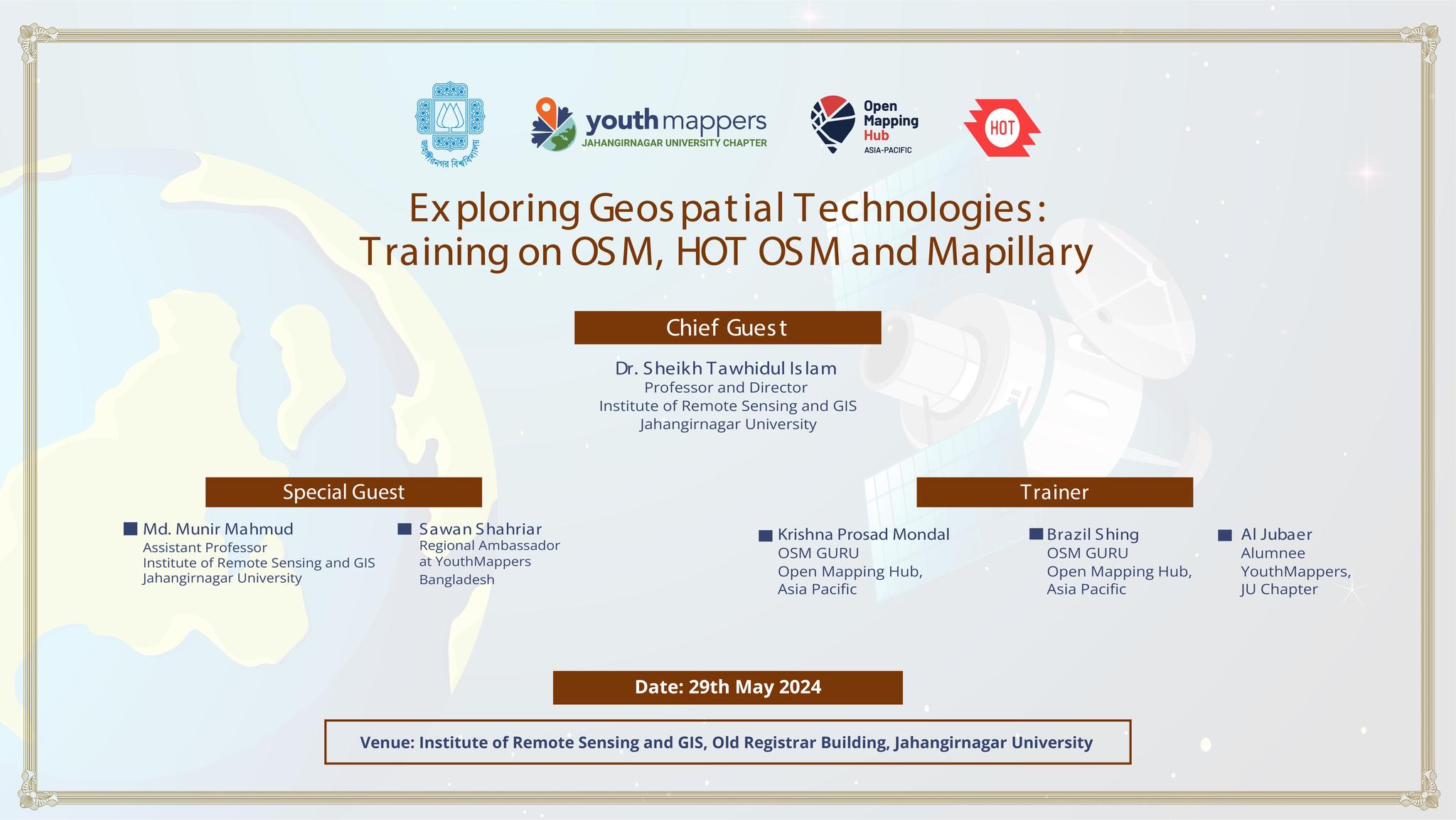
Hello, Openstreetmap community! I’m Brazil Singh, Open Mapping Guru, and I’m excited to share the highlights from my recent training session at Jahangirnagar University. As an Open Mapping Guru under the Open Mapping Hub - Asia Pacific, this experience was both enlightening and thrilling, filled with dynamic discussions, insightful training sessions, and endless fun. Here’s a summary of our amazing day together!
Event Highlights
The session began at 2 PM with a vibrant atmosphere. We were honored to have several distinguished guests who contributed immensely to the event:
Chief Guest: Dr. Sheikh Tawhidul Islam, Professor at the Institute of Remote Sensing and GIS, Jahangirnagar University
Special Guests:
    Md. Munir Mahmud, Assistant Professor at the Institute of Remote Sensing and GIS, Jahangirnagar University
    Sawan Shariar, Regional Ambassador at YouthMappers and President of OSM Bangladesh
Session Details
OpenStreetMap Training:
Dear diary, today I made my account. I hope this can count for CAS :skull:
Yesterday was a hectic day and I missed a day of mapping. I will try to make it up.
Today I mapped Duhanas which is a big village in Berat with a population of around 1500.
“#100villagesin100days #day37”

I’ve been using StreetComplete for the past few days now. It’s great fun, but I often run into questions where I’m thinking “Well… I don’t know that any of these options are right.” (Or “If Regina wasn’t a uniquely hot mess, then maybe one of these answers would actually work!” I’m looking at you Albert street rail crossing.) The tagging and questionable-edits channels on the osm-world discord have been massive helps.
It isn’t until you start tagging out in the wild that you start coming up with weird questions that you wouldn’t have thought up otherwise. Like:
- Do you mark an intersection as having no marked lanes? (Are they even supposed to have marked lanes if they aren’t turn lanes?)
- Is a concrete block coloured red a form of tactile paving, even if it has no different texture to it from any other block?
- How far does a street light have to be from a bus stop before you can say that bus stop is unlit at night?
- If there are no sidewalks next to a road and there is no way for a pedestrian to walk along the side (like if it’s too much of a slope), are they allowed to walk on the road?
- (I don’t think I’ve seen a sign telling pedestrians that they aren’t allowed to in these situations here, but I don’t know anyone who would even want to in the places where it happens.)
- Why does Regina have so many pedways over streets cars drive under, and none of them are marked with a maximum height sign?
- (It’s probably because in those areas, trucks aren’t allowed. But I never even noticed they didn’t have the signs until I thought to look!)

My journey into mapping began in 2012 when I was a college student. I started by mapping my village and later expanded to mapping numerous banks as part of my work in 2016-17. This initial exposure sparked my interest in community mapping.
In 2018, I began contributing to OpenStreetMap (OSM) alongside my volunteer contributions on Wikipedia and Wikidata. This involvement allowed me to bridge the gap between platforms by linking Wikidata entries with OSM and vice versa, enhancing the data quality and interconnectivity between these valuable resources.
Joining the Open Mapping Guru Fellowship has been a transformative experience. The fellowship provided me with access to various tools that have significantly enhanced my mapping activities. The tasks during the program helped me learn and expand my knowledge about mapping in OSM. These tasks ranged from mapping amenities using mobile applications like Every Door and remote mapping using JOSM and mapping and validating using the Tasking Manager.
Through this fellowship, I have not only improved my technical abilities but also deepened my commitment to the OSM community. The Open Mapping Guru Fellowship has been a significant part of my journey, and I’m excited about what lies ahead.
I am grateful to HOT and APHub team for this opportunity to be part of such a dynamic and collaborative environment.
As I continue my mapping journey, I look forward to applying the skills and insights gained from the fellowship to make a meaningful impact on the mapping and open data ecosystems.

It just feels like yesterday that I started OpenStreetMap Calendar, but that’s maybe because the journey has been mostly smooth sailing. I started it sometime in early summer of 2019, made it more useful by the end of that year by adding calendar subscriptions and an API. In 2020, thanks to the Microgrant, I was able to focus a little bit more on it, so it got time zone support and a wiki integration, which then replaced the old wiki-based calendar in December 2020.
Since then I have teased a few features, but not that much has actually happened: There has been the odd improvement here and there, at some point I had to add minimal moderation tools so that spam can be removed without me having to shell into the database, but other than that OSMCAL lives its own life thanks to the users who use it.
Until today, more than 2800 events have been created:

There is an OSM event happening somewhere, almost every day:

WeeklyOSM informed us recently, that the videos of the recent SOTM FR are now available at https://peertube.openstreetmap.fr/c/sotm_fr_2024/videos.
There are english subtitles that seem to be good enough to get the gist of the video. Which is why I asked ChatGPT to take the RSS feed and create a translated summary so I can pick those that I find most interesting.
I thought this might be interesting for other, so here is the list…
25 - OSerM: Mapping Stations Today to Improve Them Tomorrow
Summary: This presentation by Guillaume Chauvet discusses the use of OpenStreetMap (OSM) data for mapping and improving train stations. It focuses on how OSM data is utilized within and around stations as part of the deployment of Metropolitan Regional Express Services (SERM) projects.
Link to Video: Watch Here
29 - Promoting Tourist Areas with OSM: The Experience of L’Abel Destination (Allier)
Summary: Located in the picturesque landscapes of Bourbonnais in Allier, L’Abel Destination used OpenStreetMap to enhance its territory. Within a year, the local tourism office staff trained in OSM, contributing detailed data on heritage sites, health services, shops, and local producers. This collaborative project highlights the process from funding to the final CartoGuide publication.
Link to Video: Watch Here
28 - Carto Graou: Mapping Under the Trains
Summary: Nicolas Wurtz presents the story and future of “Carto Graou,” an online public railway map. Using polygons, lines, and points similar to LEGO pieces, the project integrates real-time data, opendata, and opensource elements. Initially aimed at enthusiasts, it has become indispensable and even useful for SNCF employees, with OpenStreetMap playing a crucial role in its success.
Link to Video: Watch Here
65 - Updates on the Simplified Street Plan

Kinda ditched OSM last year when school ended. Gonna try to finish micro-mapping my neighborhood at the very least. That was my goal from the beginning and it remains so to this day. This time, though, I truly have absolutely nothing better to do.
After that, who knows? No promises… Probably gonna ditch it again when school starts up again x)

There are a couple I walk by every week, both pretty large.
I’ve tagged them natural=beaver_dam ‘cos I found it in some discussion on the wiki somewhere.
Considering so much of Canada is shaped by beaver dams, I think they should get more respect.
(the location for this diary entry is near one of the beaver dams. It was not actually written while near it. If it had been, the beavers would have done their irritated tail-slapping dive to scare me away. It sounds like someone throwing a large rock into deep water.)

The openstreetmap project is the future of free data for resilience to the many problems of development and humanitarian response that we have in our communities. It gives access to a large database produced by enthusiasts, volunteers and people who believe that development or resilience in the face of the crises we face will require the support of such an initiative.
Someone once told me that to be immortal you have to give without expecting anything in return; support voluntary social actions as best you can,
support the initiative by making a donation of any amount, because at the end of the day it’s the gesture and the intention behind the gesture that counts.
http://supporting.openstreetmap.org/donate
or by having an impact on the management and direction of the Openstreetmap Foundation by becoming a member.
https://supporting.openstreetmap.org/#Membership-Categories
I’ve been a volunteer at openstreetmap since 2022 on 28 April and every day I try not only to help the openstreetmap project grow but also to participate in seeking and proposing solutions that could solve the problems we have in Africa, particularly in my country Cameroon, in nutrition, energy, quality education based on our cultures, water and empowering young people to face the challenges of our society. In short, the planning and development of our country
The last couple of days, I’ve been diving into a very sad chapter of Irish history - “industrial schools” which were children’s homes with less than favourable conditions for some of the children.
It stumbled into that rabbit hole, because a friend who went on a spin with me (I don’t drive myself, but I like being dependent on other people that way, because I always learn something from them that I wouldn’t have, if I drove myself) to look for holy wells had mentioned in passing a boys’ cemetery/ burial ground at St. Patrick’s Industrial School near Kilkenny. This school closed at some point after 1965 and the boys were transferred to St. Joseph’s Industrial School within Kilkenny city. St. Joseph’s had been only for girls until then.
I contacted our heritage officer at the local county council trying to find out whether they knew anything about this cemetery (I’m gonna stick with the OSM terminology from now on), but they had no record of it. It was also not marked on the official maps by Ordnance Survey Ireland (or the historical Ordnance Survey maps conducted by the UK government before Ireland’s independence).
Another friend who knew of the location offered to drive out with me and show me. So we went and I took photographs of all the grave markers (Category on Wikimedia), did a bit of mapillary and mapped the area as best I could (osm.org/way/1298817559) 68 boys and one woman (as I found out later, a matron in her 80s) were recorded as having been buried there. I did a little more research on them which you can read here: https://en.wikipedia.org/wiki/List_of_names_recorded_at_St_Patrick%27s_Industrial_School_Cemetery,_Kilkenny
When we left, my “driver” mentioned that the nuns who ran the establishment (I hesitate to call it a school) also had a cemetery there, but we were pressed for time, so we didn’t visit it that day.
The next day, I cycled out and found the nuns’ cemetery which I also photographed and mapped as a cemetery.