
Today i mapped the tiny village of Vlashaj in Bulqize. I also mapped a little the village Shupenzë and the surroundings.
“#100villagesin100days #day31”
 OpenStreetMap
Today i mapped the tiny village of Vlashaj in Bulqize. I also mapped a little the village Shupenzë and the surroundings.
“#100villagesin100days #day31”
Unique Mappers Network (UMT) has significantly impacted my personal and professional growth. Through my involvement with UMT, I have gained extensive knowledge and practical skills in geospatial technologies, which have been instrumental in advancing my career. The collaborative projects and community engagement activities have allowed me to work alongside experts and passionate individuals, fostering a strong sense of teamwork and shared purpose. Additionally, UMT’s commitment to open data and mapping for social good has inspired me to contribute to impactful projects that address real-world challenges. This experience has not only enhanced my technical expertise but also deepened my commitment to using geospatial intelligence for sustainable development and community empowerment.
On behalf of all those that has benefited from my knowledge and experience, thanks Unique Mappers Network
Today I finished mapping Shënepremte and I continued on the next village on the list. Xhan was a tiny village with just some houses scattered around the forest, so I mapped what I could and continued down the list to Floq.
Floq is a village in Korce with a population of around 1072. I was really inspired today so i went on and mapped also Pepellash and Helmës.
“#100villagesin100days #day30”
Today I almost mapped Shënepremte. I will keep mapping tomorrow till I finish it.
As a Linux sysadmin, dealing with an OpenSSH vulnerability can lead to a hectic day. Ensure you’ve checked your servers and updated OpenSSH if you haven’t already.
https://ubuntu.com/blog/ubuntu-regresshion-security-fix
“#100villagesin100days #day29”
I am reading through the comment log which resulted in a 10 year ban for using junction nodes incorrectly, when can they be used
osm.org/changeset/149827539#map=12/-34.8875/138.5788
osm.org/changeset/150094405#map=12/-34.8875/138.5788
these particular junction nodes are the only junction nodes ever to be deleted and removed, how are these any different to any other junction nodes on the map and why didnt the user who deleted these ones delete any other ones?
I am just seeking help with junction nodes, not sure how to use them correctly as the reason for their removal is not a direct quote from any part of the junction nodes wiki. hoping a discussion here would help shed some light on their removal.
My name is Victor, a 300-level student of the Geography and Environmental Management Department, University of Port Harcourt.
I am very excited to announce that I have joined the Unique Mappers IT Internship program.
This opportunity aligns perfectly with my love for technology and my desire to gain hands-on experience in the field of geographic information systems (GIS) and mapping technologies.
The Unique Mappers Network Nigeria is a renowned organization due to its approach and commitment to community-driven projects, making it an ideal platform for me to enhance my skills and contribute meaningfully.
I am also excited to work with a team of talented professionals and colleagues, learning from them and sharing my ideas.
Joining the Unique Mappers IT Internship is a significant step in my career journey, and I am ready to embrace the challenges and opportunities along the way.
I started my industrial training IT internship at Unique Mappers Network, Nigeria today. I’m excited to learn and contribute to the OpenStreetMap project. So far, I’ve met the team and gotten a brief overview of the company’s goals and objectives. I’m looking forward to learning more about the projects they’re working on and how I can assist.
Goals for the next few days:
I’ll update this diary as I progress and learn more. For now, I’m just taking it all in and trying to absorb as much as I can
Today I mapped Gllavë which is a tiny village in Memaliaj.
I wandered around the map to check how this remote tiny village is connected to main streets and I found out there are many tiny villages scattered through the mountain and none of them seem to be connected (or I can not figure out how they are connected) to the main roads.
I continued mapping, and I lost count how many small villages I mapped today. I am attaching the area I mapped and if anybody knows a quick way to figure out if these villages are in any way connected to main streets can let me know in the comments.
“#100villagesin100days #day28”
Here I come to the world of OSM…. I signed up today to join Unique Mappers OSM Nigeria community and i’m so excited
NationalMap is a open and public resource, it has datasets from every state and territory.
discussion is here https://community.openstreetmap.org/t/new-nation-wide-resource-national-map-australia/115499
posting to my personal diary in-case it gets deleted from there and also for more visibility
Finally! After over four months of near-daily almost painstaking manual editing work in JOSM, entirely using aerial imagery with no automated imports whatsoever, and going through a few episodes of arm and hand cramping, all of the remaining woodland data on Vancouver Island, all the way northwest to Cape Scott, is now present in OpenStreetMap. I hope I was able to depict my own part of the world here just a bit prettier than before.
I made a Chrome extension (which should be compatible with all Chromium-based browsers) and Firefox Add-on that hooks into the osm.org Edit buttons and redirects it to Rapid. Also, it integrates Strava heatmap support into Rapid as overlay imagery.
It’s an early version, and I’m sure there’s bugs, so please open issues (suggestions welcome too): https://github.com/emersonveenstra/rapid-power-user-extension/issues
Also, for those wondering, I am jumping back into osmdiscussiontracker development soon, I just needed to scratch this itch first :)
Happy mapping!
The names of our beaches is open and public data in Australia, the names of our beaches have been deleted for no reason at all.
this removal was based on a unofficial chat room discussion which is not documented for anybody to see.
the surf life saving club does not own the right to the names of our beaches, however granted the the surf life saving club may not the the most direct source of this information. but we have a full waiver to use this information none-the-less from our government.
there was never a formal proposal about the removal of this information
along with this massive deletion was other information such as boat ramps and beaches drawn in clearly by using imagery.
posting here because my comments keep getting removed by the moderators now.
Woo-hoo, I just noticed I have reached over 100k Map changes!
Today i mapped the village of Mushnik with a population of 259.
“#100villagesin100days #day26”
Welcome to the thirteenth OpenStreetMap NextGen development diary.
🔖 You can read other development diaries here:
osm.org/user/NorthCrab/diary/
⭐ This project is open-source — join us today!
https://github.com/Zaczero/openstreetmap-ng
🛈 This initiative is not affiliated with the OpenStreetMap Foundation.
Last week, we showcased Search 2.0: a comprehensive overhaul of the search functionality. For the first time, OSM search is now simple and intuitive to use. It’s a must-see (there’s a video too)!
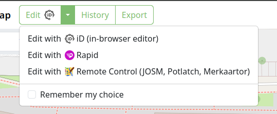
This week, OpenStreetMap-NG introduced a convenient way to change your default editor. By exposing this functionality, previously hidden in settings, we prevent editor lock-in and allow users to easily experiment with other editors. A small icon now indicates which editor is currently set as default.
We completed a major overhaul of the GPX trace database design. Here are the results:
Hi! This is Faiza Waziha. One of the Gurus of the Open Mapping Guru Fellowship. This journey started when I was selected to be a part of this incredible journey in 2023.
First of all, I want to mention the vibes this community gives. It is very welcoming, energetic and inspiring. I love the enthusiasm so much!! This is one of the reasons I get to learn so much from them and to communicate with them without worries.
There were 3 tracks in the fellowship (Training, Mapping, and Validation). I was part of the Mapping track. After getting the briefing about what we will be doing for the next 5 months, I was pumped up for the challenges. We got to map various countries; India, Bangladesh and also some Island countries like Tonga, Vanuatu, and Micronesia. Which were very interesting and got learned many geological characteristics of those areas.
From this fellowship, I have learned to use Josm (It is the most efficient thing a mapper can have to map anything and I love it!!), Mappilary and Everydoor. Also the use of Josm in validation, how to use the open data source for data analysis in QGIS. These skills will help me in building my career as a GIS analyst.
This fellowship allowed me to connect and communicate with many talented individuals like Brazil Singh Rittik Vai, Khan Mohammed Ibtehal Vai, Can Unen and many more. It was also a great experience to be a part of Slum area mapping in Mirpur in collaboration with World Vision Bangladesh. I get to lead an amazing team- Sozin’s Comet in the Climate Change Challenge 2024. Though we didn’t win any prizes it has helped me a lot in how to manage a team, how to stay motivated and keep others motivated. I learned that communication is the key to leadership. I have grown as a mapper and also a better human being.
Lastly, I want to thank Mikko Tamura, and Honey Fombuena for their immense support and for pushing us to reach our goals. Thank you so much!!
Sometimes I think I’m a bottom feeder going through the map and cleaning up the obvious errors and this comes from my observations over time and cleaning up thousands of duplicate buildings.
Because many countries do not have good census data you can do a rough calculation by multiplying the number of houses by an average number of people who live in them. It isn’t perfect but if you have nothing better then it works.
So duplicate buildings are a problem. When you’re looking to see how many schools you need duplicate buildings mess the numbers up. Buildings incorrectly tagged or not tagged at all also mess the numbers up.
Then we get to the imagery used. These days I’m seeing more and more microsoft BuildingFootprints tags on buildings. They are normally very accurate and align well with Bing imagery. The largest most accurate satellites are only accurate to 60 meters so the imagery has to be aligned. My recommendation would be to use Bing imagery and find a building that aligns with it. Then switch to your preferred imagery and align it with the Bing aligned one.
This helps ensure that buildings are only mapped once and when you add buildings you don’t add an existing building and if someone imports using microsoft BuildingFootprints then your building won’t be remapped 10 meters away in the future.
Disposable mappers are often used meaning many will only may a few times. So we don’t really have time to train them.
We want to get the most accurate mapping we can from them and as many buildings as we can. With JOSM buildings_tool plugin I can highlight one building then add more by clicking and holding down the button, moving to the opposite corner of the building and releasing the mouse button. If they aren’t in line it takes another mouse button click. You get a rectangular building correctly labelled. This is far less than using iD. Plus you don’t need a validator to inspect each one to see if it is correct.
Well, the fellowship was the first of its kind for me. The whole time, the commitment led me to learn and know the vast features and tools of OpenStreetMap. The fact that overwhelmed me most that how the organization has managed and engaged numerous volunteers and improved its tools over time. Training and resources were efficient and convenient in a structure that proved instrumental for me in completing the tasks. The biggest delight is seeing my edits come into visualization within moments which truly instills a feeling that I am making an impact by mapping. Throughout the whole time, I have been able to discover a little of it and may also have made slight and/or big mistakes during edits or validation, ahead of this, I want to explore this platform more and be an instrumental mapper.
Day 25 and 1/4 of the challenge done!
Today I mapped Kosovë and I found out that we have not one but two villages name Kosovë in Albania.
Kosovë has a population of 931 according to 2011 population census.
“#100villagesin100days #day25”


.jpg)