Diary Entries in English

Recent diary entries

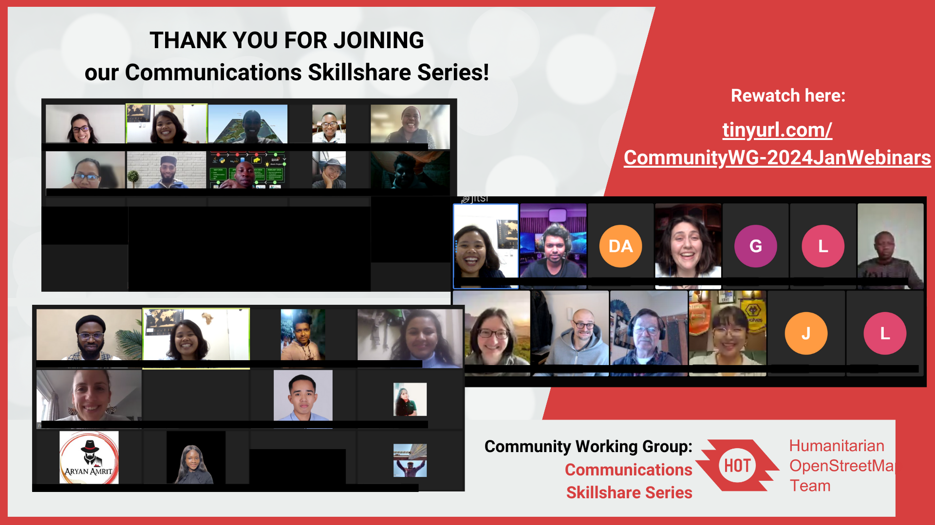
THANK YOU FOR JOINING our Communications Skillshare Series!

THANK YOU FOR JOINING our Communications Skillshare Series!

I had fun organizing and participating in these comms skillshare sessions!

Comment if you have attended or watched the sessions! Let’s level up those communications skills this year! :D

You can rewatch the recordings here

User-Friendly Website Design with Brazil Singh

Brazil is currently the President of Youthmappers Chapter at Eastern University of Bangladesh. He shared his expertise and experience in creating user-friendly website design using WordPress. He presented theoretical and step-by-step guide on how to create a website. This webinar was inspired by his passion to support Youthmappers chapters to design their own website.

Links:

  1. feedback and comments
  2. recordings
  3. slides

Also shoutout to Eka Diweti who hosted the webinar session! PS. I enjoyed listening to Eka! She said she was nervous but her voice was so calm and professional (watch the recording to listen!) :)
See full entry

Hi community!

Firstly, I would like to thank Chisom Ejeh for his efforts and chairing the CommunityWG 09:00 UTC/ Early session for the past almost 2 years! Chisom will no longer be available to be our chairperson due to conflict in work schedules and the CWG meeting. Let’s all thank Chisom for his service!

With this, we are looking for a new chairperson for 09:00 UTC/ Early Session for CommunityWG!

Note: Current chairperson for 17:00 UTC / Later session is Benedicta <3

Why become a CommunityWG Chairperson?

You will have the opportunity to connect, collaborate with and facilitate a diverse and talented set of people from the humanitarian open mapping community! You get to also sharpen you communication, networking and facilitation skills that can support your professional development!

What is the role?

Essentially, the role of CommunityWG chairperson is in two folds:

*Engagement

  • Engage with communityWG members and encouraging/reminding them to participate and attend the meetings and events
  • Ensure that communitywg meetings and channels (loomio, slack, matrix, mailing) remain an inclusive and healthy environment for everyone, following the HOT Code of Conduct

*Administrative

  • Ensure that meeting notes and documentations are organized and readable
  • Ensure that community shoutouts and agenda are filled and open for everyone to add
Who are we looking for?
  • Required: Active member of HOT Community Working Group and/or a HOT voting member and must have participated in the meeting at least twice and/or participated in community channels (slack, loomio, matrix, mailing list) *A deep passion and commitment to humanitarian open mapping / OpenStreetMap/ open data/ humanitarian or development work / community development *Working fluency in English; non-native English speaker is very welcome!
Are you interested?

Please comment on this diary, loomio thread or email community[at]hotosm[dot]org your name, experience and motivation statement to apply!

See full entry

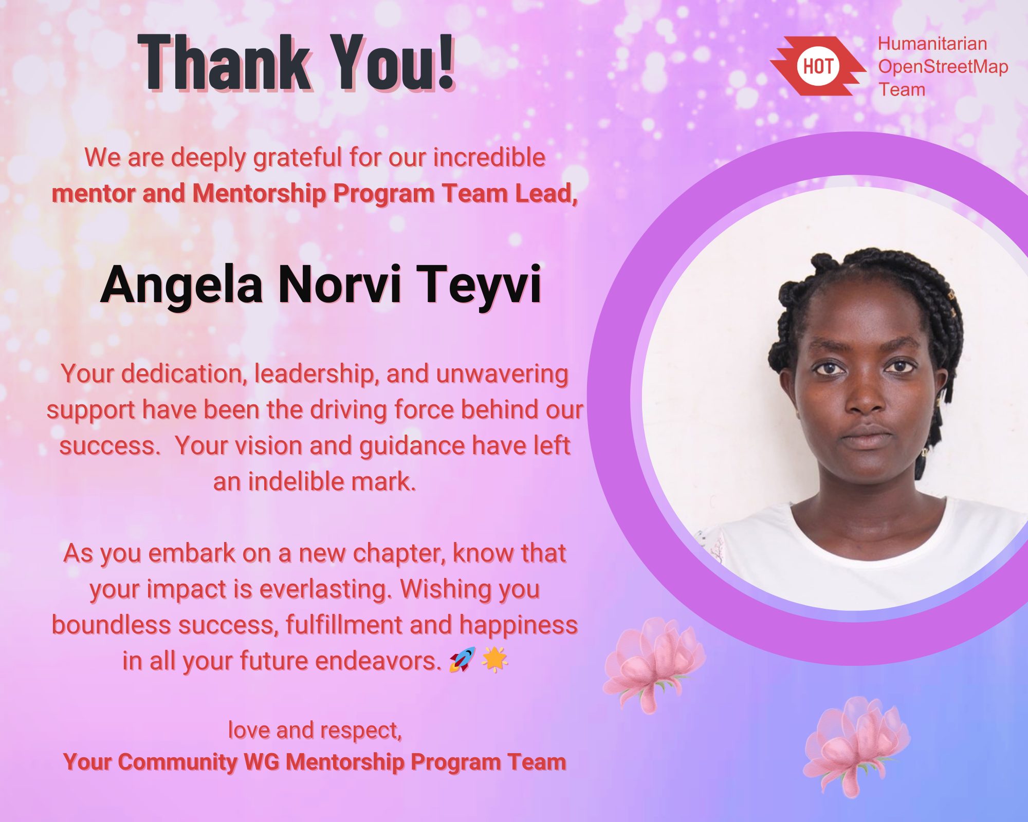
Today, I celebrate a leader, mentor and a friend, Angela Teyvi.

Thank you Angela!

As the Mentorship Month (January) come to a close, the HOT Community Working Group Mentorship Program Team would like to honor our mentor and team lead, Angela Norvi Teyvi, whose passion have sparked and made ideas come to life through the Mentorship Program.

About the HOT CommunityWG Mentorship Initiative

See full entry

Location: Byebye, Atebubu-Amantin Municipal District, Bono East Region, Ghana
Posted by b-unicycling on 30 January 2024 in English.

Stone Circle in Co. Galway

Yesterday, I got an email from the National Monuments Service (Republic of Ireland) to confirm a stone circle I had discovered in December of 2022 and reported to them as a potential site. I discovered it in Co. Galway while mapping the Co. Roscommon task (which still needs validation, btw), but the site is just across the River Suck (that’s what it’s called on OSM; it has a different name on Google, strangely) which forms the boundary between Roscommon and Galway.

Check on OpenStreetMap

I nearly didn’t report it, because it looks so neat and regular with its 27 (thanks danieldegroot2 for being able to count, not like myself :D) stones forming a perfect circle of 18m diameter. It’s not difficult to make perfect circle, but the distance between the stones looks very regular too. Hence my doubtful subject in my email to the NMS “unlikely monument in Co. Galway, only reporting just in case”, because I suspected that the farmer whose land is on (or his forefathers) had built it. I still have a little doubt. It’s also in a flood plain which seems a strange location for a stone circle to me, but I’m no expert. The stone in the centre is a standing stone, but the ones forming the circle are “only” boulders which is not entirely unusual, as attested by the more famous Kenmare Stone Circle in Co. Kerry (website, on OSM). I presume they used boulders formed partly be the ice age and partly by the River Suck. The standing stone is not as smooth as the boulders. Unfortunately, I have no photographs, because I have not visited the site myself, but the lady from the NMS sent me two photographs.

See full entry

Posted by arnalielsewhere on 30 January 2024 in English. Last updated on 31 January 2024.

I would like to congratulate and welcome OSM Belgium for being the newest (and returning) OSMF Local Chapter!

Thank you to Joost, Ben, Jonathan, Thierry and OSM Belgium community for your contributions in spreading the awareness, educating/training people and sharing the good news of OpenStreetMap!

Learn more about OSMF Local Chapters:

If you are interested in becoming a local chapter, and for questions and concerns, please comment in the community forum thread: Local Chapters: What To Know and How to Join or email local@osmfoundation.org.please email local[at]osmfoundation[dot]org :)

UPDATE AS OF 31 JAN

Hi community, I am greatly humbled by your overwhelming response! Thank you for your interest and volunteering to support our Membership Drive Campaign this Q1 of 2024!

I have scheduled a meetup this Saturday, 3 February at 11:00 UTC.

https://osmcal.org/event/2632/ https://osmcal.org/event/2632/

Please click ATTEND and answer the sign up form so we know which role you are willing to help 🙂

You can also input your email address so I can send the direct cal invite or you can click the ADD TO CALENDAR.

Important notes:

  • You need to be logged in to your OSM Account to be able to answer the sign up form 🙂
  • If you can’t make it, the session will be recorded and I will share it here as well as the meeting notes.

If you have any questions, please send it here! 🙂

Agenda: 1. Hello and Welcome 2. About OSMF and the Membership Drive 3. Timelines 4. Roles and tasking 5. Questions and comments 6. Any Other Business (AOB) 7. Actions and next steps

Meeting notes

See you!

ORIGINAL POST

Hi community,

wearing my OSMF Board hat and in our aim to grow and diversify OSMF membership, I am happy to initiate a Membership Drive/Campaign this first quarter of 2024!

Objectives:
  • Promote OSMF memberships (normal, associate, active contributor) with support from OSMF Communications WG
  • Provide general stats on membership make up (per region / per country)
  • Collaborate with regional/national community leaders especially in regions/countries where OSMF membership is low
With this, I am looking for volunteers and campaigners to be part of this initiative:
  • Mapmakers / comms volunteer/s who can help visualize membership make up and design Call to Action posters/pubmats
  • regional/national community leaders/promoters who can help us in this campaign
Are you interested?

Please comment on this diary or this thread in the community forum if you have time and are happy to help! :)

Thank you!

=Arnalie

last week the OSM Board and the DWG have given permission to anybody to change my 100% factual edits with out any intervention. This has already lead to the map displaying old outdated information. The changeset i’m bringing attention to osm.org/changeset/146818956 The Gawler Bypass which even has it’s own wikipedia article https://en.wikipedia.org/wiki/Gawler_Bypass was completed in 2010, its intended function was to divert all traffic wanting to go north of Gawler to go around the entire town. The section of Main North Road that goes through Gawler was officially downgraded to a secondary road plus it’s route number B19 was also removed. When this section was classed in OSM I suspect it was based on its class before the license change and its was kept as “primary” which was not wrong, it is a fact that it was a primary road at the time. https://imgur.com/ZrpOFr8 My edit clearly with supported information is correct to class it as secondary. I would like to ask The DWG how we move forward as a community and keeping the integrity of the information at the same time. OSM is a important project to me and I would like to find a way to work together here without slowly watching road by road the factual information fall apart. more relevant links posted below https://data.sa.gov.au/data/dataset/trailblazer-roads osm.org/changeset/12436982#map=15/-34.5780/138.7422 https://en.wikipedia.org/wiki/Main_North_Road#cite_note-8 https://www.dit.sa.gov.au/nsc/northern_expressway osm.org/#map=13/-34.6025/138.7299

previous diary entry osm.org/user/slice0/diary/403361

Posted by TrickyFoxy on 29 January 2024 in English.

TL;DR I wrote a little extension for Firefox for script developers to get an OAuth token in a couple clicks


OSM will soon remove support for Basic Auth and OAuth 1.0.

The proposal is to use OAuth 2.0, which has a much worse UX for novice developers than Basic Auth.

To show that OAuth 2.0 can be made more convenient even than Basic Auth I made a Firefox extension to automatically get an OAuth token:

demo


A bit of technical details and emotion:

See full entry

Posted by PhoebeSM on 28 January 2024 in English.

This weekend I started mapping the east-of-Gillham part of 43rd St in KC. I went from Gillham to just past 71 on Saturday, and further east to Indiana on Sunday.

Pedestrian-safety observation: The crossings on either side of Gillham Park are The Worst. You can go way up or down and find a crosswalk with a light, or you can take your chances running across both-way car traffic and then both-way bike traffic without much visibility. For this entire stretch of road (and most of my outdoor activities around KC) I wear bright dae-glo jackets. I call it protective coloring.

There wasn’t much to map in this area as it was mostly homes. I crossed the bridge over Highway 71 and found a few benches and a bookcase that was locked. I mapped these, but I do not think they are being maintained anymore. There was a defunct church nearby that I think they were part of. I took photos of the various tags on the bridge and the view looking down on the highway while crossing - cool and fun for me, but not necessarily mapping-related. I also photographed a few tags painted on walls, but nothing quite rose to the level of a mural.

See full entry

Location: Ivanhoe Southwest, Kansas City, Jackson County, Missouri, 64110, United States

Brazil

Humanitarian Open Street Team’s Community Working Group’s Skillshare Session

The Community Working Group of Humanitarian Open Street Team (HOT) organized a Skillshare Session on January 19, 2024, at 12 UTC. This informative session featured Brazil Singh, the President of YouthMappers at Eastern University, as the speaker. The focus of the session was on imparting excellent skills related to WordPress website creation.

Session Details

  • Date and Time: January 19, 2024, at 12 UTC

  • Session Speaker: Brazil Singh, President of YouthMappers at Eastern University

  • Topic: WordPress Website Creation

  • Session Host: Eka Diweti

Speaker’s Expertise

Brazil Singh, the President of YouthMappers at Eastern University, shared his excellent skills in WordPress website creation. His expertise added valuable insights to the session, providing participants with practical knowledge in this essential field.

See full entry

Open Mapping Guru Fellowship: Navigating the Path to Excellence

Unveiling a New Chapter: Open Mapping Hub Asia Pacific

The journey to mastery in the field of open mapping has taken a significant turn for the better as I proudly announce my achievement of the Open Mapping Guru Fellowship conferred by the esteemed Open Mapping Hub Asia Pacific. Brazil

Location: West Dhanmondi, Dhanmondi, West Dhanmondi, Dhaka, Dhaka Metropolitan, Dhaka District, Dhaka Division, 1205, Bangladesh
Posted by jlevente on 26 January 2024 in English. Last updated on 3 February 2024.

mapper | scientist | human

TL;DR I am deeply involved in different aspects of OSM. I am running for the OSM US board to extend my contributions beyond data creation, community organization and research.

About me

I am Levente, originally from Hungary, now living in sunny South Florida for about a decade. I came across OpenStreetMap in the early 2010s and instantly became fascinated by it. I actually decided to become a scientist because of it, and much of my research career is dedicated to understanding different aspects of the OSM project, data, and its community. Now I am running for a seat on the OSM US Board to continue my long standing commitment to the project in a different role.

During the day I am a Research Assistant Professor and currently I also serve as the Assistant Director of GIScience at Florida International University. I also teach Environmental GIS there. At night, I usually sleep. Prior to FIU, I spent a few years at the University of Florida (where I earned my PhD in Geomatics) and also held short-term visiting appointments at the Carinthia University of Applied Sciences in Villach, Austria, and at the Joint Research Centre in Ispra, Italy. In industry, I spent a few wonderful years at Mapillary (see e.g. here and here) and was also a full-stack GIS Developer at some point. I am an OsGeo Charter Member since 2023. While I am originally trained as a geographer, my background is more on the computational and data intensive side of the discipline and ventures into computer science and data science.

My involvement in OSM

I recognize that contributions are not limited to data creation. Below is a short summary of the different ways I have been involved in OSM over the last 10+ years.

As a contributor

See full entry

Location: Torch of Friendship, Miami, Miami-Dade County, Florida, 33131, United States

https://imgur.com/a/qNROb4E

When a mapping service chooses to pay for the rights for the street data and navigation they turn to the government, the state government hand over the map of their roads and classifications of the roads. The government of South Australia has given this information to the OpenStreetMap project for free all that needed to be done is for someone to translate the data onto the map. I was that person, and it has done nothing except for russle peoples jimmys all the way to the OSM board. The classification of roads goes way beyond a single dictionary meaning and has lots of different considerations such as traffic volume, width of the road, whether there are hazards such as railway crossings that the roads are engineered to avoid, speed, intersections etc. Thankfully the people who plan and engineer the roads take all of this into consideration and classify roads accordingly to what the intention of the road actually is. As far as OSM is concerned none of this matters and “what someone thinks it is from the ground” is far far more important and accurate. I 100% get that when this project started not a single government anywhere in the world gave this information over to the project and OSM needed to come up with some meaning and right and wrong way to classify roads. So the project decided on “Use highway=secondary to tag highways which are not part of major routes, but nevertheless form a link in the national route network. Secondary highways are generally specified by country road classification bylaws”. Which is fine and people were happy with that… but it leaves out a situation where. what if a government somewhere comes along and says “heres what our roads are feel free to use this” well what you see in the above screenshot happens, OSM does not allow for Real factual official government data to be allowed and I think this needs to change.

Posted by NorthCrab on 25 January 2024 in English. Last updated on 27 January 2024.

I have started an independent collection of OSM SLA statistics. Approximately once a month, I will publish my results with the aim of enhancing transparency regarding the reliability of OSM services. I use uptime-kuma to run monitoring. I also verify connectivity with non-OSM services (to prevent false positives). The current configuration includes checking the availability of openstreetmap-website and openstreetmap-cgimap (API). Tile layer availability is not currently included in the checks. The health-check resolution is set to 30 seconds, and the checks are executed from a single server in the Hetzner datacenter in Germany. For the endpoint to be marked unavailable, two consecutive checks must fail. This should be well-representative of an average user experience.

Summary

Total API downtime: 10 minutes and 37 seconds

API 31D SLA: 99.976%

Total website downtime: 30 minutes and 6 seconds

Website 31D SLA: 99.932%

Note that some functionalities of the website require API to also be available.

Details

2024-01-02 11:30:00 - 2024-01-02 11:34:32

  • Total downtime: 4 minutes 32 seconds
  • 🌐 Website unavailable

2024-01-09 12:51:39 - 2024-01-09 12:53:10

  • Total downtime: 1 minute 31 seconds
  • 🌐 Website unavailable

2024-01-09 12:56:58 - 2024-01-09 12:59:28

  • Total downtime: 2 minutes 30 seconds
  • 🌐 Website unavailable

2024-01-09 13:07:18 - 2024-01-09 13:07:48

  • Total downtime: 30 seconds
  • 🌐 Website unavailable

2024-01-09 13:09:57 - 2024-01-09 13:10:27

  • Total downtime: 30 seconds
  • 🌐 Website unavailable

2024-01-09 13:16:36 - 2024-01-09 13:19:21

  • Total downtime: 2 minutes 45 seconds
  • 🌐 Website unavailable

2024-01-14 16:10:19 - 2024-01-14 16:11:04

  • Total downtime: 45 seconds
  • 🌐 Website unavailable

2024-01-14 16:15:55 - 2024-01-14 16:16:25

  • Total downtime: 30 seconds
  • 🌐 Website unavailable

2024-01-14 16:17:58 - 2024-01-14 16:18:29

  • Total downtime: 31 seconds
  • 🌐 Website unavailable

2024-01-14 16:20:02 - 2024-01-14 16:21:02

See full entry

Posted by fossilised on 25 January 2024 in English.

After fighting the user interface, both here and after installing JOSM on my system, I’m inclined to just forget about OSM for now. Something needs to radically change if the local contributions are of any value here. I simply do not have the time to attempt to master a very broken u.i.

See full entry

Location: Evanston, South Australia, 5116, Australia
Posted by KPLHallerod on 25 January 2024 in English. Last updated on 27 January 2024.

Preparations

2023 01-25: Latitude 50.850347519055674 Longitude 4.375579829793424

Underway of preparing for the trip, and making sure I have everything and dealt with the commitments before leaving. I am looking forward, perhaps particularly to Bulgaria and Greece but also to Germany, Prague, Budapest, and Transylvania. We will see how long I travel. Maybe would be nice to continue somewhere and return in late April. Maybe the Nordics or Turkey and Georgia. We’ll see! I think I should maybe slow things down a little while sticking to the plan, not be overambitious, and enjoy.

Location: Saint-Josse-ten-Noode - Sint-Joost-ten-Node, Brussels-Capital, Belgium

Overview

In December 2023, the Hanang District of the northern Manyara Region in Tanzania faced a catastrophic disaster. The heavy rainfall triggered flooding and landslides, causing widespread destruction in the areas around the towns of Katesh and Gendabi, as well as the steep slopes of Mount Hanang. Flood in Hanang District

Mapping Initiative

See full entry