 OpenStreetMap

hi everyone
Diary Entries in English
Recent diary entries

My name is Walter Mayeku, a postgrad urban planner and currently working as a geospatial engineer and a volunteer at the OSM Kenya working group. So initially when we were bidding to host this year’s conference all our hopes were revolving around having a physical conference you know… The interactive sessions and the entire networking platforms. Thanks to the entire SOTMA 2021 committees and the local community (OSM Kenya) for putting so much selfless efforts to see us have such a great first virtual conference. Personally I enjoyed and left enlightened because it was more that what I anticipated. If there is much I have learnt from the pitching, speeches and networking is that you can not underestimate the role of partnershipsand local government involvement in the development of bigger community based groups and projects. Listening to some of the most enlightening presentations has helped me on how to analyse existing community projects as we as a community plan to undertake bigger projects from this new phase. Thank you for making the event a success.
Posted by Innocencia Sigfrid on 5 December 2021 in English.

My name is Innocencia Sigfrid a crowd2map intern in Everywhere She Maps project where female mappers are given chance to strengthen their network and also adding underrepresented places to the map.
I had a chance to attend the online conference State of Map Africa (SotMAfrica) Which is a biannual regional conference that celebrates the culture of open mapping,open data, Geographical information system (GIS) and its impacts across Africa.
It was my first time to attend to this conference and the experience was extraordinary as I happed to gain more insights about open street map Africa and found out that Open Street Map Africa is a strong and a growing network and from this network personally I can bring a lot of positive changes in my community.
During the conference I got the chance to participate in different sessions hosted by different people, organizations, youth chapters where I learned on how they perform different projects and other activities in their community and it was during this time that I convinced my self that everything is possible when a team is well organized and have same goal to accomplish. I was inspired by all speakers but more with OMDTZ, IRDP, ENOCK who presented about beyond mapping,SHAMILLAH &CLAIR who presented about the lessons learned from building footprints import,TONNY JOHN,
Posted by salumeuganda on 5 December 2021 in English.
Last updated on 9 December 2021.

My name is Angolo Salume a, a member of vision youth mapper chapter in Uganda ,first and far most i want to thank the organizers of this event it was really educative may God bless you . this was my first time to attend the state of map marathon but for the time I attended it really changed me and one of the persons who inspired me is Eric T Tamba who is a region ambassador of Tanzania , i attended his session and how he presented his projects and activities carried out in their youth chapter. I also attended the session where Christine from OSM Malawi who was talking about OSM sustainability in Malawi During the break time session i was able to interact with different people and it was amazing ,thank you for the opportunity given and would love to attend it next year again GOD BLESS everyone
Posted by Hungerburg on 5 December 2021 in English.
Last updated on 21 October 2022.

During the summer, a number of wild-life sanctuaries found their way into the openstreetmap data around the area of my local knowledge. Legal provisions place a simple conditional restriction on accessing the protected areas: From November 16 up to April 30 one must not stray from tracks, well-known paths and pistes. Some days ago, I started to think about ways to add that to the data, and came up with access:conditional=only_trail_use @ (Nov 16-Apr 30). That felt pretty good human readable, Apart from a new restriction, it was very much in line with what the documentation on conditional restrictions proposes. The new value itself follows established naming conventions of documented restrictions.
Still, that seemed too little, to pitch this tagging to a consumer of openstreetmap data in close vicinity, developing an online slippy map, that sets out to highlight protected areas to the interested public, i.e. skiers and other winter sport enthusiasts. I searched for a reference implementation, that parses openstreetmap conditional restrictions, and I did not find a single one.
So I had to start from scratch: Below some lines of python, that take the (very simple) tag value from above, and find out, if the restriction applies at a certain date. In all its simplicity, there are some pitfalls worked around. For more complete coverage, it might still be wise to look for a full blown calendaring module to evaluate time constraints, and of course a full blown parser of the myriad of expressions available in conditionals.
Posted by amapanda ᚛ᚐᚋᚐᚅᚇᚐ᚜ 🏳️⚧️ on 5 December 2021 in English.

Hi 👋, I’m Amanda McCann, I’m an current OSMF Board Member, and I’d like you to vote №1 to re-elect me to the OSMF Board. 🙂 Here’s my manifesto.
So who am I?
I’m a (craft) mapper. I’ve loved maps for a long time, and hence was drawn to OSM. I try to edit every day, and I’m doing pretty well that way. hdyc tells me I have mapped 2,700 days. For the last several years, I have mapped for 300+ days per year. I love the term “craft mapper”. I view my mapping contributors to OSM with pride, like a craftsperson of old would look at their work.
We must remember what’s important. If you don’t like maps, what are you even doing here? A board member that keeps mapping will be more aware of what most OSMers are experiencing, and will have insight into what is important, what’s easy, what’s hard, for lots of OSMers. That will make them a better OSMF Board members. OTOH I do lots of contributions which cannot be included in my OSM edit count.
I’m a hacker. I’ve been using linux for 15+ years. I’m a free software programmer. Computers & the internet are wonderful tools for the good in the world. We can use them to make our lives & our society better. You should be able to understand the computing machines around you, and to control them and make them better. In my day job I’m a regular sysadmin for the small OSM consultancy company Geofabrik, so I’ve installed lots of OpenStreetMap software & map styles. I’m pretty good at writing bash scripts, and I can write long PostgreSQL queries to work with your OSM data.
I’m a queer trans woman. I came out as trans & transitioned in mid-2021. (So you might see references to my old name, which started with “R”). Everyone in OSM has been wonderfully supportive about this. Honestly, it’s surreal how anti-climactic it has been in the OSM space. OSM is pretty cool. I founded the RainbOSM telegram group. for LGBTQ+ people & allies in OSM. I guess sometimes OSMers can adjust to a new tagging scheme quickly.

-
Install Java Development Kit for ARM 64 processors. JOSM developers now recommend Azul or Bellsoft Liberica JDK’s. At the moment, I’m using the Azul build: https://www.azul.com/downloads/?package=jdk#download-openjdk
-
Download josm-tested.jar https://josm.openstreetmap.de/josm-tested.jar
-
Drag and drop josm-tested.jar into the Dock
-
Run JOSM!

PS: Updated recommendations for JDK
UPD April 20, 2024: The instructions are effective; however, the JOSM development team now produces a build that supports both Intel and Apple Silicon processors. Currently, I download and install JOSM using Homebrew.

“Have I offended someone?”, someone asked.
Posted by TreeTracks on 4 December 2021 in English.
If you’ve ever wondered how accurate road surface tags are in OpenStreetMap, I’ve compiled a review of the accuracy of surface tags (sealed vs unsealed) in Victoria, Australia.
There’s lots of colorful maps and tables. Spoiler alert – Thanks to amazing work by hundreds of enthusiastic mappers, OpenStreetMap’s road surface tags in Victoria are extremely accurate, and provide an invaluable resource for users who want to select routes that stick to sealed or unsealed roads and tracks.
Posted by Gustavo22Soares on 4 December 2021 in English.

This year I had an amazing opportunity to participate in the HOT Data Quality Intership, being chosen to participate in these twelve weeks was the best thing that happened to me this year, I felt as if all my work on OpenStreetMap was recognized at that moment. I would like to thank everyone who shared their knowledge in the trainings and also to the project coordinators Sam and Becky thank you very much!
Without a doubt it was an experience that I will take for life, I met incredible people from many different countries…
No doubt it is a unique program for OpenStreetMap mappers and helps the community to grow, giving this opportunity to inspire and support young people like me to learn more about OSM and the ecosystem around us is priceless, I imagine that like me my colleagues continued to contribute to OSM in their local communities…
Here I must emphasize the importance of programs like Data Quality Intership in being able to fund and impact local communities around the world, perhaps it would be interesting to expand the program to the mapping hubs.
The future of OSM is not in closed teams maintained by companies that often do not know the reality of what they are mapping, the future of OSM is in funding the work of young volunteers and their communities giving them the opportunity to learn and improve their skills, well structured local communities know what is missing on the map and what they want to map, they know the region better.
For the future I intend to continue to apply what I learned during these 12 weeks and help the Brazilian community, I intend to continue mapping with the projects in TaskManager, I am still planning to have a more solid base for 2022 but I intend to continue with my work mapping cities in my state.
Translated with www.DeepL.com/Translator (free version)
To gain first- hand experience of OSM, mapping was done in Mhow subdivision of Indore district in Madhya Pradesh, India. There are 10 subdivisions in the district. Total area of the district is nearly 3900 sq. km with total and rural population of nearly 3.28 and 0.8 million respectively. Nearly 679 sq. km area is under forest cover. Indore city is commercial capital of Madhya Pradesh and has a population of nearly 2 million and has been ranked the cleanest city in India for five consecutive cleanliness surveys from 2017 to 2021. Dr Ambedkar Nagar (Mhow), the headquarter of the subdivision is an important cantonment town. The town is located 23 km south-west of Indore city and has a population of nearly 85 thousand. Four training institutes of Indian Army and Border Security Force and two premier educational institutes namely Indian Institute of Management (IIM) and Indian Institute of Technology (IIT) are also located in the subdivision. National Highways NH52, NH347BG and State Highways SH38, SH38A and SH40, IIM Road and Main District Road pass through the subdivision. Important tourist locations are Choral dam, Patal Pani waterfall, Mhow Fort and Bhim Janmbhumi (birthplace of Dr Bhimrao Ambedkar). Other nearby attractions are Ralamandal Wildlife Sanctuary, Jam Dwar (Jam Gate) etc.

Maps.me led me onto via 35 although part of this road is still under construction, so I ended up in the middle of nowhere at a bridge which was still under construction. The part from Florencia to Naranjo will only be finished in 2025! https://en.wikipedia.org/wiki/National_Route_35_(Costa_Rica)
Posted by SHABANI MAGAWILA on 30 November 2021 in English.

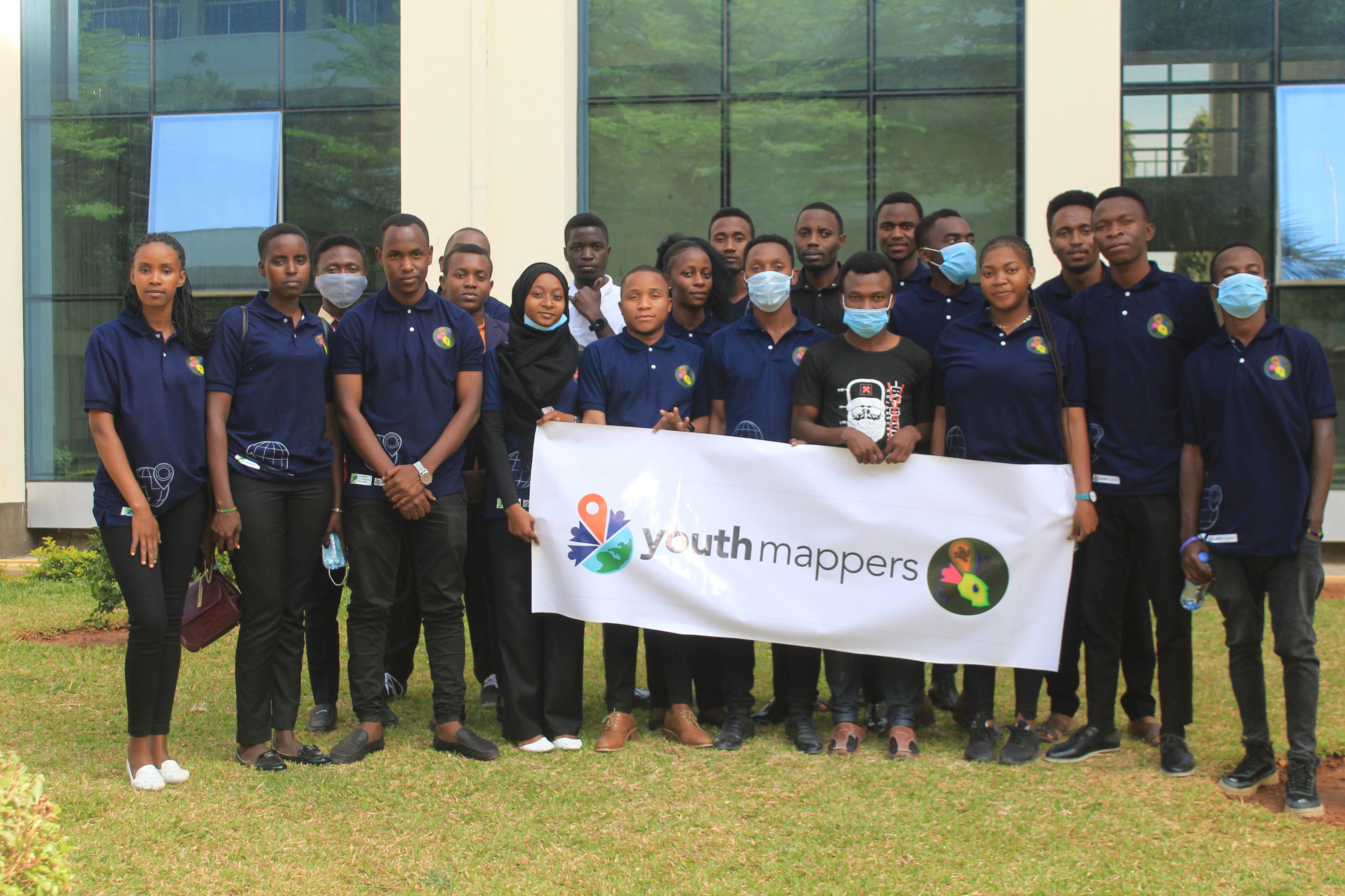
IntroductionIRDP YouthMappers is the group of students from the Institute of Rural Development Planning engaging in the provision of information related to the Geographical Information System (GIS).
This chapter was established in 2017 at IRDP. It is engaging in exploring various skills and technology which are related to their field and in one way or another can be helpful to their community.
Mnadani Community Mapping ProjectIRDP YouthMappers Team formulate and conduct this project so as to reveal and identify various social, physical and environmental problems faced by the people from Mnadani Ward. With Micro Grant from OMDTZ, help IRDP YouthMappers Team to perform the following:
- Track and address challenges faced by the Mnadani Community.
- Capacity building to Students and Community Mappers.
- Community Awareness and Participation.

The best part of being an OSM editor is being able to write in my diary. I hope the feed picks this entry up.
Posted by ngumenawesamson on 29 November 2021 in English.

My 214 Mapping Days of 2021
At the beginning of the year 2021, one of my targets was to upload a changeset at least every day until the end of the year. However, I have not managed to hit my target. Nevertheless, this year still emerges the year with my highest number of contribution days.


The OpenStreetMap Community of South Sudan, was launched on 26th.Nov.2021, in an event that brought together Government agencies like the National communication Authority, Companies like East Africa GoGreen, Academia like The University of Juba and among other individuals, this launch event was the commence point of the upcoming programs of OSM South Sudan and it strives to achieve its goal of facilitating the creation, and use on OpenStreetMap data, this shall be made possible by the couple of partnerships OSM South Sudan is looking with the Government and other entities who shall either be data users or contributors, though the collaboration with other HOT and the Open Mapping hub, East and Southern Africa has come handy in building and pushing for success of the community. OSM South Sudan is now in the process of collaborating with the NCA to map and solve address issues in Juba.
Posted by martin-kokos on 29 November 2021 in English.
 I suspect a JOSM edit.
As a Crowd2Map intern I had the opportunity to attend the conference #StateOfMap2021, it was a unique experience where for the first time I could see many experts from various areas related to data in one place, I did not know that the mapping area was too large.
Well, many sessions marked me but in particular those involving development of solutions using programming language, I hardly knew that with the knowledge I have in Python and database could do a lot of things with data, for me it was a wake-up call. It was from this awakening that I decided to explore further this area of development of solutions using data, research more about what I can do with the mapping data here in Mozambique to help in the development. With regard to networking it was possible to create networking, for an exchange of experience in the area, where it was possible to have a view also of what I can do mapping.
Congratulations to the whole team, for the beautiful organization, was all very well organized from the sessions until the presentations made, it was very good to know that there are so many people or a united group in the area of mapping and for the development of solutions for society. One of the recommendations that maybe could leave is that next time presentations are made all in English so that we can all watch all the sessions, or to the sessions in a language other than English could be put subtitles do not know if is possible or the slide could be translated into English and then sent to the participants.
Posted by TechnicallyNotDeaf on 29 November 2021 in English.
Things I’ve figured out (possibly incorrectly) in my first week of mapping, since I discovered StreetComplete and got addicted… Don’t worry, in two or three weeks I’ll simmer down, LOL

I was part of the volunteers in the SOTM preparation for the virtual conferences, I have always preferred to reserve a particular space equipped enough to participate during the conference. I must say due to traveling and preparing for Africa GIS conference calls, I didn’t prepare such an environment to attend this conference but I used any of the opportunity I have to attend. In spite of all, I had quality time to join in at some scheduled talk sessions and networking sessions with participants from other parts of the world at large.
One of the amazing talk sessions I learned most was a talk on “Community mapping to improve flood preparation in Nigeria” which was facilitated by Sharmila because in some areas in Nigeria are facings water challenge and other areas are facing water scarcity. The talk exposed the different most flooded areas affecting communities and it also presented a solution by using mapped buildings, roads, and water areas edits on OpenStreetMap. The two areas stated earlier must solve both challenge simultaneously. The facilitator also recommended other solutions that could solve the flooding problems.
During the event, I networked with GUY a member of OpenStreetMap in. Cote d’Ivoire and the interesting part was that we meet at Africa GIS conference in person such an amazing network session to talk more and take pictures together. We discussed the SOTM conference, talk about his country shared our experience in contributing to OSM, and also exchanged contacts. At the Network break session, I also had a call with Becky Chandiru, who was one of the facilitators during the HOTOSM Data quality internship 2020. We made use of the period to connect well enough and shared some ideas with each other.