Diary Entries in English

Recent diary entries

Last week I visited Baku for only the second time, and managed to see the new seaport at Alat. The Mapillary images I collected are now on line so perhaps I can update the map at some point.

Mapping these days is taking a back seat to OSM Foundation business, unfortunately. Chairing the OSM Foundation board has turned into at least a half-time job. In the last two months I have held 32 conference calls with various OSM stakeholders: mappers, users of data, corporate members of the Foundation, old-timers, software developers, and local communities in ranging from Ireland to Japan and the Philippines. That effort will continue as I reach out to members of the OSM community and hear what advice they have, what they perceive as OSM’s needs, and their thoughts on what the board should be doing to support OSM. I am boiling down everything and will present some preliminary assessments–my personal take on what it all means, not the board’s–at SOTM Baltics on March 6.

Location: Karadag Raion, Baku City, Azerbaijan
Posted by Maxwell-M-Blackman on 26 February 2020 in English.

Traveled down to the Willows of Santiago yesterday to do some business and while I was there I took pictures of the park maps. I verified several street signs against the map and it was accurate. There was actually a second park map inside the office building as well. The street signs were not county supplied and more than likely put up by the park. Either way it was a nice little community and the people there were friendly.

Location: Fresno, Fresno County, California, United States
Posted by Binnette on 25 February 2020 in English. Last updated on 28 February 2020.

In brief: uMap is a webapp that allows you to create a map with OSM layers, add markers/polygons, display OSM objects from Overpass queries, … Then you can embed your map in your site.

Find more info and the differents servers in the wiki.

uMap

How do I become a “noob uMap contributor”

Everything began during the OSM-fr administration board of february 15-16 2020 (brief in french here). During this event OSM-fr board members talked about many stuff including uMap and the fact that they were looking for new contributors to its code. In the meantime, I started several months ago to create some maps in uMap: for public bookcases and other stuffs.

See full entry

Posted by wille on 24 February 2020 in English. Last updated on 28 February 2020.

We’re back with some news about OSMCha. In a few days we are moving the OSMCha application to a new domain: osmcha.org.

If you’re only a user of OSMCha, you don’t need to worry about it. osmcha.mapbox.com will redirect your requests to this new domain for the next few months. In case you have one OSMCha RSS feed subscribed on a feed reader, probably you’ll need to change the URL there.

For API users, you need to take action and update the OSMCha URL on applications to avoid errors due to redirection. We are planning to do the change this week. If you need more time to apply the changes in your application, please let us know.

See you on https://osmcha.org in a few days!

Update on February, 28th:

Each imagery offset is different, and over time a patchwork of different referencing systems emerges… one big disaster, worse than “GCJ-02” (which is at least “smooth and not noticeable”.) Happens even with just one person editing. You’ll notice it when you finally join village A to village B. Editors of village A have been pulling the imagery downwards to match what they have already mapped. And editors of village B have been pulling the imagery upwards…

I hope one day, after offsets are finally no longer present in imagery, Artificial Intelligence (?) will somehow fix the mess.

Location: 基寮坑, Dongshi District, Taichung, 42351, Taiwan
Posted by Aku sedodo on 24 February 2020 in English.

SotM Africa 2019, held in Ivory Coast was my first ever SotM Africa conference attended. The conference lasted for three days from 21st November, 2019 to 23rd November, 2019. My journey started with a road trip that took ten hours by bus from Cape Coast in Ghana through to VITIB in Grand Bassam, Ivory Coast. The journey although long, was fun and an exciting adventure.

Arriving there, I was quick to realize the importance of being a bilingual speaker which unfortunately I am not. With my little understanding, I could pick up little words in exchanging pleasantries to make an introduction and the word ‘mange’ when it came to food.

The first day of the conference which was held in conjunction with Understanding Risk Africa in Abidjan was a massive way to kick start the conference with more than 200 participants. This being that it provided a view into Africa’s use of OSM to understand how resilience is being built and the massive contributions being made in OSM in not just Africa but the world as a whole. A highlight of the first day for me would be the showcasing of the contributions of OSM contributors through a simulation video for a number of years. This made me happy because it showed that no matter how little the contributions are into OSM, they are counted significant.

I had my presentation on the first day, under the gender and local empowerment session. It provided me with the opportunity to share how through YouthMappers, perspective was being added to mapping in OSM as well as learn about the various ways people were using OSM for local empowerment across Africa. The session ended with a much needed discussion on how to address the issue of inclusion of diversity, what worked and what did not work.

See full entry

Posted by Uyan on 23 February 2020 in English.

A quick but useful tip I found hidden in this video:

https://www.youtube.com/watch?v=iwJnZQFi_C8

At around 24:00, the speaker notes the use of opacity: using multiple layers, and lowering the opacity of the front/uppermost layer to verify map alterations across different data sets (“data sets” being the layers themselves i.e. Bing, Esri, Maxar etc.). A tip I’ve already had good success with. I find lowering the opacity to around 70% works nicely.

Posted by AmeliaMap on 23 February 2020 in English.

8012 - Missing Maps: Nizi region, Democratic Republic of Congo (2)

SHARE

MSF is assisting in an Indoor Residual Spraying (IRS) campaign in the Nizi region in Ituri in the Democratic Republic of Congo. During this campaign insecticides will be applied on the inside of dwellings where malaria infected mosquitos rest. As a result the number of mosquitos will go down, which prevents the transition of Malaria.

Spent 2 hours editing sectors and mapping buildings.

Reminding you that there is a big conference coming up: the State of the Map Baltics 2020 in Riga, Latvia. How big? Well, half a thousand attendees have already registered. It’s time for you to buy a flight and meet us and other GIS enthusiasts and professionals on 6th of March:

https://2020.sotm-baltics.org/

Why so big? Well, it’s just a part of a bigger conference: Baltic GIT is not related to version control systems, but to geospatial technologies. Think of it as a partly local FOSS4G, only with less focus on open source. And it’s free!

We’ve got Allan Mustard of OSMF, Stefan Gustafsson of ESA, Tomas Straupis, Kirill Bondarenko, Danil Kirsanov, Evgen Bodunov, Rihards Olups and dozens of other speakers and OSM members. Do visit, and let’s enjoy Riga together!

Posted by John O'Hanley on 23 February 2020 in English.

Every object in the OSM database has coordinates (in degrees in the WGS84 projection/EPSG:4326), creation date, author and a description.

The imagery usually has offset issues. The problem is that imagery usually isn’t correctly placed with respect to the coord system. The iD editor has a tool for temporarily aligning the imagery with polygons and whatnot. It’s found at the bottom of the imagery dialog.

Posted by John O'Hanley on 22 February 2020 in English. Last updated on 24 February 2020.

The Province has excellent resources online.

Provincial GIS Resources

Active Living Map

GIS Data Layers

PEI National Road Network PEINRN Up to date, includes all the data you’d ever need.

Place names in Canada No type info, or population info! No indication of the precision of the lat/long. English and French.

Feature names in Canada. Not bad. 1869 items for PEI. Water and towns. Dowside: no population number, BUT it has categories that can do the same thing: locality, community, town, city.

Lakes and rivers- National Hydro Network - NHN - GeoBase Series

Natural Earth - motherlode of global mapping data. Seems to be of high quality. 1:10000 is their most-detailed recommended scale.

Global place names with pop. About 7300 places. Small towns missing.

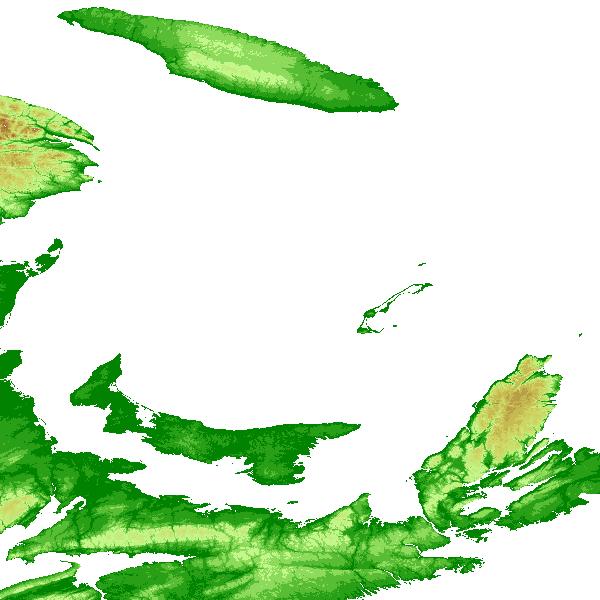
Global elevation data - the free versions of this data are usually based on data from NASA called SRTM. You can download it here. That original data set has holes, that can be filled by interpolating. The CGIAR data set interpolates. More info here. The resolution comes in 2 flavours, 90m and 30m. Here’s an example of it being used for shading. It’s certainly fine for indicating general elevation - example. Reference for mapnik.

It’s likely best to use transparency, and the alpha-channel, to render the hillshading.

Global elevation shading, $1000US

Also see OpenDEM.

Global Bathymetry - GEBCO may be low res, hard to say. Also see OpenDEM.

Bathymetry of the Gulf of St. Lawrence?

Municipal Zoning Maps

Provincial Civic Addresses

Note that large municipalities (including Charlottetown) handle their own civic addressing.There’s location data for each address. The exact point seems to line up with the driveway of a house, not the centroid of the house. This makes sense, for access by emergency services. The nominal precision is about 1 metre. Example:

91 PRINCE CHARLES DR CHARLOTTETOWN QUN 46.23739 -63.14737

See full entry

Posted by kgbarth on 21 February 2020 in English.

Finally submitted a first edit to OSM - a nordic skiing track that is groomed by scooter. (Uværsløypa (775423923)). The track is drawn based on GPS output from in field survey.

Interesting point is that neither Uværsløypa, nor the longer loop around it shows up in OSM when zooming to this area, unless I go in edit mode - then they both show up.

Question: part of the larger loop around Uværsløypa is a a path in summer. Can additional attributes be added to a section of the nordic track to show summer use?

Location: Lauvås, Uvdal alpinsenter, Nore og Uvdal, Buskerud, 3632, Norway
Posted by Uyan on 21 February 2020 in English.

After I validate a square in HOTOSM Tasking Manager, I label what imagery I validated the square against (e.g. Bing, Esri, Maxar). I got this idea after seeing mappers comment with which imagery they mapped their buildings, roads etc.

The problem arises when the imagery is validated against a different imagery that was used to map the area. For example, I regularly validate against Bing Aerial Imagery, but sometimes users have noted that they used Maxar Premium Imagery. It would make sense for me to instead validate using the same imagery - in this case Maxar - but when loading the imagery in JOSM I get the following message:

Error downloading tiles: INVALID CONNECT ID: apiKey

There are also other problems. Bing has the highest resolution imagery, the main reason it is my preferred imagery to validate against. Esri has lower resolution, and is also inconsistent with Bing, in large part due to them having taken the pictures at different times/dates in history. Which poses another question: which imagery is the most up-to-date? I’ve assumed Bing, but that assumption is without reason.

I notice that Canada Post and the province now use abbreviated street names. What I mean by that is, for example, “Grafton ST” is used, not “Grafton Street”. The last part is abbreviated (and capitalized):

  • ST - street
  • DR - drive
  • LN - lane
  • CRT - court
  • AV - avenue
  • … and so on …

Here’s a link to the Provincial data.

It seems like the data in OSM for Charlottetown is manually entered, and not uploaded en masse using data from the province.

My feeling is that I would like to change the street names to match EXACTLY what’s defined by the Province. Reasons for doing so:

  • it’s always shorter text! This helps in rendering maps, since space is at such a premium on a map.
  • it matches exactly the official source. This would make it possible (in principle) to write queries once a year, to see if there’s any mismatch at all between the Province and OSM. Thus the two could be kept in fairly close sync.
  • street names are probably the single most important items on a typical map. To be able to verify that they match the Province’s official list would be a boon.
Location: Charlottetown, Queens County, Prince Edward Island, Canada
Posted by AkuAnakTimur on 21 February 2020 in English.

… seeing changes made by remote mappers.

I get it, some corporates want(ed) gaps in the map to be populated as rapidly as possible to be exploited in the near future (well, what else?).

I’ve lost track whether field data, collected on the ground (source=survey), as my hobby, simply for fun (when I began mapping back in 2013) is completely overwritten by paid contractors from thousands of miles away.

Five years time, through the Black Mirror might translate into the measure of an eon. Back then, high resolution imagery were only available for select places. So GPS tracks made mapping possible. Fast forward in time, we get additional imagery layers to make mapping easier - with an invisible warning sign that imageries may not really tell what’s what with respect to the reality.

Now as this particular hobby has got its way shoved by other important life priorities, sometimes finding the right time to map is a challenge - but I may have not given up to volunteer uploading geodata into OpenStreetMap - right from where I traverse with my humble mode of transportation.

I’m not totally frustrated with all these remote mappers. Some areas may have been mapped gorgeously e.g. unmapped highways in housing estates with regular patterns were mapped by these team - I really disliked mapping these, though.

Some may have access to better data e.g. derived GPS tracks from trips made by car-share rides, or possible unmapped highways outputs from a machine vision with the assistance of imagery with better clarity.

Don’t get me wrong, everyone including me, made mistakes (e.g. not responding to feedbacks and so on).

But sometimes, things get too much - I may need to take a break. So, there goes my diary entry: I just wanted to vent out things. Happy mapping, everyone!

For some time I’ve been experimenting with how other information can be added to established icons. For example, here’s how I’ve been representing various tourist information items:

tourist=information icons

In those examples there are only two pieces of information - that it’s something to do with tourist information, and whether it’s a board, guidepost, plaque, etc.

With pubs, I already show several sorts of information together. For example this one:

See full entry

I’ve seen others use the diary feature to good effect, so I thought I’d join in. I actually have a lot of work backlogged from when I was in Iowa in December of 2019, to the train trip to and from the Washington, D.C. area in Dec 2019/Jan 2020 for MAGFest, as well as some work in the Champaign/Urbana area, where I’m local now.

Things on my to-do list:

Iowa/Illinois (outside of Champaign/Urbana):

  • Replace the intersections at the IA 58/Main St interchange in Cedar Falls, Iowa with a dogbone interchange also known as a “raindrop roundabout”

Prince George County, Maryland:

  • Add stops to the NH1 and NH2 bus routes. I have GPS waypoints for these

Champaign/Urbana area:

  • Extend bike lane on County Fair Drive to Prospect Avenue
  • Fix Greenbelt Bikeway near Heritage Park, which right now portrays an unbroken route and paved path in an area that has neither

Completed:

Iowa/Illinois:

  • Added maxspeed and maxspeed:source tags to IL 5/John Deere Road in Rock Island and Moline
  • Added expressway=yes tag to U.S. 63 between Waterloo and the New Hampton freeway bypass

Now that I know about the expressway and motorroad tags I’m going to be tagging roads with them. I’ll only do this for roads I’ve actually surveyed, however, and I’ll upload my GPS traces when I do as evidence I’ve actually been there. That’s a policy of mine in general, especially when editing OSM for areas outside of my local area, but as I’ve encountered edit wars on these things in the past this is an area where I like to have evidence to back up my edits should they get reversed.