 OpenStreetMap

Hello from Japan.
Today ( technically yesterday ) is my first day of OSM.
I think this activity will make me know my local area.
Diary Entries in English
Recent diary entries
I’ve recently been going through Wellington and Taunton (in Somerset) to find addresses that didn’t have the tag addr:county=”Somerset”, aided by Overpass Turbo and adding the tag and value, so as to be consistent with other addresses in the area.
- Overpass Turbo link for Taunton search: https://overpass-turbo.eu/s/Nqr
- Overpass Turbo link for Wellington search: https://overpass-turbo.eu/s/Nqu
Today was the usual mapping of buildings. When I went to upload these changes, however, quite a few warning signs came up regarding “tertiary road crosses river”. Usually only a few come up so I can click “ignore this issue” but today there were too many signs to ignore.
I can’t move or delete these rivers as I lack the knowledge on where these rivers run, and I also lack the geographical knowledge to predict where these rivers might run underground, if at all (I don’t move the roads as I can see them and know that they’re in the correct positions). I also don’t know where the mappers of these rivers got their information regarding the locations of the rivers underground unless it was first-hand knowledge from out in the field. If so, it begs the questions as to why there is a lack of labels on buildings nearby the rivers.
Perhaps this issue of roads and rivers crossing is something that mappers already look into at the validation stage. For what it’s worth, I have insufficient experience to be a validator as of yet. All in all I think it is a minor issue, but definitely something that should be looked into after the main bulk of a location is mapped.
Posted by Pradip Khatiwada on 22 October 2019 in English.

My journey with OpenStreetMap (OSM) started unofficially after the 2015 Nepal Earthquake. During this time I experienced the real impact of the use of OSM data by humanitarian agencies in Sindhupalchok—the second most devastated district after the earthquake. After the earthquake for immediate and effective response, the Government of Nepal, National Planning Commission and Himalayan Climate Initiatives’ collective established National Volunteering Program (NVP). I lead the initiative as the national coordinator. As soon as I came back to Kathmandu, I start following mapping work and got introduced to Dr. Nama Raj Budhathoki who was leading the mapping initiative with national and international digital mappers. Later, KLL became one of the co-implementation partners of NVP.
On 27 Oct 2016, I got my account on OSM and started contributing to my best ability on point, line, and polygon. My interest in OSM grew so much that I decided to leave NVP and join KLL to lead the community of OSM Nepal representing KLL. Thanks to the mentorship of Dr. Budhathoki and the team at KLL, I got involved with community expansion by sensitizing around 3000 new people about OSM by visiting various schools, colleges, conferences, and institutions. It was a proud moment for me and KLL that we were able to introduce the first and second cohort of Digital Internship and Leadership Program (DIAL) which was very successful for both quality and quantity contribution to OSM. It was another proud moment to represent the OSM Nepal community to host the 2017 State of the Map Asia conference in Nepal as one of the organizers which were a grand success. The journey with OSM in 2016, 2017, and early 2018 remained more as a contributor on a daily basis whereas the post-2018 is focused on the use of it.
dreaming my life away,,,
so then other osm programs can use all the stuff to add to their own site.

Haji Ali Muhammad Rahu
10^2 edits. Have some ideas for updating maps near my work. Looking forward to the next 100 edits.

MapRoulette serves you quick tasks that make it easy for you anyone to find something meaningful to map. The way that worked until now required loading the data related to the Task into JOSM or iD, fixing it there, and returning to MapRoulette to say you fixed it, and then move on.
Now, we’re introducing a new type of Task: the Quick Fix. In a Quick Fix Task, MapRoulette will present the suggested fix to you, and all you need to do is click Yes to agree with the fix, and the change will be applied to OSM directly.
Let’s look at an example. Consider this aerial image of a Wendy’s restaurant:

You can see from the aerial imagery that this restaurant has a drive_through: you can see cars snaking around the structure on a dedicated lane.
However, this restaurant does not have drive_through=yes in OSM. A simple fix that MapRoulette Quick Fixes are ideally suited for.

A short tutorial of identifying and fixing errors in multipolygons when editing Open Street Map in the JOSM editor.
See also my previous video on creating and editing multipolygons in JOSM: https://youtu.be/x7SPb0JtheA
The tools used are:
- JOSM editor - https://josm.openstreetmap.de/
- “Relation Toolbox” JOSM plugin - osm.wiki/JOSM/Plugins/Relation_Toolbox (not actually used in this video, but recommended for working with multipolygons.
Documentation on MultiPolygons in the OSM wiki:
Posted by Adam Franco on 16 October 2019 in English.
This is a brief overview of how I edit Open Street Map (OSM) to add adjoining land-cover areas as multipolygons with shared boundary ways to reduce duplication and overlapping ways.
The area I’m editing, is replete with examples of this type of mapping: osm.org/#map=14/44.0199/-73.1530
The tools used are:
- JOSM editor - https://josm.openstreetmap.de/
- “Relation Toolbox” JOSM plugin - osm.wiki/JOSM/Plugins/Relation_Toolbox
Documentation on MultiPolygons in the OSM wiki:
I also have a video about debugging gaps in multipolygons: https://youtu.be/87nRQHuatOE

At the State of the Map and HOT Summit conferences this year, we discussed ways to increase diversity and promote inclusion in OpenStreetMap (OSM). These discussions have evolved in format over the past few years; this year focusing on practical actions individuals can take to improve diversity. Read these ideas from 40 people attending State of the Map, to see how you can help.
By diversity, we mean broad representation across demographic characteristics of participants, including gender, racial, ethnic, geographic, socio-economic, age, sexual orientation/intersectionalism, and other dimensions of difference. We are concerned not only with the presence and participation of our diverse community, but also with the quality of the experience being inclusive.
Support diverse applications for talks and scholarships
Posted by Sawan Shariar on 15 October 2019 in English.
Last updated on 4 November 2019.

State of the Map (SotM) is an annual meeting of mappers from around the world with discussions and workshops all around the free and open map of the world. The conference is hosted by the OpenStreetMap Foundation, an international not-for-profit organization that is dedicated to encouraging the growth, development and distribution of free geospatial data and providing geospatial data for anyone to use and share.
The 2019 State of the Map event happened on September 21-23, 2019. This year SotM 2019 was held in partnership with the Institute of Geography of Heidelberg University in Germany. The event was themed Bridging the Map and invited people coming from different regions who in one way or another used OpenStreetMap in their works or fields share their knowledge, expertise and experience at the Neuenheimer Feld campus.
As YouthMappers selected as the Global Challenge winners coming from different chapters in different countries; Michael Kaluba of the Goodmappers from Uganda, Confidence Kpodo of the UCCYouthMappers from Ghana, Sawan Shariar from Dhaka College YouthMappers in Bangladesh, Aman KC from Geomatics Engineering Students Association of Nepal, Erneste Ntakobangize from Rwanda YouthMappers, and Diana Carolina Ortega Espinosa of the GeoLAB UdeA from Colombia, this was an opportunity for us to understand the extent to which our activities as YouthMappers could go in addressing issues or sectors we may not have thought of before.
Posted by SHABANI MAGAWILA on 15 October 2019 in English.

I was the Organizer of OpenData Day events twice at Institute of Rural Development Planning - Mwanza. The training was conducted on 2nd March 2018 and 2nd March, 2019. Through Women Connect Challenge Project in Serengeti Tanzania. We conducted a one-day OpenStreetMap introductory training and tools for data collection at Institute of Rural Development Planning, located in Bwiru, Mwanza Region Tanzania.
The purpose of the training was to develop the capacity of the students and community members in the use of OpenStreetMap and other tools for data collection.
And also, the training was conducted in order to prepare good initiative for new chapters of Muleba and SETCO which will also contribute in the Women Connect Challenge Project through Crowd2map Tanzania.
The training was about 10 hours, from 8:00 AM to 11:00 PM. Participants were 20 members include 2 from SETCO, 2 from Mugumu, 3 from Muleba, 1 from Dodoma, 1 from Kigoma. And others 11 from IRDP-Mwanza. And we had the following schedule.
Posted by SHABANI MAGAWILA on 15 October 2019 in English.
On April 10th, 2019, through the Women Connect Challenge project in Serengeti Tanzania, we conducted a one-day OpenStreetMap introductory training at Comenius Polytechnic Institute, located at Tabora Region Tanzania.
The purpose of the training was to develop the capacity of the students in the use of OpenStreetMap and also initiate the creation of a YouthMappers chapter whose members could also contribute to the Women Connect Challenge project through Crowd2map Tanzania.
By ensuring these I got the chance to travel up to Tabora so as to train and setup CPI YouthMapper Chapter made:
- Introduction to OpenStreetMap and Maps.me
- ID Editor
- Open Data Kit (ODK)
- Java OpenStreetMap (JOSM)
- QGIS Mapping
Outcomes of the training and next steps.
A copy of the constitution of IRDP YouthMappers was shared with new leadership committee to use as a template to create their own.
A leadership committee was voted by the teachers themselves to steer the chapter forward, first through the registration process. These were the president, vice president and patron. To ensure gender balance, we won to get Female President in this chapter.
A checklist of items to put in place before filling the registration form was shared, these included Drafting the constitution
A list of materials was shared with students so they can continue learning and exploring more about OpenStreetMap. These included the LearnOSM website and links to videos.
Today I moved onto some higher priority projects. I saw other people’s styles of mapping and learnt some techniques for improving my own.
The first, and by quite a way the most important, technique was not to map trees or woodland. I thought it would be helpful to map woodland so that aerial emergency services would know where they can and can’t land. However it takes an extremely long time to map all the trees that weave their way through the landscapes of our earth. I suppose at the end of the day they would be able to see with their own eyes if they could land at the scenes of any incidents once they got there. Trees might have been cut down, as well, in the time between the satellite imagery being uploaded and the incidents.
The second, which is more a corollary of the first, is to use less nodes when mapping. It can save some time, but saves an especially long amount of time with regards to woodland; which I won’t be mapping as much from now on, as mentioned previously. Hence there is a good chance that I’ll keep mapping nodes with the same frequency as I used to. Of course there are many objects I have yet to map, rivers would be a notable example, so I’ll revisit this rule of thumb when the time arises.

This was my first SOTM conference. Thanks, OSMF which selected me for a full scholarship.
Visa was process was simple. Since it was well documented by Dorothea(Thank you so much for all the support). I had my flight from Bangalore in 19th early morning. I have reached on 19th noon in the guest house.
HOT Summit
That afternoon and the next day I could attend HOT Summit. On Thursday, I could attend Youthmapper talk, HOT Voting member’s forum. On Friday morning, I attended a talk from Mikel, talk on HDX, healthsites and Inaware. On Friday afternoon, I could attend Impact initiatives,letsgirlsmap talk, Mapping Indigenous Communities talk etc.
I had met many staffs from HOT to tell thank you for the help they have done for India disaster response mapping. Russel, Geoffery Jeesica, Rebecca, Ramya and Tyler. From HOT Board, I could meet and had a small chat with Trudy Hope. I am happy that people like Hope is there in the board. Ramya helped me to get stats required for my presentation. Thank you Ramya.
I had also chance to meet Youthmappers team. I met Patricia and Marcela to understand how youthmappers works.
Key takeaway from HOT Summit is that
- In India, we need to start a few youthmappers chapters.
- From India community, we need few people HOT working groups.
State of the Map 2019
Posted by Sawan Shariar on 8 October 2019 in English.
Last updated on 18 November 2019.
The State of the Map 2019 event happened on September 21-23, 2019. This year SotM 2019 was held in partnership with the Institute of Geography of Heidelberg University in Germany. The event was themed on Bridging the Map, people coming from different regions who in one way or another used OpenStreetMap in their works or fields shared their knowledge, expertise and experience at the Neuenheimer Feld campus.
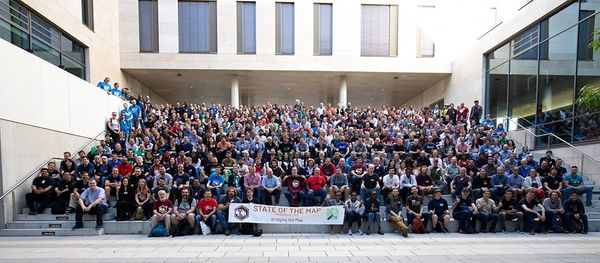

Earlier this year I applied for the scholarship to attend HOTSUMMIT and State of the Map (SOTM) global Conference in Heidelberg, Germany. The application was accepted and I got fully a funded scholarship. It was the first SOTM conference that I was able to attend and I was looking forward to meet other OSM mappers and data users and have a clear picture of the experiences shared.
OSM Foundation Assistance
In preparation for the conference I received an email from Christine Karch asking whether I would be interested in joining and working together with the program’s committee, and of course I accepted. Being part of that team gave me an insight of how preparations for such a huge conference are done, as well as the criteria used on how the choice of proposals submitted is done. That task was a good experience and I was grateful.
I would also like to show my appreciation to Dorothea for here support and guidance from the day I got accepted for scholarship. She was always available through emails and ready to respond to all the questions I had. The process of getting visa was successful first hand because of her help in listing all that’s needed and sending all the documents I would need. She also made my travel to Heidelberg stress-free from flights connections, train and public transport connections.
I also like to thank Christine ones again for believing in me and giving me an opportunity to chair nine sessions at the conference. I was grateful that I was given that chance because in my experience such little opportunities help in building one’s confidence in public speaking.