OpenStreetMap
stevea's Comments
| Changeset | When | Comment |
|---|---|---|
| 67630480 | These tags on these polygons derive from tags on the government data. If you follow the instructions on the wiki page to access the data (where it says "scroll to Zoning") you can further scroll to "Attributes" where there are some clickable web buttons for each tag. (Some of these, like the SHAPE* data, appear to be broken, this appears to be a bug with the county's GIS web site). I believe what you are saying (please correct me if I am wrong) is that "because I can't find a wiki page for these tags, they shouldn't be in OSM." As I say above, it is true that a discussion usually ensues about which tags from "official" data are or are not appropriate (some are useful, some are not) when a new version is released (as v5 recently was). However, you haven't made that case. For the record, I'll say that I find it useful to know, for example in the polygon you quote above, that I find the BASEDTL tag a useful description of how the landuse is actually specifically designated (legally) in this case, the BASENM tag useful similarly, the BASEZN, FULLZN and Zoning tags useful abbreviations of zoning using a countywide standard protocol, the OBJECTID tag helpful for comparison of data between upload_versions, and (as mentioned before) SHAPESTAre and
Does that explanation satisfy you? Would you prefer that this be in our wiki? (The reason I hesitated to do so before, is, as I have said, these tags do drift slightly between upload_versions, changing slightly as time goes by, and these data are now in their fifth incarnation as upload_version=5). I really am trying to do the right things here, avoid confusion, document fully and explain this when/where/as required. |
|
| 67630480 | Your assumption is mistaken; there is nothing wrong with my latest edits. They are quite intentional and what you call "very strange" are explainable if/as you read our local wiki which has documented the entry of several versions of these polygons for almost ten years. There is a long and storied history of these polygons being introduced into OSM. Please read about it at osm.wiki/Santa_Cruz_County,_California#Landuse . The "license" is that any data (GIS data included) produced by the state of California (as these are, since the County of Santa Cruz is a division of the state) are in the public domain. Numerous state Supreme Court decisions have expressly declared this to be true, making the data harmonious with OSM's ODbL. OSM mappers in California know this, now you do, too. Wide agreement locally (around here in the OSM community) actually encourages entry of later versions (newer data which update and correct) of these landuse polygons, that is precisely what was done here. They are part of "official" (government-produced) landuse/zoning data and accurately map to what OSM's landuse definitions are (with values of residential, commercial/retail, industrial). The SHAPE* tags give highly accurate area and length data, and other tags, some of which some do consider superfluous, are usually in a state of flux as the local community decides for any given upload_version which tags are appropriate to keep or discard during upload, as tags do change from version to version. Were I to start editing in your home town in Germany, before I started doing so I would perform the courtesy of researching local wiki and seeing if there were any local conventions I should know about. Should I find them, I would not immediately assume that "something went wrong" with editing there, I would better understand that these are simply local conventions, documented in wiki and acknowledge by the local OSM community as "this is how we do things here." By the way, many years ago, Santa Cruz won a Gold Star Award at bestofosm.org, one of only a few places in North America to receive such an accolade. The site notes that Santa Cruz has "nearly perfect landuse!" |
|
| 67565795 | I totally forgot about this drinking_fountain. Thanks for adding it! |
|
| 67371618 | Right, I know you didn't want to change forest, but you said "forest as a whole" (in your text above). It is crucial that we understand that in OSM, "forest" means "logged land." The campus and parks are not that. However, they are wooded and then we begin the endless confusion in OSM regarding landuse vs. landcover. It is confusing, people tend to tag for the renderer when they shouldn't, et cetera. The reason the campus boundary is not wooded is that that really IS tagging for the renderer. It is better, as we say in Local Conventions, "assume it is wooded except where it is tagged otherwise." This allows its primary purpose of "university" to render. If we go down your path of tagging natural=wood, now many will want to do that to leisure=park, leisure=nature_reserve and so on. It gets horribly complex when you bump up against other polygons such as landuse=forest and even landuse=residential, which are often, too, also heavily wooded around here, even with houses and people living there. Do we really want landuse=residential + natural=wooded? Simply because "it might look better" on the renderer? I don't. As this is PRIMARILY a university campus, and your tag proposal is largely to tag for the renderer, both OSM tenets of not doing that and local consensus has found that not adding natural=wood to the university (keeping its rendering as is, a university) is best. Yet, to further emphasize that the natural reserve areas are protected and almost exclusively wooded areas, (yes, parts of Lower Moore Creek Natural Reserve are part meadow) we do additionally tag them natural=wood. I've worked with many university staff, officers, faculty, architect, land steward, transportation officers, etc. as well as developing local consensus over nearly a decade, while still remaining "true" to how OSM does things. Yes, it's complicated around here. Yet it's also "as simple as we an make it so most everybody is happy with the results." |
|
| 67371618 | Not a forest, that's where there is logging activity and the natural reserves are certainly not that. There are no tagged forests at UCSC. The polygons which ARE tagged forest in this county are "Zoning=TP" (timber production), which matches the OSM defenition. "More accurately than a shapefile originating from the designation of the protected area?" How can you get more accurate than that? The answer is how it is done: "assume it is wooded except where it is tagged otherwise." This is one of the most heavily wooded university campuses on Earth. It is surrounded by state parks and open space preserves which are also heavily wooded. It is not "considered a forest as a whole" (there is no logging activity) it is considered wooded. Laws have nothing to do with it. |
|
| 67371618 | Please read osm.wiki/Santa_Cruz_County,_California#Local_Conventions |
|
| 67366898 | Why are you editing wheelchair accessibility relations? These are from official university data and are correct by definition. |
|
| 67371618 | Why are you changing Natural Reserve boundaries? These are official university shapefile polygons and are correct by definition (or at least they were when they were originally uploaded). |
|
| 67211361 | The net result of your edit is to have turned nearly ten years of university editing (of its boundary) into a "version 1" of the UCSC campus edge. That is not only immature, it is destructive to the history of edit improvements by many people over a long timeframe. Please stop the name calling. If you can, it would be mature of you (and technically, professionally and project-consensus-ally) to restore the previous boundary, with all its existing history, rather than submit a brand new (v1) boundary with absolutely no attribution or source tag. If you don't know how to revert a changeset and/or retrieve history-full polygons like this, ask. Better still would be to not destroy existing map data in the first place, whether inadvertently or as a vandal. As you are a newer mapper and I'm not sure of which of those two intents of yours you mean to effect (I do tend to give people the benefit of doubt), I'll ask you to explain what you meant to do to the campus boundary here. |
|
| 67306727 | Additionally, relation/9331155 only includes the eastern "Mainland," not the west coast and full Canadian boundary. |
|
| 67306727 | As a US citizen, I'm slightly uncomfortable with the addition of relation/9331155 (Mainland) to relation/148838 (United States). At the very least, the naming seems wrong, as I seldom if ever say "Mainland" (though I think that you may believe that Pacific Islanders, Alaskans, Puerto Ricans, Virgin Islanders, etc.) say this). Also, while your alt_name values of "Contiguous United States;Conterminus United States" are sometimes used, they are awkward. I MUCH more often hear (and use myself), "Lower 48" (sometimes preceded by "the") and MUCH more often hear "Continental United States" to refer to the lower 48 states. Also, the Department of Defense / US Military often use the abbreviation CONUS for this. In short, please reconsider this, or better, delete it, as it is far from consensus actually in existence, and there could be much more discussion about name and/or alt_name values. |
|
| 67147551 | Thanks for deleting the wooded areas here and at Stevenson. As I mentioned before, doing this can be complicated and there are no "easy answers" (yet, anyway, regarding wooded/forested areas). Happy mapping! |
|
| 66648724 | Excellent. The wiki and forum are excellent resources and allow a self-guided way to learn about OSM at your own pace in the directions that specifically interest you. Yes, the usual "specificity of confusion" about treed, wooded, forested areas has to do with the differences between "land USE" and "land COVER." OSM still has not fully resolved this and it remains an odd and difficult concept to explain the whole history of, especially to beginners. As Santa Cruz (County) is 2/3 wooded, it makes things even more confusing, as many wish to explicitly show that something is wooded (or not, as with landuse=meadow) leading to some, uh, "interesting," (yet sometimes pretty, or "visually pleasing" areas, like Wilder Ranch State Park, where leisure=park is assumed to be wooded, except where a landuse=meadow means, "but not here"). The UCSC campus is much like that (the two of these do abut) where (except for Natural Reserves, which are also explicitly tagged as natural=wood) it seems to have "evolved around here" that "the UCSC campus is assumed to be natural=wood where the underlying "light yellow of university" shines through (unless there is landuse=meadow, like the Great Meadow or Mima Meadow). As you can see, it's complicated, yet I believe your removal of these polygons (I have changed them from landuse=forest, clearly they are not, to natural=wood) is correct. Otherwise, as you note, you'd be "chasing tagging wood" all over campus, and the exceptions to exceptions to "loose rules" would likely make everybody's head spin. I'd be delighted if you were to remove these two (the Crown-9/10 one and the Stevenson-Cowell one) polygons. In the future, I'm also delighted that there is another enthusiastic OSM volunteer around Santa Cruz willing to read wiki and do his or her best to contribute great data to our wonderful map. Additionally, I offer you my firm commitment to do my best to answer any questions you might have, please simply "missive" me using OSM's built-in message system to stevea and I'll share with you the benefit of my knowledge, technical skills and sense of a decade of history in the project. Happy mapping! Steve |
|
| 66648724 | Changing this from landuse=forest to natural=wood, though it might be better to be deleted. |
|
| 66648724 | It may be that the best thing is to examine what is meant by OSM's tenet of "don't tag for the renderer" and to ask yourself/ourselves why we wish for "wooded areas" (maybe forest, maybe wood, maybe trees) to be so tagged and/or so rendered. It does seem to be part of the "more difficult, harder, chewier and maybe never-to-be-fully-answered" aspects of OSM. Or even mapping, or how the human race thinks about landuse/landcover in these days of global warming, trees dying of drought, examinations of "must we really be tree stewards, as well?" (the answer seems to often be "yes, if we are good humans") and so on. It is almost horribly complex, yet we find ourselves here simply as we attempt to be "good mappers." It seems like a conundrum, yet it isn't, it just makes me stroke my chin in the habit of any good philosopher and steward of Planet Earth, as a human, its presently-dominant species. Or, something like that. And, 2/3 of Santa Cruz County is "covered with trees," so in a sense, "I know what you mean," as I imagine the UC Regents are not totally surprised to consider themselves/ourselves "foresters, as we must manage our trees." It's easy to want a map we participate in to express "yeah, by the way, this area is dense with trees!" and UCSC is a wonderfully unique place of two thousand acres containing MANY trees. Where the lines exactly are is a crazy-wonderful fuzzy edge. Often, I find it most useful for me to fully engage my "listening skills" and simply do that. As you "agree with" a large segment of the East Field as natural=grassland, I think that tagging the "Stevenson wooded" area as natural=wood (rather than landuse=forest, as it sort of isn't more than it sort of is) I think we (me and many OSM volunteers included) might find ourselves in a kind of harmony. It's a long, somewhat chewy, for-a-lot-of-different-reasons, complicated conversation. I look forward to your further participation, response and good dialog. |
|
| 66648724 | As I've said about the Stevenson forest, maybe natural=wood, maybe landcover=trees. It's sort of ticklish. But I don't think it's landuse=forest. |
|
| 66648724 | Wilmaps (nice to "meet" you): This is not the best tag on any "treed" campus area that isn't zoned or has a specific landuse. The tag landuse=forest is "to mark areas of land managed for forestry." This isn't that. If you haven't, please read how complex and directly conflicting (with natural=wood) the tagging schemes can get at our wiki, osm.wiki/Forest . Or, see a recent controversy (one that's been going on for many, many years; I recall one I participated in back in 2009, here: https://lists.openstreetmap.org/pipermail/tagging/2019-January/042338.html , where in just a few days, dozens or a hundred?) of conflicting posts still couldn't unravel the arguments of this/these vs. that/those tagging conventions regarding "wooded" areas. In the meantime, especially because this is an incorrect tag (these trees are not being "grown" to be "harvested" as they are in real timber-production zones, what OSM means by the "forest" tag), I suggest you remove this polygon in OSM. Yes, The Natural Reserves are largely wooded (and tagged so), yes, the landuse=meadow polygons do a nice job of showing where there are meadows on campus. The fact that "amenity=university" renders "light yellowish" where no other landuse=* or natural=* polygon superimposes upon it does NOT mean that we should start adding land COVER (quite distinct from land USE) to these areas. In short: #1, "don't tag for the renderer" and #2, "it is complicated." (And has been complicated for some time, and is still quite controversial, with no end to the debate about "best practices" in sight). |
|
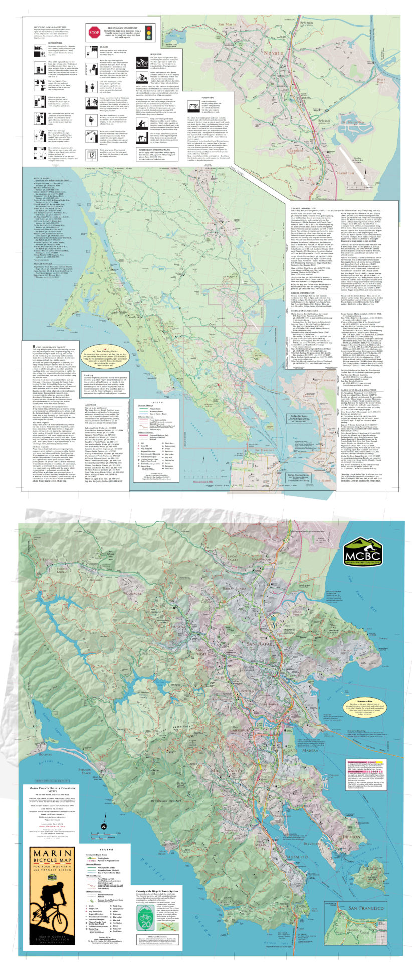
| 66751955 | What is your source for the lcn=15 route? You might say "an on-the-ground sign" and I'd be OK with that. Here is a map which does not show route 15: https://www.marinbike.org/wp-content/uploads/2016/06/Marin-Bike-Map-full.jpg |
|
| 65138197 | You're welcome, thanks and a polite wave in your direction. |
|
| 65138197 | Hi Clay. I think OSM's data can express what I believe you're doing here with simple tags rather than Relation: 7453451. I think what you want to do is tag all elements in that relation with owner=UP;operator=BNSF and you're done. Relation: 7453451 can then be deleted. Steve |