OpenStreetMap
olehz's Comments
| Changeset | When | Comment |
|---|---|---|
| 153540078 | Ну так це головна дорога як добратись до села. Альтернативно ще через Уличне є. Інші взагалі не проїзні. Я недавно візуалізував граф доріг від tertiary і вище і виявив, що кілька сіл не підєднані до дорожньої мережі. Як Зимівки. |
|
| 154712037 | ну скільки можна зсовувати будинки з GPS треків? при чому ті самі. я рівертаю, воно далі вперто ламає все. |
|
| 140792869 | Не міняй теги. Закрите - це лише по документах. Я намагаюсь використовувати тегування близьке до AMDB, яке нікому не заважає. Бо такі покращення лише ламають мій рендер http://vfr-demo-map.s3.eu-west-1.amazonaws.com/map.html |
|
| 132257255 | I fully support promoting these new tags and describing them on the wiki. And there is no need to reinvent the wheel, just copy the AMBD documentation. Since many important entities and their properties are missing. |
|
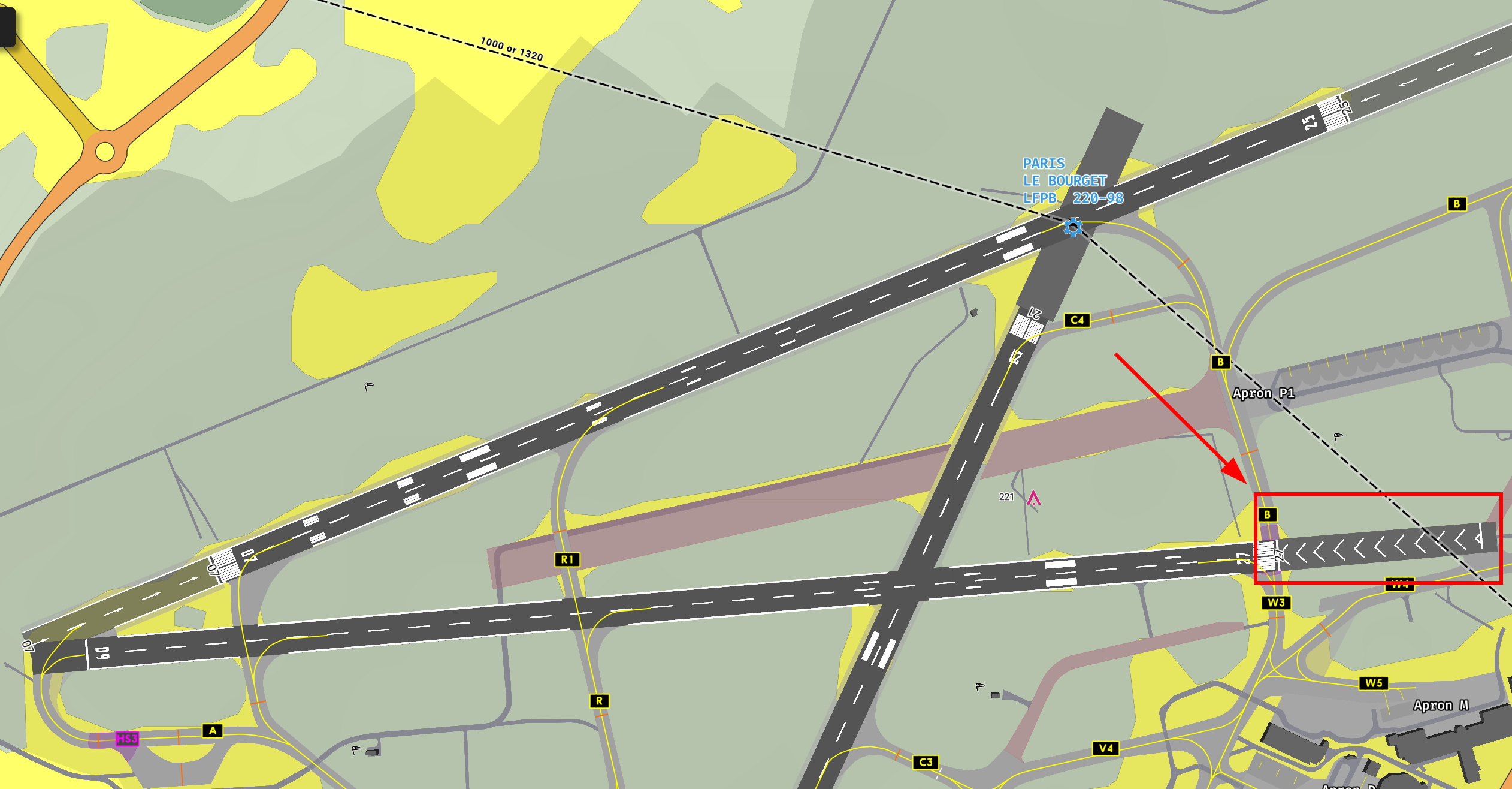
| 132257255 | Correct. It's not stopway. SWY has special marking like this one: http://vfr-demo-map.s3.eu-west-1.amazonaws.com/LFPB.png. It's a blastpad. The problem is in the usage statistics. The current OSM tagging scheme conflicts with the AMDB scheme:
https://taginfo.openstreetmap.org/tags/area:aeroway=blastpad#overview |
|
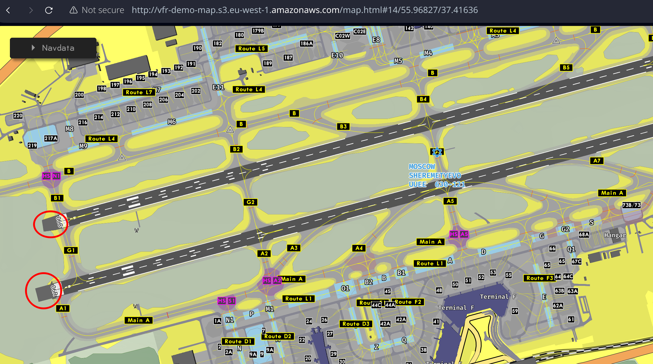
| 132257255 | https://vfr-demo-map.s3.eu-west-1.amazonaws.com/UUEE2.png - This is what it looks like in the end. So for such elements I have to use area:aeroway=blastpad or area:aeroway=stopway. |
|
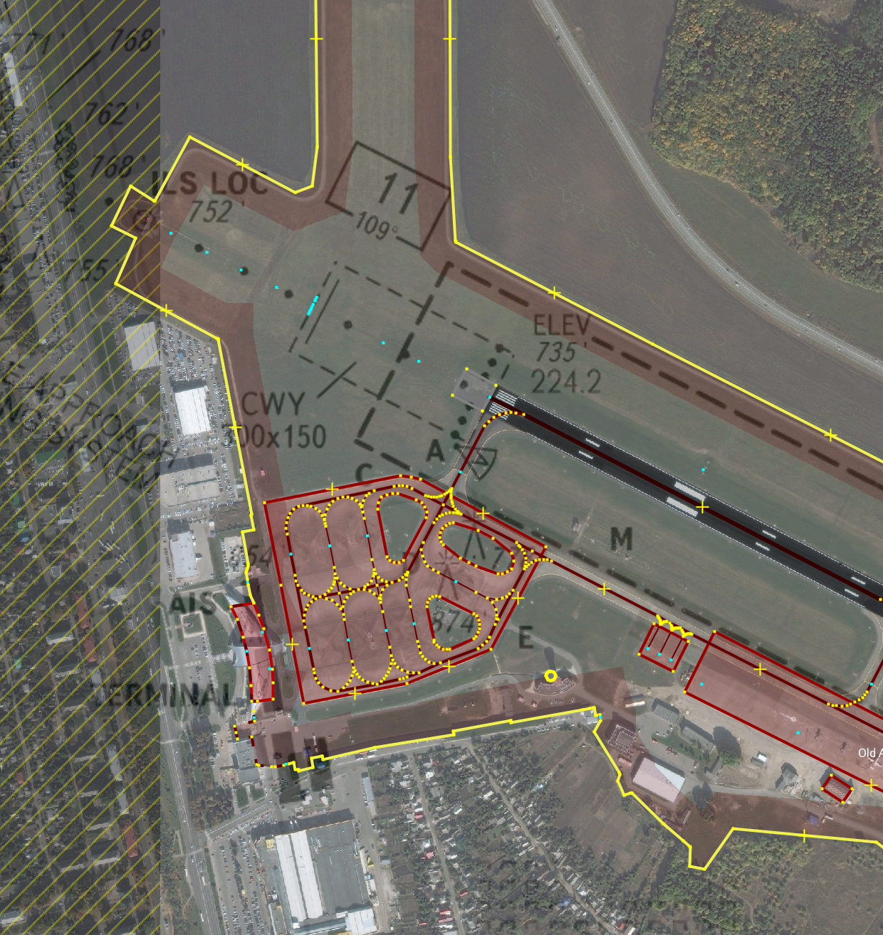
| 132257255 | See: https://vfr-demo-map.s3.eu-west-1.amazonaws.com/belgorod-aip.png - This zone exists only in documents and is not visible on the ground. Just a grass. But I drew a concrete platform, which is used as a blastpad (a surface adjacent to the ends of a runway provided to reduce the erosive effect of jet blast and propeller wash) Here is an example of jeppesen data: https://vfr-demo-map.s3.eu-west-1.amazonaws.com/UUEE.png |
|
| 137030172 | Could you explain why you removed so many substations in Belarus? |
|
| 137030461 | Why did you remove power=substation and add building=yes? Is there a reason or is it vandalism? |
|
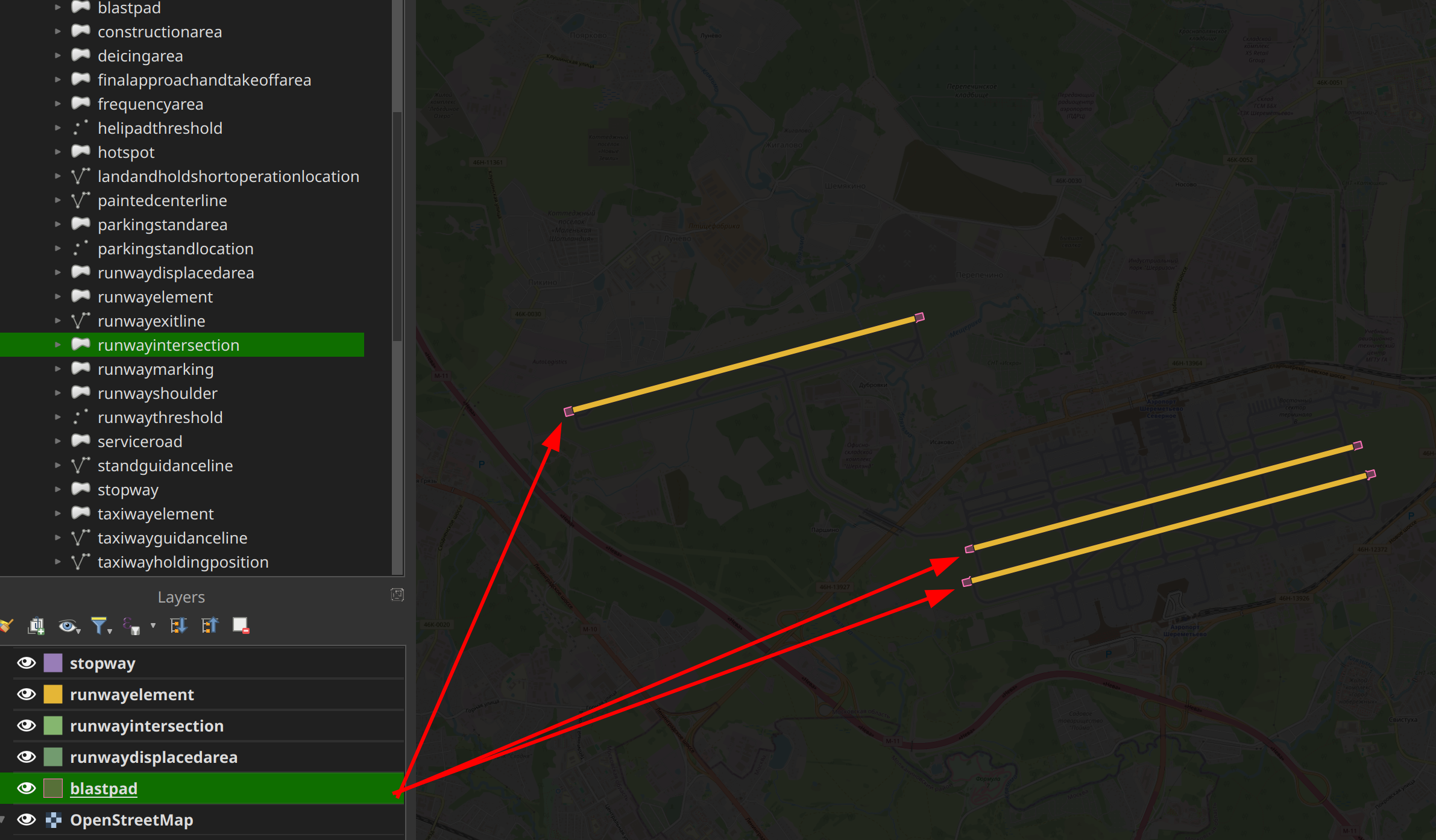
| 132257255 | I'm the author of this map (http://vfr-demo-map.s3.eu-west-1.amazonaws.com/map.html), so I guess I know the diff. For instance: https://vfr-demo-map.s3.eu-west-1.amazonaws.com/mazda.png In this case it's obviously stopway/blastpad. CWY is not used in AMDB at all - https://vfr-demo-map.s3.eu-west-1.amazonaws.com/ed-99-mapping-to-aixm_compress.pdf |
|
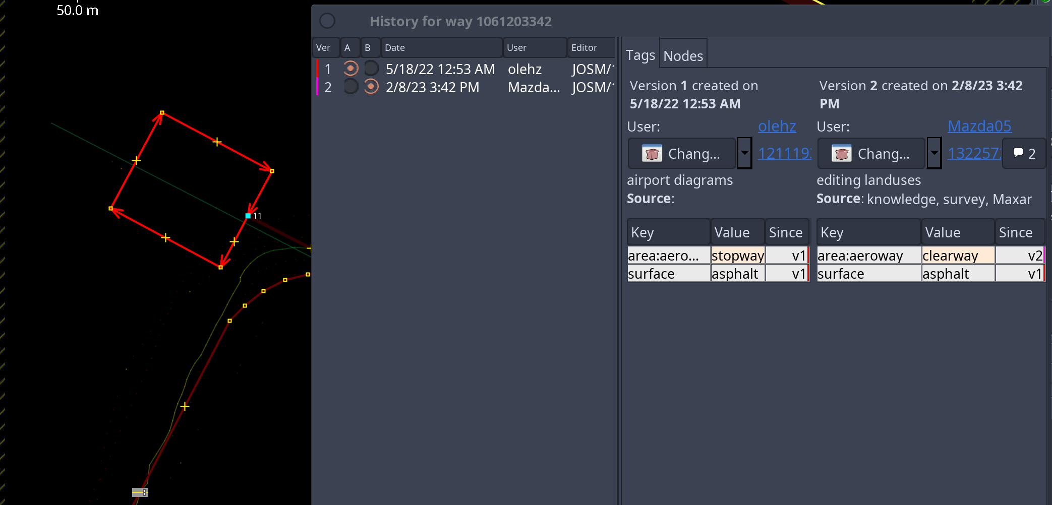
| 132257255 | Why did you change the airport diagrams? For instance area:aeroway stopway => clearway? This is nonsense. Did it bother you? The standard render does not understand such tags anyway. I just wasted my time drawing according to the AMDB scheme. Even RWY polygons were removed. (( |
|
| 146938510 | Тут близько до лінії фронту, тому не чіпав. Але таких ситуацій з частково демонтованими лініями багато. Як зробити аби люди не міняли на маячню через валідатор? |
|
| 146938510 | Resolve issue - це з недіючої лінії зробити діючу і домалювати фейкові сегменти і склеяти 35кв з 10кв? Прикольне покращення ) |
|
| 141555869 | Lovers of dictatorships from Russia/Serbia/Hungary have no relation to the Danish airport. There's nothing to discuss here |
|
| 141555869 | I want to apologize. Anyway, I hate Russia and Serbia (mini russia), you killed my friends and destroyed my future. So I don't see any constructive conversations. Fuck off and good bye. |
|
| 141555509 | See: changeset/141555869 |
|
| 141555869 | My company uses OSM as one of the sources for drawing airport diagrams (https://www.youtube.com/watch?v=L7sMxRg-JvM) and your proposal is very bad from this point of view. |
|
| 141555869 | I look at the problem from the point of view of aviation and land use, and you from the point of view of routing. You can tag the building rather than remove the official UN codes. |
|
| 141555869 | https://skybrary.aero/articles/airport-mapping-database-amdb |
|
| 141555869 | > Please provide source where is explicit explained to not divide airfields into two parts Lol. You yourself wrote that the IATA code is identical. This is one airport that has mixed MIL/CIV uses and uses the same RWYs. But it is impossible to determine this geometrically in OSM. In fact, the airport diagrams in OSM are simply terrible. This is very worse than the AMDB standard. And your proposal to ignore the IATA code, which in fact exists, seems strange to me. |