jhaluska80's Notes
Notes submitted or commented on by jhaluska80
| Id | Creator | Description | Created at | Last changed | |
|---|---|---|---|---|---|
| 4837938 | Scarlet Martin | NO FIRE DEPT HERE |
|||
| 5214667 | 2415 2nd Ave Alford Florida 32420 |
||||
| 5215570 | The marker should should show the access to home location from Blue Holly Lane - that is the only driveway to my home. All the time the navigation brings people to the other community(Running Pump Lane) from which there is NO access to my home.
|
||||
| 5216086 | this is a one way heading west |
||||
| 4951696 | This is now a roundabout. |
||||
| 5211449 | ErronSavi202 | Unable to answer "How many car lanes does this road have?" – Fern Drive (Residential Road) – way/15402580 via StreetComplete 62.2: Appears to have only parking lanes |
|||
| 5213934 | wolfwalks | The crosswalk veers off to the side here via StreetComplete 61.3 Attached photo(s):
|
|||
| 5214251 | WRobin88 | "This is a duplicate label at the wrong location. The Underwood House is correctly labeled at 2000 G"
|
|||
| 5212646 | O-dog-Malakai | Should there be an advisory speed limit of 45 mph on this curve on US-202? |
|||
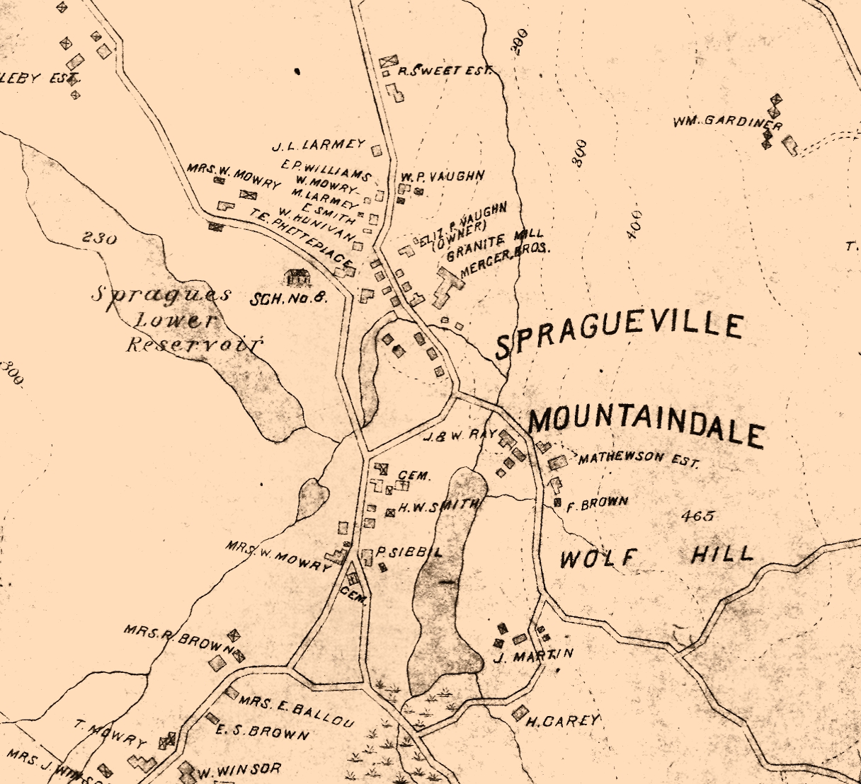
| 5176548 | Village/neighborhood called Mountaindale located here. https://en.wikipedia.org/wiki/Mountaindale,_Rhode_Island It is listed as one of the official villages of Smithfield: https://www.ri.gov/towns/view/smithfield/ Couldn't find any exact boundaries or defined central coordinates, but this historic map shows it on the northeastern corner of Mountaindale Reservoir: https://smithapplebyhouse.org/wp-content/uploads/2020/03/Spragueville-map.jpg |