OpenStreetMap logo OpenStreetMap

Users' Diaries

Recent diary entries

Posted by Eden Oluigbo on 31 January 2024 in English.

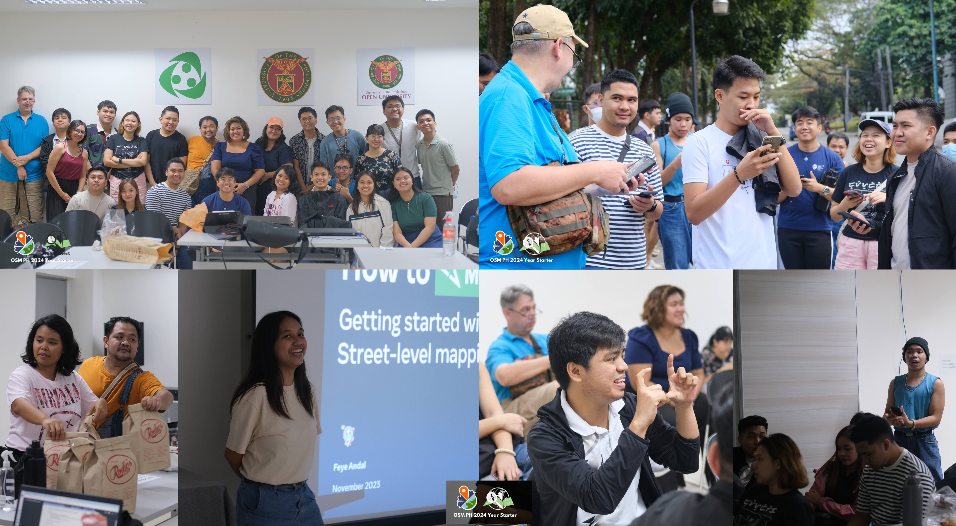
Exploring Career Opportunities in Open Source

image showing inclusivity

Sometimes, evaluating an end goal before beginning a journey can be good, especially as regards to career. And if you’re wondering what the next 1 - 3 years look like for someone committed to open source, then I’m happy to explore with you some interesting career opportunities in the open source community and share my story as well.

I was in a tech conference some years back, and during a chit-chat/mingle session before the speakers came on stage, the phrase “open source” was flying around, literally. I got confused and I was having another small chat with myself in my mind, what exactly is open source?

Could it be the company got sponsored by the public? As in “open source?” Haha! I had no idea what everyone was talking about and I was eager to begin the training so that I could learn from the speakers.

See full entry

Обновление локальной postgres базы OSM через osm2pgsq заработало, не прошло и двух месяцев.

osm2pgsql-replication update -v -d gis  --max-diff-size 100 --  -G --hstore --tag-transform-script ~/src/openstreetmap-carto/openstreetmap-carto.lua -C 0 --flat-nodes ~/data/nodes.bin --number-processes 8 -S ~/src/openstreetmap-carto/openstreetmap-carto.style

Самое обидное, что не понятно, что конкретно изменилось. Если придется переустановить убунту, а похоже придется, то всё снова может отвалиться.

Так чтобы там не писали на switch2osm, свой тайловый сервер – это побольшей части магия.

Salut tout le monde, je m’appelle Marianna MUKULUNGA, contributrice OSM et faisant partie de la communauté Open Street Map RDC, diplômé en gestion Informatique et Passionné de la Cartographie…

La conférence qui a eu lieu au Cameroun avait comme objectif de réunir différents groupes des jeunes et passionnés de la cartographie… participé à celle-ci nous a permis d'ouvrir nos horizons, de penser grand et de ne pas s'enfermer sur soi même; nous avons apprise des nouvelles méthodes de la cartographie à part ce que nous savions, différente présentation qui nous ont marquée et personnellement celle qui m'as le plus intéressé c'était celle de MARIE MAKUATE qui parlait sur "women-centered disaster resilience in saloum islands" elle nous avait montré comment les femmes joue un rôle très important dans la résilience aux catastrophes dans l'iles saloum; j'ai vite compris qu'à part la cartographie sanitaire que nous faisons chez nous accompagné des différentes type de communauté y compris les femmes; les femmes ont aussi d'autres rôles qu'elles peuvent jouer dans la cartographie; c'était une connaissance de plus qui m'a ouvert les idées sur ce que je peux aussi entreprendre dans mon pays dans le futur;

le débat de CHARLES CHILUFYA sur le" Bridging Gender Gaps in OSM" car il est était question d'évaluer le taux de pourcentage de femmes dans OSM et qu'est-ce qui peut être à la base ce faible pourcentage et il avait donner quelque piste de solution qui peut pousser les femmes que s'intégrer dans OSM.

Charles Chilufya- Presenting about Gender Gaps in OSM Africa and Tech.

il y'a aussi le thème de BAFAMODEI HOPEFUL qui avait présenté sur "Campaigning and Engaging Girls and women Towards positive change using Open Mapping Tech in Nigeria" qui par sa présentation montrait que la cartographie ouverte est l'une des moyens par lesquels un changement positif peut être réalisé pour les filles et femmes du Nigeria qui depuis longtemps elles sont toujours écartés dans la communauté;

See full entry

Location: Zoatoupsi, Mbankomo, Méfou-et-Akono, Région du Centre, Cameroun

My reflection about SotM Africa 2023 held in Yaoundé, Cameroon which focused on the theme “Open Mapping as a support tool for local development in Africa”. The State of the Map Africa (SotM Africa) is a bi-annual regional conference that celebrates the culture of open mapping, open data, GIS and its impact across Africa. It was a great opportunity for mappers, GIS & Open Mapping enthusiasts, data users, and other stakeholders in the OpenStreetMap community to come together, share knowledge, and collaborate on projects.

• Presentations and workshops: The variety of presentations on topics related to OpenStreetMap, and GIS such as Field mapping techniques, data analysis, and community building. I learned about new tools, methods, and techniques, and also gained insights into the challenges and opportunities facing OpenStreetMap in Africa and how we can collaborate together to develop and solve Open Mapping & Data challenges in Africa.

• Networking: The conference offered a great opportunity to meet with other people from other part of Africa & world, who are passionate about OpenStreetMap. I was opportune to make new friends, (the Likes of Kennedy, Yves Emmanuel, Charles, Emmanuel, Janet, and the OSM Cameroon team), established professional connections, or found collaborators for future projects

• Cultural and social Night experiences: The conference was also a chance for me to experience the Cameroonian culture especially during the social night event seeing different culture, dancing steps etc., I enjoyed the hospitality offered, local food, music, and dance, and learned more about the history and traditions of Cameroon.

See full entry

Location: Zoatoupsi, Mbankomo, Méfou-et-Akono, Centre, Cameroon

#OSMPHarin2024 - mappy is a happy word!

Credit: Photos from UPRI Youthmappers

Had so much funnn and so mappy from last Saturday’s OpenStreetMap Philippines’ 2024 Year-Starter mapping party #OSMPHarin2024* !

THANK YOU for everyone who has participated, and spent time with us and for mapping!

OSM PH community members’ aspirations

For introduction and icebreaker, our wonderful host (Jikka) asked us to introduce ourselves and share our aspirations for the 2024. Since some participants are new/beginner to OSM, aspirations can be personal and/or OSM-related.

From learning how to swim, graduating this year (lots of them are students from UPRI), healthier lifestyle (more sleep, eating on time and exercise) to growing the community and being more involved in OSM, we are really aspiring this year! Hope to go back to this and see by end of the year!

OSM field mapping and mobile tools

See full entry

Location: UP Campus, Diliman, 4th District, Quezon City, Eastern Manila District, Metro Manila, 1101, Philippines

THANK YOU FOR JOINING our Communications Skillshare Series!

THANK YOU FOR JOINING our Communications Skillshare Series!

I had fun organizing and participating in these comms skillshare sessions!

Comment if you have attended or watched the sessions! Let’s level up those communications skills this year! :D

You can rewatch the recordings here

User-Friendly Website Design with Brazil Singh

Brazil is currently the President of Youthmappers Chapter at Eastern University of Bangladesh. He shared his expertise and experience in creating user-friendly website design using WordPress. He presented theoretical and step-by-step guide on how to create a website. This webinar was inspired by his passion to support Youthmappers chapters to design their own website.

Links:

  1. feedback and comments
  2. recordings
  3. slides

Also shoutout to Eka Diweti who hosted the webinar session! PS. I enjoyed listening to Eka! She said she was nervous but her voice was so calm and professional (watch the recording to listen!) :)

See full entry

Hi community!

Firstly, I would like to thank Chisom Ejeh for his efforts and chairing the CommunityWG 09:00 UTC/ Early session for the past almost 2 years! Chisom will no longer be available to be our chairperson due to conflict in work schedules and the CWG meeting. Let’s all thank Chisom for his service!

With this, we are looking for a new chairperson for 09:00 UTC/ Early Session for CommunityWG!

Note: Current chairperson for 17:00 UTC / Later session is Benedicta <3

Why become a CommunityWG Chairperson?

You will have the opportunity to connect, collaborate with and facilitate a diverse and talented set of people from the humanitarian open mapping community! You get to also sharpen you communication, networking and facilitation skills that can support your professional development!

What is the role?

Essentially, the role of CommunityWG chairperson is in two folds:

*Engagement

  • Engage with communityWG members and encouraging/reminding them to participate and attend the meetings and events
  • Ensure that communitywg meetings and channels (loomio, slack, matrix, mailing) remain an inclusive and healthy environment for everyone, following the HOT Code of Conduct

*Administrative

  • Ensure that meeting notes and documentations are organized and readable
  • Ensure that community shoutouts and agenda are filled and open for everyone to add
Who are we looking for?
  • Required: Active member of HOT Community Working Group and/or a HOT voting member and must have participated in the meeting at least twice and/or participated in community channels (slack, loomio, matrix, mailing list) *A deep passion and commitment to humanitarian open mapping / OpenStreetMap/ open data/ humanitarian or development work / community development *Working fluency in English; non-native English speaker is very welcome!
Are you interested?

Please comment on this diary, loomio thread or email community[at]hotosm[dot]org your name, experience and motivation statement to apply!

See full entry

Today, I celebrate a leader, mentor and a friend, Angela Teyvi.

Thank you Angela!

As the Mentorship Month (January) come to a close, the HOT Community Working Group Mentorship Program Team would like to honor our mentor and team lead, Angela Norvi Teyvi, whose passion have sparked and made ideas come to life through the Mentorship Program.

About the HOT CommunityWG Mentorship Initiative

See full entry

Location: Byebye, Atebubu-Amantin Municipal District, Bono East Region, Ghana
Posted by b-unicycling on 30 January 2024 in English.

Stone Circle in Co. Galway

Yesterday, I got an email from the National Monuments Service (Republic of Ireland) to confirm a stone circle I had discovered in December of 2022 and reported to them as a potential site. I discovered it in Co. Galway while mapping the Co. Roscommon task (which still needs validation, btw), but the site is just across the River Suck (that’s what it’s called on OSM; it has a different name on Google, strangely) which forms the boundary between Roscommon and Galway.

Check on OpenStreetMap

I nearly didn’t report it, because it looks so neat and regular with its 27 (thanks danieldegroot2 for being able to count, not like myself :D) stones forming a perfect circle of 18m diameter. It’s not difficult to make perfect circle, but the distance between the stones looks very regular too. Hence my doubtful subject in my email to the NMS “unlikely monument in Co. Galway, only reporting just in case”, because I suspected that the farmer whose land is on (or his forefathers) had built it. I still have a little doubt. It’s also in a flood plain which seems a strange location for a stone circle to me, but I’m no expert. The stone in the centre is a standing stone, but the ones forming the circle are “only” boulders which is not entirely unusual, as attested by the more famous Kenmare Stone Circle in Co. Kerry (website, on OSM). I presume they used boulders formed partly be the ice age and partly by the River Suck. The standing stone is not as smooth as the boulders. Unfortunately, I have no photographs, because I have not visited the site myself, but the lady from the NMS sent me two photographs.

See full entry

Posted by Jiri Podhorecky on 30 January 2024 in Czech (Česky). Last updated on 29 February 2024.

Před lety (přesněji v srpnu 2019) jsem v Českém Krumlově začal jeden nevšední projekt.

Šlo o myšlenku založit ve městě komunitní zahradu, tedy malé relaxační místo, kde by si lidé mohli vypěstovat nějaké drobné výpěstky, ať už zeleninu, zahradní ovoce, nebo květiny. Ve městě žádná nebyla.

Věděl jsem, že to nebude snadné. Bylo k tomu potřeba několik důležitých věcí, které jsem neměl, ale plánoval je získat. A proto jsem k tomu několik let vynakládal úsilí.

Lógr

Začal jsem v kavárnách sbírat lógr jako základ pro bio hnojivo do zahrady. Zároveň jsem hledal, zda by v katastru města byla možnost najít vhodný pozemek. A také jsem se snažil záměr lidem vysvětlovat. Co dělám, proč to dělám a jak by to mohlo souviset i s nimi.

Přes 2,5 roku jsem chodil denně do kaváren v centru města. Pouze se skromnými prostředky, jako kbelíky a uzavíratelné nádoby, jsem byl schopný nasbírat přes 14 metrů krychlových kávového lógru. Tolik, či spíše ještě mnohem více dokáží vyprodukovat některé kavárny v centru města Český Krumlov!

Pro možnost komunitního sběru jsem adaptoval do češtiny aplikaci Karrot, která by se na to velmi hodila

See full entry

Location: Nový Vyšný, Nádražní Předměstí, Český Krumlov, okres Český Krumlov, Jihočeský kraj, Jihozápad, 381 01, Česko

V blízkém okolí Českého Krumlova, od PP Cvičák přes Vyšný až do Boletic vede přes 7 km dlouhá panelová cesta. Chvíli jsem špekuloval, k čemu byla a pak jsem došel k jedinému logickému závěru.

Panelová cesta

Byla to vyhrazená cesta pro přesun vojáků a vojenské techniky mezi střelnicí, kasárnami Vyšný a Vojenským výcvikovým prostorem Boletice. Těžká technika by zničila běžné civilní cesty a tak byly lepší panely. Bohužel na kole se po cestě jede velmi špatně.

Ale zase pěkná krajina.

Location: Bláhův mlýn, Kladné, Kájov, okres Český Krumlov, Jihočeský kraj, Jihozápad, 382 21, Česko
Posted by arnalielsewhere on 30 January 2024 in English. Last updated on 31 January 2024.

I would like to congratulate and welcome OSM Belgium for being the newest (and returning) OSMF Local Chapter!

Thank you to Joost, Ben, Jonathan, Thierry and OSM Belgium community for your contributions in spreading the awareness, educating/training people and sharing the good news of OpenStreetMap!

Learn more about OSMF Local Chapters:

If you are interested in becoming a local chapter, and for questions and concerns, please comment in the community forum thread: Local Chapters: What To Know and How to Join or email local@osmfoundation.org.please email local[at]osmfoundation[dot]org :)

UPDATE AS OF 31 JAN

Hi community, I am greatly humbled by your overwhelming response! Thank you for your interest and volunteering to support our Membership Drive Campaign this Q1 of 2024!

I have scheduled a meetup this Saturday, 3 February at 11:00 UTC.

https://osmcal.org/event/2632/ https://osmcal.org/event/2632/

Please click ATTEND and answer the sign up form so we know which role you are willing to help 🙂

You can also input your email address so I can send the direct cal invite or you can click the ADD TO CALENDAR.

Important notes:

  • You need to be logged in to your OSM Account to be able to answer the sign up form 🙂
  • If you can’t make it, the session will be recorded and I will share it here as well as the meeting notes.

If you have any questions, please send it here! 🙂

Agenda: 1. Hello and Welcome 2. About OSMF and the Membership Drive 3. Timelines 4. Roles and tasking 5. Questions and comments 6. Any Other Business (AOB) 7. Actions and next steps

Meeting notes

See you!

ORIGINAL POST

Hi community,

wearing my OSMF Board hat and in our aim to grow and diversify OSMF membership, I am happy to initiate a Membership Drive/Campaign this first quarter of 2024!

Objectives:
  • Promote OSMF memberships (normal, associate, active contributor) with support from OSMF Communications WG
  • Provide general stats on membership make up (per region / per country)
  • Collaborate with regional/national community leaders especially in regions/countries where OSMF membership is low
With this, I am looking for volunteers and campaigners to be part of this initiative:
  • Mapmakers / comms volunteer/s who can help visualize membership make up and design Call to Action posters/pubmats
  • regional/national community leaders/promoters who can help us in this campaign
Are you interested?

Please comment on this diary or this thread in the community forum if you have time and are happy to help! :)

Thank you!

=Arnalie

last week the OSM Board and the DWG have given permission to anybody to change my 100% factual edits with out any intervention. This has already lead to the map displaying old outdated information. The changeset i’m bringing attention to osm.org/changeset/146818956 The Gawler Bypass which even has it’s own wikipedia article https://en.wikipedia.org/wiki/Gawler_Bypass was completed in 2010, its intended function was to divert all traffic wanting to go north of Gawler to go around the entire town. The section of Main North Road that goes through Gawler was officially downgraded to a secondary road plus it’s route number B19 was also removed. When this section was classed in OSM I suspect it was based on its class before the license change and its was kept as “primary” which was not wrong, it is a fact that it was a primary road at the time. https://imgur.com/ZrpOFr8 My edit clearly with supported information is correct to class it as secondary. I would like to ask The DWG how we move forward as a community and keeping the integrity of the information at the same time. OSM is a important project to me and I would like to find a way to work together here without slowly watching road by road the factual information fall apart. more relevant links posted below https://data.sa.gov.au/data/dataset/trailblazer-roads osm.org/changeset/12436982#map=15/-34.5780/138.7422 https://en.wikipedia.org/wiki/Main_North_Road#cite_note-8 https://www.dit.sa.gov.au/nsc/northern_expressway osm.org/#map=13/-34.6025/138.7299

previous diary entry osm.org/user/slice0/diary/403361

Posted by TrickyFoxy on 29 January 2024 in English.

TL;DR I wrote a little extension for Firefox for script developers to get an OAuth token in a couple clicks


OSM will soon remove support for Basic Auth and OAuth 1.0.

The proposal is to use OAuth 2.0, which has a much worse UX for novice developers than Basic Auth.

To show that OAuth 2.0 can be made more convenient even than Basic Auth I made a Firefox extension to automatically get an OAuth token:

demo


A bit of technical details and emotion:

See full entry

Bonjour, je suis Emmanuel Youma ZOUBINNABA de la communauté OpenStreetMap au Togo. Titulaire d’une licence en géographie, mes domaines d’intérêt incluent la programmation (Python, Javascript), le traitement et l’analyse de données, la cartographie, la télédétection, ainsi que la gestion et l’administration de données spatiales.

Forte de ma passion pour la cartographie et des compétences acquises dans le traitement de données géographiques, j’ai eu le privilège marquant de participer à la 4e édition du State of the Map Africa qui s’est tenue à Yaoundé, au Cameroun, à l’United Hotel de Mbakomo, à la fin de novembre et au début de décembre 2023. Cette expérience a été l’occasion parfaite de mettre en pratique mes connaissances et de contribuer activement à la communauté OpenStreetMap dans un contexte africain stimulant.

A propos du State of the Map Africa

Le State of the Map Africa (SotM Africa) est une conférence régionale biennale célébrant la culture de la cartographie ouverte, des données ouvertes, du système d’information géographique (SIG) et de son impact à travers toute l’Afrique. La conférence de cette année à Yaoundé au Cameroun, intervient après celles organisées respectivement en Ouganda en 2017, en Côte d’Ivoire en 2019 et au Kenya (en ligne en raison de la pandémie à coronavirus) en 2021. Organisée sous le thème « La cartographie ouverte comme outil de développement local en Afrique», cette conférence qui a lieu en fin d’année 2023 à Yaoundé, la toute première du genre au lendemain de la pandémie à coronavirus, a connu au total 255 participants en présentiel provenant de 23 pays à travers l’Afrique. Fort de cette constatation, cette conférence s’est révélée être, trois jours durant, un véritable terrain de grandes retrouvailles, d’excellentes rencontres, d’échanges constructifs, d’apprentissages inédits, de partages instructifs et surtout, d’expériences inoubliables qui sauront perdurer dans le temps.

See full entry

Location: Mbakomo, Obala, Lekié, Région du Centre, Cameroun
Posted by PhoebeSM on 28 January 2024 in English.

This weekend I started mapping the east-of-Gillham part of 43rd St in KC. I went from Gillham to just past 71 on Saturday, and further east to Indiana on Sunday.

Pedestrian-safety observation: The crossings on either side of Gillham Park are The Worst. You can go way up or down and find a crosswalk with a light, or you can take your chances running across both-way car traffic and then both-way bike traffic without much visibility. For this entire stretch of road (and most of my outdoor activities around KC) I wear bright dae-glo jackets. I call it protective coloring.

There wasn’t much to map in this area as it was mostly homes. I crossed the bridge over Highway 71 and found a few benches and a bookcase that was locked. I mapped these, but I do not think they are being maintained anymore. There was a defunct church nearby that I think they were part of. I took photos of the various tags on the bridge and the view looking down on the highway while crossing - cool and fun for me, but not necessarily mapping-related. I also photographed a few tags painted on walls, but nothing quite rose to the level of a mural.

See full entry

Location: Ivanhoe Southwest, Kansas City, Jackson County, Missouri, 64110, United States